Filters: Tags: Granite (X)
568 results (18ms)|
Filters
Date Range
Extensions Types
Contacts
Categories Tag Types
|
Layered geospatial PDF Map. Layers of geospatial data include orthoimagery, roads, grids, geographic names, elevation contours, hydrography, and other selected map features.
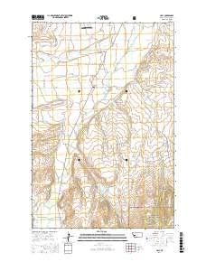
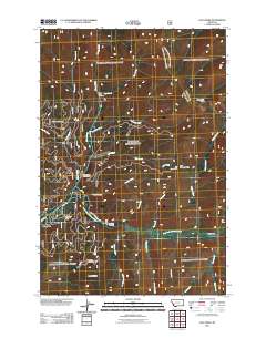
Layered GeoPDF 7.5 Minute Quadrangle Map. Layers of geospatial data include orthoimagery, roads, grids, geographic names, elevation contours, hydrography, and other selected map features.
Layered geospatial PDF Map. Layers of geospatial data include orthoimagery, roads, grids, geographic names, elevation contours, hydrography, and other selected map features.
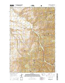
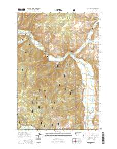
Layered GeoPDF 7.5 Minute Quadrangle Map. Layers of geospatial data include orthoimagery, roads, grids, geographic names, elevation contours, hydrography, and other selected map features.
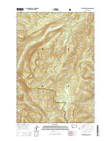
Layered GeoPDF 7.5 Minute Quadrangle Map. Layers of geospatial data include orthoimagery, roads, grids, geographic names, elevation contours, hydrography, and other selected map features.
Layered GeoPDF 7.5 Minute Quadrangle Map. Layers of geospatial data include orthoimagery, roads, grids, geographic names, elevation contours, hydrography, and other selected map features.
Layered GeoPDF 7.5 Minute Quadrangle Map. Layers of geospatial data include orthoimagery, roads, grids, geographic names, elevation contours, hydrography, and other selected map features.
Layers of geospatial data include roads, airports, trails, and railroads.
This map geodatabase digitally represents the general distribution of bedrock geologic map units in the Turtle Mountains area, California, as portrayed in Plate 1 of USGS Bulletin 1713-B, Mineral resources of the Turtle Mountains Wilderness Study Area, San Bernardino County, California (1988), https://doi.org/10.3133/b1713B. The map covers parts of the Rice, Turtle Mountains, and Savahia Peak 15’ quadrangles at 1:48,000 scale. Plate 1 is titled Mineral resource potential map of the Turtle Mountains Wilderness Study Area, San Bernardino County, California. The current database represents the geologic map base of Plate 1, but does not include mines, prospects, and mineral-potential evaluations that Plate 1 also portrays....
Core Research Center, cutting CZ08951, from well operated by PUDDLE SPRINGSRaw Properties from download, web scrape, MapServer, and Macrostrat API{"Lib Num": "CZ08951", "API Num": null, "Operator": "PUDDLE SPRINGS", "Well Name": "6 CORE HALE", "Field": null, "State": "WY", "County": "FREMONT", "Thin Sec": "F", "Analysis": "F", "Latitude": "42.81826", "Longitude": "-107.70631", "coordinates_geohash": "9xe7t4fdmn4m", "Source": "CENTER OF SECTION", "Min": "0", "Max": "980", "Security Flag": null, "crc_collection_name": "cutting", "sb_parent_id": "4f4e49d8e4b07f02db5df2d2", "intervals": [{"Formation": null, "Age": null, "Min Depth": null, "Max Depth": null}], "crcwc_url": "https://my.usgs.gov/crcwc/cutting/report/21276",...
Categories: Physical Item;
Tags: Early Eocene,
Wind River Formation,
Wind River Formation,
claystone,
conglomerate,
Core Research Center, cutting CZ08882, from well operated by RAYMOND CHORNEYRaw Properties from download, web scrape, MapServer, and Macrostrat API{"Lib Num": "CZ08882", "API Num": "4902520430", "Operator": "RAYMOND CHORNEY", "Well Name": "3 SOAPE CREEK UNIT", "Field": "WC", "State": "WY", "County": "NATRONA", "Thin Sec": "F", "Analysis": "F", "Latitude": "42.78583", "Longitude": "-107.05111", "coordinates_geohash": "9xeg7uzv82fc", "Source": "FROM STATE RECORDS", "Min": "300", "Max": "10311", "Security Flag": null, "crc_collection_name": "cutting", "sb_parent_id": "4f4e49d8e4b07f02db5df2d2", "intervals": [{"Formation": null, "Age": null, "Min Depth": null, "Max Depth": null}], "crcwc_url": "https://my.usgs.gov/crcwc/cutting/report/20985",...
Categories: Physical Item;
Tags: Early Eocene,
Wind River Formation,
Wind River Formation,
claystone,
conglomerate,
Core Research Center, cutting DZ03172, from well operated by L L NICKLERaw Properties from download, web scrape, MapServer, and Macrostrat API{"Lib Num": "DZ03172", "API Num": "4902105066", "Operator": "L L NICKLE", "Well Name": "1 GROSS-WILKERSON", "Field": "TRACY", "State": "WY", "County": "LARAMIE", "Thin Sec": "F", "Analysis": "F", "Latitude": "41.18115", "Longitude": "-104.14357", "coordinates_geohash": "9xmfq0ucwfvb", "Source": "FROM STATE RECORDS", "Min": "4000", "Max": "7540", "Security Flag": null, "crc_collection_name": "cutting", "sb_parent_id": "4f4e49d8e4b07f02db5df2d2", "intervals": [{"Formation": null, "Age": null, "Min Depth": null, "Max Depth": null}], "crcwc_url": "https://my.usgs.gov/crcwc/cutting/report/34177",...
Core Research Center, core S202, from well operated by GENERAL AMERICAN PETRaw Properties from download, web scrape, MapServer, and Macrostrat API{"Lib Num": "S202", "API Num": "4902120211", "Operator": "GENERAL AMERICAN PET", "Well Name": "1-21 FORNSTROM", "Field": "WILDCAT", "State": "WY", "County": "LARAMIE", "Type": "FULL", "Photos": "F", "Thin Sec": "F", "Analysis": "F", "Latitude": "41.17012", "Longitude": "-104.09841", "coordinates_geohash": "9xmfpnvc74xe", "Source": "FROM STATE RECORDS", "Security Flag": "NO SPECIAL RESTRICTIONS", "crc_collection_name": "core", "sb_parent_id": "4f4e49dae4b07f02db5e0486", "intervals": [{"Formation": "DAKOTA", "Age": "CRET", "Min Depth": "7317", "Max Depth": "7374"}], "crcwc_url":...
Core Research Center, cutting CZ16036, from well operated by LOMAX EXPLORATIONRaw Properties from download, web scrape, MapServer, and Macrostrat API{"Lib Num": "CZ16036", "API Num": "4901321215", "Operator": "LOMAX EXPLORATION", "Well Name": "14-23 FEDERAL", "Field": "WC", "State": "WY", "County": "FREMONT", "Thin Sec": "F", "Analysis": "F", "Latitude": "42.98642", "Longitude": "-107.71007", "coordinates_geohash": "9xekscryj3qx", "Source": "FROM STATE RECORDS", "Min": "1500", "Max": "7885", "Security Flag": null, "crc_collection_name": "cutting", "sb_parent_id": "4f4e49d8e4b07f02db5df2d2", "intervals": [{"Formation": null, "Age": null, "Min Depth": null, "Max Depth": null}], "crcwc_url": "https://my.usgs.gov/crcwc/cutting/report/27881",...
Categories: Physical Item;
Tags: Early Eocene,
Wind River Formation,
Wind River Formation,
claystone,
conglomerate,
Core Research Center, cutting CZ13816, from well operated by PACIFIC TRANSMISSIONRaw Properties from download, web scrape, MapServer, and Macrostrat API{"Lib Num": "CZ13816", "API Num": "4903721362", "Operator": "PACIFIC TRANSMISSION", "Well Name": "3-24B FEDERAL", "Field": "WC", "State": "WY", "County": "SWEETWATER", "Thin Sec": "F", "Analysis": "F", "Latitude": "41.86035", "Longitude": "-107.75118", "coordinates_geohash": "9x7qhh3ypwbf", "Source": "FROM STATE RECORDS", "Min": "1600", "Max": "13100", "Security Flag": null, "crc_collection_name": "cutting", "sb_parent_id": "4f4e49d8e4b07f02db5df2d2", "intervals": [{"Formation": null, "Age": null, "Min Depth": null, "Max Depth": null}], "crcwc_url": "https://my.usgs.gov/crcwc/cutting/report/26244",...
Categories: Physical Item;
Tags: Battle Spring Formation,
Battle Spring Formation,
Lower Eocene,
conglomerate,
granite
Core Research Center, core A326, from well operated by FOREST OIL CORPRaw Properties from download, web scrape, MapServer, and Macrostrat API{"Lib Num": "A326", "API Num": "4902505454", "Operator": "FOREST OIL CORP", "Well Name": "27 UNIT 15-1", "Field": "GRIEVE", "State": "WY", "County": "NATRONA", "Type": "SLABBED", "Photos": "T", "Thin Sec": "T", "Analysis": "T", "Latitude": "42.74857", "Longitude": "-107.11833", "coordinates_geohash": "9xeg4qnu6p00", "Source": "FROM STATE RECORDS", "Security Flag": "NO SPECIAL RESTRICTIONS", "crc_collection_name": "core", "sb_parent_id": "4f4e49dae4b07f02db5e0486", "intervals": [{"Formation": "SKULL CREEK", "Age": "CRET", "Min Depth": "2906", "Max Depth": "3022"}], "crcwc_url":...
Categories: Physical Item;
Tags: CRET,
Middle-Late Eocene,
SKULL CREEK,
Wagon Bed Formation,
Wagon Bed Formation,
Core Research Center, core W376, from well operated by BEAR CREEKRaw Properties from download, web scrape, MapServer, and Macrostrat API{"Lib Num": "W376", "API Num": null, "Operator": "BEAR CREEK", "Well Name": "7 NEWELL PROSPECT", "Field": null, "State": "NC", "County": "CABARRUS", "Type": "FULL", "Photos": "F", "Thin Sec": "F", "Analysis": "F", "Latitude": "35.274709", "Longitude": "-80.556948", "coordinates_geohash": "dnq8wvs4p43g", "Source": "PROVIDED BY DONOR", "Security Flag": null, "crc_collection_name": "core", "sb_parent_id": "4f4e49dae4b07f02db5e0486", "intervals": [{"Formation": "UNKNOWN", "Age": null, "Min Depth": "18", "Max Depth": "150"}], "crcwc_url": "https://my.usgs.gov/crcwc/core/report/102300",...
Categories: Physical Item;
Tags: Granite of Salisbury Plutonic Suite,
Lockhovian - Givetian,
granite
Core Research Center, core W378, from well operated by BEAR CREEKRaw Properties from download, web scrape, MapServer, and Macrostrat API{"Lib Num": "W378", "API Num": null, "Operator": "BEAR CREEK", "Well Name": "9 NEWELL PROSPECT", "Field": null, "State": "NC", "County": "CABARRUS", "Type": "FULL", "Photos": "F", "Thin Sec": "F", "Analysis": "F", "Latitude": "35.288711", "Longitude": "-80.551578", "coordinates_geohash": "dnq8z005shw0", "Source": "PROVIDED BY DONOR", "Security Flag": null, "crc_collection_name": "core", "sb_parent_id": "4f4e49dae4b07f02db5e0486", "intervals": [{"Formation": "UNKNOWN", "Age": null, "Min Depth": "49", "Max Depth": "118"}], "crcwc_url": "https://my.usgs.gov/crcwc/core/report/102302",...
Categories: Physical Item;
Tags: Granite of Salisbury Plutonic Suite,
Lockhovian - Givetian,
granite
|

|
