Filters: Tags: Grassland (X)
215 results (15ms)|
Filters
Date Range
Extensions (Less)
Types (Less)
Contacts (Less)
Categories (Less) Tag Types
|
This study examines the establishment patterns of exotic and ruderal species along trail corridors in grassland areas of the Colorado Front Range. The effects of trail presence, trail age, and trail traffic levels on exotic and ruderal species establishment are explored to ascertain the potential impacts of trails on surrounding vegetation. Established trails exhibited a greater presence of exotic and ruderal species along the immediate trailside, showing that disturbed trailsides tend to encourage the growth of these species over time. Furthermore, the established trails exhibited significantly less native, nonruderal, and overall species richness at the trailside. These trailside patterns did not show a significant...
Categories: Publication;
Types: Citation,
Journal Citation;
Tags: Colorado,
Environmental Management,
Exotic species,
Grassland,
Recreation trails,

This map represents the change between 1971-2000 and 2071-2100 in the annual peak fraction of total live vegetation carbon held in herbaceous plants, as simulated by the model MC1 under the CSIRO Mk3 future climate projection and A2 anthropogenic emissions scenario. The range of data values is from -0.741 to +0.999. The mean value is +0.107. Data values are calculated as GFRAC(2071-2100) minus GFRAC(1971-2000). GFRAC data is from MC1 version B60. The dynamic global vegetation model MC1 (e.g. Bachelet et al. 2001) was used to simulate vegetation dynamics, associated carbon and nitrogen cycle, water budget, and wild fire impacts at two study sites in eastern Oregon (Deschutes and Fremont-Winema National Forests)...
This dataset contains generalized landcover data for the Prairie Farm Rehabilitation Administration (PFRA) determined agricultural extent of Manitoba and Saskatchewan. This dataset was subset into two shapefiles. The other half of this dataset covers PFRA agricultural areas of Alberta and British Columbia. The Landcover Generalization process was undertaken to solve rendering problems of the original vectorized landcover data due to its unwieldy/overwhelming size. LANDSAT 7 imagery used in the process was collected during the WGTPP. This landcover imagery has a 30 meter resolution and is stored in over 1,100 vectorized 1:50,000 map sheet tiles. The data requires over seven gigabytes of disc space. If the user wishes...
Prairie restoration at the northern edge of the Great Plains can be frustrated by previously established non-native perennial grasses. We compared the emergence of a widely introduced grass, Agropyron cristatum, and a common native grass, Bouteloua gracilis, in a 4-year-old field experiment in which the Agropyron-dominated vegetation had either been left intact or treated annually with herbicide. This was done at two levels of water supply, reflecting conditions expected in wet and dry years, to examine the effects of among-year variability in precipitation. Water addition significantly increased the emergence of both surface-sown and buried (1 cm deep) seeds. Herbicide treatment of neighbors did not increase the...
Categories: Publication;
Types: Citation,
Journal Citation;
Tags: Agropyron cristatum,
Bouteloua gracilis,
Great Plains,
Restoration Ecology,
emergence,
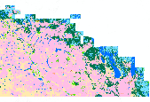
This map shows the distribution of ecological systems in the study area. These data are provided by Bureau of Land Management (BLM) "as is" and may contain errors or omissions. The User assumes the entire risk associated with its use of these data and bears all responsibility in determining whether these data are fit for the User's intended use. These data may not have the accuracy, resolution, completeness, timeliness, or other characteristics appropriate for applications that potential users of the data may contemplate. The User is encouraged to carefully consider the content of the metadata file associated with these data. The BLM should be cited as the data source in any products derived from these data.
This dataset presents current and future change agent models and combined future potential for change (PFC) within the basin grassland and shrubland system Conservation Element.The basin grassland and shrubland system extent was determined by querying the LANDFIRE existing vegetation dataset for basin grassland and shrubland and clipping the data to the ecoregion boundary.This dataset presents current and future change agent models and combined future potential for climate change (PFC). Potential for change (PFC) was determined by calculating the maximum potential for change among all change agents within each 1 km reporting unit. Current and future landscape intactness (LCM_C_FZ and LCM_N_FZ) are based on measures...
This dataset presents current and future change agent models and combined future potential for change (PFC) within the basin grassland and shrubland system Conservation Element.The basin grassland and shrubland system extent was determined by querying the LANDFIRE existing vegetation dataset for basin grassland and shrubland and clipping the data to the ecoregion boundary.This dataset presents current and future change agent models and combined future potential for climate change (PFC). Potential for change (PFC) was determined by calculating the maximum potential for change among all change agents within each 1 km reporting unit. Current and future landscape intactness (LCM_C_FZ and LCM_N_FZ) are based on measures...
BLM Surface Management Agency Layer
Types: Downloadable;
Tags: BLM,
Bankhead-Jones,
Bureau of Land Management,
Bureau of Reclamation,
DOI,
This dataset contains all National Forest Inventoried Roadless Areas (IRAs) for the Alaska Region (R10). The IRA data was originally submitted to GSTC by all national forests through their Regional Offices for the Forest Service's Roadless Area Conservation Initiative. The data was consolidated at the GSTC and used in the Draft Environment Impact Statement. Between the draft and final stages of the Environmental Impact Statement, the data was updated by the forests to reflect any corrections to Inventoried Roadless Areas that were based on their existing forest plan. The data was also supplemented to include Special Designated Area information and to include Inventoried Roadless Areas within Special Designated...
This file represents the final version of an assessment of the extent, condition, and distribution of grassland types in Arizona as indicated by expert interviews and field verification. Coverage includes the state of Arizona, Southwestern portions of the state of New Mexico, and the Northern portion of Sonora, Mexico.
Categories: Publication;
Types: Citation,
Map Service,
OGC WFS Layer,
OGC WMS Layer,
OGC WMS Service;
Tags: English,
GIS,
Madrean,
US,
assessment,
The Desert Renewable Energy Conservation Plan (DRECP), a major component of California's renewable energy planning efforts, will help provide effective protection and conservation of desert ecosystems while allowing for the appropriate development of renewable energy projects. The DRECP is focused on the desert regions and adjacent lands of seven California counties - Imperial, Inyo, Kern, Los Angeles, Riverside, San Bernardino, and San Diego. It is being prepared through an unprecedented collaborative effort between the California Energy Commission, California Department of Fish and Wildlife, the U.S. Bureau of Land Management, and the U.S. Fish and Wildlife Service also known as the Renewable Energy Action Team....
Categories: Publication;
Types: Citation,
Map Service,
OGC WFS Layer,
OGC WMS Layer,
OGC WMS Service;
Tags: English,
GIS,
OHV,
US,
bird,
What are current conditions for important park natural resources? What are the critical data and knowledge gaps? What are some of the factors that are influencing park resource conditions? Natural Resource Condition Assessments (NRCAs) evaluate and report on the above for a subset of important natural resources in national park units (hereafter, parks). Focal study resources and indicators are selected on a park-by-park basis, guided by use of structured resource assessment and reporting frameworks. Considerations include park resource setting and enabling legislation (what are this park's most important natural resources?) and presently available data and expertise (what can be evaluated at this time?). In addition...
Categories: Data;
Types: ArcGIS REST Map Service,
Map Service,
OGC WFS Layer,
OGC WMS Layer,
OGC WMS Service;
Tags: Chihuahuan Desert,
English,
GIS,
Madrean,
Mojave Desert,
Natural landscapes in the Southwestern United States are changing. In recent decades, rising temperatures and drought have led to drier conditions, contributed to large-scale ecological impacts, and affected many plant and animal species across the region. The current and future trajectory of climate change underscores the need for managers and conservation professionals to understand the impacts of these patterns on natural resources. In this regional assessment of the Southwest Climate Change Initiative, we evaluate changes in annual average temperatures from 1951–2006 across major habitats and large watersheds and compare these changes to the number of species of conservation concern that are found within these...
Categories: Publication;
Types: Citation,
Map Service,
OGC WFS Layer,
OGC WMS Layer,
OGC WMS Service;
Tags: Chihuahuan Desert,
English,
Madrean,
Mojave Desert,
Sonoran Desert,
ARS scientists publish results of their research projects in many formats. Listed below are the publications from research projects conducted at this location. Clicking on a publication title will take you to more information on the publication. Clicking on the reprint icon will take you to the publication reprint.
Types: Map Service,
OGC WFS Layer,
OGC WMS Layer,
OGC WMS Service;
Tags: GIS,
climate,
erosion,
fire,
grassland,
A Vision for the Chihuahuan Desert The Chihuahuan Desert, shared by two nations, is one of the most biologically rich desert ecoregions in the world, alive with large mammals, birds, reptiles and an unmatched diversity of cactus species. The desert’s rivers, streams and springs are considered to be of global significance, home to fish species found nowhere else on earth. Our vision is a Chihuahuan Desert where governments, local communities, non-governmental organizations, academic institutions, landowners, and other stakeholders are working together to ensure that the richness and diversity of wildlife, habitats, natural communities, and ecological processes of the Chihuahuan Desert are conserved and, where necessary,...
Types: Map Service,
OGC WFS Layer,
OGC WMS Layer,
OGC WMS Service;
Tags: Chihuahuan Desert,
assessment,
biodiversity,
connectivity,
development,
The National Forest Management Act (NFMA) of 1976 requires every national forest or grassland managed by the U.S. Forest Service to develop and maintain a Land and Resource Management Plan (often referred to as a forest plan). The forest plan is the principle long-range guidance document for each forest or grassland, providing direction for project and activity decision making. Forest plans articulate goals and objectives, the kinds of uses that are suitable for areas of a national forest, management standards and guidelines that apply to different kinds of activities, and the designation of special areas like Research Natural Areas. Forest plans are strategic in nature and do not compel any action or authorize...
Types: Map Service,
OGC WFS Layer,
OGC WMS Layer,
OGC WMS Service;
Tags: Arizona,
New Mexico,
desert,
fire,
grassland,
Vegetation and land-cover changes are not always directional but follow complex trajectories over space and time, driven by changing anthropogenic and abiotic conditions. We present a multi-observational approach to land-change analysis that addresses the complex geographic and temporal variability of vegetation changes related to climate and land use. Using land-ownership data as a proxy for land-use practices, multitemporal land-cover maps, and repeat photography dating to the late 19th century, we examine changing spatial and temporal distributions of two vegetation types with high conservation value in the southwestern United States: grasslands and riparian vegetation. In contrast to many reported vegetation...
Categories: Publication;
Types: Citation,
Map Service,
OGC WFS Layer,
OGC WMS Layer,
OGC WMS Service;
Tags: Arizona,
climate,
grassland,
land cover,
management,
A battery of questions was developed and applied to different stakeholders immersed in knowledge of the condition and the use of grazing of grasslands. One hundred people were surveyed amongst livestock producers (both from private ranches and from communal ejidos), and students and researchers at regional institutions involved in agricultural sciences in different states of Mexico: Coahuila, Durango, San Luis Potosí, and Jalisco. The objective of the survey was to determine aspects of stakeholders’ interpretation of the condition of grasslands in their region under conditions of extensive grazing, such as soil condition, harvest efficiency, vegetation condition, openness to community organizing of grazing, capacity...
Types: Map Service,
OGC WFS Layer,
OGC WMS Layer,
OGC WMS Service;
Tags: Mexico,
Spanish,
cultural,
desertification,
economic,
America’s remaining grassland in the Prairie Pothole Region (PPR) is at risk of being lost to crop production. When crop prices are high, like the historically high corn prices that the U.S. experienced between 2008 and 2014, the risk of grassland conversion is even higher. Changing climate will add uncertainties to any efforts toward conservation of grassland in the PPR. Grassland conversion to cropland in the region would imperil nesting waterfowl among other species and further impair water quality in the Mississippi watershed. In this project, we sought to contribute to the understanding of land conversion in the PPR with the aim to better target the use of public and private funds allocated toward incentivizing...
Categories: Publication;
Types: Citation,
Report;
Tags: Data Visualization & Tools,
Grasslands and Plains,
Landscapes,
Mississippi watershed,
North Central CASC,
Decomposition of grass leaf litter was studied on a shortgrass prairie using chemicals (HgCl2 and CuSO4) to prevent microbial activity (abiotic treatment), 53??m nylon mesh to exclude mesofauna (microbial treatment), and l?mm nylon mesh to allow the access of mesofauna. After 9 months, 15.2% of the blue grama grass litter was decomposed in the microbial treatment, and 29.4% was decomposed in the microbial plus mesofaunal treatment. After 7 months, 6.2% of the litter had disappeared from the abiotic treatment. There was a general decrease in C:N ratios with the microbial treatment lowest at the end of the experiment. Total available carbohydrates generally decreased with time. Certain mite families fluctuated with...
Categories: Publication;
Types: Citation,
Journal Citation;
Tags: Colorado,
Ecology,
abiotic,
carbon:nitrogen,
decomposition,
|

|
