Filters: Tags: Greenland (X)
98 results (110ms)|
Filters
Date Range
Extensions (Less) Types (Less)
Contacts (Less)
Categories (Less) Tag Types
|
Greenland. Solifluction lobes on the side of a kame 1 mile east of Beach Camp, northeast of Thule Air Force Base. August 1953.
This dataset contains the Digital Elevation Model (DEM) for Greenland from the Hydrologic Derivatives for Modeling and Analysis (HDMA) database. The HDMA database provides comprehensive and consistent global coverage of raster and vector topographically derived layers, including raster layers of digital elevation model (DEM) data, flow direction, flow accumulation, slope, and compound topographic index (CTI); and vector layers of streams and catchment boundaries. The coverage of the data is global (-180º, 180º, -90º, 90º) with the underlying DEM being a hybrid of three datasets: HydroSHEDS (Hydrological data and maps based on SHuttle Elevation Derivatives at multiple Scales), Global Multi-resolution Terrain Elevation...
This data set contains imagery from the National Agriculture Imagery Program (NAIP). The NAIP program is administered by USDA FSA and has been established to support two main FSA strategic goals centered on agricultural production. These are, increase stewardship of America's natural resources while enhancing the environment, and to ensure commodities are procured and distributed effectively and efficiently to increase food security. The NAIP program supports these goals by acquiring and providing ortho imagery that has been collected during the agricultural growing season in the U.S. The NAIP ortho imagery is tailored to meet FSA requirements and is a fundamental tool used to support FSA farm and conservation programs....
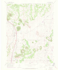
USGS Historical Quadrangle in GeoPDF.
Greenland. Interior view of a crevasse in Blue Ice Valley on the Greenland Ice Sheet. A glaciologist can be seen descending a rope ladder, 65 feet below the ice sheet surface. August 1955.
This data set contains imagery from the National Agriculture Imagery Program (NAIP). The NAIP program is administered by USDA FSA and has been established to support two main FSA strategic goals centered on agricultural production. These are increase stewardship of America's natural resources while enhancing the environment, and to ensure commodities are procured and distributed effectively and efficiently to increase food security. The NAIP program supports these goals by acquiring and providing ortho imagery that has been collected during the agricultural growing season in the U.S. The NAIP ortho imagery is tailored to meet FSA requirements and is a fundamental tool used to support FSA farm and conservation programs....
This data set contains imagery from the National Agriculture Imagery Program (NAIP). The NAIP program is administered by USDA FSA and has been established to support two main FSA strategic goals centered on agricultural production. These are, increase stewardship of America's natural resources while enhancing the environment, and to ensure commodities are procured and distributed effectively and efficiently to increase food security. The NAIP program supports these goals by acquiring and providing ortho imagery that has been collected during the agricultural growing season in the U.S. The NAIP ortho imagery is tailored to meet FSA requirements and is a fundamental tool used to support FSA farm and conservation programs....
This dataset contains the Flow Direction (FD) for Greenland from the Hydrologic Derivatives for Modeling and Analysis (HDMA) database. The HDMA database provides comprehensive and consistent global coverage of raster and vector topographically derived layers, including raster layers of digital elevation model (DEM) data, flow direction, flow accumulation, slope, and compound topographic index (CTI); and vector layers of streams and catchment boundaries. The coverage of the data is global (-180º, 180º, -90º, 90º) with the underlying DEM being a hybrid of three datasets: HydroSHEDS (Hydrological data and maps based on SHuttle Elevation Derivatives at multiple Scales), Global Multi-resolution Terrain Elevation Data...
|

|
