Filters: Tags: Guatemala (X)
97 results (14ms)|
Filters
Date Range
Extensions Types
Contacts
Categories Tag Types
|
Album caption: Tikal. Temples II, III, and IV as seen from W.A. Love's observation station on Temple I. Temple IV is the highest at this site and probably in all of the Maya area. People were living at Tikal as early as 600 B.C. Guatemala. 1923. No index card.
Categories: Image;
Types: Map Service,
OGC WFS Layer,
OGC WMS Layer,
OGC WMS Service;
Tags: Guatemala,
Kilmartin, J.O. Collection,
Photographers,
photo print
Album caption: Laguna de Eckixil from a point on the trail to Laguna de Petenxil. Guatemala. 1923. No index card.
Guatemala Earthquake 1976. Along railroad tracks that were kinked and offset approximately 107 centimeters in a sinistral sense where crossed by the Motagua fault, which is perpendicular to the tracks. This is one of numerous localities at which the main railroad line between the coastal port of Puerto Barrios and Guatemala City was disrupted by the faulting. 1976. Slide 15, U.S. Geological Survey Open-File Report 77-165.
Categories: Image;
Types: Map Service,
OGC WFS Layer,
OGC WMS Layer,
OGC WMS Service;
Tags: Earthquakes,
Guatemala,
Guatemala Earthquake 1976,
color transparency (slides)
This dataset includes polygons that describe the geologic age of surface outcrops of bedrock of the Caribbean region (Anguilla, Antigua and Barbuda, Aruba, Bahamas, Barbados, Belize, British Virgin Islands, Cayman Islands, Colombia, Costa Rica, Cuba, Dominica, Dominican Republic, El Salvador, Grenada, Guadeloupe, Guatemala, Guyana, Haiti, Honduras, Jamaica, Martinique, Mexico, Montserrat, Netherlands Antilles, Nicaragua, Panama, Puerto Rico, St. Kitts and Nevis, St. Lucia, St. Vincent and the Grenadines, Trinidad and Tobago, Turks and Caicos Islands, United States, Venezuela, and the Virgin Islands (named countries may not be completely shown on map)).
Categories: Data,
pre-SM502.8;
Types: Downloadable,
Map Service,
OGC WFS Layer,
OGC WMS Layer,
Shapefile;
Tags: AG,
AI,
AN,
AW,
Age,
Album caption: The local "sawmill" under a large leaf breadfruit tree in San Benito. Guatemala. 1923. No index card.
Categories: Image;
Types: Map Service,
OGC WFS Layer,
OGC WMS Layer,
OGC WMS Service;
Tags: Guatemala,
Kilmartin, J.O. Collection,
Photographers,
photo print
Album caption: A typical street in Flores. All streets are paved as shown here and are kept very clean. There are no wheeled vehicles on the island. Nor is there a public water supply. There is no municipal sewage facility. The coconut trees are on the Plaza. Guatemala. 1923. No index card.
Categories: Image;
Types: Map Service,
OGC WFS Layer,
OGC WMS Layer,
OGC WMS Service;
Tags: Guatemala,
Kilmartin, J.O. Collection,
Photographers,
photo print
Album caption: Amado Esquivel, major domo, and W.A. Love, observer, on the trail on the south shore of Lake Yaxha, Guatemala. 1923. No index card. .
Categories: Image;
Types: Map Service,
OGC WFS Layer,
OGC WMS Layer,
OGC WMS Service;
Tags: Guatemala,
Kilmartin, J.O. Collection,
Photographers,
photo print
Album caption: The east end of the southern arm of Lake Peten as seen from the highest mound on Tayasal Peninsula. Guatemala. 1923. No index card.
Categories: Image;
Types: Map Service,
OGC WFS Layer,
OGC WMS Layer,
OGC WMS Service;
Tags: Guatemala,
Kilmartin, J.O. Collection,
Photographers
Album caption: The largest and highest mound on Tayasal Peninsula. Islote de Lepet is in the right center. Guatemala. 1923. No index card.
Categories: Image;
Types: Map Service,
OGC WFS Layer,
OGC WMS Layer,
OGC WMS Service;
Tags: Guatemala,
Kilmartin, J.O. Collection,
Photographers,
photo print
Album caption: W.A. Love, observer, Department of Terrestrial Magnetism, Carnegie Institution of Washington. Guatemala. 1923. No index card.
Album caption: San Benito is the village on the peninsula in the upper left. It consists mainly of Negroes who fled British Honduras. Isla de Santa Barbara is the island in the upper right. This photogrpah was taken from the plaza in Flores. Guatemala. 1923. No album caption.
Categories: Image;
Types: Map Service,
OGC WFS Layer,
OGC WMS Layer,
OGC WMS Service;
Tags: Guatemala,
Kilmartin, J.O. Collection,
Photographers,
photo print
The Digital Chart of the World (DCW) is an Environmental Systems Research Institute, Inc. (ESRI) product originally developed for the US Defense Mapping Agency (DMA) using DMA data. The DCW 1993 version at 1:1,000,000 scale was used. The DMA data sources are aeronautical charts, which emphasize landmarks important from flying altitudes. This explains why there is a separate aeronautical theme with all conceivable airports, yet why on some themes small islands and lakes are simply unnamed points. ESRI, in compiling the DCW, also eliminated some detail and made some assumptions for handling tiny polygons and edgematching. Also, note that the completeness of the thematic categories present in each layer will vary....
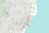
This inventory was originally created by Harp and others (1981) describing the landslides triggered by the M 7.5 Guatemala earthquake that occurred on 4 February 1976 at 09:01:43 UTC. Care should be taken when comparing with other inventories because different authors use different mapping techniques. This inventory also could be associated with other earthquakes such as aftershocks or triggered events. Please check the author methods summary and the original data source for more information on these details and to confirm the viability of this inventory for your specific use. With the exception of the data from USGS sources, the inventory data and associated metadata were not acquired by the U.S. Geological Survey...
Categories: Data;
Types: Citation,
Downloadable,
Map Service,
OGC WFS Layer,
OGC WMS Layer,
Shapefile;
Tags: Central America,
EHP,
Earthquake,
Earthquake Hazards Program,
Earthquakes,
Album caption: The principal mounds on Tayasal Peninsula as seen from San Benito. Isla de Santa Barbara is on th el
Guatemala Earthquake 1976. Landslide-dammed lake along Rio Pixcaya. The toe of the dam had been breached by the river by the time this photo was taken. February 13, 1976. Figure 37, U.S. Geological Survey Professional paper 1002.
Categories: Image;
Types: Map Service,
OGC WFS Layer,
OGC WMS Layer,
OGC WMS Service;
Tags: Earthquakes,
Guatemala,
Guatemala Earthquake 1976,
photo print
Guatemala Earthquake 1976. Pacaya volcano 25 kilometers south of Guatemala City during an ash eruption shortly after the February 4, 1976, earthquake. Although the amount of ash erupted from the volcano may have increased slightly as a result of the earthquake, the apparent increase is well within the limits of the variation in the volcano's activity that had been observed for roughly a year prior to the earthquake. 1976. Slide 51, U.S. Geological Survey Open-File Report 77-165.
Categories: Image;
Types: Map Service,
OGC WFS Layer,
OGC WMS Layer,
OGC WMS Service;
Tags: Earthquakes,
Guatemala,
Guatemala Earthquake 1976,
Pacaya volcano,
Volcanoes,
This dataset presents information about facilities relating to the mineral industries of Latin America and the Caribbean. Facilities include mines, mineral processing plants (including refineries and smelters), oil and gas field locations, and petroleum refineries. Relevant data fields include the mineral commodity, specific forms of the mineral commodity produced, location information, facility name, operator, ownership of the facility, annual production capacity, operational status, as well as geographic coordinates and locational accuracy. These data are derived from data presented by country by the Global Minerals Analysis section of the U.S. Geological Survey's (USGS) National Minerals Information Center (NMIC)...
|

|
