Filters: Tags: HAMILTON (X)
2,006 results (84ms)|
Filters
Date Range
Extensions Types
Contacts
Categories Tag Types
|
Heinrichs Geoexploration Co. Maps: Vulture Mine, Composite Drill Hole Map; 1 in. to 100 feet; 36 x 24 in.
Heinrichs Geoexploration Co. Maps: Vulture Mine Project, Composite Surface Map; 1 in. to 200 feet; 62 x 38 in.
A.F. Budge Mining Ltd. Maps: Vulture Mine, Section 21,400E; 1 in. to 40 feet; 17 x 11 in.
Heinrichs Geoexploration Co. Maps: Vulture Mine, Drill Hole Location Map; 1 in. to 200 feet; 58 x 42 in.
A.F. Budge Mining Ltd. Maps: Vulture Mine, Drill Hole Map, Sheet 4-N; 1 in. to 20 feet; 37 x 24 in.
A.F. Budge Mining Ltd. Maps: Vulture Mine, 550' Level Sample Locations; 1 in. to 20 feet; 36 x 24 in.
Heinrichs Geoexploration Co. Maps: Vulture Mine Placer Project, Geological Cross Sections and Bedrock Contours, Map 1; 1 in. to 40 feet; 36 x 24 in.
A.F. Budge Mining Ltd. Maps: Vulture Mine, Composite Drill Hole Map; 1 in. to 40 feet; 36 x 24 in.
A.F. Budge Mining Ltd. Maps: Vulture Mine, Drill Hole Map, Sheet 2-N; 1 in. to 20 feet; 36 x 24 in.
Heinrichs Geoexploration Co. Maps: Vulture Property, I.P. Line 10 Cross Section (N20W); 1 in. to 100 feet; 24 x 18 in.
Heinrichs Geoexploration Co. Maps: Vulture Mine, Composite Drill Hole Map; 1 in. to 100 feet; 36 x 24 in.
The 'Vulture: Option and Lease Agreement' file is part of the A. F. Budge Mining Ltd. Mining collection. A. F. Budge Mining Ltd., a British company owned by Tony Budge, controlled properties across several western U. S. states and northern Mexico. The company was active in Arizona during the 1980s and into the early 1990s. The collection consists of economic geologic information including maps, logs, reports and records. A few properties make up most of the collection: Vulture, United Verde Extension and Korn Kob.
This data set contains imagery from the National Agriculture Imagery Program (NAIP). The NAIP program is administered by USDA FSA and has been established to support two main FSA strategic goals centered on agricultural production. These are, increase stewardship of America's natural resources while enhancing the environment, and to ensure commodities are procured and distributed effectively and efficiently to increase food security. The NAIP program supports these goals by acquiring and providing ortho imagery that has been collected during the agricultural growing season in the U.S. The NAIP ortho imagery is tailored to meet FSA requirements and is a fundamental tool used to support FSA farm and conservation programs....
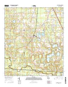
Layered GeoPDF 7.5 Minute Quadrangle Map. Layers of geospatial data include orthoimagery, roads, grids, geographic names, elevation contours, hydrography, and other selected map features.
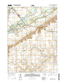
Layered GeoPDF 7.5 Minute Quadrangle Map. Layers of geospatial data include orthoimagery, roads, grids, geographic names, elevation contours, hydrography, and other selected map features.

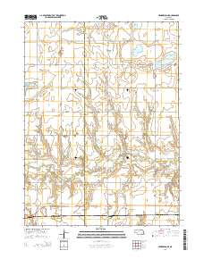
Layered geospatial PDF Map. Layers of geospatial data include orthoimagery, roads, grids, geographic names, elevation contours, hydrography, and other selected map features.
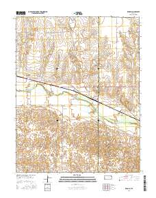
Layered GeoPDF 7.5 Minute Quadrangle Map. Layers of geospatial data include orthoimagery, roads, grids, geographic names, elevation contours, hydrography, and other selected map features.
Layered GeoPDF 7.5 Minute Quadrangle Map. Layers of geospatial data include orthoimagery, roads, grids, geographic names, elevation contours, hydrography, and other selected map features.
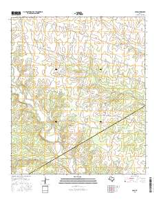
Layered GeoPDF 7.5 Minute Quadrangle Map. Layers of geospatial data include orthoimagery, roads, grids, geographic names, elevation contours, hydrography, and other selected map features.
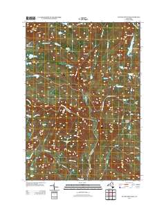
Layered GeoPDF 7.5 Minute Quadrangle Map. Layers of geospatial data include orthoimagery, roads, grids, geographic names, elevation contours, hydrography, and other selected map features.
|

|
