Filters: Tags: HANNA (X)
81 results (11ms)|
Filters
Date Range
Types Contacts
Categories Tag Types Tag Schemes |
This data set contains imagery from the National Agriculture Imagery Program (NAIP). The NAIP program is administered by USDA FSA and has been established to support two main FSA strategic goals centered on agricultural production. These are, increase stewardship of America's natural resources while enhancing the environment, and to ensure commodities are procured and distributed effectively and efficiently to increase food security. The NAIP program supports these goals by acquiring and providing ortho imagery that has been collected during the agricultural growing season in the U.S. The NAIP ortho imagery is tailored to meet FSA requirements and is a fundamental tool used to support FSA farm and conservation programs....
A portal with a vehicle parked in the adit.
Categories: Data;
Tags: 1950s,
Arizona,
Artillery Mtn.,
Artillery Mts. physiographic area,
Artillery Peak - 15 Min,
ADMMR map collection: Artillery Peak Manganese Deposits Geologic Cross Sections; 1 in. to 100 feet; 36 x 24 in.
Categories: Data;
Tags: 1940s,
Arizona,
Artillery Mtn.,
Artillery Mts. physiographic area,
Artillery Peak,
ADMMR map collection: Artillery Peak Manganese Deposits Vertical Cross Sections; 1 in. to 100 feet; 40 x 28 in.
Categories: Data;
Tags: 1940s,
Arizona,
Artillery Mtn.,
Artillery Mts. physiographic area,
Artillery Peak,
ADMMR map collection: Artillery Peak Explanation Sections; 36 x 24 in.
Categories: Data;
Tags: Arizona,
Artillery Mtn.,
Artillery Mts. physiographic area,
Artillery Peak,
Artillery Peak - 15 Min,
ADMMR map collection: Artillery Peak Explanation with Assay Data; 1 in. to 50 feet; 23 x 37 in.
Categories: Data;
Tags: Arizona,
Artillery Mtn.,
Artillery Mts. physiographic area,
Artillery Peak,
Artillery Peak - 15 Min,
This data set contains imagery from the National Agriculture Imagery Program (NAIP). The NAIP program is administered by USDA FSA and has been established to support two main FSA strategic goals centered on agricultural production. These are, increase stewardship of America's natural resources while enhancing the environment, and to ensure commodities are procured and distributed effectively and efficiently to increase food security. The NAIP program supports these goals by acquiring and providing ortho imagery that has been collected during the agricultural growing season in the U.S. The NAIP ortho imagery is tailored to meet FSA requirements and is a fundamental tool used to support FSA farm and conservation programs....
This data set contains imagery from the National Agriculture Imagery Program (NAIP). The NAIP program is administered by USDA FSA and has been established to support two main FSA strategic goals centered on agricultural production. These are, increase stewardship of America's natural resources while enhancing the environment, and to ensure commodities are procured and distributed effectively and efficiently to increase food security. The NAIP program supports these goals by acquiring and providing ortho imagery that has been collected during the agricultural growing season in the U.S. The NAIP ortho imagery is tailored to meet FSA requirements and is a fundamental tool used to support FSA farm and conservation programs....
ADMMR map collection: Artillery Peak Manganese Deposits Vertical Cross Sections; 1 in. to 100 feet; 37 x 25 in.
Categories: Data;
Tags: 1940s,
Arizona,
Artillery Mtn.,
Artillery Mts. physiographic area,
Artillery Peak,
ADMMR map collection: Artillery Peak Manganese Analysis of Special Composite Samples; 1 in. to 100 feet; 15 x 11 in.
Categories: Data;
Tags: Arizona,
Artillery Mtn.,
Artillery Mts. physiographic area,
Artillery Peak,
Artillery Peak - 15 Min,
ADMMR map collection: Artillery Peak Manganese Deposits Vertical Cross Sections; 1 in. to 100 feet; 37 x 24 in.
Categories: Data;
Tags: 1940s,
Arizona,
Artillery Mtn.,
Artillery Mts. physiographic area,
Artillery Peak,
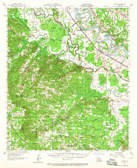
USGS Historical Quadrangle in GeoPDF.
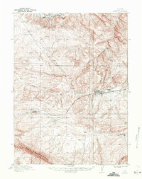
USGS Historical Quadrangle in GeoPDF.
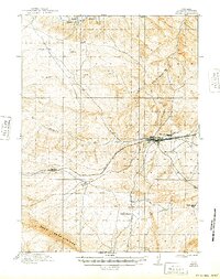
USGS Historical Quadrangle in GeoPDF.
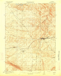
USGS Historical Quadrangle in GeoPDF.
Core Research Center, core U170, from well operated by USGS-CGRaw Properties from download, web scrape, MapServer, and Macrostrat API{"Lib Num": "U170", "API Num": null, "Operator": "USGS-CG", "Well Name": "29-E HANNA COAL FIELD", "Field": "HANNA COAL FIELD", "State": "WY", "County": "CARBON", "Type": "FULL", "Photos": "T", "Thin Sec": "F", "Analysis": "F", "Latitude": "41.88806", "Longitude": "-106.54917", "coordinates_geohash": "9xknr3mr8kk6", "Source": "FROM USGS RECORDS", "Security Flag": "NO SPECIAL RESTRICTIONS", "crc_collection_name": "core", "sb_parent_id": "4f4e49dae4b07f02db5e0486", "intervals": [{"Formation": "HANNA", "Age": "TERT", "Min Depth": "11", "Max Depth": "141"}], "crcwc_url": "https://my.usgs.gov/crcwc/core/report/16378",...
This location is part of the Arizona Mineral Industry Location System (AzMILS), an inventory of mineral occurences, prospects and mine locations in Arizona. Mohave405A is located in T12N R13W Sec 36 NW in the Artillery Peak - 15 Min quad. This collection consists of various reports, maps, records and related materials acquired by the Arizona Department of Mines and Mineral Resources regarding mining properties in Arizona. Information was obtained by various means, including the property owners, exploration companies, consultants, verbal interviews, field visits, newspapers and publications. Some sections may be redacted for copyright. Please see the access statement.
ADMMR map collection: Artillery Peak Manganese Proposed Mining Method; 1 in. to 20 feet; 38 x 26 in.
Categories: Data;
Tags: 1940s,
Arizona,
Artillery Mtn.,
Artillery Mts. physiographic area,
Artillery Peak,
This data set contains imagery from the National Agriculture Imagery Program (NAIP). The NAIP program is administered by USDA FSA and has been established to support two main FSA strategic goals centered on agricultural production. These are, increase stewardship of America's natural resources while enhancing the environment, and to ensure commodities are procured and distributed effectively and efficiently to increase food security. The NAIP program supports these goals by acquiring and providing ortho imagery that has been collected during the agricultural growing season in the U.S. The NAIP ortho imagery is tailored to meet FSA requirements and is a fundamental tool used to support FSA farm and conservation programs....
This data set contains imagery from the National Agriculture Imagery Program (NAIP). The NAIP program is administered by USDA FSA and has been established to support two main FSA strategic goals centered on agricultural production. These are, increase stewardship of America's natural resources while enhancing the environment, and to ensure commodities are procured and distributed effectively and efficiently to increase food security. The NAIP program supports these goals by acquiring and providing ortho imagery that has been collected during the agricultural growing season in the U.S. The NAIP ortho imagery is tailored to meet FSA requirements and is a fundamental tool used to support FSA farm and conservation programs....
|

|
