Filters: Tags: HOG ISLAND (X)
28 results (83ms)|
Filters
Date Range
Extensions Types Contacts
Categories Tag Types Tag Schemes |
This data set contains imagery from the National Agriculture Imagery Program (NAIP). The NAIP program is administered by USDA FSA and has been established to support two main FSA strategic goals centered on agricultural production. These are increase stewardship of America's natural resources while enhancing the environment, and to ensure commodities are procured and distributed effectively and efficiently to increase food security. The NAIP program supports these goals by acquiring and providing ortho imagery that has been collected during the agricultural growing season in the U.S. The NAIP ortho imagery is tailored to meet FSA requirements and is a fundamental tool used to support FSA farm and conservation programs....
This data set contains imagery from the National Agriculture Imagery Program (NAIP). The NAIP program is administered by USDA FSA and has been established to support two main FSA strategic goals centered on agricultural production. These are, increase stewardship of America's natural resources while enhancing the environment, and to ensure commodities are procured and distributed effectively and efficiently to increase food security. The NAIP program supports these goals by acquiring and providing ortho imagery that has been collected during the agricultural growing season in the U.S. The NAIP ortho imagery is tailored to meet FSA requirements and is a fundamental tool used to support FSA farm and conservation programs....
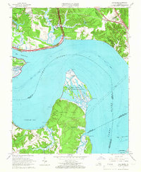
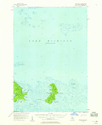
USGS Historical Quadrangle in GeoPDF.
This data set contains imagery from the National Agriculture Imagery Program (NAIP). The NAIP program is administered by USDA FSA and has been established to support two main FSA strategic goals centered on agricultural production. These are, increase stewardship of America's natural resources while enhancing the environment, and to ensure commodities are procured and distributed effectively and efficiently to increase food security. The NAIP program supports these goals by acquiring and providing ortho imagery that has been collected during the agricultural growing season in the U.S. The NAIP ortho imagery is tailored to meet FSA requirements and is a fundamental tool used to support FSA farm and conservation programs....
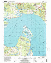
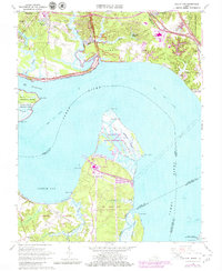
USGS Historical Quadrangle in GeoPDF.
Geologic structure and isopach maps were constructed by interpreting over 19,890 trackline kilometers of co-located multichannel boomer, sparker and chirp seismic reflection profiles from the continental shelf of the Delmarva Peninsula, including Maryland and Virginia state waters. In this region, Brothers and others (2020) interpret 12 seismic units and 11 regional unconformities. They interpret the infilled channels as Late Tertiary and Quaternary courses of the Susquehanna, Potomac, Rappahannock, York and James Rivers and tributaries, in addition to a broad drainage system. These regional unconformities form a composite unconformity interpreted as the Quaternary-Tertiary (Q-T) unconformity. A depth to Tertiary...
Categories: Data;
Types: Downloadable,
GeoTIFF,
Map Service,
Raster;
Tags: 32-bit GeoTIFF,
Applied Acoustics S-Boom Source,
Assateague Island,
Assateague Island National Seashore,
Atlantic Ocean,
These data are a qualitatively derived interpretive polygon shapefile defining surficial sediment type and distribution, and geomorphology, for nearly 1,400 square kilometers of sea floor on the inner-continental shelf from Fenwick Island, Maryland to Fisherman’s Island, Virginia, USA. These data are classified according to Barnhardt and others (1998) bottom-type classification system, which was modified to highlight changes in secondary sediment-types such as mud and gravel across this primarily sandy shelf. Most of the geophysical and sample data used to create this interpretive layer were collected as part of the Linking Coastal Processes and Vulnerability: Assateague Island Regional Study project (GS2-2C), supported...
Categories: Data;
Types: Downloadable,
Map Service,
OGC WFS Layer,
OGC WMS Layer,
Shapefile;
Tags: Assateague Island,
Assateague Island National Seashore,
Assawoman Island,
Atlantic Ocean,
Backscatter,
This data set contains imagery from the National Agriculture Imagery Program (NAIP). The NAIP program is administered by USDA FSA and has been established to support two main FSA strategic goals centered on agricultural production. These are, increase stewardship of America's natural resources while enhancing the environment, and to ensure commodities are procured and distributed effectively and efficiently to increase food security. The NAIP program supports these goals by acquiring and providing ortho imagery that has been collected during the agricultural growing season in the U.S. The NAIP ortho imagery is tailored to meet FSA requirements and is a fundamental tool used to support FSA farm and conservation programs....
This data release contains coastal wetland synthesis products for the Atlantic-facing Eastern Shore of Virginia (the data release for the Chesapeake Bay-facing portion of the Eastern Shore of Virginia is found here: https://doi.org/10.5066/P997EJYB). Metrics for resiliency, including unvegetated to vegetated ratio (UVVR), marsh elevation, and tidal range are calculated for smaller units delineated from a digital elevation model, providing the spatial variability of physical factors that influence wetland health. The U.S. Geological Survey has been expanding national assessment of coastal change hazards and forecast products to coastal wetlands with the intent of providing federal, state, and local managers with...
This data set contains imagery from the National Agriculture Imagery Program (NAIP). The NAIP program is administered by USDA FSA and has been established to support two main FSA strategic goals centered on agricultural production. These are, increase stewardship of America's natural resources while enhancing the environment, and to ensure commodities are procured and distributed effectively and efficiently to increase food security. The NAIP program supports these goals by acquiring and providing ortho imagery that has been collected during the agricultural growing season in the U.S. The NAIP ortho imagery is tailored to meet FSA requirements and is a fundamental tool used to support FSA farm and conservation programs....
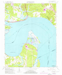
USGS Historical Quadrangle in GeoPDF.
This data release contains coastal wetland synthesis products for the Atlantic-facing Eastern Shore of Virginia (the data release for the Chesapeake Bay-facing portion of the Eastern Shore of Virginia is found here: https://doi.org/10.5066/P997EJYB). Metrics for resiliency, including unvegetated to vegetated ratio (UVVR), marsh elevation, and tidal range are calculated for smaller units delineated from a digital elevation model, providing the spatial variability of physical factors that influence wetland health. The U.S. Geological Survey has been expanding national assessment of coastal change hazards and forecast products to coastal wetlands with the intent of providing federal, state, and local managers with...
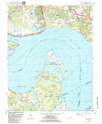
USGS Historical Quadrangle in GeoPDF.
This data set contains imagery from the National Agriculture Imagery Program (NAIP). The NAIP program is administered by USDA FSA and has been established to support two main FSA strategic goals centered on agricultural production. These are, increase stewardship of America's natural resources while enhancing the environment, and to ensure commodities are procured and distributed effectively and efficiently to increase food security. The NAIP program supports these goals by acquiring and providing ortho imagery that has been collected during the agricultural growing season in the U.S. The NAIP ortho imagery is tailored to meet FSA requirements and is a fundamental tool used to support FSA farm and conservation programs....
This data set contains imagery from the National Agriculture Imagery Program (NAIP). The NAIP program is administered by USDA FSA and has been established to support two main FSA strategic goals centered on agricultural production. These are, increase stewardship of America's natural resources while enhancing the environment, and to ensure commodities are procured and distributed effectively and efficiently to increase food security. The NAIP program supports these goals by acquiring and providing ortho imagery that has been collected during the agricultural growing season in the U.S. The NAIP ortho imagery is tailored to meet FSA requirements and is a fundamental tool used to support FSA farm and conservation programs....
This data set contains imagery from the National Agriculture Imagery Program (NAIP). The NAIP program is administered by USDA FSA and has been established to support two main FSA strategic goals centered on agricultural production. These are increase stewardship of America's natural resources while enhancing the environment, and to ensure commodities are procured and distributed effectively and efficiently to increase food security. The NAIP program supports these goals by acquiring and providing ortho imagery that has been collected during the agricultural growing season in the U.S. The NAIP ortho imagery is tailored to meet FSA requirements and is a fundamental tool used to support FSA farm and conservation programs....
USGS Historical Quadrangle in GeoPDF.
USGS Historical Quadrangle in GeoPDF.
Geologic structure and isopach maps were constructed by interpreting over 19.890 trackline kilometers of co-located multichannel boomer, sparker and chirp seismic reflection profiles from the continental shelf of the Delmarva Peninsula, including Maryland and Virginia state waters. In this region, Brothers and others (2020) interpret 12 seismic units and 11 regional unconformities. They interpret the infilled channels as Late Tertiary and Quaternary courses of the Susquehanna, Potomac, Rappahannock, York and James Rivers and tributaries, in addition to a broad drainage system. These regional unconformities form a composite unconformity interpreted as the Quaternary-Tertiary (Q-T) unconformity. A depth to Tertiary...
Categories: Data;
Types: Downloadable,
GeoTIFF,
Map Service,
Raster;
Tags: 32-bit GeoTIFF,
Applied Acoustics S-Boom Source,
Assateague Island,
Assateague Island National Seashore,
Atlantic Ocean,

USGS Historical Quadrangle in GeoPDF.
|

|
