Filters: Tags: HONNEDAGA LAKE (X)
8 results (48ms)|
Filters
Date Range
Types Contacts
Categories Tag Types
|
This data set contains imagery from the National Agriculture Imagery Program (NAIP). The NAIP program is administered by USDA FSA and has been established to support two main FSA strategic goals centered on agricultural production. These are, increase stewardship of America's natural resources while enhancing the environment, and to ensure commodities are procured and distributed effectively and efficiently to increase food security. The NAIP program supports these goals by acquiring and providing ortho imagery that has been collected during the agricultural growing season in the U.S. The NAIP ortho imagery is tailored to meet FSA requirements and is a fundamental tool used to support FSA farm and conservation programs....
Macroinvertebrate samples were collected from streams tributary to Honnedaga Lake and from the Middle Branch of the Black River during 2012-2016 and analyzed for methylmercury concentrations and for stable isotope ratios of nitrogen and carbon. Macroinvertebrates were identified in the field, and the level of taxonomic resolution varied from order to species; most taxa were identified to the family level. Specimens were field-processed into composite samples, field-frozen, and submitted to the mercury laboratory for freeze-drying and analysis. Subsamples were then submitted to the stable isotope laboratory for analysis of nitrogen and carbon isotope ratios. This database contains the resulting data and associated...
Categories: Data;
Types: Map Service,
OGC WFS Layer,
OGC WMS Layer,
OGC WMS Service;
Tags: Ambient Monitoring,
Aquatic Biology,
Aquatic Community Health,
Ecosystem Health,
Environmental Health,
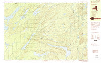
USGS Historical Quadrangle in GeoPDF.
This data set contains imagery from the National Agriculture Imagery Program (NAIP). The NAIP program is administered by USDA FSA and has been established to support two main FSA strategic goals centered on agricultural production. These are, increase stewardship of America's natural resources while enhancing the environment, and to ensure commodities are procured and distributed effectively and efficiently to increase food security. The NAIP program supports these goals by acquiring and providing ortho imagery that has been collected during the agricultural growing season in the U.S. The NAIP ortho imagery is tailored to meet FSA requirements and is a fundamental tool used to support FSA farm and conservation programs....
This data set contains imagery from the National Agriculture Imagery Program (NAIP). The NAIP program is administered by USDA FSA and has been established to support two main FSA strategic goals centered on agricultural production. These are, increase stewardship of America's natural resources while enhancing the environment, and to ensure commodities are procured and distributed effectively and efficiently to increase food security. The NAIP program supports these goals by acquiring and providing ortho imagery that has been collected during the agricultural growing season in the U.S. The NAIP ortho imagery is tailored to meet FSA requirements and is a fundamental tool used to support FSA farm and conservation programs....
In 2012, a program was initiated using in-stream and aerial (whole-watershed) liming to improve water quality and Brook Trout (Salvelinus fontinalis) recruitment in three acidified tributaries of a high-elevation Adirondack lake in New York State. Concurrently, macroinvertebrates were sampled annually between 2013 and 2016 at 3 treated and 3 untreated reference sites to assess the effects of each liming technique on this community. Macroinvertebrate communities were monitored at 6 study sites: T16, T8A (50 m upstream of lime application point), T8 (50 m downstream of lime application point), T6 (1230 m downstream of the lime application point), and at two unlimed reference streams, T24 and T20. T24 is of similar...
Categories: Data;
Tags: Adirondack Mountains,
Aquatic Biology,
Ecology,
Herkimer County,
Honnedaga Lake,
This data set contains imagery from the National Agriculture Imagery Program (NAIP). The NAIP program is administered by USDA FSA and has been established to support two main FSA strategic goals centered on agricultural production. These are, increase stewardship of America's natural resources while enhancing the environment, and to ensure commodities are procured and distributed effectively and efficiently to increase food security. The NAIP program supports these goals by acquiring and providing ortho imagery that has been collected during the agricultural growing season in the U.S. The NAIP ortho imagery is tailored to meet FSA requirements and is a fundamental tool used to support FSA farm and conservation programs....
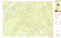
USGS Historical Quadrangle in GeoPDF.
|

|
