Filters
Date Range
Types
Contacts
Tag Types
Tag Schemes
|

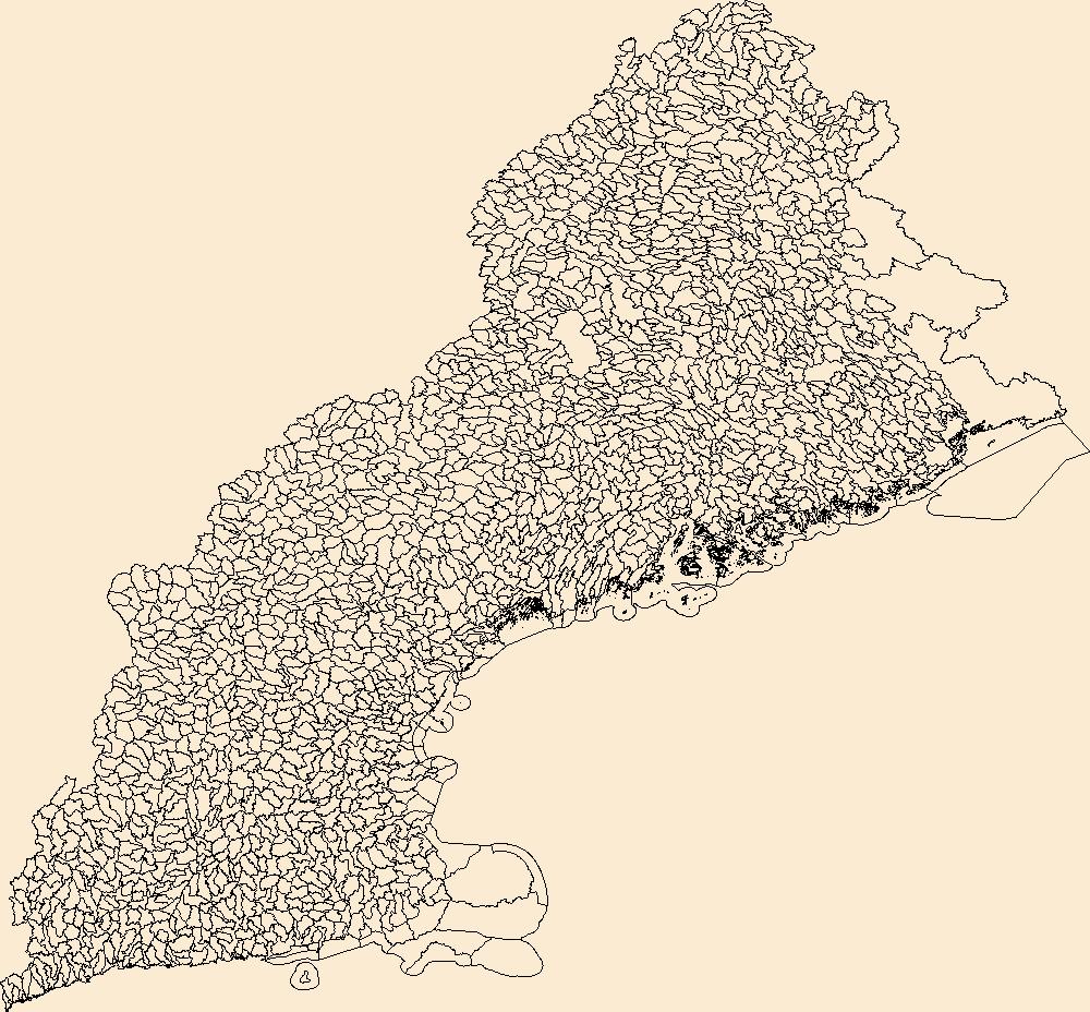
The Watershed Boundary Dataset (WBD) is a comprehensive aggregated collection of hydrologic unit data consistent with the national criteria for delineation and resolution. It defines the areal extent of surface water drainage to a point except in coastal or lake front areas where there could be multiple outlets as stated by the "Federal Standards and Procedures for the National Watershed Boundary Dataset (WBD)" "Standard" (https://pubs.usgs.gov/tm/11/a3/). Watershed boundaries are determined solely upon science-based hydrologic principles, not favoring any administrative boundaries or special projects, nor particular program or agency. This dataset represents the hydrologic unit boundaries to the 12-digit (6th level)...
Tags: 10-digit,
12-digit,
14-digit,
16-digit,
2-digit, All tags...
4-digit,
6-digit,
8-digit,
Addison,
Androscoggin,
Aroostook,
Barnstable,
Basin,
Belknap,
Bennington,
Berkshire,
Bristol,
CT,
Caledonia,
Capitol,
Carroll,
Cheshire,
Columbia,
Connecticut,
Coos,
Cumberland,
Downloadable Data,
Dukes,
Dutchess,
Essex,
Franklin,
GeoPackage,
Grafton,
Greater Bridgeport,
HU-2,
HU-2 Region,
HU2_01,
HUC,
Hampden,
Hampshire,
Hancock,
Hillsborough,
Hydrography,
Hydrologic Unit Code,
Hydrologic Units,
Kennebec,
Kent,
Knox,
Lincoln,
Lower Connecticut River Valley,
MA,
ME,
Maine,
Massachusetts,
Merrimack,
Middlesex,
NH,
NY,
Nantucket,
National Watershed Boundary Dataset (WBD),
National Watershed Boundary Dataset (WBD),
Naugatuck Valley,
New Hampshire,
New York,
Newport,
Norfolk,
Northeastern Connecticut,
Northwest Hills,
Open Geospatial Consortium GeoPackage 1.2,
Orange,
Orleans,
Oxford,
Penobscot,
Piscataquis,
Plymouth,
Providence,
Putnam,
RI,
Region,
Rhode Island,
Rockingham,
Rutland,
Sagadahoc,
Somerset,
South Central Connecticut,
Southeastern Connecticut,
Strafford,
Sub-basin,
Sub-region,
Subwatershed,
Suffolk,
Sullivan,
US,
United States,
VT,
Vermont,
WBD,
Waldo,
Washington,
Watershed,
Watershed Boundary Dataset,
Westchester,
Western Connecticut,
Windham,
Windsor,
Worcester,
York,
inlandWaters, Fewer tags

The Watershed Boundary Dataset (WBD) is a comprehensive aggregated collection of hydrologic unit data consistent with the national criteria for delineation and resolution. It defines the areal extent of surface water drainage to a point except in coastal or lake front areas where there could be multiple outlets as stated by the "Federal Standards and Procedures for the National Watershed Boundary Dataset (WBD)" "Standard" (https://pubs.usgs.gov/tm/11/a3/). Watershed boundaries are determined solely upon science-based hydrologic principles, not favoring any administrative boundaries or special projects, nor particular program or agency. This dataset represents the hydrologic unit boundaries to the 12-digit (6th level)...
Types: Citation;
Tags: 10-digit,
12-digit,
14-digit,
16-digit,
2-digit, All tags...
4-digit,
6-digit,
8-digit,
Addison,
Androscoggin,
Aroostook,
Barnstable,
Basin,
Belknap,
Bennington,
Berkshire,
Bristol,
CT,
Caledonia,
Capitol,
Carroll,
Cheshire,
Columbia,
Connecticut,
Coos,
Cumberland,
Downloadable Data,
Dukes,
Dutchess,
Esri Shapefile nan,
Essex,
Franklin,
Grafton,
Greater Bridgeport,
HU-2,
HU-2 Region,
HU2_01,
HUC,
Hampden,
Hampshire,
Hancock,
Hillsborough,
Hydrography,
Hydrologic Unit Code,
Hydrologic Units,
Kennebec,
Kent,
Knox,
Lincoln,
Lower Connecticut River Valley,
MA,
ME,
Maine,
Massachusetts,
Merrimack,
Middlesex,
NH,
NY,
Nantucket,
National Watershed Boundary Dataset (WBD),
National Watershed Boundary Dataset (WBD),
Naugatuck Valley,
New Hampshire,
New York,
Newport,
Norfolk,
Northeastern Connecticut,
Northwest Hills,
Orange,
Orleans,
Oxford,
Penobscot,
Piscataquis,
Plymouth,
Providence,
Putnam,
RI,
Region,
Rhode Island,
Rockingham,
Rutland,
Sagadahoc,
Shapefile,
Somerset,
South Central Connecticut,
Southeastern Connecticut,
Strafford,
Sub-basin,
Sub-region,
Subwatershed,
Suffolk,
Sullivan,
US,
United States,
VT,
Vermont,
WBD,
Waldo,
Washington,
Watershed,
Watershed Boundary Dataset,
Westchester,
Western Connecticut,
Windham,
Windsor,
Worcester,
York,
inlandWaters, Fewer tags
The Watershed Boundary Dataset (WBD) is a comprehensive aggregated collection of hydrologic unit data consistent with the national criteria for delineation and resolution. It defines the areal extent of surface water drainage to a point except in coastal or lake front areas where there could be multiple outlets as stated by the "Federal Standards and Procedures for the National Watershed Boundary Dataset (WBD)" "Standard" (https://pubs.usgs.gov/tm/11/a3/). Watershed boundaries are determined solely upon science-based hydrologic principles, not favoring any administrative boundaries or special projects, nor particular program or agency. This dataset represents the hydrologic unit boundaries to the 12-digit (6th level)...
Tags: 10-digit,
12-digit,
14-digit,
16-digit,
2-digit, All tags...
4-digit,
6-digit,
8-digit,
Addison,
Androscoggin,
Aroostook,
Barnstable,
Basin,
Belknap,
Bennington,
Berkshire,
Bristol,
CT,
Caledonia,
Capitol,
Carroll,
Cheshire,
Columbia,
Connecticut,
Coos,
Cumberland,
Downloadable Data,
Dukes,
Dutchess,
Esri File GeoDatabase 10,
Essex,
FileGDB,
Franklin,
Grafton,
Greater Bridgeport,
HU-2,
HU-2 Region,
HU2_01,
HUC,
Hampden,
Hampshire,
Hancock,
Hillsborough,
Hydrography,
Hydrologic Unit Code,
Hydrologic Units,
Kennebec,
Kent,
Knox,
Lincoln,
Lower Connecticut River Valley,
MA,
ME,
Maine,
Massachusetts,
Merrimack,
Middlesex,
NH,
NY,
Nantucket,
National Watershed Boundary Dataset (WBD),
National Watershed Boundary Dataset (WBD),
Naugatuck Valley,
New Hampshire,
New York,
Newport,
Norfolk,
Northeastern Connecticut,
Northwest Hills,
Orange,
Orleans,
Oxford,
Penobscot,
Piscataquis,
Plymouth,
Providence,
Putnam,
RI,
Region,
Rhode Island,
Rockingham,
Rutland,
Sagadahoc,
Somerset,
South Central Connecticut,
Southeastern Connecticut,
Strafford,
Sub-basin,
Sub-region,
Subwatershed,
Suffolk,
Sullivan,
US,
United States,
VT,
Vermont,
WBD,
Waldo,
Washington,
Watershed,
Watershed Boundary Dataset,
Westchester,
Western Connecticut,
Windham,
Windsor,
Worcester,
York,
inlandWaters, Fewer tags
|
|

