Filters
Date Range
Contacts
Tag Types
Tag Schemes
|
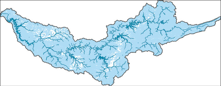
The National Hydrography Dataset (NHD) is a feature-based database that interconnects and uniquely identifies the stream segments or reaches that make up the nation's surface water drainage system. NHD data was originally developed at 1:100,000-scale and exists at that scale for the whole country. This high-resolution NHD, generally developed at 1:24,000/1:12,000 scale, adds detail to the original 1:100,000-scale NHD. (Data for Alaska, Puerto Rico and the Virgin Islands was developed at high-resolution, not 1:100,000 scale.) Local resolution NHD is being developed where partners and data exist. The NHD contains reach codes for networked features, flow direction, names, and centerline representations for areal water...
Tags: Adair,
Administrative watershed units,
Administrative watershed units,
Anderson,
Area of Complex Channels, All tags...
Area to be submerged,
Basin,
Basin,
Bay/Inlet,
Bedford,
Bell,
Bledsoe,
Boundaries,
Boundary,
Bridge,
Caldwell,
Campbell,
Canal/Ditch,
Cannon,
Casey,
Cheatham,
Christian,
Claiborne,
Clay,
Clinton,
Coastline,
Coffee,
Connector,
Crittenden,
Cumberland,
Dam/Weir,
Davidson,
DeKalb,
Dickson,
Downloadable Data,
Drainage areas for surface water,
Drainageway,
Esri Shapefile nan,
Estuary,
Fentress,
Flow direction network,
Flume,
ForeShore,
Gaging Station,
Garrard,
Gate,
Grundy,
HU-4,
HU-4 Subregion,
HU10,
HU12,
HU14,
HU16,
HU2,
HU4,
HU4_0513,
HU6,
HU8,
HUC,
Harlan,
Hazard Zone,
Hickman,
Houston,
Humphreys,
Hydrographic,
Hydrography,
Hydrography,
Hydrography,
Hydrologic Unit Code,
Hydrologic Units,
Ice mass,
Inundation Area,
Jackson,
KY,
Kentucky,
Knox,
Laurel,
Lee,
Leslie,
Letcher,
Levee,
Lincoln,
Line,
Livingston,
Lock Chamber,
Logan,
Lyon,
Macon,
Madison,
Marion,
Marsh,
McCreary,
Metcalfe,
Monroe,
Montgomery,
Morgan,
National Hydrography Dataset (NHD),
National Hydrography Dataset (NHD) Best Resolution,
National Hydrography Dataset (NHD) Best Resolution,
Nonearthen Shore,
Orthoimage,
Overton,
Pickett,
Playa,
Point,
PointEvent,
Pond,
Pulaski,
Putnam,
Rapids,
Rapids,
Reach,
Reach code,
Reef,
Region,
Reservoir,
Robertson,
Rock,
Rockcastle,
Russell,
Rutherford,
Scott,
Sea/Ocean,
Sequatchie,
Shapefile,
Simpson,
Sink/Rise,
Smith,
Sounding Datum Line,
Special Use Zone,
Special Use Zone Limit,
Spillway,
Stewart,
Stream,
Stream/River,
Sub-basin,
Sub-region,
Subbasin,
Submerged Stream,
Subregion,
Subwatershed,
Sumner,
Surface water systems,
Swamp,
TN,
Tennessee,
Todd,
Topographic,
Trigg,
Trousdale,
Tunnel,
US,
Underground Conduit,
United States,
VA,
Van Buren,
Virginia,
WBD,
WBD,
Wall,
Warren,
Wash,
Water Intake Outflow,
Waterfall,
Watershed,
Watershed Boundaries,
Watershed Boundary Dataset,
Watershed Boundary Dataset,
Wayne,
Well,
White,
Whitley,
Williamson,
Wilson,
Wise,
artificial path,
boundaries,
dams,
drainage systems and characteristics,
inlandWaters,
lakes,
ngda,
rivers, Fewer tags

The National Hydrography Dataset (NHD) is a feature-based database that interconnects and uniquely identifies the stream segments or reaches that make up the nation's surface water drainage system. NHD data was originally developed at 1:100,000-scale and exists at that scale for the whole country. This high-resolution NHD, generally developed at 1:24,000/1:12,000 scale, adds detail to the original 1:100,000-scale NHD. (Data for Alaska, Puerto Rico and the Virgin Islands was developed at high-resolution, not 1:100,000 scale.) Local resolution NHD is being developed where partners and data exist. The NHD contains reach codes for networked features, flow direction, names, and centerline representations for areal water...
Tags: Adair,
Administrative watershed units,
Administrative watershed units,
Anderson,
Area of Complex Channels, All tags...
Area to be submerged,
Basin,
Basin,
Bay/Inlet,
Bedford,
Bell,
Bledsoe,
Boundaries,
Boundary,
Bridge,
Caldwell,
Campbell,
Canal/Ditch,
Cannon,
Casey,
Cheatham,
Christian,
Claiborne,
Clay,
Clinton,
Coastline,
Coffee,
Connector,
Crittenden,
Cumberland,
Dam/Weir,
Davidson,
DeKalb,
Dickson,
Downloadable Data,
Drainage areas for surface water,
Drainageway,
Esri File GeoDatabase 10,
Estuary,
Fentress,
FileGDB,
Flow direction network,
Flume,
ForeShore,
Gaging Station,
Garrard,
Gate,
Grundy,
HU-4,
HU-4 Subregion,
HU10,
HU12,
HU14,
HU16,
HU2,
HU4,
HU4_0513,
HU6,
HU8,
HUC,
Harlan,
Hazard Zone,
Hickman,
Houston,
Humphreys,
Hydrographic,
Hydrography,
Hydrography,
Hydrography,
Hydrologic Unit Code,
Hydrologic Units,
Ice mass,
Inundation Area,
Jackson,
KY,
Kentucky,
Knox,
Laurel,
Lee,
Leslie,
Letcher,
Levee,
Lincoln,
Line,
Livingston,
Lock Chamber,
Logan,
Lyon,
Macon,
Madison,
Marion,
Marsh,
McCreary,
Metcalfe,
Monroe,
Montgomery,
Morgan,
National Hydrography Dataset (NHD),
National Hydrography Dataset (NHD) Best Resolution,
National Hydrography Dataset (NHD) Best Resolution,
Nonearthen Shore,
Orthoimage,
Overton,
Pickett,
Playa,
Point,
PointEvent,
Pond,
Pulaski,
Putnam,
Rapids,
Rapids,
Reach,
Reach code,
Reef,
Region,
Reservoir,
Robertson,
Rock,
Rockcastle,
Russell,
Rutherford,
Scott,
Sea/Ocean,
Sequatchie,
Simpson,
Sink/Rise,
Smith,
Sounding Datum Line,
Special Use Zone,
Special Use Zone Limit,
Spillway,
Stewart,
Stream,
Stream/River,
Sub-basin,
Sub-region,
Subbasin,
Submerged Stream,
Subregion,
Subwatershed,
Sumner,
Surface water systems,
Swamp,
TN,
Tennessee,
Todd,
Topographic,
Trigg,
Trousdale,
Tunnel,
US,
Underground Conduit,
United States,
VA,
Van Buren,
Virginia,
WBD,
WBD,
Wall,
Warren,
Wash,
Water Intake Outflow,
Waterfall,
Watershed,
Watershed Boundaries,
Watershed Boundary Dataset,
Watershed Boundary Dataset,
Wayne,
Well,
White,
Whitley,
Williamson,
Wilson,
Wise,
artificial path,
boundaries,
dams,
drainage systems and characteristics,
inlandWaters,
lakes,
ngda,
rivers, Fewer tags

The High Resolution National Hydrography Dataset Plus (NHDPlus HR) is an integrated set of geospatial data layers, including the best available National Hydrography Dataset (NHD), the 10-meter 3D Elevation Program Digital Elevation Model (3DEP DEM), and the National Watershed Boundary Dataset (WBD). The NHDPlus HR combines the NHD, 3DEP DEMs, and WBD to create a stream network with linear referencing, feature naming, "value added attributes" (VAAs), elevation-derived catchments, and other features for hydrologic data analysis. The stream network with linear referencing is a system of data relationships applied to hydrographic systems so that one stream reach "flows" into another and "events" can be tied to and traced...
Tags: Adair County,
Anderson County,
Bedford County,
Bell County,
Bledsoe County, All tags...
Caldwell County,
Campbell County,
Cannon County,
Casey County,
Cheatham County,
Christian County,
Claiborne County,
Clay County,
Clay County,
Clinton County,
Coffee County,
Crittenden County,
Cumberland County,
Cumberland County,
Davidson County,
DeKalb County,
Dickson County,
Downloadable Data,
Fentress County,
FileGDB,
FileGDB 10.1,
Garrard County,
Grundy County,
HU-4 Subregion,
HU-4 Subregion,
HU4_0513,
Harlan County,
Hickman County,
Houston County,
Humphreys County,
Hydrography,
Jackson County,
Jackson County,
KY,
Kentucky,
Knox County,
Laurel County,
Lee County,
Leslie County,
Letcher County,
Lincoln County,
Livingston County,
Logan County,
Lyon County,
Macon County,
Madison County,
Marion County,
McCreary County,
Metcalfe County,
Monroe County,
Montgomery County,
Morgan County,
NHDPlus HR Rasters,
NHDPlus High Resolution (NHDPlus HR),
National Hydrography Dataset (NHD),
National Hydrography Dataset Plus High Resolution (NHDPlus HR),
National Hydrography Dataset Plus High Resolution (NHDPlus HR) Current,
Overton County,
Pickett County,
Pulaski County,
Putnam County,
Robertson County,
Rockcastle County,
Russell County,
Rutherford County,
Scott County,
Sequatchie County,
Simpson County,
Smith County,
Stewart County,
Sumner County,
TN,
Tennessee,
Todd County,
Trigg County,
Trousdale County,
US,
United States,
VA,
Van Buren County,
Virginia,
Warren County,
Wayne County,
White County,
Whitley County,
Williamson County,
Wilson County,
Wise County,
base maps,
cartography,
catchments,
channels,
digital elevation models,
drainage basins,
earth sciences,
elevation,
environment,
geographic information systems,
geoscientific,
geospatial analysis,
hydrographic datasets,
hydrographic features,
hydrology,
imagery,
inland waters,
lakes,
land surface characteristics,
reservoirs,
river reaches,
rivers,
streamflow,
streamflow data,
streams,
topography,
water bodies,
water quality,
water resources,
watersheds, Fewer tags

The National Hydrography Dataset (NHD) is a feature-based database that interconnects and uniquely identifies the stream segments or reaches that make up the nation's surface water drainage system. NHD data was originally developed at 1:100,000-scale and exists at that scale for the whole country. This high-resolution NHD, generally developed at 1:24,000/1:12,000 scale, adds detail to the original 1:100,000-scale NHD. (Data for Alaska, Puerto Rico and the Virgin Islands was developed at high-resolution, not 1:100,000 scale.) Local resolution NHD is being developed where partners and data exist. The NHD contains reach codes for networked features, flow direction, names, and centerline representations for areal water...
Tags: Adair,
Administrative watershed units,
Administrative watershed units,
Anderson,
Area of Complex Channels, All tags...
Area to be submerged,
Basin,
Basin,
Bay/Inlet,
Bedford,
Bell,
Bledsoe,
Boundaries,
Boundary,
Bridge,
Caldwell,
Campbell,
Canal/Ditch,
Cannon,
Casey,
Cheatham,
Christian,
Claiborne,
Clay,
Clinton,
Coastline,
Coffee,
Connector,
Crittenden,
Cumberland,
Dam/Weir,
Davidson,
DeKalb,
Dickson,
Downloadable Data,
Drainage areas for surface water,
Drainageway,
Estuary,
Fentress,
Flow direction network,
Flume,
ForeShore,
Gaging Station,
Garrard,
Gate,
GeoPackage,
Grundy,
HU-4,
HU-4 Subregion,
HU10,
HU12,
HU14,
HU16,
HU2,
HU4,
HU4_0513,
HU6,
HU8,
HUC,
Harlan,
Hazard Zone,
Hickman,
Houston,
Humphreys,
Hydrographic,
Hydrography,
Hydrography,
Hydrography,
Hydrologic Unit Code,
Hydrologic Units,
Ice mass,
Inundation Area,
Jackson,
KY,
Kentucky,
Knox,
Laurel,
Lee,
Leslie,
Letcher,
Levee,
Lincoln,
Line,
Livingston,
Lock Chamber,
Logan,
Lyon,
Macon,
Madison,
Marion,
Marsh,
McCreary,
Metcalfe,
Monroe,
Montgomery,
Morgan,
National Hydrography Dataset (NHD),
National Hydrography Dataset (NHD) Best Resolution,
National Hydrography Dataset (NHD) Best Resolution,
Nonearthen Shore,
Open Geospatial Consortium GeoPackage 1.2,
Orthoimage,
Overton,
Pickett,
Playa,
Point,
PointEvent,
Pond,
Pulaski,
Putnam,
Rapids,
Rapids,
Reach,
Reach code,
Reef,
Region,
Reservoir,
Robertson,
Rock,
Rockcastle,
Russell,
Rutherford,
Scott,
Sea/Ocean,
Sequatchie,
Simpson,
Sink/Rise,
Smith,
Sounding Datum Line,
Special Use Zone,
Special Use Zone Limit,
Spillway,
Stewart,
Stream,
Stream/River,
Sub-basin,
Sub-region,
Subbasin,
Submerged Stream,
Subregion,
Subwatershed,
Sumner,
Surface water systems,
Swamp,
TN,
Tennessee,
Todd,
Topographic,
Trigg,
Trousdale,
Tunnel,
US,
Underground Conduit,
United States,
VA,
Van Buren,
Virginia,
WBD,
WBD,
Wall,
Warren,
Wash,
Water Intake Outflow,
Waterfall,
Watershed,
Watershed Boundaries,
Watershed Boundary Dataset,
Watershed Boundary Dataset,
Wayne,
Well,
White,
Whitley,
Williamson,
Wilson,
Wise,
artificial path,
boundaries,
dams,
drainage systems and characteristics,
inlandWaters,
lakes,
ngda,
rivers, Fewer tags
|
|

