Filters: Tags: Habitat (X) > partyWithName: U.S. Geological Survey (X)
168 results (13ms)|
Filters
Date Range
Extensions Types Contacts
Categories Tag Types
|

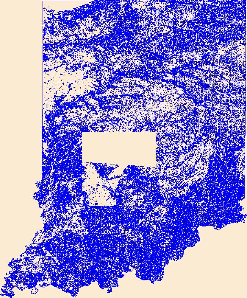
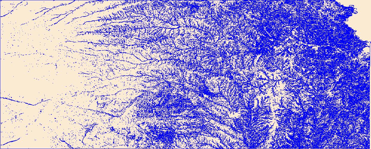
Geospatial data that is a derivative land cover product depicting woodland on topographic maps.

Geospatial data that is a derivative land cover product depicting woodland on topographic maps.

Geospatial data that is a derivative land cover product depicting woodland on topographic maps.

Geospatial data that is a derivative land cover product depicting woodland on topographic maps.

Geospatial data that is a derivative land cover product depicting woodland on topographic maps.

Geospatial data that is a derivative land cover product depicting woodland on topographic maps.

Geospatial data that is a derivative land cover product depicting woodland on topographic maps.

Geospatial data that is a derivative land cover product depicting woodland on topographic maps.

Geospatial data that is a derivative land cover product depicting woodland on topographic maps.

Geospatial data that is a derivative land cover product depicting woodland on topographic maps.
All gillnet data represented here expand upon vessel operations (OP table) data, all of which are collected by the United States Geological Survey, Great Lakes Science Center and its partners. The Gillnet Tables contain data collected from the research vessel deploying various gear used for gillnet data collection. The database uses sample_type to indicate the gear deployed. The tables relating to Gillnet are: GN_Annulus.csv, GN_Catch.csv, GN_Effort.csv, GN_Fish.csv, GN_L, GN_LF.csv, GN_OP.csv, GN_Prey.csv, GN_Stomach.csv, LMMB_Fish_Prey.csv, and LMMB_Invert_Prey.csv Data Quality: Note that the following data release is a snapshot of the database at the time of release. Some data quality checks are still being...

Geospatial data that is a derivative land cover product depicting woodland on topographic maps.
Potential habitat for the piping plover (Charadrius melodus) in Oklahoma was derived from the published Gap Analysis Project (GAP) Species Habitat Map.
Potential habitat for the gray bat (Myotis grisescens) in Oklahoma was derived from the published Gap Analysis Project (GAP) Species Habitat Map.
The Area of Influence for the rabbitsfoot (Theliderma cylindrica) in Oklahoma was derived from the national Area of Influence map provided by the U.S. Fish and Wildlife Service.
The Area of Influence for the winged mapleleaf (Quadrula fragosa) in Oklahoma was derived from the national Area of Influence map provided by the U.S. Fish and Wildlife Service.
OBIS-USA brings together marine biological occurrence data – recorded observations of identifiable marine species at a known time and place, collected primarily from U.S. Waters or with U.S. funding. Coordinated by the Science Analytics and Synthesis (SAS) Program of the United States Geological Survey (USGS), OBIS-USA, strives to meet national data integration and dissemination needs for marine data about organisms and ecosystems. OBIS-USA is part of an international data sharing network (Ocean Biodiversity Information System, OBIS) coordinated by the Intergovernmental Oceanographic Commission, of UNESCO (United Nations Educational, Science and Cultural Organization) International Oceanographic Data and Information...
The delineation of priority areas in western North America for managing Greater Sage-Grouse (Centrocercus urophasianus) represents a broad-scale experiment in conservation biology. The strategy of limiting spatial disturbance and focusing conservation actions within delineated areas may benefit the greatest proportion of Greater Sage-Grouse. However, land use under normal restrictions outside priority areas potentially limits dispersal and gene flow, which can isolate priority areas and lead to spatially disjunct populations. We used graph theory, representing priority areas as spatially distributed nodes interconnected by movement corridors, to understand the capacity of priority areas to function as connected...
Geospatial data that is a derivative land cover product depicting woodland on topographic maps.
Geospatial data that is a derivative land cover product depicting woodland on topographic maps.
|

|
