Filters: Tags: Hailey (X)
35 results (1.7s)|
Filters
Date Range
Extensions Types
Contacts
Categories Tag Types Tag Schemes |
The data release for the geologic terranes of the Hailey 1 x 2 degrees quadrangle and the western part of the Idaho Falls 1 x 2 degrees quadrangle, south-central Idaho is a Geologic Map Schema (GeMS)-compliant version that updates the GIS files for the geologic map published in U.S. Geological Survey (USGS) Bulletin 2064-A (Worl and Johnson, 1995). The updated digital data present the attribute tables and geospatial features (lines and polygons) in the format that meets GeMS requirements. This data release presents the geologic map as shown on the plate and captured in geospatial data for the published map. Minor errors, such as mistakes in line decoration or differences between the digital data and the map image,...
Categories: Data;
Types: ArcGIS REST Map Service,
ArcGIS Service Definition,
Downloadable,
Map Service;
Tags: Ada County,
Blaine County,
Butte County,
Camas County,
Custer County,

These data were released prior to the October 1, 2016 effective date for the USGS’s policy dictating the review, approval, and release of scientific data as referenced in USGS Survey Manual Chapter 502.8 Fundamental Science Practices: Review and Approval of Scientific Data for Release. Water levels in 93 wells completed in the Wood River Valley aquifer system were measured during October 22–24, 2012; these wells are part of a network established by the U.S. Geological Survey in 2006. Maps of the October 2012 water-table altitude in the unconfined aquifer and the potentiometric- surface altitude of the confined aquifer have similar topology to those on maps of October 2006 conditions. Between October 2006 and October...
These data were released prior to the October 1, 2016 effective date for the USGS’s policy dictating the review, approval, and release of scientific data as referenced in USGS Survey Manual Chapter 502.8 Fundamental Science Practices: Review and Approval of Scientific Data for Release. The entire population of the Wood River Valley depends on ground water for domestic supply, either from domestic or municipal-supply wells, rapid population growth since the 1970s has raised concerns about the continued availability of ground and surface water to support existing uses and streamflow. To help address these concerns, ground- and surface-water conditions in the area before and during the population growth that started...
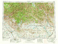
USGS Historical Quadrangle in GeoPDF.

These data were released prior to the October 1, 2016 effective date for the USGS’s policy dictating the review, approval, and release of scientific data as referenced in USGS Survey Manual Chapter 502.8 Fundamental Science Practices: Review and Approval of Scientific Data for Release. Water levels in 93 wells completed in the Wood River Valley aquifer system were measured during October 22–24, 2012; these wells are part of a network established by the U.S. Geological Survey in 2006. Maps of the October 2012 water-table altitude in the unconfined aquifer and the potentiometric -surface altitude of the confined aquifer have similar topology to those on maps of October 2006 conditions. Between October 2006 and October...
This data set contains imagery from the National Agriculture Imagery Program (NAIP). The NAIP program is administered by USDA FSA and has been established to support two main FSA strategic goals centered on agricultural production. These are, increase stewardship of America's natural resources while enhancing the environment, and to ensure commodities are procured and distributed effectively and efficiently to increase food security. The NAIP program supports these goals by acquiring and providing ortho imagery that has been collected during the agricultural growing season in the U.S. The NAIP ortho imagery is tailored to meet FSA requirements and is a fundamental tool used to support FSA farm and conservation programs....

USGS Historical Quadrangle in GeoPDF.

These data were released prior to the October 1, 2016 effective date for the USGS’s policy dictating the review, approval, and release of scientific data as referenced in USGS Survey Manual Chapter 502.8 Fundamental Science Practices: Review and Approval of Scientific Data for Release. This dataset is the estimated altitude of the top of the uppermost fine-grained sediment within the Wood River Valley aquifer system. This map was compiled by describing the estimated altitude of the top of the fine-grained sediment from about 160 well-driller reports for boreholes drilled within the area of the approximate extent of the confined aquifer. A surface was generated using kriging of the point data. This dataset was created...
These data were released prior to the October 1, 2016 effective date for the USGS’s policy dictating the review, approval, and release of scientific data as referenced in USGS Survey Manual Chapter 502.8 Fundamental Science Practices: Review and Approval of Scientific Data for Release. The entire population of the Wood River Valley depends on ground water for domestic supply, either from domestic or municipal-supply wells, rapid population growth since the 1970s has raised concerns about the continued availability of ground and surface water to support existing uses and streamflow. To help address these concerns, ground- and surface-water conditions in the area before and during the population growth that started...

These data were released prior to the October 1, 2016 effective date for the USGS’s policy dictating the review, approval, and release of scientific data as referenced in USGS Survey Manual Chapter 502.8 Fundamental Science Practices: Review and Approval of Scientific Data for Release. This dataset is the estimated altitude of the consolidated rock surface underlying Quaternary sediment of the Wood River Valley aquifer system. This surface is composed of the top of pre-Quaternary bedrock and Quaternary basalt, Wood River Valley, south-central Idaho. This surface was constructed using the depth of bedrock from about 1,000 well-driller reports for boreholes and about 70 Horizontal-to-Vertical Spectral Ratio (HVSR)...
These data were released prior to the October 1, 2016 effective date for the USGS’s policy dictating the review, approval, and release of scientific data as referenced in USGS Survey Manual Chapter 502.8 Fundamental Science Practices: Review and Approval of Scientific Data for Release. The entire population of the Wood River Valley depends on ground water for domestic supply, either from domestic or municipal-supply wells, rapid population growth since the 1970s has raised concerns about the continued availability of ground and surface water to support existing uses and streamflow. To help address these concerns, ground- and surface-water conditions in the area before and during the population growth that started...

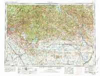
USGS Historical Quadrangle in GeoPDF.

USGS Historical Quadrangle in GeoPDF.
These data were released prior to the October 1, 2016 effective date for the USGS’s policy dictating the review, approval, and release of scientific data as referenced in USGS Survey Manual Chapter 502.8 Fundamental Science Practices: Review and Approval of Scientific Data for Release. The entire population of the Wood River Valley depends on ground water for domestic supply, either from domestic or municipal-supply wells, rapid population growth since the 1970s has raised concerns about the continued availability of ground and surface water to support existing uses and streamflow. To help address these concerns, ground- and surface-water conditions in the area before and during the population growth that started...
This data set contains imagery from the National Agriculture Imagery Program (NAIP). The NAIP program is administered by USDA FSA and has been established to support two main FSA strategic goals centered on agricultural production. These are, increase stewardship of America's natural resources while enhancing the environment, and to ensure commodities are procured and distributed effectively and efficiently to increase food security. The NAIP program supports these goals by acquiring and providing ortho imagery that has been collected during the agricultural growing season in the U.S. The NAIP ortho imagery is tailored to meet FSA requirements and is a fundamental tool used to support FSA farm and conservation programs....
USGS Historical Quadrangle in GeoPDF.
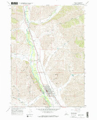
USGS Historical Quadrangle in GeoPDF.

These data were released prior to the October 1, 2016 effective date for the USGS’s policy dictating the review, approval, and release of scientific data as referenced in USGS Survey Manual Chapter 502.8 Fundamental Science Practices: Review and Approval of Scientific Data for Release. This dataset is the estimated thickness of Quaternary sediment of the Wood River Valley aquifer system. This isopach map was constructed by subtracting the estimated altitude of the consolidated rock surface underlying Quaternary sediments surface (sir12-5053_BRsurf) from the altitude of land surface obtained from the 2009 1-Arc Second National Elevation Dataset as described in the "Process Step" section below. This dataset was created...

These data were released prior to the October 1, 2016 effective date for the USGS’s policy dictating the review, approval, and release of scientific data as referenced in USGS Survey Manual Chapter 502.8 Fundamental Science Practices: Review and Approval of Scientific Data for Release. Water levels in 93 wells completed in the Wood River Valley aquifer system were measured during October 22–24, 2012; these wells are part of a network established by the U.S. Geological Survey in 2006. Maps of the October 2012 water-table altitude in the unconfined aquifer and the potentiometric-surface altitude of the confined aquifer have similar topology to those on maps of October 2006 conditions. Between October 2006 and October...

USGS Historical Quadrangle in GeoPDF.
|

|
