Filters: Tags: Hazard (X)
123 results (50ms)|
Filters
Date Range
Extensions Types Contacts
Categories Tag Types
|
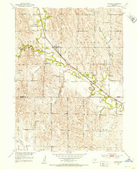
USGS Historical Quadrangle in GeoPDF.
Peak ground acceleration ground motion values for 50, 10, and 2 percent probability of exceedance in 50 years are converted to equivalent modified Mercalli intensity using the relationships of Worden and others (2012). Values are for NEHRP site class B/C with a VS30 = 760 m/s.
Types: Map Service,
OGC WFS Layer,
OGC WMS Layer,
OGC WMS Service;
Tags: Class B/C,
Conterminous United States (CONUS),
Earthquake,
Hazard,
MMI,

Global Landslide Hazard Distribution is a 2.5 by 2.5 minute grid of global landslide and snow avalanche hazards based upon work of the Norwegian Geotechnical Institute (NGI). The hazards mapping of NGI incorporates a range of data including slope, soil, soil moisture conditions, precipitation, seismicity, and temperature. Shuttle Radar Topography Mission (SRTM) elevation data at 30 seconds resolution are also incorporated. Hazards values 4 and below are considered neglibile and only values 5 through 9 are utilized in further analyses. To ensure compatibiliy with other datasets, 1 is added to each of the values to provide a hazard ranking ranging 6 through 10 in increasing hazard. The dataset is a result of the collaboration...
This data set represents the results of calculations of hazard curves for a grid of points with a spacing of 0.05 degrees in latitude and longitude. This particular data set is for horizontal spectral response acceleration for 0.2-second period with a 1 percent probability of exceedance in 1 year. The data are for the Central and Eastern United States and are based on the one-year model.
Categories: Data;
Types: Citation,
Downloadable,
Map Service,
OGC WFS Layer,
OGC WMS Layer,
Shapefile;
Tags: Alabama,
Arizona,
Arkansas,
Colorado,
Connecticut,
Risk-targeted maximum considered earthquake ground acceleration maps (MCER) are for the design of buildings and other structures. The maps are derived from the USGS seismic hazard maps in accordance with the site-specific ground-motion procedures of the NEHRP Recommended Seismic Provisions for New Building and Other Structures and the ASCE Minimum Design Loads for Buildings and Other Structures (also known as the ASCE 7 Standard; ASCE, 2016). The MCER ground motions are taken as the lesser of probabilistic and deterministic values, as explained in the Provisions. The gridded probabilistic and deterministic values for 0.2-second spectral response acceleration are available here.
Categories: Data;
Types: Citation,
Downloadable,
Map Service,
OGC WFS Layer,
OGC WMS Layer,
Shapefile;
Tags: Argentina,
Bolivia,
Brazil,
Chile,
Colombia,
A seismic hazard model for South America, based on a smoothed (gridded) seismicity model, a subduction model, a crustal fault model, and a ground motion model, has been produced by the U.S. Geological Survey. These models are combined to account for ground shaking from earthquakes on known faults as well as earthquakes on un-modeled faults. This data set represents the results of calculations of hazard curves for a grid of points with a spacing of 0.1 degrees in latitude and longitude. This particular data set is for horizontal spectral response acceleration for 1.0-second period with a 50 percent probability of exceedance in 50 years.
Categories: Data;
Types: Citation,
Downloadable,
Map Service,
OGC WFS Layer,
OGC WMS Layer,
Shapefile;
Tags: Argentina,
Bolivia,
Brazil,
Chile,
Colombia,
Digital flood-inundation maps were created for a 7.1-mile reach of the North Fork Kentucky River at Hazard, Kentucky. The flood-inundation maps, which can be accessed through the U.S. Geological Survey (USGS) Flood Inundation Mapping Science website at https://water.usgs.gov/osw/flood_inundation/, depict estimates of the areal extent and depth of flooding corresponding to selected water levels (stages) at the USGS streamgage on the North Fork Kentucky River at Hazard, Kentucky (USGS station number 03277500). Near-real-time stages at this streamgage may be obtained on the Internet from the USGS National Water Information System at https://waterdata.usgs.gov/ or the National Weather Service (NWS) Advanced Hydrologic...
The U. S. Geological Survey (USGS) makes long-term seismic hazard forecasts that are used in building codes. The hazard models usually consider only natural seismicity; non-tectonic (man-made) earthquakes are excluded because they are transitory or too small. In the past decade, however, thousands of earthquakes related to underground fluid injection have occurred in the central and eastern U.S. (CEUS), and some have caused damage. In response, the USGS is now also making short-term forecasts that account for the hazard from these induced earthquakes. A uniform earthquake catalog is assembled by combining and winnowing pre-existing source catalogs. Seismicity statistics are analyzed to develop recurrence models,...
A one-year seismic hazard forecast for the Central and Eastern United States, based on induced and natural earthquakes, has been produced by the U.S. Geological Survey. The model assumes that earthquake rates calculated from several different time windows will remain relatively stationary and can be used to forecast earthquake hazard and damage intensity for the year 2016. This assessment is the first step in developing an operational earthquake forecast for the CEUS, and the analysis could be revised with updated seismicity and model parameters. Consensus input models consider alternative earthquake catalog durations, smoothing parameters, maximum magnitudes, and ground motion estimates, and represent uncertainties...
Categories: Data;
Types: Downloadable,
GeoTIFF,
Map Service,
Raster;
Tags: Arizona,
California,
Colorado,
Earthquake,
Hazard,
A one-year seismic hazard forecast for the Central and Eastern United States, based on induced and natural earthquakes, has been produced by the U.S. Geological Survey. The model assumes that earthquake rates calculated from several different time windows will remain relatively stationary and can be used to forecast earthquake hazard and damage intensity for the year 2016. This assessment is the first step in developing an operational earthquake forecast for the CEUS, and the analysis could be revised with updated seismicity and model parameters. Consensus input models consider alternative earthquake catalog durations, smoothing parameters, maximum magnitudes, and ground motion estimates, and represent uncertainties...
Categories: Data;
Types: Downloadable,
Map Service,
OGC WFS Layer,
OGC WMS Layer,
Shapefile;
Tags: Arizona,
California,
Colorado,
Earthquake,
Hazard,
This data set represents the results of calculations of hazard curves for a grid of points with a spacing of 0.05 degrees in latitude and longitude. It represents the average Modified Mercalli Intensity (MMI) with a 1-percent probability of exceedance in 1 year. Using a topographic-based soil classification method, the ground motions are amplified for soil type. The MMI values are the average of the MMI values obtained by converting peak ground acceleration to MMI and 1.0-second spectral response acceleration to MMI. The data are for the Central and Eastern United States and are based on the one-year model.
Categories: Data;
Types: Citation,
Downloadable,
GeoTIFF,
Map Service,
Raster;
Tags: Alabama,
Arizona,
Arkansas,
Colorado,
Connecticut,
These data sets are the results of calculations of hazard curves for a grid of points with a spacing of 0.05 degrees in latitude and longitude. They represent the chance of experiencing potentially damaging ground shaking for fixed ground shaking levels that corresponds with MMI = VI. The values are obtained by averaging the probability of experiencing MMI = VI based on a peak ground acceleration value of 0.1155 g for site class D, and the probability of experiencing MMI = VI based on 1.0-second spectral acceleration value of 0.102 g for site class D. The data are for the Western United States.
Categories: Data;
Types: Downloadable,
Map Service,
OGC WFS Layer,
OGC WMS Layer,
Shapefile;
Tags: Arizona,
California,
Colorado,
Earthquake,
Hazard,
- Observations and treatment of various species of raptorial birds admitted to a rehabilitation facility, and of nestling barn owls observed and sampled in the field - Clotting time parameters (prothrombin time, Russell’s viper venom time, fibrinogen concentration) - Anticoagulant rodenticide residue data
Categories: Data;
Types: Map Service,
OGC WFS Layer,
OGC WMS Layer,
OGC WMS Service;
Tags: Anticoagulant rodenticides,
British Columbia,
Ecotoxicology,
Ecotoxicology,
Environmental Contaminants,
Gridded, uniform-hazard data for 2%, 5%, and 10% probability of exceedance in 50 years were extracted from the hazard curves for all twenty-three ground-motion intensity measures and all eight soil site classes. The ground-motion intensity measures, including PGA, PGV, and spectral accelerations for 0.01, 0.02, 0.03, 0.05, 0.075, 0.1, 0.15, 0.2, 0.25, 0.3, 0.4, 0.5, 0.75, 1, 1.5, 2, 3, 4, 5, 7.5 and 10 second, and the soil site classes include VS30 = 1500, 1080, 760, 530, 365, 260, 185, and 150 m/sec, representing NEHRP site classes A/B, B, B/C, C, C/D, D, D/E, and E.
Types: Map Service,
OGC WFS Layer,
OGC WMS Layer,
OGC WMS Service;
Tags: Earthquake,
Hawaii,
Hazard,
Seismic
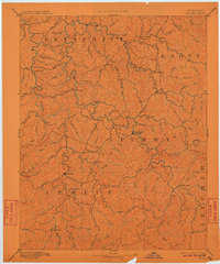
USGS Historical Quadrangle in GeoPDF.
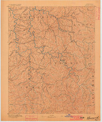
USGS Historical Quadrangle in GeoPDF.
This data set contains maps and shapefiles of uniform-hazard ground motion values calculated for a grid of points with a spacing of 0.2° in latitude and longitude over the conterminous U.S and Alaska, and 0.02° over Hawaii, using the 2023 National Seismic Hazard Model. 2%, 5% and 10% in 50-year probability of exceedance values are shown for peak ground acceleration (PGA), and 0.2, 1, and 5 second spectral acceleration for VS30 = 760 and 260 m/s, representing the National Earthquake Hazards Reduction Program site conditions B/C and D, respectively.
Types: Map Service,
OGC WFS Layer,
OGC WMS Layer,
OGC WMS Service;
Tags: Class B/C,
Class D,
Conterminous United States (CONUS),
Earthquake,
Hazard,
This data set represents the results of calculations of hazard curves for a grid of points with a spacing of 0.05 degrees in latitude and longitude. This particular data set is for horizontal spectral response acceleration for 1.0-second period with a 1 percent probability of exceedance in 1 year. The data are for the Western United States and are based on the long-term 2014 National Seismic Hazard Model.
Categories: Data;
Types: Citation,
Downloadable,
Map Service,
OGC WFS Layer,
OGC WMS Layer,
Shapefile;
Tags: Arizona,
California,
Colorado,
Earthquake,
Hazard,
This maps portrays the spatial potential for damaging earthquake ground shaking quantified as moderate (MMI ≥ VII) in 100 years. The maps and data are based on the average of the results obtained from peak ground acceleration and 1.0-second horizontal spectral acceleration. Site specific soil factors based on Vs30 shear wave velocities were implemented using a simple topographic proxy technique (Allen and Wald, 2009) and site amplification based on the relationships of Seyhan and Stewart (2014). MMI ≥ VII is equivalent to peak ground acceleration of 0.22g and 1.0-second horizontal spectral acceleration of 0.23g (Worden et al., 2012). Allen, T.A. and Wald, D.J. 2009,. On the use of high-resolution topographic...
Categories: Data;
Types: Citation,
Downloadable,
Map Service,
OGC WFS Layer,
OGC WMS Layer,
Shapefile;
Tags: Argentina,
Bolivia,
Brazil,
Chile,
Colombia,
On May 25, 2014, a rain-on-snow induced rock avalanche occurred in the West Salt Creek Valley on the northern flank of Grand Mesa in western Colorado. The avalanche traveled 4.6 km down the confined valley, killing 3 people. The avalanche was rare for the contiguous U.S. because of its large size (54.5 Mm3) and long travel distance. To understand the avalanche failure sequence, mechanisms, and mobility, we mapped landslide structures, geology, and ponds at 1:1000-scale. We used high-resolution, Unmanned Aircraft System (UAS) imagery from July 2014 as a base for our field mapping. Here we present the map data and UAS imagery. The data accompany an interpretive paper published in the journal Geosphere. The full citation...
Types: Citation,
Map Service,
OGC WFS Layer,
OGC WMS Layer,
OGC WMS Service;
Tags: Collbran,
Colorado,
Grand Mesa,
Green River Formation,
UAS,
|

|
