Filters: Tags: Highways (X) > partyWithName: U.S. Geological Survey (X)
10 results (60ms)|
Filters
Date Range
Extensions Types Contacts
Categories Tag Types Tag Schemes
|
All Interstates in the western United States from the 2000 US Census TIGER/line files.
Categories: Data;
Types: Downloadable,
Map Service,
OGC WFS Layer,
OGC WMS Layer,
Shapefile;
Tags: Arizona,
California,
Census 2000,
Colorado,
Idaho,

This map layer portrays the major roads in the United States, Puerto Rico, and the U.S. Virgin Islands. The file was produced by joining the individual State roads layers from the National Highway Planning Network (NHPN), Geographic Data Technology (GDT) Dynamap, and TIGER/Line files. This is a revised version of the July 2012 map layer.
Density (km / km^2) of all roads in the western United States. Dataset was developed to generalize the 2000 US Census TIGER/Line Roads layer to a density within 18km of each pixel. Obtained from 2000 US Census TIGER/Line Roads using LINEDENSITY with an 18km search radius.
Categories: Data;
Types: Downloadable,
GeoTIFF,
Map Service,
Raster;
Tags: Arizona,
California,
Census 2000,
Colorado,
Idaho,
Major roads in northern North America as determined by the U.S. National Atlas and The National Atlas of Canada (geogratis.cgdi.gc.ca). National data layers were re-attributed and merged to create a seamless major road layer for North America.
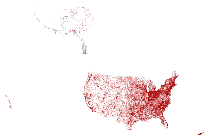
This map layer portrays the major roads in the United States, Puerto Rico, and the U.S. Virgin Islands. The file was produced by joining the individual State roads layers from the National Highway Planning Network (NHPN), Geographic Data Technology (GDT) Dynamap, and TIGER/Line files. This is a revised version of the July 2012 map layer.
All State and Federal Highways in the western United States from the 2000 US Census TIGER/line files.
All secondary roads in the western United States from the 2000 US Census TIGER/line files. Secondary roads are defined as all roadways not classified as an interstate, state highway, or federal highway.
Categories: Data;
Types: Downloadable,
Map Service,
OGC WFS Layer,
OGC WMS Layer,
Shapefile;
Tags: Arizona,
California,
Census 2000,
Colorado,
Idaho,
This dataset consists of point features identifying indices for potential passage rate at intersections with major transportation corridors for grizzly bear movements between the Greater Yellowstone Ecosystem (GYE) and Northern Continental Divide Ecosystem (NCDE) in the northwestern United States. Points are spaced at 300-meter intervals along major road corridors (interstates and U.S. highways) and are populated with values from Randomized Shortest Path (RSP) predictive raster models of potential male grizzly bear movement between the two ecosystems as described in Peck et al. 2016 (Potential paths for male-mediated gene flow to and from an isolated grizzly bear population, Ecosphere 8(10):e01969). RSP scores extracted...
Categories: Data;
Types: Downloadable,
Map Service,
OGC WFS Layer,
OGC WMS Layer,
Shapefile;
Tags: Greater Yellowstone Ecosystem,
Idaho,
Montana,
United States,
biota,
All roads in the western United States from the 2000 US CensusTIGER/line files.
Categories: Data;
Types: Downloadable,
Map Service,
OGC WFS Layer,
OGC WMS Layer,
Shapefile;
Tags: Arizona,
California,
Census 2000,
Colorado,
Idaho,
All Interstates and State and Federal Highways in the western United States from the 2000 US Census TIGER/line files.
Categories: Data;
Types: Downloadable,
Map Service,
OGC WFS Layer,
OGC WMS Layer,
Shapefile;
Tags: Arizona,
California,
Census 2000,
Colorado,
Federal Highway,
|

|
