Filters: Tags: Honduras (X)
19 results (42ms)|
Filters
|

The Digital Chart of the World (DCW) is an Environmental Systems Research Institute, Inc. (ESRI) product originally developed for the US Defense Mapping Agency (DMA) using DMA data. The DCW 1993 version at 1:1,000,000 scale was used. The DMA data sources are aeronautical charts, which emphasize landmarks important from flying altitudes. This explains why there is a separate aeronautical theme with all conceivable airports, yet why on some themes small islands and lakes are simply unnamed points. ESRI, in compiling the DCW, also eliminated some detail and made some assumptions for handling tiny polygons and edgematching. Also, note that the completeness of the thematic categories present in each layer will vary....
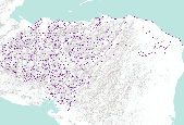
The Critical Minerals in Archived Mine Samples Database (CMDB) contains chemistry and geologic information for historic ore and ore-related rock samples from mineral deposits in the United States. In addition, the database contains samples from archetypal deposits from 27 other countries in North America, South America, Asia, Africa and Europe. Samples were obtained from archived ore collections under the U.S. Geological Survey's project titled "Quick Assessment of Rare and Critical Metals in Ore Deposits: A National Assessment" (2008 to 2013) in an effort to begin an assessment of the Nations' previously mined ore deposits for critical minerals. Mineralized and altered rock samples were provided by the Colorado...
Categories: Data;
Types: ArcGIS REST Map Service,
ArcGIS Service Definition,
Downloadable,
Map Service,
OGC WFS Layer,
OGC WMS Layer,
Shapefile;
Tags: Alaska,
Argentina,
Arizona,
Arkansas,
Australia,
This composite shaded relief image dataset depicts generalized bathymetry and topography of the Caribbean region.
The Caribbean region is part of World Energy Assessment region 6 (Central and South America). A fundamental task in the assessment is to map the locations and type of production for existing oil and gas fields. The Petroconsultants database is the only available database that has coverage for the Caribbean region. Oil and gas field symbols represent field center-points and are published with permission from Petroconsultants International Data Corporation, 2002 database.
Categories: Data,
pre-SM502.8;
Types: Downloadable,
Map Service,
OGC WFS Layer,
OGC WMS Layer,
Shapefile;
Tags: AG,
AI,
AN,
AW,
Anguilla,
This dataset describes mercury (Hg) stable isotope values in fish dorsal muscle from different freshwater environments across the globe. Fish were collected at numerous field sites in North America, South and Central America, Africa, and Asia from 2006-2020. Sub-samples were provided by cooperators to the U.S. Geological Survey Mercury Research Laboratory and the University of Wisconsin for mercury stable isotope analysis. Samples were analyzed for mercury stable isotopes from 2017-2021. These specimens represent multiple trophic levels and body sizes from different food webs and when adequate mass was available, multiple species from the same food web were examined. Cooperators include, but are not limited to:...

The Digital Chart of the World (DCW) is an Environmental Systems Research Institute, Inc. (ESRI) product originally developed for the US Defense Mapping Agency (DMA) using DMA data. The DCW 1993 version at 1:1,000,000 scale was used. The DMA data sources are aeronautical charts, which emphasize landmarks important from flying altitudes. This explains why there is a separate aeronautical theme with all conceivable airports, yet why on some themes small islands and lakes are simply unnamed points. ESRI, in compiling the DCW, also eliminated some detail and made some assumptions for handling tiny polygons and edgematching. Also, note that the completeness of the thematic categories present in each layer will vary....
This dataset includes a modified subset of polygon features that describe U.S. Geological Survey's defined geologic provinces of the World. Each province has a set of geologic characteristics that distinguish it from surrounding provinces. These characteristics may include dominant lithologies, the age of the strata, and/or structural type. Each province is assigned a unique numeric code and may fall within two or more countries or assessment regions.
Categories: Data,
pre-SM502.8;
Types: Downloadable,
Map Service,
OGC WFS Layer,
OGC WMS Layer,
Shapefile;
Tags: AG,
AI,
AN,
AW,
Anguilla,
Invasive lionfish have been widely recorded throughout the western Atlantic on both shallow and mesophotic reefs, where they have been linked to declines in reef health. In this study we report the first lionfish observations from the deep sea (>200 m) in Bermuda and Roatan, Honduras, with lionfish observed to a maximum depth of 304 m off the Bermuda platform, and 250 m off West End, Roatan. Placed in the context of other deeper lionfish observations and records, our results imply that lionfish may be found more widely in the 200-300 m depth range of the upper bathyal zone across the western Atlantic, but currently are severely underreported. We highlight the need for considering deep-sea lionfish populations in...
Categories: Data;
Types: Citation;
Tags: Bermuda,
Honduras,
USGS Science Data Catalog (SDC),
invasive species
The Digital Chart of the World (DCW) is an Environmental Systems Research Institute, Inc. (ESRI) product originally developed for the US Defense Mapping Agency (DMA) using DMA data. The DCW 1993 version at 1:1,000,000 scale was used. The DMA data sources are aeronautical charts, which emphasize landmarks important from flying altitudes. This explains why there is a separate aeronautical theme with all conceivable airports, yet why on some themes small islands and lakes are simply unnamed points. ESRI, in compiling the DCW, also eliminated some detail and made some assumptions for handling tiny polygons and edgematching. Also, note that the completeness of the thematic categories present in each layer will vary....
This database contains a comprehensive inventory of geologic (coral, coral reef, limestone, and sediment) cores and samples collected, analyzed, published, and/or archived by, or in collaboration with, the U.S. Geological Survey St. Petersburg Coastal and Marine Science Center (USGS SPCMSC). The SPCMSC Geologic Core and Sample Database includes geologic cores and samples collected beginning in the 1970s to present day, from study sites across the world. This database can be accessed through the CoreViewer 3.0 ArcOnline web mapping application, linked below. A copy of the data can also be downloaded from the web mapping application and the metadata is accessible through a link in the header of the application, as...
Categories: Collection,
Data;
Tags: Alabama,
Atlantic Ocean,
Bahamas,
Belize,
Biological Collection,
The Digital Chart of the World (DCW) is an Environmental Systems Research Institute, Inc. (ESRI) product originally developed for the US Defense Mapping Agency (DMA) using DMA data. The DCW 1993 version at 1:1,000,000 scale was used. The DMA data sources are aeronautical charts, which emphasize landmarks important from flying altitudes. This explains why there is a separate aeronautical theme with all conceivable airports, yet why on some themes small islands and lakes are simply unnamed points. ESRI, in compiling the DCW, also eliminated some detail and made some assumptions for handling tiny polygons and edgematching. Also, note that the completeness of the thematic categories present in each layer will vary....

The Digital Chart of the World (DCW) is an Environmental Systems Research Institute, Inc. (ESRI) product originally developed for the US Defense Mapping Agency (DMA) using DMA data. The DCW 1993 version at 1:1,000,000 scale was used. The DMA data sources are aeronautical charts, which emphasize landmarks important from flying altitudes. This explains why there is a separate aeronautical theme with all conceivable airports, yet why on some themes small islands and lakes are simply unnamed points. ESRI, in compiling the DCW, also eliminated some detail and made some assumptions for handling tiny polygons and edgematching. Also, note that the completeness of the thematic categories present in each layer will vary....
This database contains a comprehensive inventory of geologic (coral, coral reef, limestone, and sediment) cores and samples collected, analyzed, published, and/or archived by, or in collaboration with, the U.S. Geological Survey St. Petersburg Coastal and Marine Science Center (USGS SPCMSC). The SPCMSC Geologic Core and Sample Database includes geologic cores and samples collected beginning in the 1970s to present day, from study sites across the world. This database can be accessed through the CoreViewer 3.0 ArcOnline web mapping application, linked below. A copy of the data can also be downloaded from the web mapping application and the metadata is accessible through a link in the header of the application, as...
Types: Application,
Map Service,
OGC WFS Layer,
OGC WMS Layer,
OGC WMS Service;
Tags: Alabama,
Atlantic Ocean,
Bahamas,
Belize,
Brazil,
This dataset describes faults and structural features of the Caribbean region (Anguilla, Antigua and Barbuda, Aruba, Bahamas, Barbados, Belize, British Virgin Islands, Cayman Islands, Colombia, Costa Rica, Cuba, Dominica, Dominican Republic, El Salvador, Grenada, Guadeloupe, Guatemala, Guyana, Haiti, Honduras, Jamaica, Martinique, Mexico, Montserrat, Netherlands Antilles, Nicaragua, Panama, Puerto Rico, St. Kitts and Nevis, St. Lucia, St. Vincent and the Grenadines, Trinidad and Tobago, Turks and Caicos Islands, United States, Venezuela, and the Virgin Islands (named countries may not be completely shown on map)).
Categories: Data,
pre-SM502.8;
Types: Downloadable,
Map Service,
OGC WFS Layer,
OGC WMS Layer,
Shapefile;
Tags: AG,
AI,
AN,
AW,
Age,
Illegal logging is one of the leading causes of deforestation today. Sadly, tree species indigenous to regions critical to maintaining Earth’s ecological diversity also possess properties (i.e. appearance, aroma, etc.) desirable to humans, which often leads to exploitation. In 1992, due to illegal logging, Brazilian rosewood (Dalbergia nigra) became the first ever tree species to be listed in an appendix of the Convention of International Trade in Endangered Species of Wild Fauna and Flora (CITES), which prohibited international trade of the timber or other products from this species between entities which had voluntarily joined CITES. Despite its inclusion in Appendix I of CITES, the species continues to be logged...
This data release presents the Yale stocks and flows database (YSTAFDB). Its data describe the use of 102 materials from the early 1800s to circa 2013 through anthropogenic cycles, their recycling and criticality properties, and on spatial scales ranging from suburbs to global. This data collection was previously scattered across multiple non-uniformly formatted files such as journal papers, reports, and unpublished spreadsheets. These data have been synthesized into YSTAFDB, which is presented as individual comma-separated text files and also in MySQL and PostgreSQL database formats. Consolidation of these data into a single database can increase their accessibility and reusability, which is relevant to diverse...
This dataset includes polygons that describe the geologic age of surface outcrops of bedrock of the Caribbean region (Anguilla, Antigua and Barbuda, Aruba, Bahamas, Barbados, Belize, British Virgin Islands, Cayman Islands, Colombia, Costa Rica, Cuba, Dominica, Dominican Republic, El Salvador, Grenada, Guadeloupe, Guatemala, Guyana, Haiti, Honduras, Jamaica, Martinique, Mexico, Montserrat, Netherlands Antilles, Nicaragua, Panama, Puerto Rico, St. Kitts and Nevis, St. Lucia, St. Vincent and the Grenadines, Trinidad and Tobago, Turks and Caicos Islands, United States, Venezuela, and the Virgin Islands (named countries may not be completely shown on map)).
Categories: Data,
pre-SM502.8;
Types: Downloadable,
Map Service,
OGC WFS Layer,
OGC WMS Layer,
Shapefile;
Tags: AG,
AI,
AN,
AW,
Age,
This dataset presents information about facilities relating to the mineral industries of Latin America and the Caribbean. Facilities include mines, mineral processing plants (including refineries and smelters), oil and gas field locations, and petroleum refineries. Relevant data fields include the mineral commodity, specific forms of the mineral commodity produced, location information, facility name, operator, ownership of the facility, annual production capacity, operational status, as well as geographic coordinates and locational accuracy. These data are derived from data presented by country by the Global Minerals Analysis section of the U.S. Geological Survey's (USGS) National Minerals Information Center (NMIC)...
|

|

