Filters: Tags: Hoover Dam (X)
33 results (75ms)|
Filters
Date Range
Types Contacts
Tag Types Tag Schemes |
These data were compiled to demonstrate new predictive mapping approaches and provide comprehensive gridded 30-meter resolution soil property maps for the Colorado River Basin above Hoover Dam. Random forest models related environmental raster layers representing soil forming factors with field samples to render predictive maps that interpolate between sample locations. Maps represented soil pH, texture fractions (sand, silt clay, fine sand, very fine sand), rock, electrical conductivity (ec), gypsum, CaCO3, sodium adsorption ratio (sar), available water capacity (awc), bulk density (dbovendry), erodibility (kwfact), and organic matter (om) at 7 depths (0, 5, 15, 30, 60, 100, and 200 cm) as well as depth to restrictive...
These data were compiled to demonstrate new predictive mapping approaches and provide comprehensive gridded 30-meter resolution soil property maps for the Colorado River Basin above Hoover Dam. Random forest models related environmental raster layers representing soil forming factors with field samples to render predictive maps that interpolate between sample locations. Maps represented soil pH, texture fractions (sand, silt clay, fine sand, very fine sand), rock, electrical conductivity (ec), gypsum, CaCO3, sodium adsorption ratio (sar), available water capacity (awc), bulk density (dbovendry), erodibility (kwfact), and organic matter (om) at 7 depths (0, 5, 15, 30, 60, 100, and 200 cm) as well as depth to restrictive...
This data set contains imagery from the National Agriculture Imagery Program (NAIP). The NAIP program is administered by USDA FSA and has been established to support two main FSA strategic goals centered on agricultural production. These are, increase stewardship of America's natural resources while enhancing the environment, and to ensure commodities are procured and distributed effectively and efficiently to increase food security. The NAIP program supports these goals by acquiring and providing ortho imagery that has been collected during the agricultural growing season in the U.S. The NAIP ortho imagery is tailored to meet FSA requirements and is a fundamental tool used to support FSA farm and conservation programs....
This data set contains imagery from the National Agriculture Imagery Program (NAIP). The NAIP program is administered by USDA FSA and has been established to support two main FSA strategic goals centered on agricultural production. These are, increase stewardship of America's natural resources while enhancing the environment, and to ensure commodities are procured and distributed effectively and efficiently to increase food security. The NAIP program supports these goals by acquiring and providing ortho imagery that has been collected during the agricultural growing season in the U.S. The NAIP ortho imagery is tailored to meet FSA requirements and is a fundamental tool used to support FSA farm and conservation programs....
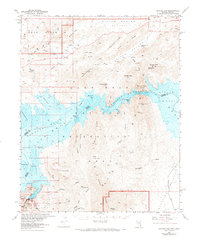
USGS Historical Quadrangle in GeoPDF.
Two unique datasets were gathered to document whether flow management for hydropower affects the abundance and diversity of aquatic insect assemblages. The first dataset was collected in Grand Canyon from 2012-2014 by citizen scientists rafting the Colorado River. Simple light traps were set out each night in camp and used to capture the adult life stages of aquatic insects that emerged from the Colorado River. Three aquatic insect taxa were captured in sufficient abundance to analyze statistically including midges (order Diptera, family Chironomidae), micro-caddisflies (order Trichoptera, family Hydroptilidae), and blackflies (order Diptera, family Simuliidae, principally Simulium arcticum). These data were used...
These data were compiled to demonstrate new predictive mapping approaches and provide comprehensive gridded 30-meter resolution soil property maps for the Colorado River Basin above Hoover Dam. Random forest models related environmental raster layers representing soil forming factors with field samples to render predictive maps that interpolate between sample locations. Maps represented soil pH, texture fractions (sand, silt clay, fine sand, very fine sand), rock, electrical conductivity (ec), gypsum, CaCO3, sodium adsorption ratio (sar), available water capacity (awc), bulk density (dbovendry), erodibility (kwfact), and organic matter (om) at 7 depths (0, 5, 15, 30, 60, 100, and 200 cm) as well as depth to restrictive...
These data were compiled to demonstrate new predictive mapping approaches and provide comprehensive gridded 30-meter resolution soil property maps for the Colorado River Basin above Hoover Dam. Random forest models related environmental raster layers representing soil forming factors with field samples to render predictive maps that interpolate between sample locations. Maps represented soil pH, texture fractions (sand, silt clay, fine sand, very fine sand), rock, electrical conductivity (ec), gypsum, CaCO3, sodium adsorption ratio (sar), available water capacity (awc), bulk density (dbovendry), erodibility (kwfact), and organic matter (om) at 7 depths (0, 5, 15, 30, 60, 100, and 200 cm) as well as depth to restrictive...
These data were compiled to demonstrate new predictive mapping approaches and provide comprehensive gridded 30-meter resolution soil property maps for the Colorado River Basin above Hoover Dam. Random forest models related environmental raster layers representing soil forming factors with field samples to render predictive maps that interpolate between sample locations. Maps represented soil pH, texture fractions (sand, silt clay, fine sand, very fine sand), rock, electrical conductivity (ec), gypsum, CaCO3, sodium adsorption ratio (sar), available water capacity (awc), bulk density (dbovendry), erodibility (kwfact), and organic matter (om) at 7 depths (0, 5, 15, 30, 60, 100, and 200 cm) as well as depth to restrictive...
This data set contains imagery from the National Agriculture Imagery Program (NAIP). The NAIP program is administered by USDA FSA and has been established to support two main FSA strategic goals centered on agricultural production. These are, increase stewardship of America's natural resources while enhancing the environment, and to ensure commodities are procured and distributed effectively and efficiently to increase food security. The NAIP program supports these goals by acquiring and providing ortho imagery that has been collected during the agricultural growing season in the U.S. The NAIP ortho imagery is tailored to meet FSA requirements and is a fundamental tool used to support FSA farm and conservation programs....
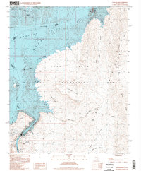
USGS Historical Quadrangle in GeoPDF.
This data set contains imagery from the National Agriculture Imagery Program (NAIP). The NAIP program is administered by USDA FSA and has been established to support two main FSA strategic goals centered on agricultural production. These are, increase stewardship of America's natural resources while enhancing the environment, and to ensure commodities are procured and distributed effectively and efficiently to increase food security. The NAIP program supports these goals by acquiring and providing ortho imagery that has been collected during the agricultural growing season in the U.S. The NAIP ortho imagery is tailored to meet FSA requirements and is a fundamental tool used to support FSA farm and conservation programs....
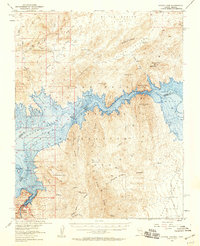
USGS Historical Quadrangle in GeoPDF.
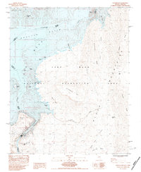
USGS Historical Quadrangle in GeoPDF.
These data were compiled to demonstrate new predictive mapping approaches and provide comprehensive gridded 30-meter resolution soil property maps for the Colorado River Basin above Hoover Dam. Random forest models related environmental raster layers representing soil forming factors with field samples to render predictive maps that interpolate between sample locations. Maps represented soil pH, texture fractions (sand, silt clay, fine sand, very fine sand), rock, electrical conductivity (ec), gypsum, CaCO3, sodium adsorption ratio (sar), available water capacity (awc), bulk density (dbovendry), erodibility (kwfact), and organic matter (om) at 7 depths (0, 5, 15, 30, 60, 100, and 200 cm) as well as depth to restrictive...
This data set contains imagery from the National Agriculture Imagery Program (NAIP). The NAIP program is administered by USDA FSA and has been established to support two main FSA strategic goals centered on agricultural production. These are, increase stewardship of America's natural resources while enhancing the environment, and to ensure commodities are procured and distributed effectively and efficiently to increase food security. The NAIP program supports these goals by acquiring and providing ortho imagery that has been collected during the agricultural growing season in the U.S. The NAIP ortho imagery is tailored to meet FSA requirements and is a fundamental tool used to support FSA farm and conservation programs....
This data set contains imagery from the National Agriculture Imagery Program (NAIP). The NAIP program is administered by USDA FSA and has been established to support two main FSA strategic goals centered on agricultural production. These are, increase stewardship of America's natural resources while enhancing the environment, and to ensure commodities are procured and distributed effectively and efficiently to increase food security. The NAIP program supports these goals by acquiring and providing ortho imagery that has been collected during the agricultural growing season in the U.S. The NAIP ortho imagery is tailored to meet FSA requirements and is a fundamental tool used to support FSA farm and conservation programs....
These data were compiled to demonstrate new predictive mapping approaches and provide comprehensive gridded 30-meter resolution soil property maps for the Colorado River Basin above Hoover Dam. Random forest models related environmental raster layers representing soil forming factors with field samples to render predictive maps that interpolate between sample locations. Maps represented soil pH, texture fractions (sand, silt clay, fine sand, very fine sand), rock, electrical conductivity (ec), gypsum, CaCO3, sodium adsorption ratio (sar), available water capacity (awc), bulk density (dbovendry), erodibility (kwfact), and organic matter (om) at 7 depths (0, 5, 15, 30, 60, 100, and 200 cm) as well as depth to restrictive...
|

|
