Filters: Tags: Hopewell County (X)
10 results (12ms)|
Filters
Date Range
Extensions Types Contacts
Categories Tag Types Tag Schemes |
Airborne magnetic data are provided here as part of the data release, 'Airborne magnetic and radiometric survey, Virginia and North Carolina Fall Zone, 2021.' This website includes the processed aeromagnetic data provided in an ascii .csv file and a geoTIFF image showing the total magnetic intensity. The contractor report is available on the parent page.
Categories: Data;
Types: Downloadable,
GeoTIFF,
Map Service,
Raster;
Tags: AASG,
Amelia County,
Association of State Geologists,
Bertie County,
Brunswick County,

The High Resolution National Hydrography Dataset Plus (NHDPlus HR) is an integrated set of geospatial data layers, including the National Hydrography Dataset (NHD), National Watershed Boundary Dataset (WBD), and 3D Elevation Program Digital Elevation Model (3DEP DEM). The NHDPlus HR combines the NHD, 3DEP DEMs, and WBD to a data suite that includes the NHD stream network with linear referencing functionality, the WBD hydrologic units, elevation-derived catchment areas for each stream segment, "value added attributes" (VAAs), and other features that enhance hydrologic data analysis and routing.
Airborne radiometric data are provided here as part of the data release "Airborne magnetic and radiometric survey, Virginia and North Carolina Fall Zone, 2021." This website includes the processed aeroradiometric data (gamma spectrometry for K, U and Th) in an ascii .csv file and geoTIFF images showing the total count values and potassium, thorium, and uranium concentrations. The spectral data are provided in a netcdf file that can be reviewed using any freely available viewer (such as HDFview) or loaded using software or programming languages with netcdf support, such as GSPy for Python (Foks, 2022). The contractor report is available on the parent page. References: Foks, N.L., James, S. R., and Minsely, B....
Categories: Data;
Types: Downloadable,
GeoTIFF,
Map Service,
Raster;
Tags: AASG,
Amelia County,
Association of State Geologists,
Bertie County,
Brunswick County,
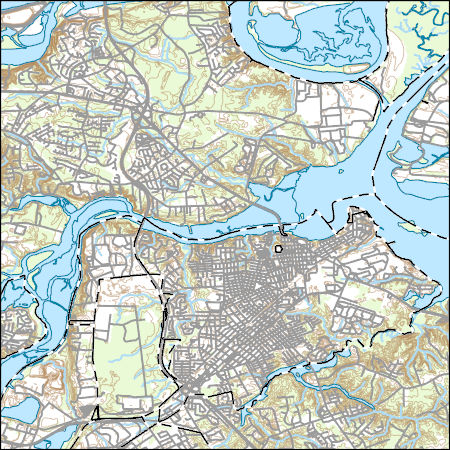
Layers of geospatial data include contours, boundaries, land cover, hydrography, roads, transportation, geographic names, structures, and other selected map features.
Types: Citation;
Tags: 7.5 x 7.5 minute,
7_5_Min,
Charles City County,
Chesterfield County,
Colonial Heights County,
This data release provides digital flight line data for a high-resolution airborne magnetic and radiometric survey over Virginia and North Carolina along and near the eastern U.S. 'Fall Zone', which represents the transitional area between Atlantic Coastal Plain sediments and Piedmont metamorphic and igneous rocks. The airborne data collection was funded by the U.S. Geological Survey (USGS) Earth Mapping Resources Initiative (Earth MRI) and National Cooperative Geological Mapping Program (NCGMP). Goals include a gaining a better understanding of placer deposits containing critical mineral resources titanium, zirconium, and rare earth elements, assisting geologic mapping of the crystalline basement either exposed...
Categories: Data;
Types: Downloadable,
Map Service,
OGC WFS Layer,
OGC WMS Layer,
Shapefile;
Tags: "Geophysics",
"Mineral Resources",
"Sedimentology"],
"Structural Geology",
AASG,

These vector contour lines are derived from the 3D Elevation Program using automated and semi-automated processes. They were created to support 1:24,000-scale CONUS and Hawaii, 1:25,000-scale Alaska, and 1:20,000-scale Puerto Rico / US Virgin Island topographic map products, but are also published in this GIS vector format. Contour intervals are assigned by 7.5-minute quadrangle, so this vector dataset is not visually seamless across quadrangle boundaries. The vector lines have elevation attributes (in feet above mean sea level on NAVD88), but this dataset does not carry line symbols or annotation.

Layers of geospatial data include contours, boundaries, land cover, hydrography, roads, transportation, geographic names, structures, and other selected map features.
Types: Citation;
Tags: 7.5 x 7.5 minute,
7_5_Min,
Charles City County,
Chesterfield County,
Colonial Heights County,
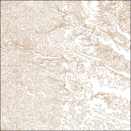
These vector contour lines are derived from the 3D Elevation Program using automated and semi-automated processes. They were created to support 1:24,000-scale CONUS and Hawaii, 1:25,000-scale Alaska, and 1:20,000-scale Puerto Rico / US Virgin Island topographic map products, but are also published in this GIS vector format. Contour intervals are assigned by 7.5-minute quadrangle, so this vector dataset is not visually seamless across quadrangle boundaries. The vector lines have elevation attributes (in feet above mean sea level on NAVD88), but this dataset does not carry line symbols or annotation.
|

|
