Filters: Tags: Hot Creek (X)
8 results (63ms)|
Filters
Date Range
Types Contacts
Categories Tag Types Tag Schemes |
This data set contains imagery from the National Agriculture Imagery Program (NAIP). The NAIP program is administered by USDA FSA and has been established to support two main FSA strategic goals centered on agricultural production. These are, increase stewardship of America's natural resources while enhancing the environment, and to ensure commodities are procured and distributed effectively and efficiently to increase food security. The NAIP program supports these goals by acquiring and providing ortho imagery that has been collected during the agricultural growing season in the U.S. The NAIP ortho imagery is tailored to meet FSA requirements and is a fundamental tool used to support FSA farm and conservation programs....
This data set contains imagery from the National Agriculture Imagery Program (NAIP). The NAIP program is administered by USDA FSA and has been established to support two main FSA strategic goals centered on agricultural production. These are, increase stewardship of America's natural resources while enhancing the environment, and to ensure commodities are procured and distributed effectively and efficiently to increase food security. The NAIP program supports these goals by acquiring and providing ortho imagery that has been collected during the agricultural growing season in the U.S. The NAIP ortho imagery is tailored to meet FSA requirements and is a fundamental tool used to support FSA farm and conservation programs....
NOTE: This data release has been superseded by a newer version: https://www.sciencebase.gov/catalog/item/5b6c8432e4b006a11f7bd01d Hot Creek Gorge contains the most obvious surface expression of the hydrothermal system in Long Valley Caldera, California, discharging 200-300 L/s of thermal water according to USGS measurements made since 1988. Formerly, Hot Creek was a popular public swimming area, but it was closed in 2006 due to unpredictable temperature fluctuations and sporadic geysering of thermal water within the creek (Evans et al., 2018). The USGS has monitored the thermal regime in the area since the mid-1980s, including a series of long-term studies 0.6 km away at well CH-10b. Temperature measurements in...
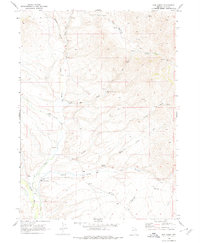
USGS Historical Quadrangle in GeoPDF.
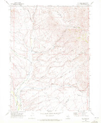
USGS Historical Quadrangle in GeoPDF.
This data set contains imagery from the National Agriculture Imagery Program (NAIP). The NAIP program is administered by USDA FSA and has been established to support two main FSA strategic goals centered on agricultural production. These are, increase stewardship of America's natural resources while enhancing the environment, and to ensure commodities are procured and distributed effectively and efficiently to increase food security. The NAIP program supports these goals by acquiring and providing ortho imagery that has been collected during the agricultural growing season in the U.S. The NAIP ortho imagery is tailored to meet FSA requirements and is a fundamental tool used to support FSA farm and conservation programs....
Hot Creek Gorge contains the most obvious surface expression of the hydrothermal system in Long Valley Caldera, California, discharging 200-300 L/s of thermal water according to USGS measurements made since 1988. Formerly, Hot Creek was a popular public swimming area, but it was closed in 2006 due to unpredictable temperature fluctuations and sporadic geysering of thermal water within the creek (Evans et al., 2018). The USGS has monitored the thermal regime in the area since the mid-1980s, including a series of long-term studies 0.6 km away at well CH-10b. Temperature measurements in the ~100 m deep well, which have been performed on an intermittent basis since it was drilled in 1983, reveal a complex temperature...
Categories: Data;
Tags: California,
Hot Creek,
Long Valley Caldera,
Mono County,
USGS Science Data Catalog (SDC),
This data set contains imagery from the National Agriculture Imagery Program (NAIP). The NAIP program is administered by USDA FSA and has been established to support two main FSA strategic goals centered on agricultural production. These are, increase stewardship of America's natural resources while enhancing the environment, and to ensure commodities are procured and distributed effectively and efficiently to increase food security. The NAIP program supports these goals by acquiring and providing ortho imagery that has been collected during the agricultural growing season in the U.S. The NAIP ortho imagery is tailored to meet FSA requirements and is a fundamental tool used to support FSA farm and conservation programs....
|

|
