Filters
Date Range
Types
Contacts
Tag Types
Tag Schemes
|
This data set contains imagery from the National Agriculture Imagery Program (NAIP). The NAIP program is administered by USDA FSA and has been established to support two main FSA strategic goals centered on agricultural production. These are increase stewardship of America's natural resources while enhancing the environment, and to ensure commodities are procured and distributed effectively and efficiently to increase food security. The NAIP program supports these goals by acquiring and providing ortho imagery that has been collected during the agricultural growing season in the U.S. The NAIP ortho imagery is tailored to meet FSA requirements and is a fundamental tool used to support FSA farm and conservation programs....
Types: Citation;
Tags: 28039,
3.75 x 3.75 minute,
3008813,
Aerial Compliance,
Compliance, All tags...
Digital Ortho rectified Image,
Downloadable Data,
GEORGE CO MS FSA,
George,
HOWELL,
HOWELL, SE,
JPEG 2000,
JPEG2000,
MS,
MS039,
NAIP,
Ortho Rectification,
Orthoimagery,
Quarter Quadrangle,
USDA National Agriculture Imagery Program (NAIP),
farming,
imageryBaseMapsEarthCover, Fewer tags
This data set contains imagery from the National Agriculture Imagery Program (NAIP). The NAIP program is administered by USDA FSA and has been established to support two main FSA strategic goals centered on agricultural production. These are increase stewardship of America's natural resources while enhancing the environment, and to ensure commodities are procured and distributed effectively and efficiently to increase food security. The NAIP program supports these goals by acquiring and providing ortho imagery that has been collected during the agricultural growing season in the U.S. The NAIP ortho imagery is tailored to meet FSA requirements and is a fundamental tool used to support FSA farm and conservation programs....
Types: Citation;
Tags: 29091,
3.75 x 3.75 minute,
3609103,
Aerial Compliance,
Compliance, All tags...
Digital Ortho rectified Image,
Downloadable Data,
HOWELL CO MO FSA,
Howell,
JPEG 2000,
JPEG2000,
MO,
MO091,
MOUNTAIN VIEW,
MOUNTAIN VIEW, SW,
NAIP,
Ortho Rectification,
Orthoimagery,
Quarter Quadrangle,
USDA National Agriculture Imagery Program (NAIP),
farming,
imageryBaseMapsEarthCover, Fewer tags
This data set contains imagery from the National Agriculture Imagery Program (NAIP). The NAIP program is administered by USDA FSA and has been established to support two main FSA strategic goals centered on agricultural production. These are increase stewardship of America's natural resources while enhancing the environment, and to ensure commodities are procured and distributed effectively and efficiently to increase food security. The NAIP program supports these goals by acquiring and providing ortho imagery that has been collected during the agricultural growing season in the U.S. The NAIP ortho imagery is tailored to meet FSA requirements and is a fundamental tool used to support FSA farm and conservation programs....
Types: Citation;
Tags: 29091,
3.75 x 3.75 minute,
3609109,
Aerial Compliance,
Compliance, All tags...
Digital Ortho rectified Image,
Downloadable Data,
HOWELL CO MO FSA,
Howell,
JPEG 2000,
JPEG2000,
MO,
MO091,
NAIP,
Ortho Rectification,
Orthoimagery,
POMONA,
POMONA, SE,
Quarter Quadrangle,
USDA National Agriculture Imagery Program (NAIP),
farming,
imageryBaseMapsEarthCover, Fewer tags
This data set contains imagery from the National Agriculture Imagery Program (NAIP). The NAIP program is administered by USDA FSA and has been established to support two main FSA strategic goals centered on agricultural production. These are increase stewardship of America's natural resources while enhancing the environment, and to ensure commodities are procured and distributed effectively and efficiently to increase food security. The NAIP program supports these goals by acquiring and providing ortho imagery that has been collected during the agricultural growing season in the U.S. The NAIP ortho imagery is tailored to meet FSA requirements and is a fundamental tool used to support FSA farm and conservation programs....
Types: Citation;
Tags: 29091,
3.75 x 3.75 minute,
3609117,
Aerial Compliance,
Compliance, All tags...
Digital Ortho rectified Image,
Downloadable Data,
HOWELL CO MO FSA,
Howell,
JPEG 2000,
JPEG2000,
MO,
MO091,
NAIP,
Ortho Rectification,
Orthoimagery,
Quarter Quadrangle,
SOUTH FORK,
SOUTH FORK, NE,
USDA National Agriculture Imagery Program (NAIP),
farming,
imageryBaseMapsEarthCover, Fewer tags
This data set contains imagery from the National Agriculture Imagery Program (NAIP). The NAIP program is administered by USDA FSA and has been established to support two main FSA strategic goals centered on agricultural production. These are increase stewardship of America's natural resources while enhancing the environment, and to ensure commodities are procured and distributed effectively and efficiently to increase food security. The NAIP program supports these goals by acquiring and providing ortho imagery that has been collected during the agricultural growing season in the U.S. The NAIP ortho imagery is tailored to meet FSA requirements and is a fundamental tool used to support FSA farm and conservation programs....
Types: Citation;
Tags: 29091,
3.75 x 3.75 minute,
3609208,
Aerial Compliance,
Compliance, All tags...
DYESTONE MOUNTAIN,
DYESTONE MOUNTAIN, NE,
Digital Ortho rectified Image,
Downloadable Data,
HOWELL CO MO FSA,
Howell,
JPEG 2000,
JPEG2000,
MO,
MO091,
NAIP,
Ortho Rectification,
Orthoimagery,
Quarter Quadrangle,
USDA National Agriculture Imagery Program (NAIP),
farming,
imageryBaseMapsEarthCover, Fewer tags
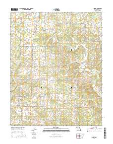
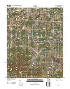
Layered GeoPDF 7.5 Minute Quadrangle Map. Layers of geospatial data include orthoimagery, roads, grids, geographic names, elevation contours, hydrography, and other selected map features.
Tags: 7.5 x 7.5 minute,
Downloadable Data,
EarthCover,
GeoPDF,
Howell, All tags...
Imagery and Base Maps,
Map,
Missouri,
Pine Crest, MO,
Public Land Survey System,
Shannon,
Texas,
U.S. National Grid,
US,
US Topo,
US Topo Historical,
United States,
boundary,
contour,
geographic names,
hydrography,
imageryBaseMapsEarthCover,
orthoimage,
structures,
topographic,
transportation,
woodland, Fewer tags
Layered GeoPDF 7.5 Minute Quadrangle Map. Layers of geospatial data include orthoimagery, roads, grids, geographic names, elevation contours, hydrography, and other selected map features.
Tags: 7.5 x 7.5 minute,
Douglas,
Downloadable Data,
EarthCover,
GeoPDF, All tags...
Howell,
Imagery and Base Maps,
Map,
Missouri,
Ozark,
Public Land Survey System,
Siloam Springs, MO,
U.S. National Grid,
US,
US Topo,
US Topo Historical,
United States,
boundary,
contour,
geographic names,
hydrography,
imageryBaseMapsEarthCover,
orthoimage,
structures,
topographic,
transportation,
woodland, Fewer tags
Layered geospatial PDF Map. Layers of geospatial data include orthoimagery, roads, grids, geographic names, elevation contours, hydrography, and other selected map features.
Tags: 7.5 x 7.5 minute,
Arkansas,
Downloadable Data,
EarthCover,
Fulton, All tags...
GeoPDF,
Gepp, AR-MO,
Howell,
Imagery and Base Maps,
Map,
Missouri,
Ozark,
Public Land Survey System,
U.S. National Grid,
US,
US Topo,
US Topo Historical,
United States,
boundary,
contour,
geographic names,
hydrography,
imageryBaseMapsEarthCover,
orthoimage,
structures,
topographic,
transportation,
woodland, Fewer tags
The Watershed Boundary Dataset (WBD) is a comprehensive aggregated collection of hydrologic unit data consistent with the national criteria for delineation and resolution. It defines the areal extent of surface water drainage to a point except in coastal or lake front areas where there could be multiple outlets as stated by the "Federal Standards and Procedures for the National Watershed Boundary Dataset (WBD)" "Standard" (https://pubs.usgs.gov/tm/11/a3/). Watershed boundaries are determined solely upon science-based hydrologic principles, not favoring any administrative boundaries or special projects, nor particular program or agency. This dataset represents the hydrologic unit boundaries to the 12-digit (6th level)...
Tags: 10-digit,
12-digit,
14-digit,
16-digit,
2-digit, All tags...
4-digit,
6-digit,
8-digit,
AR,
Adair,
Alamosa,
Alfalfa,
Allen,
Anderson,
Archer,
Arkansas,
Armstrong,
Atoka,
Baca,
Barber,
Barry,
Barton,
Basin,
Baxter,
Baylor,
Beaver,
Beckham,
Bent,
Benton,
Bienville,
Blaine,
Boone,
Bossier,
Bourbon,
Bowie,
Briscoe,
Bryan,
Butler,
CO,
Caddo,
Camp,
Canadian,
Carroll,
Carson,
Carter,
Cass,
Castro,
Chaffee,
Chase,
Chautauqua,
Cherokee,
Cheyenne,
Childress,
Choctaw,
Christian,
Cimarron,
Claiborne,
Clark,
Clay,
Cleburne,
Cleveland,
Coal,
Coffey,
Colfax,
Collingsworth,
Colorado,
Columbia,
Comanche,
Conway,
Cooke,
Costilla,
Cottle,
Cotton,
Cowley,
Craig,
Crawford,
Creek,
Crosby,
Crowley,
Curry,
Custer,
Dade,
Dallam,
De Soto,
Deaf Smith,
Delaware,
Delta,
Dent,
Dewey,
Dickens,
Donley,
Douglas,
Downloadable Data,
Eagle,
Edwards,
El Paso,
Elbert,
Elk,
Ellis,
Ellsworth,
Fannin,
Faulkner,
Finney,
Floyd,
Foard,
Ford,
Franklin,
Fremont,
Fulton,
Garfield,
Garland,
Garvin,
GeoPackage,
Grady,
Grant,
Gray,
Grayson,
Greeley,
Greene,
Greenwood,
Greer,
Gregg,
Guadalupe,
Gunnison,
HU-2,
HU-2 Region,
HU2_11,
HUC,
Hale,
Hall,
Hamilton,
Hansford,
Hardeman,
Harding,
Harmon,
Harper,
Harrison,
Hartley,
Harvey,
Haskell,
Hemphill,
Hempstead,
Hodgeman,
Hopkins,
Howard,
Howell,
Huerfano,
Hughes,
Hunt,
Hutchinson,
Hydrography,
Hydrologic Unit Code,
Hydrologic Units,
Independence,
Iron,
Izard,
Jackson,
Jasper,
Jefferson,
Johnson,
Johnston,
KS,
Kansas,
Kay,
Kearny,
King,
Kingfisher,
Kingman,
Kiowa,
Kit Carson,
Knox,
LA,
Labette,
Lafayette,
Lake,
Lamar,
Lane,
Las Animas,
Latimer,
Lawrence,
Le Flore,
Lincoln,
Lipscomb,
Little River,
Logan,
Lonoke,
Louisiana,
Love,
Lyon,
MO,
Madison,
Major,
Marion,
Marshall,
Mayes,
McClain,
McCurtain,
McDonald,
McIntosh,
McPherson,
Meade,
Miller,
Missouri,
Montague,
Montgomery,
Moore,
Mora,
Morris,
Morton,
Motley,
Murray,
Muskogee,
NM,
Natchitoches,
National Watershed Boundary Dataset (WBD),
National Watershed Boundary Dataset (WBD),
Neosho,
Ness,
Nevada,
New Mexico,
Newton,
Noble,
Nowata,
OK,
Ochiltree,
Okfuskee,
Oklahoma,
Oklahoma,
Okmulgee,
Oldham,
Open Geospatial Consortium GeoPackage 1.2,
Oregon,
Osage,
Otero,
Ottawa,
Ozark,
Panola,
Park,
Parmer,
Pawnee,
Payne,
Perry,
Pike,
Pitkin,
Pittsburg,
Polk,
Pontotoc,
Pope,
Pottawatomie,
Potter,
Pratt,
Prowers,
Pueblo,
Pulaski,
Pushmataha,
Quay,
Randall,
Randolph,
Rapides,
Red River,
Region,
Reno,
Reynolds,
Rice,
Rio Arriba,
Ripley,
Roberts,
Roger Mills,
Rogers,
Rush,
Sabine,
Saguache,
Saline,
San Miguel,
Scott,
Searcy,
Sebastian,
Sedgwick,
Seminole,
Sequoyah,
Sevier,
Seward,
Shannon,
Sharp,
Sherman,
Stafford,
Stanton,
Stephens,
Stevens,
Stone,
Sub-basin,
Sub-region,
Subwatershed,
Summit,
Sumner,
Swisher,
TX,
Taney,
Taos,
Teller,
Texas,
Texas,
Tillman,
Titus,
Tulsa,
US,
Union,
United States,
Upshur,
Van Buren,
Vernon,
WBD,
Wabaunsee,
Wagoner,
Washington,
Washita,
Watershed,
Watershed Boundary Dataset,
Wayne,
Webster,
Wheeler,
White,
Wichita,
Wilbarger,
Wilson,
Winn,
Wood,
Woodruff,
Woods,
Woodson,
Woodward,
Wright,
Yell,
Young,
inlandWaters, Fewer tags
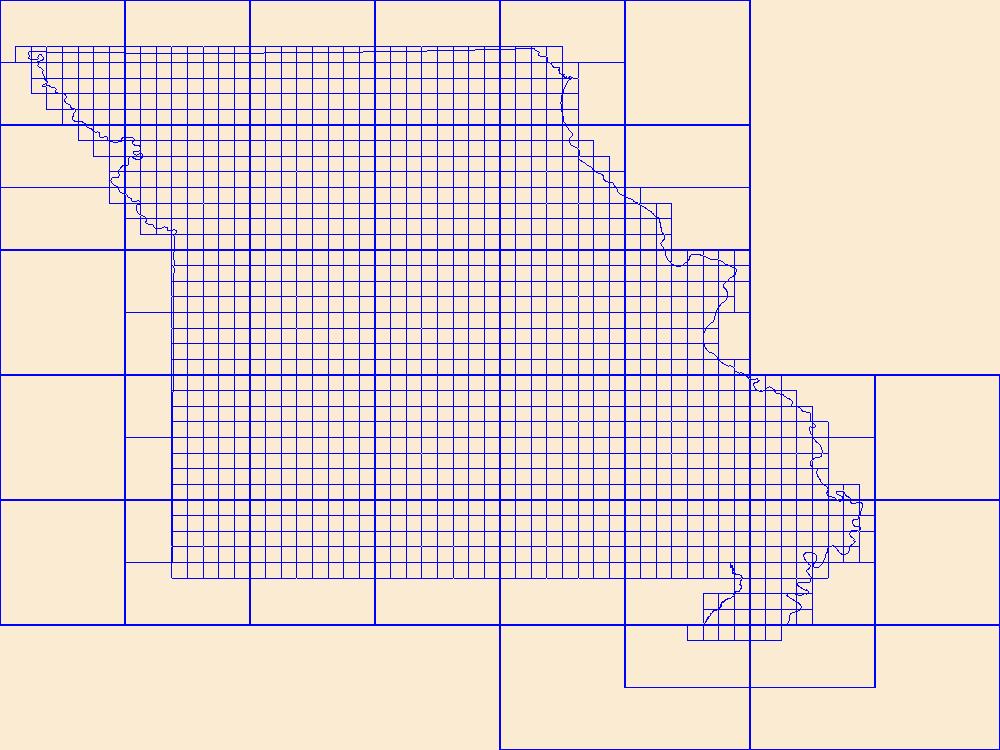
This data represents the map extent for current and historical USGS topographic maps for the United States and Territories, including 1 X 2 Degree, 1 X 1 Degree, 30 X 60 Minute, 15 X 15 Minute, 7.5 X 7.5 Minute, and 3.75 X 3.75 Minute. The grid was generated using ESRI ArcInfo GIS software.
Types: Citation;
Tags: Adair,
Andrew,
Atchison,
Audrain,
Barry, All tags...
Barton,
Bates,
Benton,
Bollinger,
Boone,
Boundaries,
Buchanan,
Butler,
Caldwell,
Callaway,
Camden,
Cape Girardeau,
Carroll,
Carter,
Cass,
Cedar,
Chariton,
Christian,
Clark,
Clay,
Clinton,
Cole,
Cooper,
Crawford,
Dade,
Dallas,
Daviess,
DeKalb,
Dent,
Douglas,
Downloadable Data,
Dunklin,
Esri Shapefile nan,
Franklin,
Gasconade,
Gentry,
Greene,
Grundy,
Harrison,
Henry,
Hickory,
Holt,
Howard,
Howell,
Iron,
Jackson,
Jasper,
Jefferson,
Johnson,
Knox,
Laclede,
Lafayette,
Lawrence,
Lewis,
Lincoln,
Linn,
Livingston,
MO,
Macon,
Madison,
Map Indices,
Map Indices,
Map Indices,
Maries,
Marion,
McDonald,
Mercer,
Miller,
Mississippi,
Missouri,
Moniteau,
Monroe,
Montgomery,
Morgan,
New Madrid,
Newton,
Nodaway,
Oregon,
Osage,
Ozark,
Pemiscot,
Perry,
Pettis,
Phelps,
Pike,
Platte,
Polk,
Pulaski,
Putnam,
Ralls,
Randolph,
Ray,
Reynolds,
Ripley,
Saline,
Schuyler,
Scotland,
Scott,
Shannon,
Shapefile,
Shelby,
St. Charles,
St. Clair,
St. Francois,
St. Louis,
State,
State,
Ste. Genevieve,
Stoddard,
Stone,
Sullivan,
Taney,
Texas,
US,
United States,
United States of America,
Vernon,
Warren,
Washington,
Wayne,
Webster,
Worth,
Wright,
cells,
map indices,
polygon grid, Fewer tags
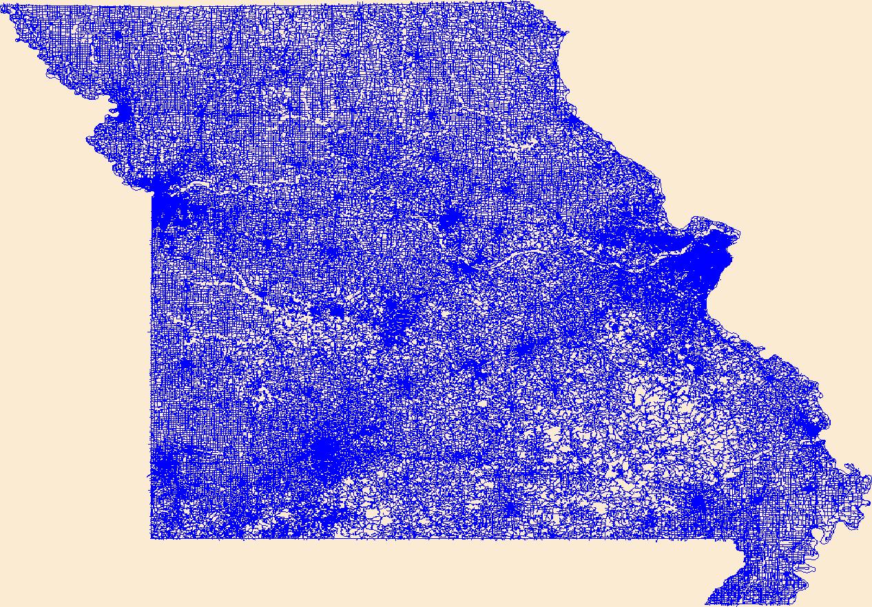
Layers of geospatial data include roads, airports, trails, and railroads.
Tags: Adair,
Airport Complex,
Airport Point,
Airport Runway,
Airports, All tags...
Airstrips,
Andrew,
Atchison,
Audrain,
Barry,
Barton,
Bates,
Benton,
Bollinger,
Boone,
Buchanan,
Butler,
Caldwell,
Callaway,
Camden,
Cape Girardeau,
Carroll,
Carter,
Cass,
Cedar,
Chariton,
Christian,
Clark,
Clay,
Clinton,
Cole,
Cooper,
Crawford,
Dade,
Dallas,
Daviess,
DeKalb,
Dent,
Douglas,
Downloadable Data,
Dunklin,
Franklin,
Gasconade,
Gentry,
GeoPackage,
Geographic names,
Greene,
Grundy,
Harrison,
Henry,
Hickory,
Holt,
Howard,
Howell,
Iron,
Jackson,
Jasper,
Jefferson,
Johnson,
Knox,
Laclede,
Lafayette,
Lawrence,
Lewis,
Lincoln,
Linn,
Livingston,
MO,
Macon,
Madison,
Maries,
Marion,
McDonald,
Mercer,
Miller,
Mississippi,
Missouri,
Moniteau,
Monroe,
Montgomery,
Morgan,
National Transportation Dataset (NTD),
National Transportation Dataset (NTD),
New Madrid,
Newton,
Nodaway,
Open Geospatial Consortium GeoPackage 1.2,
Oregon,
Osage,
Ozark,
Pemiscot,
Perry,
Pettis,
Phelps,
Pike,
Platte,
Polk,
Pulaski,
Putnam,
Railways,
Ralls,
Randolph,
Ray,
Reynolds,
Ripley,
Roads,
Saline,
Schuyler,
Scotland,
Scott,
Shannon,
Shelby,
St. Charles,
St. Clair,
St. Francois,
St. Louis,
State,
State,
Ste. Genevieve,
Stoddard,
Stone,
Sullivan,
Taney,
Texas,
Trail,
Trails,
Transportation,
Transportation,
US,
United States,
Vernon,
Warren,
Washington,
Waterway,
Wayne,
Webster,
Worth,
Wright,
transportation, Fewer tags

Layers of geospatial data include roads, airports, trails, and railroads.
Tags: Adair,
Airport Complex,
Airport Point,
Airport Runway,
Airports, All tags...
Airstrips,
Andrew,
Atchison,
Audrain,
Barry,
Barton,
Bates,
Benton,
Bollinger,
Boone,
Buchanan,
Butler,
Caldwell,
Callaway,
Camden,
Cape Girardeau,
Carroll,
Carter,
Cass,
Cedar,
Chariton,
Christian,
Clark,
Clay,
Clinton,
Cole,
Cooper,
Crawford,
Dade,
Dallas,
Daviess,
DeKalb,
Dent,
Douglas,
Downloadable Data,
Dunklin,
Esri File GeoDatabase 10,
FileGDB,
Franklin,
Gasconade,
Gentry,
Geographic names,
Greene,
Grundy,
Harrison,
Henry,
Hickory,
Holt,
Howard,
Howell,
Iron,
Jackson,
Jasper,
Jefferson,
Johnson,
Knox,
Laclede,
Lafayette,
Lawrence,
Lewis,
Lincoln,
Linn,
Livingston,
MO,
Macon,
Madison,
Maries,
Marion,
McDonald,
Mercer,
Miller,
Mississippi,
Missouri,
Moniteau,
Monroe,
Montgomery,
Morgan,
National Transportation Dataset (NTD),
National Transportation Dataset (NTD),
New Madrid,
Newton,
Nodaway,
Oregon,
Osage,
Ozark,
Pemiscot,
Perry,
Pettis,
Phelps,
Pike,
Platte,
Polk,
Pulaski,
Putnam,
Railways,
Ralls,
Randolph,
Ray,
Reynolds,
Ripley,
Roads,
Saline,
Schuyler,
Scotland,
Scott,
Shannon,
Shelby,
St. Charles,
St. Clair,
St. Francois,
St. Louis,
State,
State,
Ste. Genevieve,
Stoddard,
Stone,
Sullivan,
Taney,
Texas,
Trail,
Trails,
Transportation,
Transportation,
US,
United States,
Vernon,
Warren,
Washington,
Waterway,
Wayne,
Webster,
Worth,
Wright,
transportation, Fewer tags
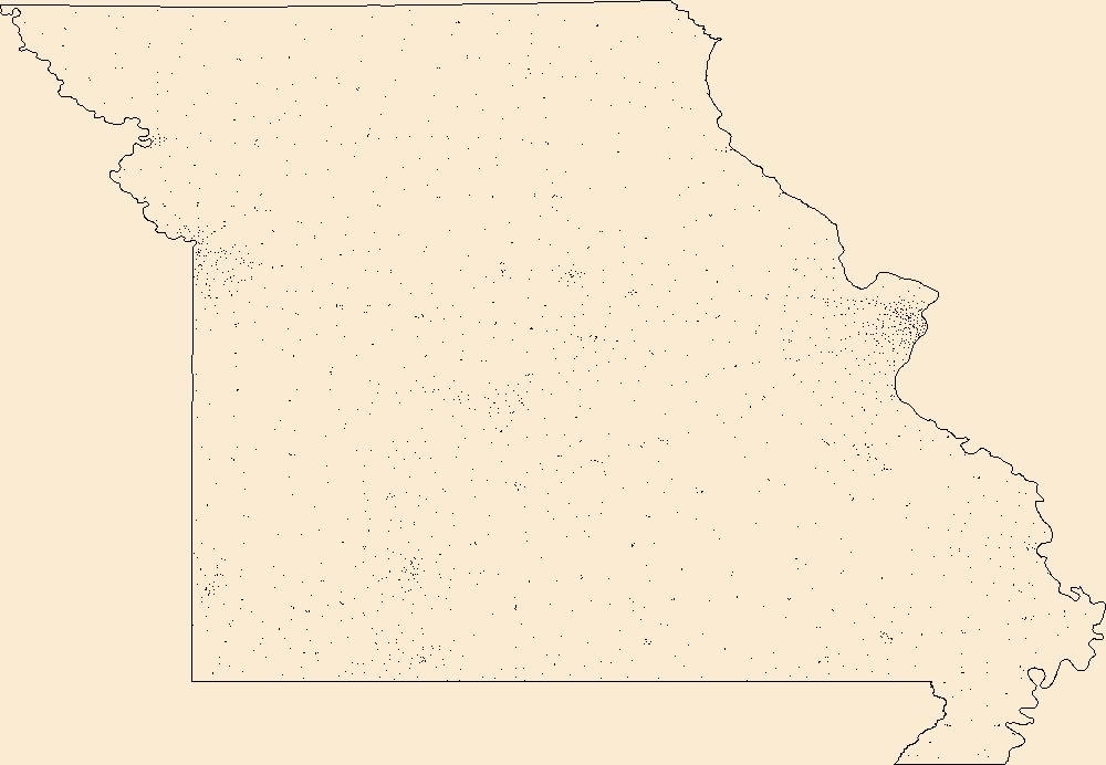
Geospatial data includes structures and other selected map features.
Tags: Adair,
Andrew,
Atchison,
Audrain,
Barry, All tags...
Barton,
Bates,
Benton,
Bollinger,
Boone,
Buchanan,
Butler,
Caldwell,
Callaway,
Camden,
Campground,
Cape Girardeau,
Carroll,
Carter,
Cass,
Cedar,
Chariton,
Christian,
Clark,
Clay,
Clinton,
Cole,
College / University,
Cooper,
Courthouse,
Crawford,
Dade,
Dallas,
Daviess,
DeKalb,
Dent,
Douglas,
Downloadable Data,
Dunklin,
Esri File GeoDatabase 10,
FileGDB,
Fire Station/ EMS Station,
Franklin,
Gasconade,
Gentry,
Greene,
Grundy,
Harrison,
Henry,
Hickory,
Holt,
Hospital/Medical Center,
Howard,
Howell,
Information Center,
Iron,
Jackson,
Jasper,
Jefferson,
Johnson,
Knox,
Laclede,
Lafayette,
Law Enforcement,
Lawrence,
Lewis,
Lincoln,
Linn,
Livingston,
MO,
Macon,
Madison,
Maries,
Marion,
McDonald,
Mercer,
Miller,
Mississippi,
Missouri,
Moniteau,
Monroe,
Montgomery,
Morgan,
National Structures Dataset (NSD),
National Structures Dataset (NSD),
New Madrid,
Newton,
Nodaway,
Oregon,
Osage,
Ozark,
Pemiscot,
Perry,
Pettis,
Phelps,
Pike,
Platte,
Polk,
Post Office,
Prison/ Correctional Facility,
Pulaski,
Putnam,
Ralls,
Randolph,
Ray,
Reynolds,
Ripley,
Saline,
School,
School:Elementary,
School:High School,
School:Middle School,
Schuyler,
Scotland,
Scott,
Shannon,
Shelby,
St. Charles,
St. Clair,
St. Francois,
St. Louis,
State,
State,
State Capitol,
Ste. Genevieve,
Stoddard,
Stone,
Structures,
Sullivan,
Taney,
Technical School,
Texas,
Town Hall,
Trade School,
Trailhead,
US,
United States,
Vernon,
Visitor Center,
Warren,
Washington,
Wayne,
Webster,
Worth,
Wright,
structure, Fewer tags
This data set contains imagery from the National Agriculture Imagery Program (NAIP). The NAIP program is administered by USDA FSA and has been established to support two main FSA strategic goals centered on agricultural production. These are increase stewardship of America's natural resources while enhancing the environment, and to ensure commodities are procured and distributed effectively and efficiently to increase food security. The NAIP program supports these goals by acquiring and providing ortho imagery that has been collected during the agricultural growing season in the U.S. The NAIP ortho imagery is tailored to meet FSA requirements and is a fundamental tool used to support FSA farm and conservation programs....
Types: Citation;
Tags: 29091,
3.75 x 3.75 minute,
3609110,
Aerial Compliance,
Compliance, All tags...
Digital Ortho rectified Image,
Downloadable Data,
HOWELL CO MO FSA,
Howell,
JPEG 2000,
JPEG2000,
MO,
MO091,
NAIP,
Ortho Rectification,
Orthoimagery,
Quarter Quadrangle,
USDA National Agriculture Imagery Program (NAIP),
WHITE CHURCH,
WHITE CHURCH, NE,
farming,
imageryBaseMapsEarthCover, Fewer tags
This data set contains imagery from the National Agriculture Imagery Program (NAIP). The NAIP program is administered by USDA FSA and has been established to support two main FSA strategic goals centered on agricultural production. These are increase stewardship of America's natural resources while enhancing the environment, and to ensure commodities are procured and distributed effectively and efficiently to increase food security. The NAIP program supports these goals by acquiring and providing ortho imagery that has been collected during the agricultural growing season in the U.S. The NAIP ortho imagery is tailored to meet FSA requirements and is a fundamental tool used to support FSA farm and conservation programs....
Types: Citation;
Tags: 29091,
3.75 x 3.75 minute,
3609110,
Aerial Compliance,
Compliance, All tags...
Digital Ortho rectified Image,
Downloadable Data,
HOWELL CO MO FSA,
Howell,
JPEG 2000,
JPEG2000,
MO,
MO091,
NAIP,
Ortho Rectification,
Orthoimagery,
Quarter Quadrangle,
USDA National Agriculture Imagery Program (NAIP),
WHITE CHURCH,
WHITE CHURCH, SE,
farming,
imageryBaseMapsEarthCover, Fewer tags

This data set contains imagery from the National Agriculture Imagery Program (NAIP). The NAIP program is administered by USDA FSA and has been established to support two main FSA strategic goals centered on agricultural production. These are, increase stewardship of America's natural resources while enhancing the environment, and to ensure commodities are procured and distributed effectively and efficiently to increase food security. The NAIP program supports these goals by acquiring and providing ortho imagery that has been collected during the agricultural growing season in the U.S. The NAIP ortho imagery is tailored to meet FSA requirements and is a fundamental tool used to support FSA farm and conservation programs....
Types: Citation;
Tags: 3.75 x 3.75 minute,
4111213,
49003,
Aerial Compliance,
BOX ELDER CO UT FSA, All tags...
Box Elder,
Compliance,
Digital Ortho rectified Image,
Downloadable Data,
HOWELL,
HOWELL, SW,
JPEG2000,
NAIP,
Ortho Rectification,
Orthoimagery,
Quarter Quadrangle,
USDA National Agriculture Imagery Program (NAIP),
UT,
UT003,
farming, Fewer tags
This data set contains imagery from the National Agriculture Imagery Program (NAIP). The NAIP program is administered by USDA FSA and has been established to support two main FSA strategic goals centered on agricultural production. These are increase stewardship of America's natural resources while enhancing the environment, and to ensure commodities are procured and distributed effectively and efficiently to increase food security. The NAIP program supports these goals by acquiring and providing ortho imagery that has been collected during the agricultural growing season in the U.S. The NAIP ortho imagery is tailored to meet FSA requirements and is a fundamental tool used to support FSA farm and conservation programs....
Types: Citation;
Tags: 29091,
3.75 x 3.75 minute,
3609125,
Aerial Compliance,
Compliance, All tags...
Digital Ortho rectified Image,
Downloadable Data,
HOWELL CO MO FSA,
Howell,
JPEG 2000,
JPEG2000,
MO,
MO091,
MOODY,
MOODY, SW,
NAIP,
Ortho Rectification,
Orthoimagery,
Quarter Quadrangle,
USDA National Agriculture Imagery Program (NAIP),
farming,
imageryBaseMapsEarthCover, Fewer tags
This data set contains imagery from the National Agriculture Imagery Program (NAIP). The NAIP program is administered by USDA FSA and has been established to support two main FSA strategic goals centered on agricultural production. These are, increase stewardship of America's natural resources while enhancing the environment, and to ensure commodities are procured and distributed effectively and efficiently to increase food security. The NAIP program supports these goals by acquiring and providing ortho imagery that has been collected during the agricultural growing season in the U.S. The NAIP ortho imagery is tailored to meet FSA requirements and is a fundamental tool used to support FSA farm and conservation programs....
Types: Citation;
Tags: 3.75 x 3.75 minute,
4110536,
56001,
ALBANY CO WY FSA,
Aerial Compliance, All tags...
Albany,
Compliance,
Digital Ortho rectified Image,
Downloadable Data,
HOWELL,
HOWELL, SW,
JPEG2000,
NAIP,
Ortho Rectification,
Orthoimagery,
Quarter Quadrangle,
USDA National Agriculture Imagery Program (NAIP),
WY,
WY001,
farming, Fewer tags
Layered GeoPDF 7.5 Minute Quadrangle Map. Layers of geospatial data include orthoimagery, roads, grids, geographic names, elevation contours, hydrography, and other selected map features.
Tags: 7.5 x 7.5 minute,
Downloadable Data,
EarthCover,
GeoPDF,
Howell, All tags...
Imagery and Base Maps,
Map,
Missouri,
Moody, MO,
Public Land Survey System,
U.S. National Grid,
US,
US Topo,
US Topo Historical,
United States,
boundary,
contour,
geographic names,
hydrography,
imageryBaseMapsEarthCover,
orthoimage,
structures,
topographic,
transportation,
woodland, Fewer tags
Layered GeoPDF 7.5 Minute Quadrangle Map. Layers of geospatial data include orthoimagery, roads, grids, geographic names, elevation contours, hydrography, and other selected map features.
Tags: 7.5 x 7.5 minute,
Downloadable Data,
EarthCover,
GeoPDF,
Howell, All tags...
Imagery and Base Maps,
Map,
Missouri,
Mountain View, MO,
Oregon,
Shannon,
U.S. National Grid,
US,
US Topo,
US Topo Historical,
United States,
contour,
geographic names,
hydrography,
imageryBaseMapsEarthCover,
orthoimage,
structures,
topographic,
transportation, Fewer tags
|
|

