Filters: Tags: Hyde Park (X)
27 results (43ms)|
Filters
Date Range
Types Contacts
Categories Tag Types Tag Schemes |
This data set contains imagery from the National Agriculture Imagery Program (NAIP). The NAIP program is administered by USDA FSA and has been established to support two main FSA strategic goals centered on agricultural production. These are, increase stewardship of America's natural resources while enhancing the environment, and to ensure commodities are procured and distributed effectively and efficiently to increase food security. The NAIP program supports these goals by acquiring and providing ortho imagery that has been collected during the agricultural growing season in the U.S. The NAIP ortho imagery is tailored to meet FSA requirements and is a fundamental tool used to support FSA farm and conservation programs....
This data set contains imagery from the National Agriculture Imagery Program (NAIP). The NAIP program is administered by USDA FSA and has been established to support two main FSA strategic goals centered on agricultural production. These are, increase stewardship of America's natural resources while enhancing the environment, and to ensure commodities are procured and distributed effectively and efficiently to increase food security. The NAIP program supports these goals by acquiring and providing ortho imagery that has been collected during the agricultural growing season in the U.S. The NAIP ortho imagery is tailored to meet FSA requirements and is a fundamental tool used to support FSA farm and conservation programs....
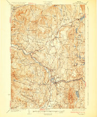
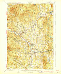
USGS Historical Quadrangle in GeoPDF.
USGS Historical Quadrangle in GeoPDF.
This data set contains imagery from the National Agriculture Imagery Program (NAIP). The NAIP program is administered by USDA FSA and has been established to support two main FSA strategic goals centered on agricultural production. These are, increase stewardship of America's natural resources while enhancing the environment, and to ensure commodities are procured and distributed effectively and efficiently to increase food security. The NAIP program supports these goals by acquiring and providing ortho imagery that has been collected during the agricultural growing season in the U.S. The NAIP ortho imagery is tailored to meet FSA requirements and is a fundamental tool used to support FSA farm and conservation programs....
These data were collected as part of the Great Lakes Restoration Initiative (GLRI) project template 678-1 entitled “Evaluate immediate and long-term BMP effectiveness of GLRI restoration efforts at urban beaches on Southern and Western Lake Michigan”. This project is evaluating the effectiveness of projects that are closely associated with restoration of local habitat and contact recreational activities at two GLRI funded sites in Southern Lake Michigan and one non-GLRI site in Western Lake Michigan. Evaluation of GLRI projects will assess whether goals of recipients are on track and identify any developing unforeseen consequences. Including a third, non-GLRI project site in the evaluation allows comparison between...

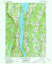
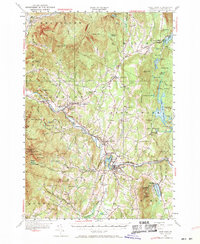
USGS Historical Quadrangle in GeoPDF.
USGS Historical Quadrangle in GeoPDF.
These data were collected as part of the Great Lakes Restoration Initiative (GLRI) project template 678-1 entitled “Evaluate immediate and long-term BMP effectiveness of GLRI restoration efforts at urban beaches on Southern and Western Lake Michigan”. This project is evaluating the effectiveness of projects that are closely associated with restoration of local habitat and contact recreational activities at two GLRI funded sites in Southern Lake Michigan and one non-GLRI site in Western Lake Michigan. Evaluation of GLRI projects will assess whether goals of recipients are on track and identify any developing unforeseen consequences. Including a third, non-GLRI project site in the evaluation allows comparison between...
These data were collected as part of the Great Lakes Restoration Initiative (GLRI) project template 678-1 entitled "Evaluate immediate and long-term BMP effectiveness of GLRI restoration efforts at urban beaches on Southern and Western Lake Michigan". This project is evaluating the effectiveness of projects that are closely associated with restoration of local habitat and contact recreational activities at two GLRI funded sites in Southern Lake Michigan and one non-GLRI site in Western Lake Michigan. Evaluation of GLRI projects will assess whether goals of recipients are on track and identify any developing unforeseen consequences. Including a third, non-GLRI project site in the evaluation allows comparison between...
These data were collected as part of the Great Lakes Restoration Initiative (GLRI) project template 678-1 entitled 'Evaluate immediate and long-term BMP effectiveness of GLRI restoration efforts at urban beaches on Southern and Western Lake Michigan'. This project is evaluating the effectiveness of projects that are closely associated with restoration of local habitat and contact recreational activities at two GLRI funded sites in Southern Lake Michigan and one non-GLRI site in Western Lake Michigan. Evaluation of GLRI projects will assess whether goals of recipients are on track and identify any developing unforeseen consequences. Including a third, non-GLRI project site in the evaluation allows comparison between...
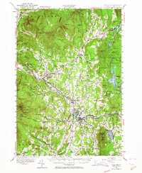
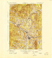
USGS Historical Quadrangle in GeoPDF.
USGS Historical Quadrangle in GeoPDF.
These data were collected as part of the Great Lakes Restoration Initiative (GLRI) project template 678-1 entitled "Evaluate immediate and long-term BMP effectiveness of GLRI restoration efforts at urban beaches on Southern and Western Lake Michigan". This project is evaluating the effectiveness of projects that are closely associated with restoration of local habitat and contact recreational activities at two GLRI funded sites in Southern Lake Michigan and one non-GLRI site in Western Lake Michigan. Evaluation of GLRI projects will assess whether goals of recipients are on track and identify any developing unforeseen consequences. Including a third, non-GLRI project site in the evaluation allows comparison between...
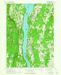
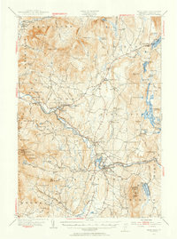
USGS Historical Quadrangle in GeoPDF.

USGS Historical Quadrangle in GeoPDF.
USGS Historical Quadrangle in GeoPDF.
USGS Historical Quadrangle in GeoPDF.
|

|
