Filters: Tags: Hydro (X)
9 results (44ms)|
Filters
Date Range
Extensions Types Contacts
Categories Tag Types
|
The National Hydro Network (NHN), for which the standard was officially adopted by the Canadian Council on Geomatics (CCOG) in August 2004, focuses on providing a quality geometric description and a set of basic attributes describing Canada's inland surface waters. It provides geospatial vector data describing hydrographic features such as lakes, reservoirs, rivers, streams, canals, islands, obstacles (e.g. waterfalls, rapids, rocks in water) and constructions (e.g. dams, wharves, dikes), as well as a linear drainage network and the toponymic information (geographical names) associated to hydrography. The NHN forms the hydrographic layer of the GeoBase. The best available federal and provincial/territorial data...
This data set contains imagery from the National Agriculture Imagery Program (NAIP). The NAIP program is administered by USDA FSA and has been established to support two main FSA strategic goals centered on agricultural production. These are, increase stewardship of America's natural resources while enhancing the environment, and to ensure commodities are procured and distributed effectively and efficiently to increase food security. The NAIP program supports these goals by acquiring and providing ortho imagery that has been collected during the agricultural growing season in the U.S. The NAIP ortho imagery is tailored to meet FSA requirements and is a fundamental tool used to support FSA farm and conservation programs....
This data set contains imagery from the National Agriculture Imagery Program (NAIP). The NAIP program is administered by USDA FSA and has been established to support two main FSA strategic goals centered on agricultural production. These are, increase stewardship of America's natural resources while enhancing the environment, and to ensure commodities are procured and distributed effectively and efficiently to increase food security. The NAIP program supports these goals by acquiring and providing ortho imagery that has been collected during the agricultural growing season in the U.S. The NAIP ortho imagery is tailored to meet FSA requirements and is a fundamental tool used to support FSA farm and conservation programs....
This data set contains imagery from the National Agriculture Imagery Program (NAIP). The NAIP program is administered by USDA FSA and has been established to support two main FSA strategic goals centered on agricultural production. These are, increase stewardship of America's natural resources while enhancing the environment, and to ensure commodities are procured and distributed effectively and efficiently to increase food security. The NAIP program supports these goals by acquiring and providing ortho imagery that has been collected during the agricultural growing season in the U.S. The NAIP ortho imagery is tailored to meet FSA requirements and is a fundamental tool used to support FSA farm and conservation programs....
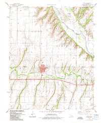
USGS Historical Quadrangle in GeoPDF.
We interpret new chemical and isotopic data from samples collected between October 1998 and March 2002 from the NSF well (also called the Keller well), the only deep well on the summit of Kilauea Volcano, Hawaii. Sample collection followed cleaning of the well, which renewed access to the hydrothermal system very close to the loci of magmatic and fumarolic activity. The chemical and isotopic compositions of the new samples differ remarkably from data published previously. On the basis of the S/Cl ratio and carbon and helium isotopes we conclude that the thermal fluids formed by condensation of magmatic gas into shallow meteoric groundwater. Gas condensation was followed by a complex pattern of basalt dissolution...
Categories: Publication;
Types: Citation;
Tags: Groundwater transport,
ground water hydrology,
hydro
Lakes bathymetry is a line feature-based layer that includes bathymetric information for selected reservoirs, lakes, and ponds in Montana. The layer is based on information collected by multiple sources including contractors with Montana Department of Environmental Quality, the Bureau of Reclamation, and Montana Fish, Wildlife & Parks. Data collection methods vary over time with techniques using a variety of different equipment including manual and electronic depth soundings, use of a GPS receiver, and digitizing previously published bathymetry maps. Data were compiled at a variety of scales and resolutions, depending on the collection method used for a particular waterbody. These data are planned to be regularly...
Categories: Data;
Types: Downloadable,
Map Service,
OGC WFS Layer,
OGC WMS Layer,
Shapefile;
Tags: Data,
EARTH SCIENCE > LAND SURFACE > LANDSCAPE,
Federal resource managers,
LCC Network Science Catalog,
Regional & county planners,
We interpret new chemical and isotopic data from samples collected between October 1998 and March 2002 from the NSF well (also called the Keller well), the only deep well on the summit of Kilauea Volcano, Hawaii. Sample collection followed cleaning of the well, which renewed access to the hydrothermal system very close to the loci of magmatic and fumarolic activity. The chemical and isotopic compositions of the new samples differ remarkably from data published previously. On the basis of the S/Cl ratio and carbon and helium isotopes we conclude that the thermal fluids formed by condensation of magmatic gas into shallow meteoric groundwater. Gas condensation was followed by a complex pattern of basalt dissolution...
Categories: Publication;
Types: Citation;
Tags: Groundwater transport,
ground water hydrology,
hydro
This data set contains imagery from the National Agriculture Imagery Program (NAIP). The NAIP program is administered by USDA FSA and has been established to support two main FSA strategic goals centered on agricultural production. These are, increase stewardship of America's natural resources while enhancing the environment, and to ensure commodities are procured and distributed effectively and efficiently to increase food security. The NAIP program supports these goals by acquiring and providing ortho imagery that has been collected during the agricultural growing season in the U.S. The NAIP ortho imagery is tailored to meet FSA requirements and is a fundamental tool used to support FSA farm and conservation programs....
|

|
