Filters: Tags: Hydrologic Unit (X)
29 results (31ms)|
Filters
|

This map service contains GIS data in NAD83 projection from the EPA Office of Water for HUC2, HUC4, HUC6, HUC8, HUC10 and HUC12 polygons for the USDA Watershed Boundary Dataset. It is available as a WFS, WMS, and REST service as well as the native MapServer service.

The Watershed Boundary Dataset (WBD) from The National Map (TNM) defines the perimeter of drainage areas formed by the terrain and other landscape characteristics. The drainage areas are nested within each other so that a large drainage area, such as the Upper Mississippi River, will be composed of multiple smaller drainage areas, such as the Wisconsin River. Each of these smaller areas can further be subdivided into smaller and smaller drainage areas. The WBD uses six different levels in this hierarchy, with the smallest averaging about 30,000 acres. The WBD is made up of polygons nested into six levels of data respectively defined by Regions, Subregions, Basins, Subbasins, Watersheds, and Subwatersheds. For additional...

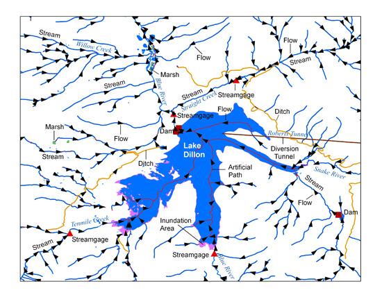
The USGS National Hydrography Dataset (NHD) service from The National Map (TNM) is a comprehensive set of digital spatial data that encodes information about naturally occurring and constructed bodies of surface water (lakes, ponds, and reservoirs), paths through which water flows (canals, ditches, streams, and rivers), and related entities such as point features (springs, wells, stream gages, and dams). The information encoded about these features includes classification and other characteristics, delineation, geographic name, position and related measures, a "reach code" through which other information can be related to the NHD, and the direction of water flow. The network of reach codes delineating water and...

The National Hydrography Dataset (NHD) is a feature-based database that interconnects and uniquely identifies the stream segments or reaches that make up the nation's surface water drainage system. NHD data was originally developed at 1:100,000-scale and exists at that scale for the whole country. This high-resolution NHD, generally developed at 1:24,000/1:12,000 scale, adds detail to the original 1:100,000-scale NHD. (Data for Alaska, Puerto Rico and the Virgin Islands was developed at high-resolution, not 1:100,000 scale.) Local resolution NHD is being developed where partners and data exist. The NHD contains reach codes for networked features, flow direction, names, and centerline representations for areal water...
Categories: Data;
Types: Citation;
Tags: Administrative watershed units,
Area of Complex Channels,
Area to be submerged,
Basin,
Bay/Inlet,
This dataset represents one of three derived outlets or "pour points" for each 12-digit hydrologic unit (HU12) in the Watershed Boundary Dataset (WBD) snapshot delivered with NHDPlus V2.1. The three related pour point locations, each delivered in a stand-alone dataset, are: "from" (fpp) and "to" (tpp) points that identify the location where flow leaves the HU12 polygon based on a flow direction raster, and a third "vector pour point" (vpp) selected "upstream" used to identify flow confluences near the "from" and "to" pour point locations. The points are derived from the NHDPlus V2.1 flow direction rasters and the WBD snapshot delivered with NHDPlus V2.1. This metadata document describes the "vector" pourpoints (vpp).
Categories: Data;
Types: Downloadable,
Map Service,
OGC WFS Layer,
OGC WMS Layer,
Shapefile;
Tags: Conterminous United States,
Hydrologic Unit,
NHDPlus V2.1,
National Hydrography Dataset Plus version 2.1,
Outlet point,

The Geographic Information Retrieval and Analysis System (GIRAS) was developed in the mid 70s to put into digital form a number of data layers which were of interest to the USGS. One of these data layers was the Hydrologic Units. The map is based on the Hydrologic Unit Maps published by the U.S. Geological Survey Office of Water Data Coordination, together with the list descriptions and name of region, subregion, accounting units, and cataloging unit. The hydrologic units are encoded with an eight- digit number that indicates the hydrologic region (first two digits), hydrologic subregion (second two digits), accounting unit (third two digits), and cataloging unit (fourth two digits). The data produced by GIRAS...

U.S. Geological Survey, Department of the Interior - The annual Watershed Boundary Dataset (WBD) stewardship plan is to maintain watershed boundary data through usage of WBD edit tools over the United States and its territories. WBD for the nation has been collected and is now in maintenance mode. Interested parties who wish to become a stewardship partner with the USGS in FY15 or in future years should contact a USGS Geospatial Liaison - http://liaisons.usgs.gov/geospatial/documents/TNM_Partnership_User_ContactList.pdf. To find out more about watershed boundary stewardship go to http://nhd.usgs.gov/wbd.html or http://nhd.usgs.gov/WBDstewardshipInfoSheet.pdf
This dataset represents one of three derived outlets or "pour points" for each 12-digit hydrologic unit (HU12) in the Watershed Boundary Dataset (WBD) snapshot delivered with NHDPlus V2.1. The three related pour point locations, each delivered in a stand-alone dataset, are: "from" (fpp) and "to" (tpp) points that identify the location where flow leaves the HU12 polygon based on a flow direction raster, and a third "vector pour point" (vpp) selected "upstream" used to identify flow confluences near the "from" and "to" pour point locations. The points are derived from the NHDPlus V2.1 flow direction rasters and the WBD snapshot delivered with NHDPlus V2.1. This metadata document describes the "from" pourpoints (fpp).
Categories: Data;
Types: Downloadable,
Map Service,
OGC WFS Layer,
OGC WMS Layer,
Shapefile;
Tags: Conterminous United States,
Hydrologic Unit,
NHDPlus V2.1,
National Hydrography Dataset Plus version 2.1,
Outlet point,

The High Resolution National Hydrography Dataset Plus (NHDPlus HR) is an integrated datset of geospatial data layers, including the most current National Hydrography Dataset (NHD), the 10-meter 3D Elevation Program Digital Elevation Model (3DEP DEM), and the National Watershed Boundary Dataset (WBD). The NHDPlus HR combines the NHD, 3DEP DEMs, and WBD to create a stream network with linear referencing, feature naming, "value added attributes" (VAAs), elevation-derived catchments, and other features for hydrologic data analysis. The stream network with linear referencing is a system of data relationships applied to hydrographic systems so that one stream reach "flows" into another and "events" can be tied to and...
Types: Citation;
Tags: Administrative watershed units,
Area of Complex Channels,
Area to be submerged,
Basin,
Bay/Inlet,

These data were released prior to the October 1, 2016 effective date for the USGS’s policy dictating the review, approval, and release of scientific data as referenced in USGS Survey Manual Chapter 502.8 Fundamental Science Practices: Review and Approval of Scientific Data for Release. The USGS compiles online access to water-resources data collected at approximately 1.5 million sites in all 50 States, the District of Columbia, Puerto Rico, the Virgin Islands, Guam, American Samoa and the Commonwealth of the Northern Mariana Islands.
This data set is a complete digital hydrologic unit boundary layer of the Subbasin (10-digit) 5th level for the entire United States, clipped to the Northeast. A hydrologic unit (HU) is a drainage area delineated to nest a multi-level, hierarchical drainage system. Its boundaries are defined by a hydrographic and topographic criteria that delineate an area of land upstream from a specific point on a river, stream, or similar surfaces waters. An HU can accept surface water directly from upstream drainage areas, and indirectly from associated surface areas such as remnant, non-contributing, and diversions to form a drainage area with single or multiple outlet points. HUs are only synonymous with classic watersheds...
Categories: Data;
Types: ArcGIS REST Map Service,
ArcGIS Service Definition,
Downloadable,
Map Service;
Tags: Canada,
HUC,
HUC8,
Mexico,
Puerto Rico,

These data were released prior to the October 1, 2016 effective date for the USGS’s policy dictating the review, approval, and release of scientific data as referenced in USGS Survey Manual Chapter 502.8 Fundamental Science Practices: Review and Approval of Scientific Data for Release. The USGS compiles online access to water-resources data collected at approximately 1.5 million sites in all 50 States, the District of Columbia, Puerto Rico, the Virgin Islands, Guam, American Samoa and the Commonwealth of the Northern Mariana Islands.
These data were released prior to the October 1, 2016 effective date for the USGS’s policy dictating the review, approval, and release of scientific data as referenced in USGS Survey Manual Chapter 502.8 Fundamental Science Practices: Review and Approval of Scientific Data for Release. The Geographic Information Retrieval and Analysis System (GIRAS) was developed in the mid 70s to put into digital form a number of data layers which were of interest to the USGS. One of these data layers was the Hydrologic Units. The map is based on the Hydrologic Unit Maps published by the U.S. Geological Survey Office of Water Data Coordination, together with the list descriptions and name of region, subregion, accounting units,...
Categories: pre-SM502.8;
Tags: Conterminous United States,
NSDI,
USGS Science Data Catalog (SDC),
environment,
geoscientificInformation,

These data were released prior to the October 1, 2016 effective date for the USGS’s policy dictating the review, approval, and release of scientific data as referenced in USGS Survey Manual Chapter 502.8 Fundamental Science Practices: Review and Approval of Scientific Data for Release. The USGS compiles online access to water-resources data collected at approximately 1.5 million sites in all 50 States, the District of Columbia, Puerto Rico, the Virgin Islands, Guam, American Samoa and the Commonwealth of the Northern Mariana Islands.

These data were released prior to the October 1, 2016 effective date for the USGS’s policy dictating the review, approval, and release of scientific data as referenced in USGS Survey Manual Chapter 502.8 Fundamental Science Practices: Review and Approval of Scientific Data for Release. The U.S. Geological Survey's National Water-Use Information Program is responsible for compiling and disseminating the nation's water-use data. The USGS works in cooperation with local, State, and Federal environmental agencies to collect water-use information. USGS compiles these data to produce water-use information aggregated at the county, state, and national levels. Every five years, data at the county level are compiled into...
This USGS data release includes a shapefile of outlet point locations for 12-digit hydrologic units (HU12s) from the Watershed Boundary Dataset (WBD), dated August 13, 2020 (U.S. Geological Survey and others, 2020), draining to the Gulf of Mexico in the south-central and southeastern United States. The outlet locations were derived by combining the WBD boundaries with flow direction grids from the National Hydrography Dataset Plus (NHDPlus) v 2.1 (U.S. Environmental Protection Agency and U.S. Geological Survey, 2012). Most of the outlet locations were determined by finding the cell with highest flow accumulation from the NHDPlus flow-direction grids within each WBD HU12 boundary. Some locations were found to be...
Types: Map Service,
OGC WFS Layer,
OGC WMS Layer,
OGC WMS Service;
Tags: Alabama,
Arkansas,
Ecology,
Florida,
Georgia,
This dataset represents one of three derived outlets or "pour points" for each 12-digit hydrologic unit (HU12) in the Watershed Boundary Dataset (WBD) snapshot delivered with NHDPlus V2.1. The three related pour point locations, each delivered in a stand-alone dataset, are: "from" (fpp) and "to" (tpp) points that identify the location where flow leaves the HU12 polygon based on a flow direction raster, and a third "vector pour point" (vpp) selected "upstream" used to identify flow confluences near the "from" and "to" pour point locations. The points are derived from the NHDPlus V2.1 flow direction rasters and the WBD snapshot delivered with NHDPlus V2.1. This metadata document describes the "to" pourpoints (tpp).
Categories: Data;
Types: Downloadable,
Map Service,
OGC WFS Layer,
OGC WMS Layer,
Shapefile;
Tags: Conterminous United States,
Hydrologic Unit,
NHDPlus V2.1,
National Hydrography Dataset Plus version 2.1,
Outlet point,

This dataset is HUC6 for OR downloaded from http://www.oregon.gov/DAS/EISPD/GEO/alphalist.shtml#H and attributed with our analysis regions for summary. This dataset is part of a larger groundwater project across the Pacific NW (Brown et al. 2009) region which has two primary goals: (1) develop tools to identify where and how groundwater is important to biodiversity conservation and (2) assess the pressing threats to the quantity and quality of that groundwater and develop strategies to abate those threats. Data and analyses conducted are intended for use at a statewide scale. Therefore, more detailed mapping may be necessary at local scales. For more information please contact the Oregon Field Office of The Nature...
Drainage basin areas for 376 USGS streamgages in West Virginia and adjacent states were delineated digitally. The USGS Watershed Boundary Dataset HUC12 sub-watershed lines were used as outer limits of basins, and heads-up digitizing was used to delineate boundaries from the stream gage to the HUC12 boundary. The USGS National Map was used, as background, to show both contour lines and digital elevation to highlight drainage basin divides, ridges, and valleys. Basins were delineated for (1) all active continuous-flow and crest-stage streamgages, in West Virginia, through water year 2020, (2) selected inactive streamgages, in West Virginia and adjacent states, that were used in the flood-frequency report prepared...
Categories: Data;
Types: ArcGIS REST Map Service,
ArcGIS Service Definition,
Downloadable,
Map Service,
OGC WFS Layer,
OGC WMS Layer,
OGC WMS Service;
Tags: Basin boundary,
Drainage area,
Drainage divide,
Hydrologic Unit,
Kentucky,
This data set is a complete digital hydrologic unit boundary layer of the Subbasin (8-digit) 4th level for the entire United States, clipped to the Northeast. A hydrologic unit (HU) is a drainage area delineated to nest a multi-level, hierarchical drainage system. Its boundaries are defined by a hydrographic and topographic criteria that delineate an area of land upstream from a specific point on a river, stream, or similar surfaces waters. An HU can accept surface water directly from upstream drainage areas, and indirectly from associated surface areas such as remnant, non-contributing, and diversions to form a drainage area with single or multiple outlet points. HUs are only synonymous with classic watersheds...
Categories: Data;
Types: ArcGIS REST Map Service,
ArcGIS Service Definition,
Downloadable,
Map Service;
Tags: Canada,
HUC,
HUC8,
Mexico,
Puerto Rico,
|

|