Filters: Tags: IRETON (X)
12 results (118ms)|
Filters
Date Range
Types Contacts
Categories Tag Types Tag Schemes |
Core Research Center, core R522, from well operated by SUNRAY DX OILRaw Properties from download, web scrape, MapServer, and Macrostrat API{"Lib Num": "R522", "API Num": "2508505242", "Operator": "SUNRAY DX OIL", "Well Name": "1 FORT PECK", "Field": "TULE CREEK EAST", "State": "MT", "County": "ROOSEVELT", "Type": "FULL", "Photos": "F", "Thin Sec": "F", "Analysis": "F", "Latitude": "48.369469", "Longitude": "-105.427649", "coordinates_geohash": "c8t50vmutdx1", "Source": "FROM STATE RECORDS", "Security Flag": "NO SPECIAL RESTRICTIONS", "crc_collection_name": "core", "sb_parent_id": "4f4e49dae4b07f02db5e0486", "intervals": [{"Formation": "NISKU", "Age": "DEVO", "Min Depth": "7784", "Max Depth": "7810"}, {"Formation":...
This data set contains imagery from the National Agriculture Imagery Program (NAIP). The NAIP program is administered by USDA FSA and has been established to support two main FSA strategic goals centered on agricultural production. These are, increase stewardship of America's natural resources while enhancing the environment, and to ensure commodities are procured and distributed effectively and efficiently to increase food security. The NAIP program supports these goals by acquiring and providing ortho imagery that has been collected during the agricultural growing season in the U.S. The NAIP ortho imagery is tailored to meet FSA requirements and is a fundamental tool used to support FSA farm and conservation programs....
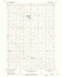
USGS Historical Quadrangle in GeoPDF.
Core Research Center, core R843, from well operated by GENERAL AMERICAN PETRaw Properties from download, web scrape, MapServer, and Macrostrat API{"Lib Num": "R843", "API Num": "2508521288", "Operator": "GENERAL AMERICAN PET", "Well Name": "1-20 MCWHIRTER", "Field": "BENRUD", "State": "MT", "County": "ROOSEVELT", "Type": "SLABBED", "Photos": "F", "Thin Sec": "F", "Analysis": "F", "Latitude": "48.418685", "Longitude": "-105.631824", "coordinates_geohash": "c8sgkq372154", "Source": "FROM STATE RECORDS", "Security Flag": "NO SPECIAL RESTRICTIONS", "crc_collection_name": "core", "sb_parent_id": "4f4e49dae4b07f02db5e0486", "intervals": [{"Formation": "IRETON", "Age": "DEVO", "Min Depth": "7592", "Max Depth": "7597"},...
This data set contains imagery from the National Agriculture Imagery Program (NAIP). The NAIP program is administered by USDA FSA and has been established to support two main FSA strategic goals centered on agricultural production. These are, increase stewardship of America's natural resources while enhancing the environment, and to ensure commodities are procured and distributed effectively and efficiently to increase food security. The NAIP program supports these goals by acquiring and providing ortho imagery that has been collected during the agricultural growing season in the U.S. The NAIP ortho imagery is tailored to meet FSA requirements and is a fundamental tool used to support FSA farm and conservation programs....
Core Research Center, core R554, from well operated by MURPHY OIL CORPRaw Properties from download, web scrape, MapServer, and Macrostrat API{"Lib Num": "R554", "API Num": "2508505262", "Operator": "MURPHY OIL CORP", "Well Name": "1 WETSIT", "Field": "BENRUD EAST", "State": "MT", "County": "ROOSEVELT", "Type": "FULL", "Photos": "F", "Thin Sec": "F", "Analysis": "F", "Latitude": "48.393999", "Longitude": "-105.553152", "coordinates_geohash": "c8sgq1fe3r32", "Source": "FROM STATE RECORDS", "Security Flag": "NO SPECIAL RESTRICTIONS", "crc_collection_name": "core", "sb_parent_id": "4f4e49dae4b07f02db5e0486", "intervals": [{"Formation": "NISKU", "Age": "DEVO", "Min Depth": "7620", "Max Depth": "7640"}, {"Formation":...
Core Research Center, core C971, from well operated by GENERAL AM OIL TEXASRaw Properties from download, web scrape, MapServer, and Macrostrat API{"Lib Num": "C971", "API Num": "2508521215", "Operator": "GENERAL AM OIL TEXAS", "Well Name": "1-9 STENSLAND", "Field": "WILDCAT", "State": "MT", "County": "ROOSEVELT", "Type": "SLABBED", "Photos": "F", "Thin Sec": "F", "Analysis": "F", "Latitude": "48.452135", "Longitude": "-105.616812", "coordinates_geohash": "c8sgssknjusg", "Source": "FROM STATE RECORDS", "Security Flag": "NO SPECIAL RESTRICTIONS", "crc_collection_name": "core", "sb_parent_id": "4f4e49dae4b07f02db5e0486", "intervals": [{"Formation": "NISKU", "Age": "DEVO", "Min Depth": "7703", "Max Depth": "7794"},...
Core Research Center, core D015, from well operated by SHELL OIL COMPANYRaw Properties from download, web scrape, MapServer, and Macrostrat API{"Lib Num": "D015", "API Num": "2510521122", "Operator": "SHELL OIL COMPANY", "Well Name": "1 GREEN", "Field": "WILDCAT", "State": "MT", "County": "VALLEY", "Type": "SLABBED", "Photos": "T", "Thin Sec": "F", "Analysis": "F", "Latitude": "48.662954", "Longitude": "-106.211684", "coordinates_geohash": "c8skz4g422h7", "Source": "FROM STATE RECORDS", "Security Flag": "NO SPECIAL RESTRICTIONS", "crc_collection_name": "core", "sb_parent_id": "4f4e49dae4b07f02db5e0486", "intervals": [{"Formation": "NISKU", "Age": "DEVO", "Min Depth": "6800", "Max Depth": "6888"}, {"Formation": "IRETON",...
This data set contains imagery from the National Agriculture Imagery Program (NAIP). The NAIP program is administered by USDA FSA and has been established to support two main FSA strategic goals centered on agricultural production. These are, increase stewardship of America's natural resources while enhancing the environment, and to ensure commodities are procured and distributed effectively and efficiently to increase food security. The NAIP program supports these goals by acquiring and providing ortho imagery that has been collected during the agricultural growing season in the U.S. The NAIP ortho imagery is tailored to meet FSA requirements and is a fundamental tool used to support FSA farm and conservation programs....
This data set contains imagery from the National Agriculture Imagery Program (NAIP). The NAIP program is administered by USDA FSA and has been established to support two main FSA strategic goals centered on agricultural production. These are, increase stewardship of America's natural resources while enhancing the environment, and to ensure commodities are procured and distributed effectively and efficiently to increase food security. The NAIP program supports these goals by acquiring and providing ortho imagery that has been collected during the agricultural growing season in the U.S. The NAIP ortho imagery is tailored to meet FSA requirements and is a fundamental tool used to support FSA farm and conservation programs....
Core Research Center, core R558, from well operated by TESORO PETROLEUMRaw Properties from download, web scrape, MapServer, and Macrostrat API{"Lib Num": "R558", "API Num": "2508505268", "Operator": "TESORO PETROLEUM", "Well Name": "1 CAMRUD", "Field": "BENRUD EAST", "State": "MT", "County": "ROOSEVELT", "Type": "FULL", "Photos": "F", "Thin Sec": "F", "Analysis": "F", "Latitude": "48.398289", "Longitude": "-105.525456", "coordinates_geohash": "c8sgqdwsqwuz", "Source": "FROM STATE RECORDS", "Security Flag": "NO SPECIAL RESTRICTIONS", "crc_collection_name": "core", "sb_parent_id": "4f4e49dae4b07f02db5e0486", "intervals": [{"Formation": "IRETON", "Age": "DEVO", "Min Depth": "7608", "Max Depth": "7644"}], "crcwc_url":...
Categories: Physical Item;
Tags: DEVO,
Danian,
IRETON,
Tullock Member,
Tullock Member of Fort Union Formation,
Core Research Center, core B528, from well operated by MURPHY OIL CORPRaw Properties from download, web scrape, MapServer, and Macrostrat API{"Lib Num": "B528", "API Num": "2510505024", "Operator": "MURPHY OIL CORP", "Well Name": "1 FIREMOON", "Field": "SARGENT AREA", "State": "MT", "County": "VALLEY", "Type": "CHIPS", "Photos": "T", "Thin Sec": "F", "Analysis": "T", "Latitude": "48.365762", "Longitude": "-106.327173", "coordinates_geohash": "c8s7hkwyvr92", "Source": "FROM STATE RECORDS", "Security Flag": "NO SPECIAL RESTRICTIONS", "crc_collection_name": "core", "sb_parent_id": "4f4e49dae4b07f02db5e0486", "intervals": [{"Formation": "CHARLES /SALT/", "Age": "MISS", "Min Depth": "4985", "Max Depth": "5150"}, {"Formation":...
|

|
