Filters
Date Range
Types
Contacts
Categories
Tag Types
Tag Schemes
|

Mountain sheep near the open pit at Morenci.
Categories: Data;
Tags: 1990s,
Arizona,
Arizona Central,
Bon Ton,
Caynga, All tags...
Clifton - 15 Min,
Copper King,Alice Winifred,
Copper Mountain,
Copper Mountain metallic mineral dist.,
Copper, Sulfide,
Dataset,
Delaware,
Detr,
East And West Yankie,
Garfield,
Greenlee,
Hormeyer,
Humboldt,
Ida,
Jameson, Joy, Raton,
King,
Las Terrazas,
Manganese Blue,
Metcalf,
Montezuma,
Morenci physiographic area,
Northwest Extension,
Ryerson,
Shannon,
T4S R29E Sec 16 N2,
Thompson,
United States,
animals,
geoscientificInformation,
image collections,
mining,
photographic prints,
surface mining, Fewer tags

Heinrichs Geoexploration Co. Maps: Essex-Morenci Claim Map; 1 in. to 400 feet; 25 x 26 in.
Categories: Data;
Tags: 1970s,
Abrasive, Garnet Andra,
Arizona,
Arizona Central,
Bon Ton, All tags...
Calcium, Limestone,
Caynga,
Clay,
Clifton - 15 Min,
Copper King,Alice Winifred,
Copper Mountain,
Copper Mountain metallic mineral dist.,
Copper, Native,
Copper, Oxide,
Copper, Sulfide,
Dataset,
Delaware,
Detr,
East And West Yankie,
Garfield,
Gemstone, Turquoise,
Gold,
Greenlee County,
Greenlee47,
Hormeyer,
Humboldt,
Ida,
Jameson, Joy, Raton,
King,
Las Terrazas,
Manganese Blue,
Metcalf,
Montezuma,
Morenci physiographic area,
Northwest Extension,
Ryerson,
Shannon,
Silicon,
Silver,
T4S R29E Sec 16 N2,
Thompson,
United States,
Vanadium,
claim maps,
geoscientificInformation,
maps and atlases,
mineral resources, Fewer tags
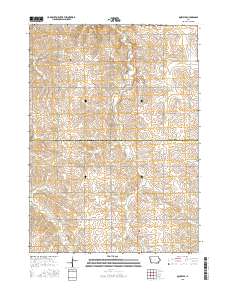
Layered GeoPDF 7.5 Minute Quadrangle Map. Layers of geospatial data include orthoimagery, roads, grids, geographic names, elevation contours, hydrography, and other selected map features.
Tags: 7.5 x 7.5 minute,
Cherokee,
Downloadable Data,
EarthCover,
GeoPDF, All tags...
Ida,
Imagery and Base Maps,
Iowa,
Map,
Public Land Survey System,
Quimby SE, IA,
U.S. National Grid,
US,
US Topo,
US Topo Historical,
United States,
boundary,
contour,
geographic names,
hydrography,
imageryBaseMapsEarthCover,
orthoimage,
structures,
topographic,
transportation,
woodland, Fewer tags

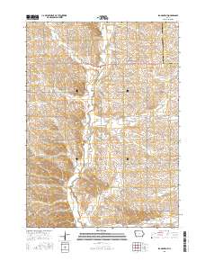
Layered GeoPDF 7.5 Minute Quadrangle Map. Layers of geospatial data include orthoimagery, roads, grids, geographic names, elevation contours, hydrography, and other selected map features.
Tags: 7.5 x 7.5 minute,
Downloadable Data,
EarthCover,
GeoPDF,
Holstein SW, IA, All tags...
Ida,
Imagery and Base Maps,
Iowa,
Map,
U.S. National Grid,
US,
US Topo,
US Topo Historical,
United States,
Woodbury,
contour,
geographic names,
hydrography,
orthoimage,
topographic,
transportation, Fewer tags
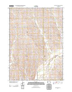
Layered GeoPDF 7.5 Minute Quadrangle Map. Layers of geospatial data include orthoimagery, roads, grids, geographic names, elevation contours, hydrography, and other selected map features.
Tags: 7.5 x 7.5 minute,
Downloadable Data,
EarthCover,
GeoPDF,
Ida, All tags...
Ida Grove NW, IA,
Imagery and Base Maps,
Iowa,
Map,
Public Land Survey System,
Sac,
U.S. National Grid,
US,
US Topo,
US Topo Historical,
United States,
boundary,
contour,
geographic names,
hydrography,
imageryBaseMapsEarthCover,
orthoimage,
structures,
topographic,
transportation,
woodland, Fewer tags
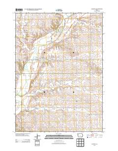
Layered GeoPDF 7.5 Minute Quadrangle Map. Layers of geospatial data include orthoimagery, roads, grids, geographic names, elevation contours, hydrography, and other selected map features.
Tags: 7.5 x 7.5 minute,
Downloadable Data,
EarthCover,
GeoPDF,
Holstein SW, IA, All tags...
Ida,
Imagery and Base Maps,
Iowa,
Map,
Public Land Survey System,
U.S. National Grid,
US,
US Topo,
US Topo Historical,
United States,
Woodbury,
boundary,
contour,
geographic names,
hydrography,
imageryBaseMapsEarthCover,
orthoimage,
structures,
topographic,
transportation,
woodland, Fewer tags
Layered GeoPDF 7.5 Minute Quadrangle Map. Layers of geospatial data include orthoimagery, roads, grids, geographic names, elevation contours, hydrography, and other selected map features.
Tags: 7.5 x 7.5 minute,
Cherokee,
Downloadable Data,
EarthCover,
GeoPDF, All tags...
Ida,
Imagery and Base Maps,
Iowa,
Map,
Public Land Survey System,
U.S. National Grid,
US,
US Topo,
US Topo Historical,
United States,
Washta, IA,
Woodbury,
boundary,
contour,
geographic names,
hydrography,
imageryBaseMapsEarthCover,
orthoimage,
structures,
topographic,
transportation,
woodland, Fewer tags
The Geographic Names Information System (GNIS) is the Federal standard for geographic nomenclature. The U.S. Geological Survey developed the GNIS for the U.S. Board on Geographic Names, a Federal inter-agency body chartered by public law to maintain uniform feature name usage throughout the Government and to promulgate standard names to the public. The GNIS is the official repository of domestic geographic names data; the official vehicle for geographic names use by all departments of the Federal Government; and the source for applying geographic names to Federal electronic and printed products of all types.
Tags: Adair,
Adams,
Allamakee,
Antarctica,
Antarctica, All tags...
Appanoose,
Audubon,
BGN,
Benton,
Black Hawk,
Board on Geographic Names,
Boone,
Borough,
Bremer,
Buchanan,
Buena Vista,
Butler,
Calhoun,
Carroll,
Cass,
Cedar,
Census Area,
Cerro Gordo,
Cherokee,
Chickasaw,
Clarke,
Clay,
Clayton,
Clinton,
Commonwealth,
County,
Crawford,
Dallas,
Davis,
Decatur,
Delaware,
Des Moines,
Dickinson,
District,
Downloadable Data,
Dubuque,
Emmet,
Fayette,
Feature class,
Feature coordinates,
Feature county,
Feature description,
Feature designation,
Feature history,
Feature indentification,
Feature name,
Feature state,
Floyd,
Franklin,
Fremont,
GNIS,
Geographic Names,
Geographic Names Federal Codes,
Geographic Names Information System,
Geographic feature,
Geographic name,
Geographical feature,
Geographical name,
Greene,
Grundy,
Guthrie,
Hamilton,
Hancock,
Hardin,
Harrison,
Henry,
Howard,
Humboldt,
IA,
Ida,
Iowa,
Iowa,
Jackson,
Jasper,
Jefferson,
Johnson,
Jones,
Keokuk,
Kossuth,
Lee,
Linn,
Louisa,
Lucas,
Lyon,
Madison,
Mahaska,
Marion,
Marshall,
Mills,
Mitchell,
Monona,
Monroe,
Montgomery,
Municipio,
Muscatine,
National Geographic Names Information System (GNIS),
National Geographic Names Information System (GNIS),
O'Brien,
Official feature name,
Osceola,
Outlying Area,
Page,
Palo Alto,
Parish,
Place name,
Plymouth,
Pocahontas,
Polk,
Populated Place,
Pottawattamie,
Poweshiek,
Ringgold,
Sac,
Scott,
Shelby,
Sioux,
State,
Story,
TXT (pipes),
Tama,
Taylor,
Territories,
Territory,
Topographic Map,
U.S. Board on Geographic Names,
U.S. Geological Survey,
US,
USA,
USBGN,
USGS,
UTF-8 Pipe Delimited Text File nan,
Union,
United States,
United States,
United States,
Van Buren,
Variant name,
Wapello,
Warren,
Washington,
Wayne,
Webster,
Winnebago,
Winneshiek,
Woodbury,
Worth,
Wright,
antarctic,
database,
economy,
environment,
feature,
gazetteer,
geographic,
geographic names,
geographical,
geography,
geospatial,
imageryBaseMapsEarthCover,
inlandWaters,
location,
map,
name,
place,
placename,
society,
structure,
topographic map,
toponymy, Fewer tags

This data represents the map extent for current and historical USGS topographic maps for the United States and Territories, including 1 X 2 Degree, 1 X 1 Degree, 30 X 60 Minute, 15 X 15 Minute, 7.5 X 7.5 Minute, and 3.75 X 3.75 Minute. The grid was generated using ESRI ArcInfo GIS software.
Types: Citation;
Tags: Adair,
Adams,
Allamakee,
Appanoose,
Audubon, All tags...
Benton,
Black Hawk,
Boone,
Boundaries,
Bremer,
Buchanan,
Buena Vista,
Butler,
Calhoun,
Carroll,
Cass,
Cedar,
Cerro Gordo,
Cherokee,
Chickasaw,
Clarke,
Clay,
Clayton,
Clinton,
Crawford,
Dallas,
Davis,
Decatur,
Delaware,
Des Moines,
Dickinson,
Downloadable Data,
Dubuque,
Emmet,
Esri Shapefile nan,
Fayette,
Floyd,
Franklin,
Fremont,
Greene,
Grundy,
Guthrie,
Hamilton,
Hancock,
Hardin,
Harrison,
Henry,
Howard,
Humboldt,
IA,
Ida,
Iowa,
Iowa,
Jackson,
Jasper,
Jefferson,
Johnson,
Jones,
Keokuk,
Kossuth,
Lee,
Linn,
Louisa,
Lucas,
Lyon,
Madison,
Mahaska,
Map Indices,
Map Indices,
Map Indices,
Marion,
Marshall,
Mills,
Mitchell,
Monona,
Monroe,
Montgomery,
Muscatine,
O'Brien,
Osceola,
Page,
Palo Alto,
Plymouth,
Pocahontas,
Polk,
Pottawattamie,
Poweshiek,
Ringgold,
Sac,
Scott,
Shapefile,
Shelby,
Sioux,
State,
State,
Story,
Tama,
Taylor,
US,
Union,
United States,
United States of America,
Van Buren,
Wapello,
Warren,
Washington,
Wayne,
Webster,
Winnebago,
Winneshiek,
Woodbury,
Worth,
Wright,
cells,
map indices,
polygon grid, Fewer tags
The Watershed Boundary Dataset (WBD) is a comprehensive aggregated collection of hydrologic unit data consistent with the national criteria for delineation and resolution. It defines the areal extent of surface water drainage to a point except in coastal or lake front areas where there could be multiple outlets as stated by the "Federal Standards and Procedures for the National Watershed Boundary Dataset (WBD)" "Standard" (https://pubs.usgs.gov/tm/11/a3/). Watershed boundaries are determined solely upon science-based hydrologic principles, not favoring any administrative boundaries or special projects, nor particular program or agency. This dataset represents the hydrologic unit boundaries to the 12-digit (6th level)...
Tags: 10-digit,
12-digit,
14-digit,
16-digit,
2-digit, All tags...
4-digit,
6-digit,
8-digit,
Adair,
Adams,
Albany,
Allen,
Anderson,
Andrew,
Antelope,
Appanoose,
Arapahoe,
Arthur,
Atchison,
Audrain,
Audubon,
Aurora,
Banner,
Barnes,
Barton,
Basin,
Bates,
Beadle,
Beaverhead,
Bennett,
Benton,
Big Horn,
Billings,
Blaine,
Bon Homme,
Boone,
Boulder,
Bourbon,
Bowman,
Box Butte,
Boyd,
Broadwater,
Brookings,
Broomfield,
Brown,
Brule,
Buchanan,
Buena Vista,
Buffalo,
Burke,
Burleigh,
Burt,
Butler,
Butte,
CO,
Caldwell,
Callaway,
Camden,
Campbell,
Carbon,
Carroll,
Carter,
Cascade,
Cass,
Cedar,
Chaffee,
Chariton,
Charles Mix,
Chase,
Cherokee,
Cherry,
Cheyenne,
Chouteau,
Christian,
Clark,
Clarke,
Clay,
Clear Creek,
Clinton,
Cloud,
Codington,
Coffey,
Cole,
Colfax,
Colorado,
Converse,
Cooper,
Corson,
Crawford,
Crook,
Cuming,
Custer,
Dade,
Dakota,
Dallas,
Daniels,
Daviess,
Davis,
Davison,
Dawes,
Dawson,
Day,
DeKalb,
Decatur,
Deer Lodge,
Dent,
Denver,
Deuel,
Dewey,
Dickey,
Dickinson,
Divide,
Dixon,
Dodge,
Doniphan,
Douglas,
Downloadable Data,
Dundy,
Dunn,
Eddy,
Edmunds,
El Paso,
Elbert,
Ellis,
Ellsworth,
Emmet,
Emmons,
Esri File GeoDatabase 10,
Fall River,
Fallon,
Faulk,
Fergus,
FileGDB,
Fillmore,
Flathead,
Foster,
Franklin,
Fremont,
Frontier,
Furnas,
Gage,
Gallatin,
Garden,
Garfield,
Gasconade,
Geary,
Gentry,
Gilpin,
Glacier,
Golden Valley,
Goshen,
Gosper,
Gove,
Graham,
Grand,
Granite,
Grant,
Greeley,
Greene,
Gregory,
Grundy,
Guthrie,
HU-2,
HU-2 Region,
HU2_10,
HUC,
Haakon,
Hall,
Hamilton,
Hamlin,
Hand,
Hanson,
Harding,
Harlan,
Harrison,
Hayes,
Henry,
Hettinger,
Hickory,
Hill,
Hitchcock,
Holt,
Hooker,
Hot Springs,
Howard,
Howell,
Hughes,
Hutchinson,
Hyde,
Hydrography,
Hydrologic Unit Code,
Hydrologic Units,
IA,
ID,
Ida,
Idaho,
Iowa,
Jackson,
Jefferson,
Jerauld,
Jewell,
Johnson,
Jones,
Judith Basin,
KS,
Kansas,
Kearney,
Keith,
Keya Paha,
Kidder,
Kimball,
Kingsbury,
Kit Carson,
Knox,
LaMoure,
Laclede,
Lafayette,
Lake,
Lancaster,
Lane,
Laramie,
Larimer,
Lawrence,
Leavenworth,
Lemhi,
Lewis and Clark,
Liberty,
Lincoln,
Linn,
Livingston,
Logan,
Loup,
Lucas,
Lyman,
Lyon,
MN,
MO,
MT,
Macon,
Madison,
Maries,
Marion,
Marshall,
McCone,
McCook,
McHenry,
McIntosh,
McKenzie,
McLean,
McPherson,
Meade,
Meagher,
Mellette,
Mercer,
Merrick,
Miami,
Miller,
Mills,
Miner,
Minnehaha,
Minnesota,
Missouri,
Mitchell,
Moniteau,
Monona,
Monroe,
Montana,
Montgomery,
Moody,
Morgan,
Morrill,
Morris,
Morton,
Mountrail,
Murray,
Musselshell,
ND,
NE,
Nance,
National Watershed Boundary Dataset (WBD),
National Watershed Boundary Dataset (WBD),
Natrona,
Nebraska,
Nemaha,
Ness,
Niobrara,
Nobles,
Nodaway,
North Dakota,
Norton,
Nuckolls,
O'Brien,
Oglala Lakota,
Oliver,
Osage,
Osborne,
Osceola,
Otoe,
Ottawa,
Page,
Palo Alto,
Park,
Pawnee,
Pennington,
Perkins,
Petroleum,
Pettis,
Phelps,
Phillips,
Pierce,
Pipestone,
Platte,
Plymouth,
Polk,
Pondera,
Pottawatomie,
Pottawattamie,
Potter,
Powder River,
Powell,
Prairie,
Pulaski,
Putnam,
Randolph,
Ransom,
Ravalli,
Rawlins,
Ray,
Red Willow,
Region,
Republic,
Rice,
Richardson,
Richland,
Riley,
Ringgold,
Roberts,
Rock,
Rooks,
Roosevelt,
Rosebud,
Routt,
Rush,
Russell,
SD,
Sac,
Saline,
Sanborn,
Sargent,
Sarpy,
Saunders,
Schuyler,
Scott,
Scotts Bluff,
Sedgwick,
Seward,
Shawnee,
Shelby,
Sheridan,
Sherman,
Silver Bow,
Sioux,
Slope,
Smith,
South Dakota,
Spink,
St. Charles,
St. Clair,
St. Louis,
Stanley,
Stanton,
Stark,
Stillwater,
Stutsman,
Sub-basin,
Sub-region,
Sublette,
Subwatershed,
Sullivan,
Sully,
Summit,
Sweet Grass,
Sweetwater,
Taylor,
Teller,
Teton,
Texas,
Thayer,
Thomas,
Thurston,
Todd,
Toole,
Treasure,
Trego,
Tripp,
Turner,
US,
Union,
United States,
Valley,
Vernon,
WBD,
WY,
Wabaunsee,
Wallace,
Walworth,
Ward,
Warren,
Washakie,
Washington,
Watershed,
Watershed Boundary Dataset,
Wayne,
Webster,
Weld,
Wells,
Weston,
Wheatland,
Wheeler,
Wibaux,
Wichita,
Williams,
Woodbury,
Worth,
Wright,
Wyandotte,
Wyoming,
Yankton,
Yellowstone,
York,
Yuma,
Ziebach,
inlandWaters, Fewer tags

ADMMR map collection: Arrangement of Primary Hole in Bank - Morenci Mine; 11 x 8 in.
Categories: Data;
Tags: Abrasive, Garnet Andra,
Arizona,
Arizona Central,
Bon Ton,
Calcium, Limestone, All tags...
Caynga,
Clay,
Clifton - 15 Min,
Copper King,Alice Winifred,
Copper Mountain,
Copper, Native,
Copper, Oxide,
Copper, Sulfide,
Dataset,
Delaware,
Detr,
East And West Yankie,
Garfield,
Gemstone, Turquoise,
Gold,
Greenlee County,
Hormeyer,
Humboldt,
Ida,
Jameson, Joy, Raton,
King,
Las Terrazas,
Manganese Blue,
Metcalf,
Montezuma,
Morenci Mine,
Northwest Extension,
Ryerson,
Shannon,
Silicon,
Silver,
T4S R29E Sec 16 N2,
Thompson,
United States,
Vanadium,
diagrams,
drilling and coring,
geoscientificInformation,
maps and atlases,
mining and quarrying,
sections,
subsurface maps, Fewer tags

A.F. Budge Mining Ltd. Maps: Geologic Map of Cuprite Area; 1 in. to 2600 feet; 11 x 15 in.
Categories: Data;
Tags: Abrasive, Garnet Andra,
Arizona,
Arizona Central,
Bon Ton,
Calcium, Limestone, All tags...
Caynga,
Clay,
Clifton - 15 Min,
Copper King,Alice Winifred,
Copper Mountain,
Copper Mountain metallic mineral dist.,
Copper, Native,
Copper, Oxide,
Copper, Sulfide,
Dataset,
Delaware,
Detr,
East And West Yankie,
Garfield,
Gemstone, Turquoise,
Gold,
Greenlee County,
Greenlee47,
Hormeyer,
Humboldt,
Ida,
Jameson, Joy, Raton,
King,
Las Terrazas,
Manganese Blue,
Metcalf,
Montezuma,
Morenci physiographic area,
Northwest Extension,
Ryerson,
Shannon,
Silicon,
Silver,
T4S R29E Sec 16 N2,
Thompson,
United States,
Vanadium,
geologic maps,
geology,
geoscientificInformation,
maps and atlases,
mineral resources, Fewer tags

An aerial view of the Morenci pit and mine roads.
Categories: Data;
Tags: 1970s,
Arizona,
Arizona Central,
Bon Ton,
Caynga, All tags...
Clifton - 15 Min,
Copper King,Alice Winifred,
Copper Mountain,
Copper Mountain metallic mineral dist.,
Copper, Sulfide,
Dataset,
Delaware,
Detr,
East And West Yankie,
Garfield,
Greenlee,
Hormeyer,
Humboldt,
Ida,
Jameson, Joy, Raton,
King,
Las Terrazas,
Manganese Blue,
Metcalf,
Montezuma,
Morenci physiographic area,
Northwest Extension,
Ryerson,
Shannon,
T4S R29E Sec 16 N2,
Thompson,
United States,
aerial photography,
geoscientificInformation,
image collections,
mining,
photographic prints,
surface mining, Fewer tags

The raffinate pond at the Metcalf portion of the Morenci mine with a crushed ore stockpile in the background.
Categories: Data;
Tags: 1990s,
Arizona,
Arizona Central,
Bon Ton,
Caynga, All tags...
Clifton - 15 Min,
Copper King,Alice Winifred,
Copper Mountain,
Copper Mountain metallic mineral dist.,
Copper, Sulfide,
Dataset,
Delaware,
Detr,
East And West Yankie,
Garfield,
Greenlee,
Hormeyer,
Humboldt,
Ida,
Jameson, Joy, Raton,
King,
Las Terrazas,
Manganese Blue,
Metcalf,
Montezuma,
Morenci physiographic area,
Northwest Extension,
Ryerson,
Shannon,
T4S R29E Sec 16 N2,
Thompson,
United States,
dumps and tailings,
geoscientificInformation,
image collections,
mining,
photographic prints,
solution mining,
water use, Fewer tags

The tire stockpile in the foreground, the truck shop in midground, and mine benches in the background.
Categories: Data;
Tags: 1990s,
Arizona,
Arizona Central,
Bon Ton,
Caynga, All tags...
Clifton - 15 Min,
Copper King,Alice Winifred,
Copper Mountain,
Copper Mountain metallic mineral dist.,
Copper, Sulfide,
Dataset,
Delaware,
Detr,
East And West Yankie,
Garfield,
Greenlee,
Hormeyer,
Humboldt,
Ida,
Jameson, Joy, Raton,
King,
Las Terrazas,
Manganese Blue,
Metcalf,
Montezuma,
Morenci physiographic area,
Northwest Extension,
Ryerson,
Shannon,
T4S R29E Sec 16 N2,
Thompson,
United States,
buildings,
geoscientificInformation,
image collections,
mining,
photographic prints,
surface mining,
trucks, Fewer tags

A view of an open pit showing haul roads, benches, drills, and haul trucks.
Categories: Data;
Tags: 1990s,
Arizona,
Arizona Central,
Bon Ton,
Caynga, All tags...
Clifton - 15 Min,
Copper King,Alice Winifred,
Copper Mountain,
Copper Mountain metallic mineral dist.,
Copper, Sulfide,
Dataset,
Delaware,
Detr,
East And West Yankie,
Garfield,
Greenlee,
Hormeyer,
Humboldt,
Ida,
Jameson, Joy, Raton,
King,
Las Terrazas,
Manganese Blue,
Metcalf,
Montezuma,
Morenci physiographic area,
Northwest Extension,
Ryerson,
Shannon,
T4S R29E Sec 16 N2,
Thompson,
United States,
drilling and coring,
geoscientificInformation,
image collections,
mining,
photographic prints,
surface mining, Fewer tags

A view of an open pit at the Morenci mine.
Categories: Data;
Tags: 1990s,
Arizona,
Arizona Central,
Bon Ton,
Caynga, All tags...
Clifton - 15 Min,
Copper King,Alice Winifred,
Copper Mountain,
Copper Mountain metallic mineral dist.,
Copper, Sulfide,
Dataset,
Delaware,
Detr,
East And West Yankie,
Garfield,
Greenlee,
Hormeyer,
Humboldt,
Ida,
Jameson, Joy, Raton,
King,
Las Terrazas,
Manganese Blue,
Metcalf,
Montezuma,
Morenci physiographic area,
Northwest Extension,
Ryerson,
Shannon,
T4S R29E Sec 16 N2,
Thompson,
United States,
geoscientificInformation,
image collections,
mining,
photographic prints,
surface mining, Fewer tags

The Morenci open pit showing the NW extension.
Categories: Data;
Tags: 1990s,
Arizona,
Arizona Central,
Bon Ton,
Caynga, All tags...
Clifton - 15 Min,
Copper King,Alice Winifred,
Copper Mountain,
Copper Mountain metallic mineral dist.,
Copper, Sulfide,
Dataset,
Delaware,
Detr,
East And West Yankie,
Garfield,
Greenlee,
Hormeyer,
Humboldt,
Ida,
Jameson, Joy, Raton,
King,
Las Terrazas,
Manganese Blue,
Metcalf,
Montezuma,
Morenci physiographic area,
Northwest Extension,
Ryerson,
Shannon,
T4S R29E Sec 16 N2,
Thompson,
United States,
geoscientificInformation,
image collections,
mining,
photographic prints,
surface mining, Fewer tags

ADMMR map collection: Location of Morenci Mine Open-Pit Copper Mine; 11 x 9 in.
Categories: Data;
Tags: Abrasive, Garnet Andra,
Arizona,
Arizona Central,
Bon Ton,
Calcium, Limestone, All tags...
Caynga,
Clay,
Clifton - 15 Min,
Copper King,Alice Winifred,
Copper Mountain,
Copper, Native,
Copper, Oxide,
Copper, Sulfide,
Dataset,
Delaware,
Detr,
East And West Yankie,
Garfield,
Gemstone, Turquoise,
Gold,
Greenlee County,
Hormeyer,
Humboldt,
Ida,
Jameson, Joy, Raton,
King,
Las Terrazas,
Manganese Blue,
Metcalf,
Montezuma,
Morenci Mine,
Northwest Extension,
Ryerson,
Shannon,
Silicon,
Silver,
T4S R29E Sec 16 N2,
Thompson,
United States,
Vanadium,
geoscientificInformation,
maps and atlases,
mining and quarrying, Fewer tags

A.F. Budge Mining Ltd. Maps: Copper King Mountain-Colorado Gulch Area, Sheet No. 2 of 2; 1 in. to 400 feet; 23 x 26 in.
Categories: Data;
Tags: 1960s,
Abrasive, Garnet Andra,
Arizona,
Arizona Central,
Bon Ton, All tags...
Calcium, Limestone,
Caynga,
Clay,
Clifton - 15 Min,
Copper King,Alice Winifred,
Copper Mountain,
Copper Mountain metallic mineral dist.,
Copper, Native,
Copper, Oxide,
Copper, Sulfide,
Dataset,
Delaware,
Detr,
East And West Yankie,
Garfield,
Gemstone, Turquoise,
Gold,
Greenlee County,
Greenlee47,
Hormeyer,
Humboldt,
Ida,
Jameson, Joy, Raton,
King,
Las Terrazas,
Manganese Blue,
Metcalf,
Montezuma,
Morenci physiographic area,
Northwest Extension,
Ryerson,
Shannon,
Silicon,
Silver,
T4S R29E Sec 16 N2,
Thompson,
United States,
Vanadium,
claim maps,
geoscientificInformation,
maps and atlases,
mineral resources, Fewer tags
|
|

