Filters: Tags: Indio (X)
28 results (35ms)|
Filters
Date Range
Extensions Types Contacts
Categories Tag Types Tag Schemes |
This data set contains imagery from the National Agriculture Imagery Program (NAIP). The NAIP program is administered by USDA FSA and has been established to support two main FSA strategic goals centered on agricultural production. These are increase stewardship of America's natural resources while enhancing the environment, and to ensure commodities are procured and distributed effectively and efficiently to increase food security. The NAIP program supports these goals by acquiring and providing ortho imagery that has been collected during the agricultural growing season in the U.S. The NAIP ortho imagery is tailored to meet FSA requirements and is a fundamental tool used to support FSA farm and conservation programs....
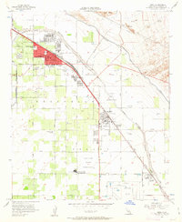
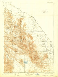
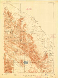
USGS Historical Quadrangle in GeoPDF.
The U.S. Geological Survey collected groundwater samples from 38 wells used for domestic and small system drinking water supply in the Coachella Valley of California in 2020. The wells were sampled for the Coachella Valley Basin (CODA) Domestic Aquifer Study Unit of the California State Water Resources Control Board Groundwater Ambient Monitoring and Assessment (GAMA) Program Priority Basin Project’s assessment of the quality of groundwater resources used for domestic and small system drinking water supplies. Coachella Valley is located in the Desert hydrogeologic province (Johnson and Belitz, 2003) and is structurally divided into four subbasins by the San Andreas fault: the Indio subbasin, the Mission Creek subbasin,...
Categories: Data;
Tags: California,
Coachella Valley,
GAMA,
Groundwater Ambient Monitoring and Assessment Program,
Hydrology,
Data provided here describe the contribution of up to 7 different water sources to the major ion geochemistry of U.S. Geological Survey (USGS) and California State Water Resources Control Board Division of Drinking Water (CA-DDW) groundwater samples within the Indio Subbasin of the Coachella Valley, California. The Inverse Geochemical Modeling was performed in the USGS's PHREEQC ver. 3 program and the results are discussed in the associated publication of Harkness and others (2023). Datasets include the major ion chemistry and model input parameters of 1593 samples included in the analysis, the median model results for each sample, and a data dictionary describing the tables. Analyses completed as part of this assessment...
This data set contains imagery from the National Agriculture Imagery Program (NAIP). The NAIP program is administered by USDA FSA and has been established to support two main FSA strategic goals centered on agricultural production. These are, increase stewardship of America's natural resources while enhancing the environment, and to ensure commodities are procured and distributed effectively and efficiently to increase food security. The NAIP program supports these goals by acquiring and providing ortho imagery that has been collected during the agricultural growing season in the U.S. The NAIP ortho imagery is tailored to meet FSA requirements and is a fundamental tool used to support FSA farm and conservation programs....
The U.S. Geological Survey collected groundwater samples from 17 wells in the Indio subbasin (CA basin designation 7-21.01) of the Coachella Valley and surface water samples from two sites representing sources of recharge to the Indio subbasin in 2021. These samples are intended to provide inorganic water quality data, particularly total dissolved solids (TDS), within areas of the Indio subbasin not sampled for the Groundwater Ambient Monitoring and Assessment (GAMA) Program Priority Basin Project’s assessment of the quality of groundwater used for domestic and small system drinking water supplies in Coachella Valley (CODA). Other areas of special interest for the Indio salinity study were nearby managed aquifer...
Categories: Data;
Types: Downloadable,
Map Service,
OGC WFS Layer,
OGC WMS Layer,
Shapefile;
Tags: California,
Coachella Valley,
Geochemistry,
Groundwater,
Groundwater age,
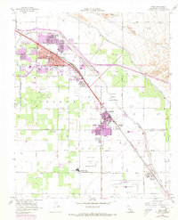
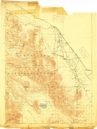
USGS Historical Quadrangle in GeoPDF.
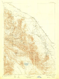
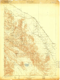
USGS Historical Quadrangle in GeoPDF.
This data set contains imagery from the National Agriculture Imagery Program (NAIP). The NAIP program is administered by USDA FSA and has been established to support two main FSA strategic goals centered on agricultural production. These are increase stewardship of America's natural resources while enhancing the environment, and to ensure commodities are procured and distributed effectively and efficiently to increase food security. The NAIP program supports these goals by acquiring and providing ortho imagery that has been collected during the agricultural growing season in the U.S. The NAIP ortho imagery is tailored to meet FSA requirements and is a fundamental tool used to support FSA farm and conservation programs....
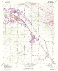
USGS Historical Quadrangle in GeoPDF.
USGS Historical Quadrangle in GeoPDF.
The U.S. Geological Survey collected groundwater samples from 38 wells used for domestic and small system drinking water supply in the Coachella Valley of California in 2020. The wells were sampled for the Coachella Valley Basin (CODA) Domestic Aquifer Study Unit of the California State Water Resources Control Board Groundwater Ambient Monitoring and Assessment (GAMA) Program Priority Basin Project’s assessment of the quality of groundwater resources used for domestic and small system drinking water supplies. Coachella Valley is located in the Desert hydrogeologic province (Johnson and Belitz, 2003) and is structurally divided into four subbasins by the San Andreas fault: the Indio subbasin, the Mission Creek subbasin,...
This data set contains imagery from the National Agriculture Imagery Program (NAIP). The NAIP program is administered by USDA FSA and has been established to support two main FSA strategic goals centered on agricultural production. These are, increase stewardship of America's natural resources while enhancing the environment, and to ensure commodities are procured and distributed effectively and efficiently to increase food security. The NAIP program supports these goals by acquiring and providing ortho imagery that has been collected during the agricultural growing season in the U.S. The NAIP ortho imagery is tailored to meet FSA requirements and is a fundamental tool used to support FSA farm and conservation programs....
USGS Historical Quadrangle in GeoPDF.
USGS Historical Quadrangle in GeoPDF.
USGS Historical Quadrangle in GeoPDF.

USGS Historical Quadrangle in GeoPDF.
The U.S. Geological Survey collected groundwater samples from 38 wells used for domestic and small system drinking water supply in the Coachella Valley of California in 2020. The wells were sampled for the Coachella Valley Basin (CODA) Domestic Aquifer Study Unit of the California State Water Resources Control Board Groundwater Ambient Monitoring and Assessment (GAMA) Program Priority Basin Project’s assessment of the quality of groundwater resources used for domestic and small system drinking water supplies. Coachella Valley is located in the Desert hydrogeologic province (Johnson and Belitz, 2003) and is structurally divided into four subbasins by the San Andreas fault: the Indio subbasin, the Mission Creek subbasin,...
Categories: Data;
Types: Downloadable,
Map Service,
OGC WFS Layer,
OGC WMS Layer,
Shapefile;
Tags: California,
Coachella Valley,
GAMA,
Groundwater Ambient Monitoring and Assessment Program,
Hydrology,
USGS Historical Quadrangle in GeoPDF.
Groundwater salinity presents a challenge to the management of water quality in the Indio subbasin of the Coachella Valley where a growing population is dependent primarily on groundwater for drinking water. The U.S. Geological survey, along with the Colorado River Basin regional water quality control board, are working to provide an assessment of salinity trends and sources in the Indio subbasin (California (CA) basin designation 7-21.01; California Department of Water Resources (2020)). As part of this work, salinity data and other selected inorganic water quality data, along with well construction information, for wells with available total dissolved solids (TDS) or conductance data were compiled from published...
|

|
