Filters: Tags: Inland Waters (X) > Categories: Data Release - Revised (X)
2 results (13ms)|
Filters
Date Range
Contacts
Tag Types Tag Schemes |
These data are high-resolution bathymetry (riverbed elevation) in ASCII format, generated from hydrographic surveys near six highway bridge structures over the Gasconade River in central Missouri. These sites were surveyed in June 2017 to help identify possible effects from extreme flooding on May 1-2, 2017. At the five downstream sites, hydrographic data were collected using a high-resolution multibeam echosounder mapping system (MBMS), which consists of a multibeam echosounder (MBES) and an inertial navigation system (INS) mounted on a marine survey vessel. Data were collected as the vessel traversed the river along planned survey lines distributed throughout the reach. Data collection software integrated and...
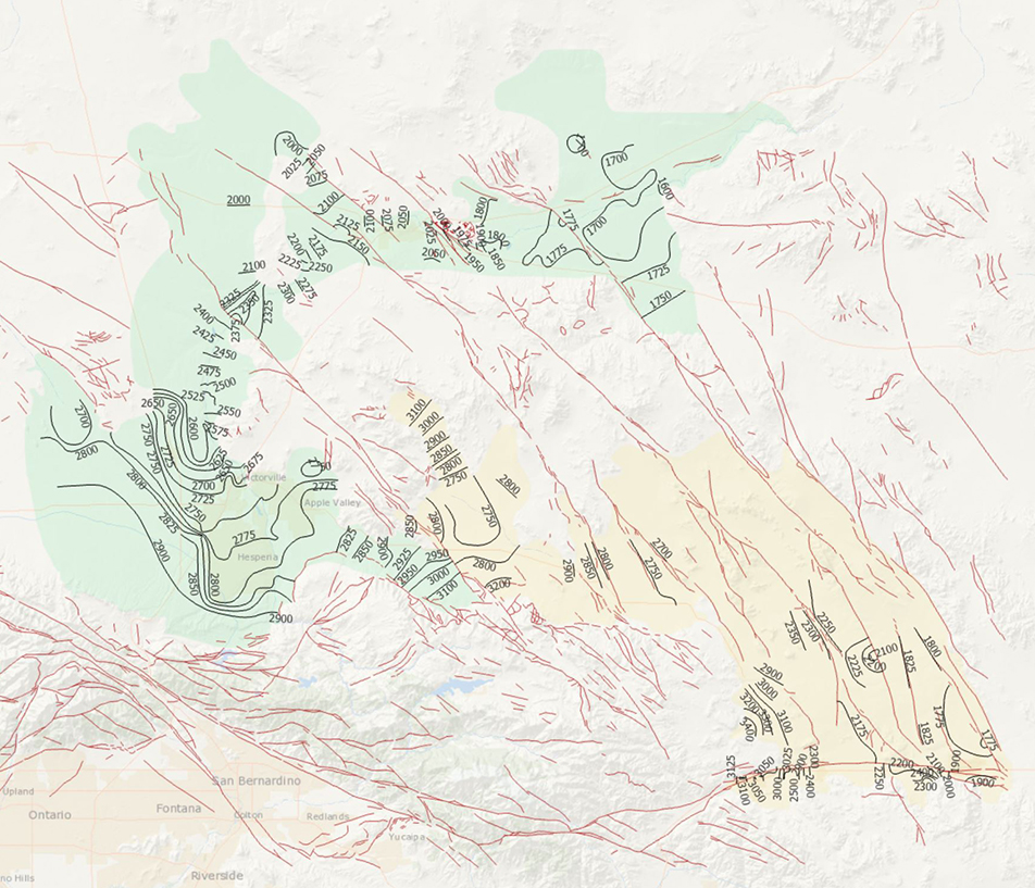
During 2014, the U.S. Geological Survey and other agencies made approximately 1,026 water-level measurements in the Mojave River and Morongo groundwater basins. These data document recent conditions and, when compared with previous data, changes in groundwater levels. A water-level contour map was drawn using data from about 610 wells, providing coverage for most of the basins. Twenty-four hydrographs show long-term (1930-2014) water-level conditions throughout the basins, and 9 short-term (1992 to 2014) hydrographs show the effects of recharge and discharge along the Mojave River. In addition, a water-level-change map was compiled to compare was compiled to compare the 2014 water levels to the 2012 water levels...
Categories: Data Release - Revised;
Tags: USGS,
USGS Science Data Catalog (SDC),
contours,
drainage basin,
ground water,
|

|
