Filters
Date Range
Types
Contacts
Tag Types
Tag Schemes
|
This data set contains imagery from the National Agriculture Imagery Program (NAIP). The NAIP program is administered by USDA FSA and has been established to support two main FSA strategic goals centered on agricultural production. These are, increase stewardship of America's natural resources while enhancing the environment, and to ensure commodities are procured and distributed effectively and efficiently to increase food security. The NAIP program supports these goals by acquiring and providing ortho imagery that has been collected during the agricultural growing season in the U.S. The NAIP ortho imagery is tailored to meet FSA requirements and is a fundamental tool used to support FSA farm and conservation programs....
Types: Citation;
Tags: 3.75 x 3.75 minute,
30057,
4411101,
Aerial Compliance,
Compliance, All tags...
Digital Ortho rectified Image,
Downloadable Data,
IRON CREEK,
IRON CREEK, NE,
JPEG2000,
MADISON CO MT FSA,
MT,
MT057,
Madison,
NAIP,
Ortho Rectification,
Orthoimagery,
Quarter Quadrangle,
USDA National Agriculture Imagery Program (NAIP),
farming, Fewer tags

This publication, GPR 2017-1, provides geophysical data produced from an airborne geophysical survey conducted in 2001 and released in 2002 for 276 sq miles of the Liberty Bell area, western Bonnifield mining district, central Alaska. Aeromagnetic and electromagnetic data were acquired during the survey. During 2016, the same digital data were reformatted for ease of use with modern processing tools; vector shapefiles and the analytic signal and calculated first vertical derivative grids were added. Other than the creation of calculated grids, no new processing was done. Data provided in GPR 2017-1 include processed (1) linedata ASCII databases, (2) gridded files of magnetic and resistivity data, (3) vector files...
Tags: Aeromagnetic,
Aeromagnetic Data,
Aeromagnetic Map,
Aeromagnetic Survey,
Airborne Geophysical Survey, All tags...
Alaska, State of,
Apparent Resistivity Data,
Apparent Resistivity Map,
Apparent Resistivity Survey,
Bonanza Creek,
Bonnifield Mining District,
Buzzard Creek,
California Creek,
Chicken Creek,
Coal Creek,
Cody Creek,
DIGHEM-V EM System,
Daniels Creek,
Digital Elevation Model,
Eagle Creek,
Electromagnetic Anomalies,
Electromagnetic Data,
Electromagnetic Survey,
Elsie Creek,
Emma Creek,
Eva Creek,
Fairbanks Quadrangle,
First Vertical Derivative,
Fourth of July Creek,
Geophysical Map,
Geophysical Survey,
Geophysics,
Geophysics Search Tag,
Homestake Creek,
Iron Creek,
Liberty Bell Mine,
Little Moose Creek,
Lynx Creek,
Magnetics,
Marguerite Creek,
McAdam Creek,
Resistivity,
Resistivity Survey,
Rex Creek,
Rex Dome,
Saint Charles Creek,
Spruce Creek,
Steep Creek,
Wilson Creek,
Winter Creek,
geoscientificInformation, Fewer tags
This data set contains imagery from the National Agriculture Imagery Program (NAIP). The NAIP program is administered by USDA FSA and has been established to support two main FSA strategic goals centered on agricultural production. These are, increase stewardship of America's natural resources while enhancing the environment, and to ensure commodities are procured and distributed effectively and efficiently to increase food security. The NAIP program supports these goals by acquiring and providing ortho imagery that has been collected during the agricultural growing season in the U.S. The NAIP ortho imagery is tailored to meet FSA requirements and is a fundamental tool used to support FSA farm and conservation programs....
Types: Citation;
Tags: 3.75 x 3.75 minute,
30057,
4411101,
Aerial Compliance,
Compliance, All tags...
Digital Ortho rectified Image,
Downloadable Data,
IRON CREEK,
IRON CREEK, NW,
JPEG2000,
MADISON CO MT FSA,
MT,
MT057,
Madison,
NAIP,
Ortho Rectification,
Orthoimagery,
Quarter Quadrangle,
USDA National Agriculture Imagery Program (NAIP),
farming, Fewer tags

Aerial photographs of the coastline from Nome to Elim were collected on August 23, 2015. The photographs were processed using Structure-from-Motion (SfM) photogrammetric techniques. Global Positioning System (GPS) checkpoints were collected via a Global Navigation Satellite System (GNSS) survey conducted between August 15 and September 14, 2015. For the purposes of open access to elevation and orthoimagery datasets in coastal regions of Alaska, this collection is being released as a Raw Data File with an open end-user license. This file is a single-band, 32-bit float DSM (digital surface model) which represents surface elevations of buildings, vegetation, and uncovered ground surfaces in meters with 20 cm GSD. The...
Tags: Bear Creek,
Bonanza River,
Cape Darby,
Cape Nome,
Coastal, All tags...
Coastal Erosion,
Coastal and River,
Daniels Creek,
Dry Creek,
Elim,
Engineering,
Engineering Geology,
Environmental,
Fish River,
Flambeau River,
Geologic,
Geologic Hazards,
Geological Process,
Geomorphology,
Golovin,
Hazards,
Hillshade Image,
Iron Creek,
Kachauik River,
Kwiniuk River,
Methods,
Moses Point Fishing Village,
Mudyutok River,
Nome,
Nome River,
Orthoimagery,
Port Safety,
Portage Creek,
Raster Image,
Rock Creek,
Snake River,
Solomon,
Solomon River,
Surface,
Surficial,
Surficial Geology,
White Mountain,
Yuonglik River,
geoscientificInformation, Fewer tags
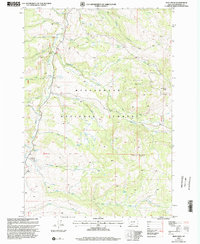
USGS Historical Quadrangle in GeoPDF.
Tags: 7.5 x 7.5 minute,
Downloadable Data,
GeoPDF,
GeoTIFF,
Historical Topographic Maps, All tags...
Historical Topographic Maps 7.5 x 7.5 Minute Map Series,
Iron Creek,
MT,
Map,
imageryBaseMapsEarthCover, Fewer tags

The Alaska Division of Geological & Geophysical Surveys (DGGS), in partnership with the U.S. National Cooperative Geologic Mapping Program, mapped approximately 450 mi2 of the Talkeetna Mountains region of central Alaska at 1:50,000 scale over the course of six weeks in 2014. This area contains significant exposures of Late Triassic mafic volcanics and gabbro sills that have been the focus of region-wide exploration for the Strategic and Critical platinum-group elements (PGEs). The area also exposes numerous inactive and possibly active faults which project through the area of proposed hydropower development. The resulting geologic map offers an improved understanding of the geology, structural history, and mineral...
Tags: 40Ar/39Ar,
Aerial Geology,
Aerial Photography,
Alluvial,
Alluvial Deposits, All tags...
Amphibolite Facies Units,
Bedrock Geologic Map,
Bedrock Geology,
Brachiopods,
Cleary Creek,
Colluvial Deposits,
Cordilleran Ice Sheet,
Crinoids,
Esker,
Faulting,
Faults,
Floodplain,
Fluvial,
Fossils,
Geochronology,
Geologic Map,
Geologic Materials,
Geomorphology,
Glacial,
Glacial Deposits,
Glacial Drift,
Glacial Geology,
Glacial Geomorphology,
Glacial History,
Glacial Lake,
Glacial Processes,
Glacial Stratigraphy,
Glaciation,
Ice Contact Deposits,
Ice-Contact,
Iron Creek,
Lacustrine,
Lacustrine Sedimentation,
Landslide,
Landslide Deposit,
Outwash,
Outwash Fan,
Paleochannel,
Permafrost and Periglacial,
Remote Sensing,
Rock Glaciers,
Rock-Glacier Deposits,
Rockfall,
STATEMAP Project,
Sand and Gravel,
Slides,
Slope Instability,
Soil Creep,
Stephan Lake,
Surficial,
Surficial Geologic Map,
Surficial Geology,
Talkeetna Mountains,
Talkeetna Mountains Quadrangle,
Talkeetna River,
Till,
geoscientificInformation, Fewer tags
This data set contains imagery from the National Agriculture Imagery Program (NAIP). The NAIP program is administered by USDA FSA and has been established to support two main FSA strategic goals centered on agricultural production. These are, increase stewardship of America's natural resources while enhancing the environment, and to ensure commodities are procured and distributed effectively and efficiently to increase food security. The NAIP program supports these goals by acquiring and providing ortho imagery that has been collected during the agricultural growing season in the U.S. The NAIP ortho imagery is tailored to meet FSA requirements and is a fundamental tool used to support FSA farm and conservation programs....
Types: Citation;
Tags: 3.75 x 3.75 minute,
4410857,
56029,
Aerial Compliance,
Compliance, All tags...
Digital Ortho rectified Image,
Downloadable Data,
IRON CREEK,
IRON CREEK, NE,
JPEG2000,
NAIP,
Ortho Rectification,
Orthoimagery,
PARK CO WY FSA,
Park,
Quarter Quadrangle,
USDA National Agriculture Imagery Program (NAIP),
WY,
WY029,
farming, Fewer tags
This data set contains imagery from the National Agriculture Imagery Program (NAIP). The NAIP program is administered by USDA FSA and has been established to support two main FSA strategic goals centered on agricultural production. These are, increase stewardship of America's natural resources while enhancing the environment, and to ensure commodities are procured and distributed effectively and efficiently to increase food security. The NAIP program supports these goals by acquiring and providing ortho imagery that has been collected during the agricultural growing season in the U.S. The NAIP ortho imagery is tailored to meet FSA requirements and is a fundamental tool used to support FSA farm and conservation programs....
Types: Citation;
Tags: 3.75 x 3.75 minute,
4410857,
56029,
Aerial Compliance,
Compliance, All tags...
Digital Ortho rectified Image,
Downloadable Data,
IRON CREEK,
IRON CREEK, NW,
JPEG2000,
NAIP,
Ortho Rectification,
Orthoimagery,
PARK CO WY FSA,
Park,
Quarter Quadrangle,
USDA National Agriculture Imagery Program (NAIP),
WY,
WY029,
farming, Fewer tags
This data set contains imagery from the National Agriculture Imagery Program (NAIP). The NAIP program is administered by USDA FSA and has been established to support two main FSA strategic goals centered on agricultural production. These are, increase stewardship of America's natural resources while enhancing the environment, and to ensure commodities are procured and distributed effectively and efficiently to increase food security. The NAIP program supports these goals by acquiring and providing ortho imagery that has been collected during the agricultural growing season in the U.S. The NAIP ortho imagery is tailored to meet FSA requirements and is a fundamental tool used to support FSA farm and conservation programs....
Types: Citation;
Tags: 3.75 x 3.75 minute,
30057,
4411101,
Aerial Compliance,
Compliance, All tags...
Digital Ortho rectified Image,
Downloadable Data,
IRON CREEK,
IRON CREEK, SE,
JPEG2000,
MADISON CO MT FSA,
MT,
MT057,
Madison,
NAIP,
Ortho Rectification,
Orthoimagery,
Quarter Quadrangle,
USDA National Agriculture Imagery Program (NAIP),
farming, Fewer tags
This data set contains imagery from the National Agriculture Imagery Program (NAIP). The NAIP program is administered by USDA FSA and has been established to support two main FSA strategic goals centered on agricultural production. These are, increase stewardship of America's natural resources while enhancing the environment, and to ensure commodities are procured and distributed effectively and efficiently to increase food security. The NAIP program supports these goals by acquiring and providing ortho imagery that has been collected during the agricultural growing season in the U.S. The NAIP ortho imagery is tailored to meet FSA requirements and is a fundamental tool used to support FSA farm and conservation programs....
Types: Citation;
Tags: 3.75 x 3.75 minute,
4410857,
56029,
Aerial Compliance,
Compliance, All tags...
Digital Ortho rectified Image,
Downloadable Data,
IRON CREEK,
IRON CREEK, SW,
JPEG2000,
NAIP,
Ortho Rectification,
Orthoimagery,
PARK CO WY FSA,
Park,
Quarter Quadrangle,
USDA National Agriculture Imagery Program (NAIP),
WY,
WY029,
farming, Fewer tags

Aerial photographs of the coastline from Nome to Elim were collected on August 23, 2015. The photographs were processed using Structure-from-Motion (SfM) photogrammetric techniques. Global Positioning System (GPS) checkpoints were collected via a Global Navigation Satellite System (GNSS) survey conducted between August 15 and September 14, 2015. For the purposes of open access to elevation and orthoimagery datasets in coastal regions of Alaska, this collection is being released as a Raw Data File with an open end-user license. Orthoimages contain 4-band, 8-bit, unsigned raster data (red/green/blue/no data; file format-GeoTIFF; source-Fairbanks Fodar) with 20 cm GSD. No-data values are found in band 4 or shown as...
Tags: Bear Creek,
Bonanza River,
Cape Darby,
Cape Nome,
Coastal, All tags...
Coastal Erosion,
Coastal and River,
Daniels Creek,
Dry Creek,
Elim,
Engineering,
Engineering Geology,
Environmental,
Fish River,
Flambeau River,
Geologic,
Geologic Hazards,
Geological Process,
Geomorphology,
Golovin,
Hazards,
Hillshade Image,
Iron Creek,
Kachauik River,
Kwiniuk River,
Methods,
Moses Point Fishing Village,
Mudyutok River,
Nome,
Nome River,
Orthoimagery,
Port Safety,
Portage Creek,
Raster Image,
Rock Creek,
Snake River,
Solomon,
Solomon River,
Surface,
Surficial,
Surficial Geology,
White Mountain,
Yuonglik River,
geoscientificInformation, Fewer tags
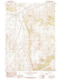
USGS Historical Quadrangle in GeoPDF.
Tags: 7.5 x 7.5 minute,
Downloadable Data,
GeoPDF,
GeoTIFF,
Historical Topographic Maps, All tags...
Historical Topographic Maps 7.5 x 7.5 Minute Map Series,
Iron Creek,
Map,
Provisional,
WY,
imageryBaseMapsEarthCover, Fewer tags
This data set contains imagery from the National Agriculture Imagery Program (NAIP). The NAIP program is administered by USDA FSA and has been established to support two main FSA strategic goals centered on agricultural production. These are, increase stewardship of America's natural resources while enhancing the environment, and to ensure commodities are procured and distributed effectively and efficiently to increase food security. The NAIP program supports these goals by acquiring and providing ortho imagery that has been collected during the agricultural growing season in the U.S. The NAIP ortho imagery is tailored to meet FSA requirements and is a fundamental tool used to support FSA farm and conservation programs....
Types: Citation;
Tags: 3.75 x 3.75 minute,
30057,
4411101,
Aerial Compliance,
Compliance, All tags...
Digital Ortho rectified Image,
Downloadable Data,
IRON CREEK,
IRON CREEK, SW,
JPEG2000,
MADISON CO MT FSA,
MT,
MT057,
Madison,
NAIP,
Ortho Rectification,
Orthoimagery,
Quarter Quadrangle,
USDA National Agriculture Imagery Program (NAIP),
farming, Fewer tags
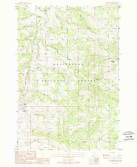
USGS Historical Quadrangle in GeoPDF.
Tags: 7.5 x 7.5 minute,
Downloadable Data,
GeoPDF,
GeoTIFF,
Historical Topographic Maps, All tags...
Historical Topographic Maps 7.5 x 7.5 Minute Map Series,
Iron Creek,
MT,
Map,
Provisional,
imageryBaseMapsEarthCover, Fewer tags
This data set contains imagery from the National Agriculture Imagery Program (NAIP). The NAIP program is administered by USDA FSA and has been established to support two main FSA strategic goals centered on agricultural production. These are, increase stewardship of America's natural resources while enhancing the environment, and to ensure commodities are procured and distributed effectively and efficiently to increase food security. The NAIP program supports these goals by acquiring and providing ortho imagery that has been collected during the agricultural growing season in the U.S. The NAIP ortho imagery is tailored to meet FSA requirements and is a fundamental tool used to support FSA farm and conservation programs....
Types: Citation;
Tags: 3.75 x 3.75 minute,
4410857,
56029,
Aerial Compliance,
Compliance, All tags...
Digital Ortho rectified Image,
Downloadable Data,
IRON CREEK,
IRON CREEK, SE,
JPEG2000,
NAIP,
Ortho Rectification,
Orthoimagery,
PARK CO WY FSA,
Park,
Quarter Quadrangle,
USDA National Agriculture Imagery Program (NAIP),
WY,
WY029,
farming, Fewer tags

The mineral-resources group from the Alaska Division of Geological & Geophysical Surveys (DGGS) carried out a geologic mapping project in the Talkeetna Mountains C-4, C-3, and B-4 quadrangles from July 23 through August 3, 2014. This project is a part of a multi-year project focusing on improving the publicly-available geological and geochemical data and assessing the mineral potential of the less-explored extension of the western Wrangellia terrane. This program of geologic mapping and rock sampling was conducted as part of the U.S. Geological Survey National Cooperative Geologic Mapping Program and the state of Alaska's Strategic Minerals Assessment project, an initiative designed to evaluate Alaska's potential...
Tags: Copper,
Geochemical Data,
Geochemical Surveys,
Gold,
Greenstone, All tags...
Iron Creek,
Major Oxides,
Mineral Assessment,
Platinum Group Elements,
Rare Earth Elements,
STATEMAP Project,
Silver,
Stephan Lake,
Strategic and Critical Minerals Assessment Project,
Talkeetna Mountains,
Talkeetna Mountains Quadrangle,
Talkeetna River,
Trace Elements,
Tsisi Creek,
geoscientificInformation, Fewer tags
|
|

