Filters: Tags: Ithaca (X)
27 results (38ms)|
Filters
Date Range
Extensions (Less) Types (Less)
Contacts (Less)
Categories (Less) Tag Types
|
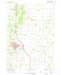
This data set contains imagery from the National Agriculture Imagery Program (NAIP). The NAIP program is administered by USDA FSA and has been established to support two main FSA strategic goals centered on agricultural production. These are increase stewardship of America's natural resources while enhancing the environment, and to ensure commodities are procured and distributed effectively and efficiently to increase food security. The NAIP program supports these goals by acquiring and providing ortho imagery that has been collected during the agricultural growing season in the U.S. The NAIP ortho imagery is tailored to meet FSA requirements and is a fundamental tool used to support FSA farm and conservation programs....
This data set contains imagery from the National Agriculture Imagery Program (NAIP). The NAIP program is administered by USDA FSA and has been established to support two main FSA strategic goals centered on agricultural production. These are increase stewardship of America's natural resources while enhancing the environment, and to ensure commodities are procured and distributed effectively and efficiently to increase food security. The NAIP program supports these goals by acquiring and providing ortho imagery that has been collected during the agricultural growing season in the U.S. The NAIP ortho imagery is tailored to meet FSA requirements and is a fundamental tool used to support FSA farm and conservation programs....
Background / Problem – The City of Ithaca, Tompkins County, N.Y., is in the process of developing a flood management plan for the streams that flow through the City. Flooding in the City is caused by a variety of distinct and sometimes interconnected reasons. Flooding often is a result of snowmelt and rain during the winter and spring. Slow ice-melt and breakup can lead to ice jams and subsequent flooding. Flash floods are produced by summer thunderstorms. All of these flood types are compounded by two factors: the storm-sewer system in the City and the elevation of Cayuga Lake. The storm sewers drain to the nearby streams at points below the tops of the streambanks. Because the streamward ends of the storm sewers...
Categories: Data,
Project;
Types: Downloadable,
Map Service,
OGC WFS Layer,
OGC WMS Layer,
Shapefile;
Tags: Cascadilla Creek,
Cayuga Inlet,
Cooperative Water Program,
Fall Creek,
Flood Science,
This dataset contains raster grids of water surface elevation for 15 modeled water-surface profiles at 5 flood frequencies (50- , 10,- 2- , 1- , and 0.2-percent annual exceedance probabilities, or 2- , 10- , 50- , 100- , and 500-year recurrence intervals) and 3 lake levels (representing average conditions, a 2-year-high condition, and a 100-year-high condition).
Categories: Data;
Types: Downloadable,
GeoTIFF,
Map Service,
Raster;
Tags: Cascadilla Creek,
Cayuga Inlet,
Cayuga Lake,
Fall Creek,
Inundation map,
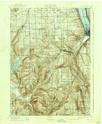
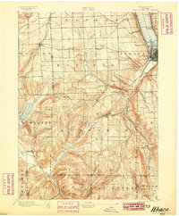
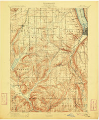
USGS Historical Quadrangle in GeoPDF.
USGS Historical Quadrangle in GeoPDF.
Digital flood-inundation maps for a 2.9-square-mile area of Ithaca, New York, were created in 2015–18 by the U.S. Geological Survey in cooperation with the City of Ithaca, New York, and the New York State Department of State. The flood-inundation maps depict estimates of the maximum areal extent and depth of flooding corresponding to selected flood frequencies for Cayuga Inlet, Sixmile Creek, Cascadilla Creek, and Fall Creek and selected water-surface elevations of Cayuga Lake. Flood profiles for the stream reaches were computed by combining a one-dimensional step-backwater model for the stream channels and a two-dimensional model for the overbank areas. The resulting hydraulic model was calibrated by using water-surface...
Categories: Data;
Types: ArcGIS REST Map Service,
ArcGIS Service Definition,
Downloadable,
Map Service;
Tags: Cascadilla Creek,
Cayuga Inlet,
Cayuga Lake,
Fall Creek,
Inundation map,
USGS Historical Quadrangle in GeoPDF.
Flood profiles for the stream reaches were computed by combining a one-dimensional step-backwater model for the stream channels and a two-dimensional model for the overbank areas. The resulting hydraulic model was calibrated by using water-surface profiles from five observed storm events. The model was then used to compute 15 water-surface profiles for 5 flood frequencies (50- , 10- , 2- , 1- , and 0.2-percent annual exceedance probabilities, or 2- , 10- , 50- , 100- , and 500-year recurrence intervals) and 3 lake levels (representing average conditions, a 2-year-high condition, and a 100-year-high condition). The geographic information system flood-extent polygons, depth grids, and water surface elevation grids...
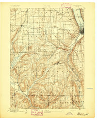
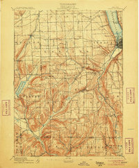
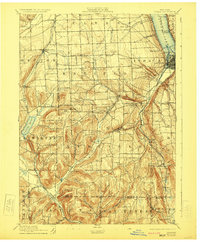
USGS Historical Quadrangle in GeoPDF.
USGS Historical Quadrangle in GeoPDF.
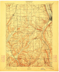
USGS Historical Quadrangle in GeoPDF.
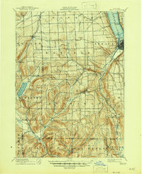
USGS Historical Quadrangle in GeoPDF.
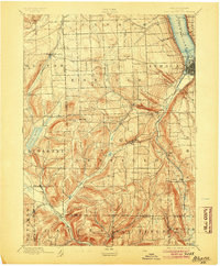
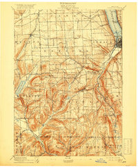
USGS Historical Quadrangle in GeoPDF.
USGS Historical Quadrangle in GeoPDF.
This dataset contains raster grids of inundation depth for 15 modeled water-surface profiles at 5 flood frequencies (50- , 10- , 2- , 1- , and 0.2-percent annual exceedance probabilities, or 2- , 10- , 50- , 100- , and 500-year recurrence intervals) and 3 lake levels (representing average conditions, a 2-year-high condition, and a 100-year-high condition).
Categories: Data;
Types: Downloadable,
GeoTIFF,
Map Service,
Raster;
Tags: Cascadilla Creek,
Cayuga Inlet,
Cayuga Lake,
Fall Creek,
Inundation map,

USGS Historical Quadrangle in GeoPDF.
USGS Historical Quadrangle in GeoPDF.
USGS Historical Quadrangle in GeoPDF.
This data set contains imagery from the National Agriculture Imagery Program (NAIP). The NAIP program is administered by USDA FSA and has been established to support two main FSA strategic goals centered on agricultural production. These are increase stewardship of America's natural resources while enhancing the environment, and to ensure commodities are procured and distributed effectively and efficiently to increase food security. The NAIP program supports these goals by acquiring and providing ortho imagery that has been collected during the agricultural growing season in the U.S. The NAIP ortho imagery is tailored to meet FSA requirements and is a fundamental tool used to support FSA farm and conservation programs....
|

|
