Filters: Tags: KIRKWOOD (X)
50 results (63ms)|
Filters
Date Range
Extensions Types
Contacts
Categories Tag Types
|
The U.S. Geological Survey (USGS) is providing a polygon feature class showing the extent of the study area, the Binghamton East 1:24,000 quadrangle, located within south-central Broome County, New York, 2014-2021. The shapefile was created and intended for use with geographic information system (GIS) software. A companion report, USGS Scientific Investigations Report 2021-5026 (Van Hoesen and others, 2021; https://doi.org/10.3133/sir20215026) further describes data collection and map preparation.
Categories: Data;
Types: Downloadable,
Map Service,
OGC WFS Layer,
OGC WMS Layer,
Shapefile;
Tags: Aquifer Mapping,
Basin & Hydrogeologic Characterization,
Broome County,
Conklin,
Kirkwood,
This data set contains imagery from the National Agriculture Imagery Program (NAIP). The NAIP program is administered by USDA FSA and has been established to support two main FSA strategic goals centered on agricultural production. These are, increase stewardship of America's natural resources while enhancing the environment, and to ensure commodities are procured and distributed effectively and efficiently to increase food security. The NAIP program supports these goals by acquiring and providing ortho imagery that has been collected during the agricultural growing season in the U.S. The NAIP ortho imagery is tailored to meet FSA requirements and is a fundamental tool used to support FSA farm and conservation programs....
This data set contains imagery from the National Agriculture Imagery Program (NAIP). The NAIP program is administered by USDA FSA and has been established to support two main FSA strategic goals centered on agricultural production. These are increase stewardship of America's natural resources while enhancing the environment, and to ensure commodities are procured and distributed effectively and efficiently to increase food security. The NAIP program supports these goals by acquiring and providing ortho imagery that has been collected during the agricultural growing season in the U.S. The NAIP ortho imagery is tailored to meet FSA requirements and is a fundamental tool used to support FSA farm and conservation programs....
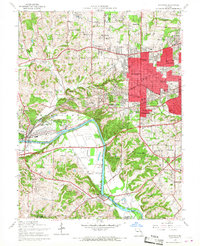
USGS Historical Quadrangle in GeoPDF.
The U.S. Geological Survey (USGS) is providing the approximate location of the valley aquifer boundary within the Binghamton East quadrangle of south-central Broome County, New York, 2014-2021. The shapefile was created and intended for use with geographic information system (GIS) software. A companion report, USGS Scientific Investigations Report 2021-5026 (Van Hoesen and others, 2021; https://doi.org/10.3133/sir20215026) further describes data collection and map preparation.
Categories: Data;
Types: Downloadable,
Map Service,
OGC WFS Layer,
OGC WMS Layer,
Shapefile;
Tags: Aquifer Mapping,
Basin & Hydrogeologic Characterization,
Broome County,
Conklin,
Kirkwood,
The U.S. Geological Survey (USGS) is providing a polygon feature class delineating and describing the subsurface facies within the Binghamton East 1:24,000 quadrangle of south-central Broome County, New York, 2014-2021. The shapefile was created and intended for use with geographic information system (GIS) software. A companion report, USGS Scientific Investigations Report 2021-5026 (Van Hoesen and others, 2021; https://doi.org/10.3133/sir20215026) further describes data collection and map preparation.
Categories: Data;
Types: Downloadable,
Map Service,
OGC WFS Layer,
OGC WMS Layer,
Shapefile;
Tags: Aquifer Mapping,
Basin & Hydrogeologic Characterization,
Broome County,
Conklin,
Kirkwood,
This data set contains imagery from the National Agriculture Imagery Program (NAIP). The NAIP program is administered by USDA FSA and has been established to support two main FSA strategic goals centered on agricultural production. These are, increase stewardship of America's natural resources while enhancing the environment, and to ensure commodities are procured and distributed effectively and efficiently to increase food security. The NAIP program supports these goals by acquiring and providing ortho imagery that has been collected during the agricultural growing season in the U.S. The NAIP ortho imagery is tailored to meet FSA requirements and is a fundamental tool used to support FSA farm and conservation programs....
This data set contains imagery from the National Agriculture Imagery Program (NAIP). The NAIP program is administered by USDA FSA and has been established to support two main FSA strategic goals centered on agricultural production. These are, increase stewardship of America's natural resources while enhancing the environment, and to ensure commodities are procured and distributed effectively and efficiently to increase food security. The NAIP program supports these goals by acquiring and providing ortho imagery that has been collected during the agricultural growing season in the U.S. The NAIP ortho imagery is tailored to meet FSA requirements and is a fundamental tool used to support FSA farm and conservation programs....
The U.S. Geological Survey (USGS) is providing a line feature class delineating the approximate locations of glacial ice-margins within the Binghamton East 1:24,000 quadrangle of south-central Broome County, New York, 2020. The shapefile was created and intended for use with geographic information system (GIS) software. A companion report, USGS Scientific Investigations Report 2021-5026 (Van Hoesen and others, 2021; https://doi.org/10.3133/sir20215026) further describes data collection and map preparation.
Categories: Data;
Types: Downloadable,
Map Service,
OGC WFS Layer,
OGC WMS Layer,
Shapefile;
Tags: Aquifer Mapping,
Basin & Hydrogeologic Characterization,
Broome County,
Conklin,
Kirkwood,
The U.S. Geological Survey (USGS) is providing a line feature class containing the hydrogeologic transects (A-G) referred to in this study, within the Binghamton East 1:24,000 quadrangle of south-central Broome County, New York, 2020. The shapefile was created and intended for use with geographic information system (GIS) software. A companion report, USGS Scientific Investigations Report 2021-5026 (Van Hoesen and others, 2021; https://doi.org/10.3133/sir20215026) further describes data collection and map preparation.
Categories: Data;
Types: Downloadable,
Map Service,
OGC WFS Layer,
OGC WMS Layer,
Shapefile;
Tags: Aquifer Mapping,
Basin & Hydrogeologic Characterization,
Broome County,
Conklin,
Kirkwood,
The U.S. Geological Survey (USGS), in cooperation with the New York State Department of Environmental Conservation (NYSDEC), collected and compiled well records to characterize the valley-fill aquifers of south-central Broome County beginning in 2014. The study area is defined by the limits of the Binghamton East quadrangle, which encompasses 55.5 square-miles (mi^2), and includes a 9-mile (mi) stretch of the Susquehanna River between Binghamton and Riverside, New York.
Categories: Data;
Tags: Aquifer Mapping,
Basin & Hydrogeologic Characterization,
Broome County,
Conklin,
Geography,
This data set contains imagery from the National Agriculture Imagery Program (NAIP). The NAIP program is administered by USDA FSA and has been established to support two main FSA strategic goals centered on agricultural production. These are, increase stewardship of America's natural resources while enhancing the environment, and to ensure commodities are procured and distributed effectively and efficiently to increase food security. The NAIP program supports these goals by acquiring and providing ortho imagery that has been collected during the agricultural growing season in the U.S. The NAIP ortho imagery is tailored to meet FSA requirements and is a fundamental tool used to support FSA farm and conservation programs....
This data set contains imagery from the National Agriculture Imagery Program (NAIP). The NAIP program is administered by USDA FSA and has been established to support two main FSA strategic goals centered on agricultural production. These are, increase stewardship of America's natural resources while enhancing the environment, and to ensure commodities are procured and distributed effectively and efficiently to increase food security. The NAIP program supports these goals by acquiring and providing ortho imagery that has been collected during the agricultural growing season in the U.S. The NAIP ortho imagery is tailored to meet FSA requirements and is a fundamental tool used to support FSA farm and conservation programs....
The U.S. Geological Survey (USGS) is providing a point feature class containing a compilation of geologic well records (n=221) obtained from: 1) previous U.S. Geological Survey groundwater investigations, 2) the U.S. Geological Survey's National Water Information System (NWIS), 3) the New York State Department of Environmental Conservation (NYSDEC) Water Well Contractor Program, and 4) the New York State Department of Transportation (NYSDOT). The wells are located within the Binghamton East 1:24,000 quadrangle of south-central Broome County, New York, 2014-2020. The shapefile was created and intended for use with geographic information system (GIS) software. A companion report, USGS Scientific Investigations Report...
Categories: Data;
Types: Downloadable,
Map Service,
OGC WFS Layer,
OGC WMS Layer,
Shapefile;
Tags: Aquifer Mapping,
Basin & Hydrogeologic Characterization,
Broome County,
Conklin,
Kirkwood,
The U.S. Geological Survey (USGS) is providing a polygon feature class containing the delineated areas of postglacial and glacial deposits within the Binghamton East quadrangle of south-central Broome County, New York, 2014-2021. Surficial units included are alluvium, alluvial fans, outwash, glacial lake clay, ice-contact deposit, and variable thicknesses of till. The shapefile was created and intended for use with geographic information system (GIS) software. A companion report, USGS Scientific Investigations Report 2021-5026 (Van Hoesen and others, 2021; https://doi.org/10.3133/sir20215026) further describes data collection and map preparation.
Categories: Data;
Types: Downloadable,
Map Service,
OGC WFS Layer,
OGC WMS Layer,
Shapefile;
Tags: Aquifer Mapping,
Basin & Hydrogeologic Characterization,
Broome County,
Conklin,
Kirkwood,
The U.S. Geological Survey (USGS) is providing a compilation of geologic well records (n=221) collected from 2014-2020 within the Binghamton East 1:24,000 quadrangle in south-central Broome County, New York. The well records were obtained from: 1) previous U.S. Geological Survey groundwater investigations, 2) the U.S. Geological Survey’s National Water Information System (NWIS), 3) the New York State Department of Environmental Conservation (NYSDEC) Water Well Contractor Program, and 4) the New York State Department of Transportation (NYSDOT). The dataset is in comma-separated values (CSV) format. A companion report, USGS Scientific Investigations Report 2021-5026 (Van Hoesen and others, 2021; https://doi.org/10.3133/sir20215026)...
Categories: Data;
Tags: Aquifer Mapping,
Basin & Hydrogeologic Characterization,
Broome County,
Conklin,
Kirkwood,
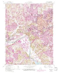
USGS Historical Quadrangle in GeoPDF.
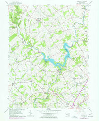
USGS Historical Quadrangle in GeoPDF.
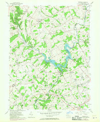
USGS Historical Quadrangle in GeoPDF.
This data set contains imagery from the National Agriculture Imagery Program (NAIP). The NAIP program is administered by USDA FSA and has been established to support two main FSA strategic goals centered on agricultural production. These are, increase stewardship of America's natural resources while enhancing the environment, and to ensure commodities are procured and distributed effectively and efficiently to increase food security. The NAIP program supports these goals by acquiring and providing ortho imagery that has been collected during the agricultural growing season in the U.S. The NAIP ortho imagery is tailored to meet FSA requirements and is a fundamental tool used to support FSA farm and conservation programs....
|

|
