Filters: Tags: Kahoolawe (X)
12 results (14ms)|
Filters
Date Range
Extensions
Types
Contacts
Categories Tag Types Tag Schemes |
This dataset provides information on the current status and various other habitat and descriptive attributes of the native coastal vegetation for seven of the main Hawaiian Islands (i.e., does not include Ni`ihau).
Categories: Data;
Types: ArcGIS REST Map Service,
ArcGIS Service Definition,
Citation,
Downloadable,
Map Service;
Tags: Ecology,
Hawaii,
Kahoolawe,
Kauai,
Lanai,
Here we present surface current results from a physics-based, 3-dimensional coupled ocean-atmosphere numerical model that was generated to understand coral larval dispersal patterns in Maui Nui, Hawaii, USA. The model was used to simulate coral larval dispersal patterns from a number of existing State-managed reefs and large tracks of reefs with high coral coverage that might be good candidates for marine-protected areas (MPAs) during 8 spawning events during 2010-2013. The goal of this effort is to provide geophysical data to help provide guidance to sustain coral health in Maui Nui, Hawaii, USA. Each model output run is available as a netCDF file with self-contained attribute information. Each file name is appended...
Categories: Data;
Types: Citation,
Map Service,
NetCDF OPeNDAP Service,
OGC WFS Layer,
OGC WMS Layer,
OGC WMS Service;
Tags: CMGP,
Coastal and Marine Geology Program,
Geophysics,
Hawaii,
Kahoolawe,
This data release provides flooding extent polygons (flood masks) and depth values (flood points) based on wave-driven total water levels for 22 locations within the States of Hawaii and Florida, the Territories of Guam, American Samoa, Puerto Rico, and the U.S. Virgin Islands, and the Commonwealth of the Northern Mariana Islands. For each of the 22 locations there are eight associated flood mask polygons and flood depth point files: one for each four nearshore wave energy return periods (rp; 10-, 50-, 100-, and 500-years) and both with (wrf) and without (worf) the presence of coral reefs. These flood masks can be combined with economic, ecological, and engineering tools to provide a rigorous financial valuation...
This digital publication contains all the geologic map information used to publish U.S. Geological Survey Geologic Investigations Map Series SIM-3143 (Sherrod and others, 2021). This geologic map shows the distribution and stratigraphic relation of volcanic, intrusive, and sedimentary units emplaced in the past 8 million years across the eight principal islands of the Hawaiian archipelago, State of Hawaii, U.S.A. This geologic map database is accompanied by a report, which includes the formatted geologic map and explanatory pamphlet, available at https://doi.org/10.3133/sim3143. The authors ask that users of the geologic map database cite both the report and the database: Report: Sherrod, D.R., Sinton, J.M.,...
Categories: Data;
Types: ArcGIS Map Package,
ArcGIS REST Map Service,
ArcGIS Service Definition,
Downloadable,
Map Service;
Tags: Hana,
Hawaii,
Honolulu,
Kahoolawe,
Kauai County,
This layer depicts the status, or degree of disturbance, to plant communities on the main Hawaiian Islands. Several layers were uset to create this version (v 3.4). The original HabQual layer was developed by Jon Price and Jim Jacobi based on the mapped land cover units from the Hawaii GAP analysis program (Gon et al. 2006). This map was revised by combining data on land use and the “Bare” category from the NOAA C-CAP 2005 map (NOAA National Ocean Service Coastal Services Center 2012), and adding road corridors to the heavily disturbed category based on the Tiger Roads layer (United States Census Bureau 2014). Additionally, corrections were made to this version of the map by visually inspecting previously mapped...
Categories: Data;
Types: Citation,
Downloadable,
GeoTIFF,
Map Service,
Raster;
Tags: Hawaii Island,
Hawaiian Islands,
Kahoolawe,
Kauai,
Lanai,

USGS Historical Quadrangle in GeoPDF.
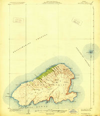
USGS Historical Quadrangle in GeoPDF.
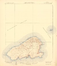
USGS Historical Quadrangle in GeoPDF.

USGS Historical Quadrangle in GeoPDF.
While there have been many maps produced that depict vegetation for the state of Hawai‘i only a few of these display land cover for all of the main Hawaiian Islands, and most of those that were created before the year 2000 have very generalized units or are somewhat inaccurate as a result of more recent land use changes or due to poor resolution (both spatial and spectral) in the imagery that was used to produce the map. Some of the more detailed and accurate maps include the Hawai‘i GAP Analysis (HI-GAP) Land Cover map (Gon et al. 2006), the NOAA C-CAP Land Cover map (NOAA National Ocean Service Coastal Services Center 2012), and the more recently released Hawai‘i LANDFIRE EVT Land Cover map (U.S. Geological Survey...
Categories: Data;
Types: Citation,
Downloadable,
GeoTIFF,
Map Service,
Raster;
Tags: Hawaii Island,
Hawaiian Islands,
Kahoolawe,
Kauai,
Lanai,

This part of the data release presents projected flooding extent polygon (flood masks) and flooding depth points (flood points) shapefiles based on wave-driven total water levels for the State of Hawaii (the islands of Hawaii, Kahoolawe, Kauai, Lanai, Maui, Molokai, Niihau, and Oahu). For each island there are 8 associated flood mask and flood depth shapefiles: one for each of four nearshore wave energy return periods (rp; 10-, 50-, 100-, and 500-years) and both with (wrf) and without (worf) the presence of coral reefs. Flooding depth point data are also presented as a comma-separated value (.csv) text file.
Categories: Data;
Types: Downloadable,
Map Service,
OGC WFS Layer,
OGC WMS Layer,
Shapefile;
Tags: CMHRP,
Coastal and Marine Hazards and Resources Program,
Coral Reef,
Habitat,
Hawaiian Islands,
These two raster data layers depict the land cover and degree of human disturbance to plant communities on the seven main Hawaiian Islands, and were developed as part of a comprehensive USGS assessment of carbon sequestration potential by natural ecosystems in the State of Hawaii.
|

|
