Filters: Tags: Kauai (X)
114 results (30ms)|
Filters
Date Range
Extensions Types Contacts
Categories Tag Types
|

Geospatial data is comprised of government boundaries.
Geospatial data is comprised of government boundaries.
Types: Citation;
Tags: Boundaries,
County or Equivalent,
Downloadable Data,
Esri File GeoDatabase 10,
FileGDB,
The National Hydrography Dataset (NHD) is a feature-based database that interconnects and uniquely identifies the stream segments or reaches that make up the nation's surface water drainage system. NHD data was originally developed at 1:100,000-scale and exists at that scale for the whole country. This high-resolution NHD, generally developed at 1:24,000/1:12,000 scale, adds detail to the original 1:100,000-scale NHD. (Data for Alaska, Puerto Rico and the Virgin Islands was developed at high-resolution, not 1:100,000 scale.) Local resolution NHD is being developed where partners and data exist. The NHD contains reach codes for networked features, flow direction, names, and centerline representations for areal water...
This data release provides flooding extent polygons (flood masks) and depth values (flood points) based on wave-driven total water levels for 22 locations within the States of Hawaii and Florida, the Territories of Guam, American Samoa, Puerto Rico, and the U.S. Virgin Islands, and the Commonwealth of the Northern Mariana Islands. For each of the 22 locations there are eight associated flood mask polygons and flood depth point files: one for each four nearshore wave energy return periods (rp; 10-, 50-, 100-, and 500-years) and both with (wrf) and without (worf) the presence of coral reefs. These flood masks can be combined with economic, ecological, and engineering tools to provide a rigorous financial valuation...
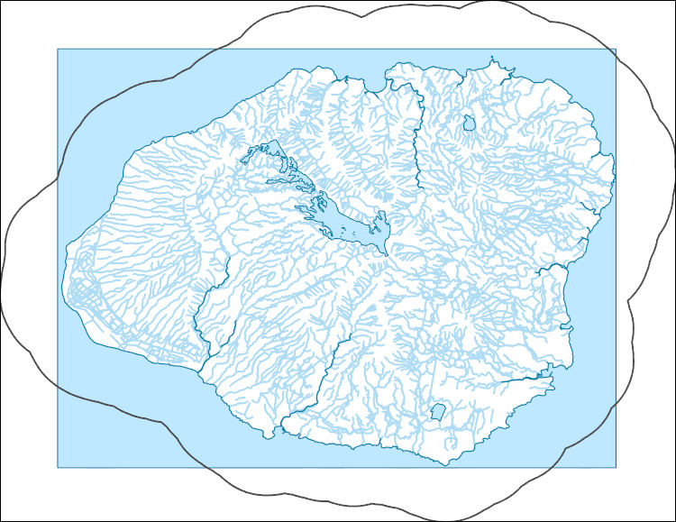
The National Hydrography Dataset (NHD) is a feature-based database that interconnects and uniquely identifies the stream segments or reaches that make up the nation's surface water drainage system. NHD data was originally developed at 1:100,000-scale and exists at that scale for the whole country. This high-resolution NHD, generally developed at 1:24,000/1:12,000 scale, adds detail to the original 1:100,000-scale NHD. (Data for Alaska, Puerto Rico and the Virgin Islands was developed at high-resolution, not 1:100,000 scale.) Local resolution NHD is being developed where partners and data exist. The NHD contains reach codes for networked features, flow direction, names, and centerline representations for areal water...
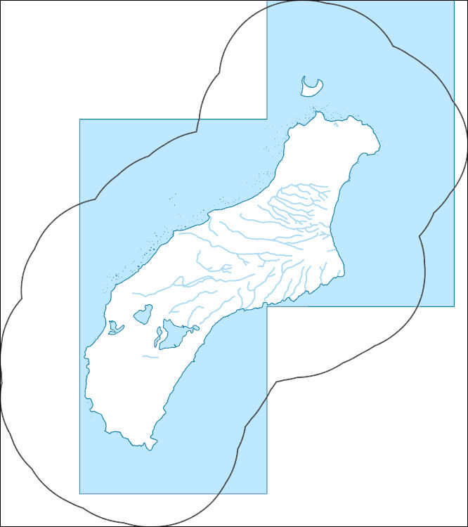
The National Hydrography Dataset (NHD) is a feature-based database that interconnects and uniquely identifies the stream segments or reaches that make up the nation's surface water drainage system. NHD data was originally developed at 1:100,000-scale and exists at that scale for the whole country. This high-resolution NHD, generally developed at 1:24,000/1:12,000 scale, adds detail to the original 1:100,000-scale NHD. (Data for Alaska, Puerto Rico and the Virgin Islands was developed at high-resolution, not 1:100,000 scale.) Local resolution NHD is being developed where partners and data exist. The NHD contains reach codes for networked features, flow direction, names, and centerline representations for areal water...
This shapefile represents the spatial distribution of mean annual water-budget components, in inches, for the Island of Kauai, Hawaii. The water-budget components in the shapefile were computed by a water-budget model for a scenario representative of recent conditions (1978–2007 rainfall and 2010 land cover), as described in USGS Scientific Investigations Report (SIR) 2015-5164. The model was developed for estimating groundwater recharge and other water-budget components for each subarea of the model. The model-subarea data set, consisting of 400,714 subareas (polygons), was generated using Esri ArcGIS software by intersecting (merging) multiple spatial data sets. Spatial datasets merged include those that characterize...

USGS Historical Quadrangle in GeoPDF.
Along-shore surface-based 2D electrical resistivity tomography (ERT) surveys were collected in the nearshore region of Makua, Kauai.

The National Hydrography Dataset (NHD) is a feature-based database that interconnects and uniquely identifies the stream segments or reaches that make up the nation's surface water drainage system. NHD data was originally developed at 1:100,000-scale and exists at that scale for the whole country. This high-resolution NHD, generally developed at 1:24,000/1:12,000 scale, adds detail to the original 1:100,000-scale NHD. (Data for Alaska, Puerto Rico and the Virgin Islands was developed at high-resolution, not 1:100,000 scale.) Local resolution NHD is being developed where partners and data exist. The NHD contains reach codes for networked features, flow direction, names, and centerline representations for areal water...
Hawai‘i’s endangered waterbirds have experienced epizootics caused by ingestion of prey that accumulated a botulinum neurotoxin produced by the anaerobic bacterium Clostridium botulinum (avian botulism; Type C). Waterbird carcasses, necrophagous flies, and their larvae initiate and spread avian botulism, a food-borne paralytic disease lethal to waterbirds. Each new carcass has potential to develop toxin-accumulating necrophagous vectors amplifying outbreaks and killing hundreds of endangered birds. Early carcass removal is an effective mitigation strategy for preventing avian intoxication, toxin concentration in necrophagous and secondary food webs, and reducing the magnitude of epizootics. However, rapid detection...
Mosquito-borne avian malaria is a key limiting factor on Hawaiian forest bird populations. Preservation of endemic forest birds and restoration of Hawaiian forest bird communities will rely on mosquito control. While landscape level control is being developed, managers need short term and reliable tools for monitoring and controlling mosquito populations to protect remaining breeding bird populations. As part of a larger study looking at the efficacy of the biopesticide VectoMax FG for control of larval Culex quinquefasciatus, USGS and DOFAW personnel monitored adult mosquitoes (Culex quinquefasciatus and Aedes japonicus) along the Kawaikoi Stream during late summer, September through November 2016 and 2017. Ten...
Categories: Data;
Tags: Alakai Wilderness Preserve,
Culex quinquefaciatus,
Hawaiian honeycreepers,
Kauai,
Kawaikoi Stream,
We used a stratified-random sampling approach to estimate the total abundance of Wedge-tailed Shearwater (Ardenna pacifica) nest sites across Kīlauea Point National Wildlife Refuge (KPNWR), Kauaʻi, during 1-7 July 2019. We first identified strata as unique geographic areas of the refuge to account for potential differences in nesting habitat and non-uniform nest site clustering. We then sub-divided strata where we expected high, low, minimal, or no nest site abundance. These distinctions were based on knowledge of shearwater nesting distribution gained while performing extensive ground-searching for tropicbirds across the entire refuge in April and May 2019. We delineated strata boundaries using recent satellite...
Categories: Data;
Types: Downloadable,
Map Service,
OGC WFS Layer,
OGC WMS Layer,
Shapefile;
Tags: Kauai,
USGS-EMA-LOW-SB SMC: Seabirds,
animal and plant census,
biota,
plot sampling
During 13-18 May, 2019, we censused red-footed boobies (Sula sula) at Kīlauea Point National Wildlife Refuge (KPNWR), Kauaʻi. To evaluate ground-based visual counts and assess variability among methods, we employed photographic techniques to count nesting red-footed boobies at KPNWR in three distinct sub-colony areas: Crater Hill East, Crater Hill Interior, and Crater Hill West (see associated data series report for delineation of sub-colony areas). For ground-based photos, we used a Sony a7rii camera (42 megapixel full-frame) equipped with a Sony 100-400mm F4.5-5.6G lens to allow sufficient resolution to count nests and birds. We achieved pixel resolutions (as a function of camera resolution, focal length, and...
Categories: Data;
Tags: Kauai,
USGS-EMA-LOW-SB SMC: Seabirds,
aerial photography,
animal and plant census,
biota
This layer depicts the status, or degree of disturbance, to plant communities on the main Hawaiian Islands. Several layers were uset to create this version (v 3.4). The original HabQual layer was developed by Jon Price and Jim Jacobi based on the mapped land cover units from the Hawaii GAP analysis program (Gon et al. 2006). This map was revised by combining data on land use and the “Bare” category from the NOAA C-CAP 2005 map (NOAA National Ocean Service Coastal Services Center 2012), and adding road corridors to the heavily disturbed category based on the Tiger Roads layer (United States Census Bureau 2014). Additionally, corrections were made to this version of the map by visually inspecting previously mapped...
Categories: Data;
Types: Citation,
Downloadable,
GeoTIFF,
Map Service,
Raster;
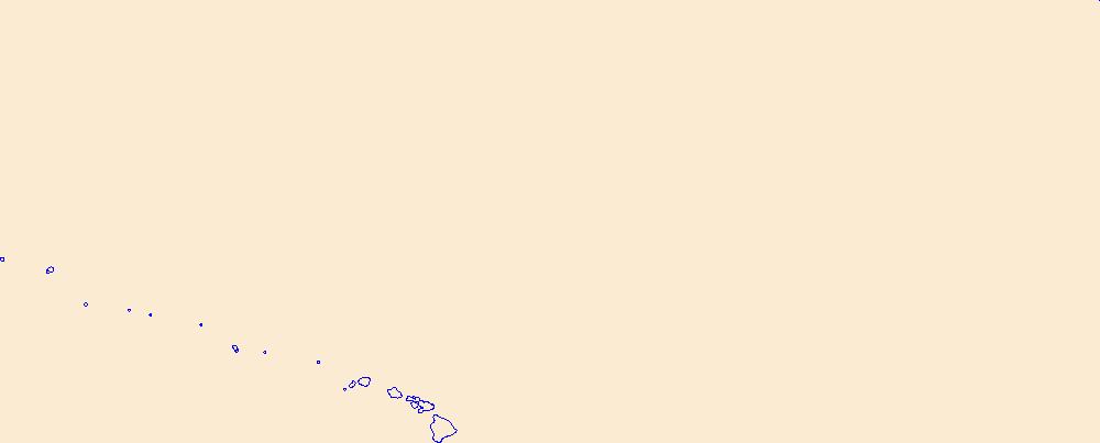
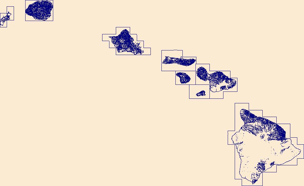
Tags: Hawaii Island,
Hawaiian Islands,
Kahoolawe,
Kauai,
Lanai,
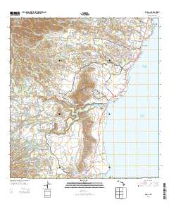
Layered GeoPDF 7.5 Minute Quadrangle Map. Layers of geospatial data include orthoimagery, roads, grids, geographic names, elevation contours, hydrography, and other selected map features.
The U.S. Geological Survey, Western Ecological Research Center (USGS-WERC), with support from the Bureau of Ocean Energy Management (BOEM), is working with many partners to generate an Atlas of Breeding Seabirds of the Main Hawaiian Islands. This atlas will provide benchmarks to measure future changes in seabird population sizes and breeding distribution throughout Hawai‘i and will also assist efforts to evaluate threats to Hawaiian seabirds both on land and at sea. Ultimately, species- and colony-specific data for main Hawaiian Island seabirds on land and at sea will inform evaluations of potential risk and options for mitigation strategies for effects of offshore energy infrastructure on seabirds. This ScienceBase...
-- Methods -- The Weather Research and Forecast model (WRF) is applied to construct triply-nested meshes. The outermost domain (20-km horizontal resolution) is large enough to cover almost the whole tropical and subtropical areas from the central Pacific to the western Pacific. The intermediate domain has 4-km horizontal resolution, and the innermost domain of each individual island has a horizontal resolution of 0.8 km. The driving fields for the atmosphere are the NASA Modern-Era Retrospective Analysis for Research and Applications reanalysis, and the sea surface temperature (SST) is from NOAA. Variables in the driving fields include temperature, wind, geopotential height, water vapor, etc. For the future runs,...
Layers of geospatial data include roads, airports, trails, and railroads.

The National Hydrography Dataset (NHD) is a feature-based database that interconnects and uniquely identifies the stream segments or reaches that make up the nation's surface water drainage system. NHD data was originally developed at 1:100,000-scale and exists at that scale for the whole country. This high-resolution NHD, generally developed at 1:24,000/1:12,000 scale, adds detail to the original 1:100,000-scale NHD. (Data for Alaska, Puerto Rico and the Virgin Islands was developed at high-resolution, not 1:100,000 scale.) Local resolution NHD is being developed where partners and data exist. The NHD contains reach codes for networked features, flow direction, names, and centerline representations for areal water...
|

|
