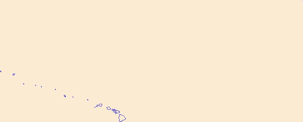
Filters: Tags: Kauai (X)
114 results (31ms)|
Filters
Date Range
Extensions Types Contacts
Categories Tag Types
|
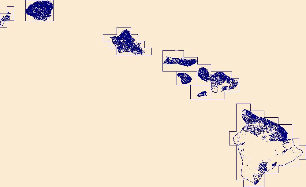
In cooperation with the State of Hawaii Department of Transportation, the U.S. Geological Survey (USGS) has computed a series of basin characteristic rasters for Hawaii to be implemented into the USGS StreamStats application (https://streamstats.usgs.gov/ss/). The basin characteristics, along with geospatial datasets for watershed delineation published as a separate USGS data release (https://doi.org/10.5066/P9N61WJ7), were used to delineate watersheds and determine basin characteristics in StreamStats for Hawaii.
Types: Map Service,
OGC WFS Layer,
OGC WMS Layer,
OGC WMS Service;
Tags: Geography,
Hawaii,
Hawaii Island,
Hydrology,
Kauai,
The U.S. Geological Survey (USGS), in cooperation with the State of Hawaii Department of Transportation, has compiled and processed a series of geospatial datasets for Hawaii to be implemented into the USGS StreamStats application (https://streamstats.usgs.gov/ss/). These geospatial datasets, along with basin characteristic datasets published as a separate USGS data release (https://doi.org/10.5066/P9TOQANM), are used to delineate watersheds and determine basin characteristics in StreamStats.
Types: Map Service,
OGC WFS Layer,
OGC WMS Layer,
OGC WMS Service;
Tags: Geography,
Hawaii,
Hawaii Island,
Hydrology,
Kauai,
During 8-11 April, 13-18 May, and 1-7 July 2019, we censused Red-tailed Tropicbird (Phaethon rubricauda) and White-tailed Tropicbird (P. lepturus) nests in Kīlauea Point National Wildlife Refuge (KPNWR), Kauaʻi, by searching all foot-accessible areas and by searching all cliffs and islets with spotting scopes from remote vantage points. We censused over the course of three visits to account for prolonged and asynchronous nesting. For ground searching, we used previous nest census results, recommendations from the previous Refuge biologist, and knowledge of tropicbird nesting habitat, to focus searches in areas where nesting was likely: along cliff edges and steep slopes, particularly at the base of ironwood trees...
The National Hydrography Dataset (NHD) is a feature-based database that interconnects and uniquely identifies the stream segments or reaches that make up the nation's surface water drainage system. NHD data was originally developed at 1:100,000-scale and exists at that scale for the whole country. This high-resolution NHD, generally developed at 1:24,000/1:12,000 scale, adds detail to the original 1:100,000-scale NHD. (Data for Alaska, Puerto Rico and the Virgin Islands was developed at high-resolution, not 1:100,000 scale.) Local resolution NHD is being developed where partners and data exist. The NHD contains reach codes for networked features, flow direction, names, and centerline representations for areal water...
Layers of geospatial data include roads, airports, trails, and railroads.
Previously constructed steady-state numerical groundwater-flow models for the islands of Kauai, Oahu, and Maui, Hawaii (https://doi.org/10.3133/sir20205126) using MODFLOW-2005 with the Seawater Intrusion (SWI2) package, were used to examine the consequences of historical and plausible future withdrawals and changes in recharge. The volcanic aquifers of the Hawaiian Islands supply water to 1.46 million residents, diverse industries, and a large component of the U.S. military in the Pacific. Groundwater also supplies freshwater that supports ecosystems in streams and near the coast. Hawaii’s aquifers are remarkable given their small size, but the islands’ capacity to store fresh groundwater is limited because each...
Types: Map Service,
OGC WFS Layer,
OGC WMS Layer,
OGC WMS Service;
Tags: Groundwater Model,
Hawaiian Islands,
Hydrology,
Kauai,
MODFLOW-2005,
The U.S. Geological Survey (USGS), in cooperation with the State of Hawaiʻi Department of Transportation, estimated flood magnitudes for the 50-, 20-, 10-, 4-, 2-, 1-, 0.5-, and 0.2-percent annual exceedance probabilities (AEP) for unregulated streamgages in Kauaʻi, Oʻahu, Molokaʻi, Maui, and Hawaiʻi, State of Hawaiʻi, using data through water year 2020. Regression equations which can be used to estimate flood magnitude and associated frequency at ungaged streams were developed.The methods and results of the study are published in a separate report (https://doi.org/10.3133/sir20235014). This data release includes two geographic information system (GIS) shapefiles, one of polygons representing the extents of the...

The National Hydrography Dataset (NHD) is a feature-based database that interconnects and uniquely identifies the stream segments or reaches that make up the nation's surface water drainage system. NHD data was originally developed at 1:100,000-scale and exists at that scale for the whole country. This high-resolution NHD, generally developed at 1:24,000/1:12,000 scale, adds detail to the original 1:100,000-scale NHD. (Data for Alaska, Puerto Rico and the Virgin Islands was developed at high-resolution, not 1:100,000 scale.) Local resolution NHD is being developed where partners and data exist. The NHD contains reach codes for networked features, flow direction, names, and centerline representations for areal water...
While there have been many maps produced that depict vegetation for the state of Hawai‘i only a few of these display land cover for all of the main Hawaiian Islands, and most of those that were created before the year 2000 have very generalized units or are somewhat inaccurate as a result of more recent land use changes or due to poor resolution (both spatial and spectral) in the imagery that was used to produce the map. Some of the more detailed and accurate maps include the Hawai‘i GAP Analysis (HI-GAP) Land Cover map (Gon et al. 2006), the NOAA C-CAP Land Cover map (NOAA National Ocean Service Coastal Services Center 2012), and the more recently released Hawai‘i LANDFIRE EVT Land Cover map (U.S. Geological Survey...
Categories: Data;
Types: Citation,
Downloadable,
GeoTIFF,
Map Service,
Raster;
Tags: Hawaii Island,
Hawaiian Islands,
Kahoolawe,
Kauai,
Lanai,
The spreadsheets associated with this metadata file represent: (Tab 1) Streamflow and drainage basin characteristics of selected gaged steams in Hawaii used to develop statistical models to estimate surface-water availability during low flow conditions and for varying rainfall conditions. For gaged streams on Maui, two sets of projected rainfall conditions for the late 21st century and associated estimates of changes in low flows and usable habitat for native stream fauna are also provided. (Tab 2) Drainage basin characteristics of ungaged streams on Maui used to apply the statistical models, two sets of projected rainfall conditions for the late 21st century, and associated estimates of changes in low flows and...
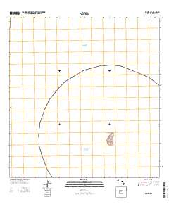
Layered GeoPDF 7.5 Minute Quadrangle Map. Layers of geospatial data include orthoimagery, roads, grids, geographic names, elevation contours, hydrography, and other selected map features.
Genetic diversity levels, effective population size estimates, and population structure of the endangered Hawaiian hoary bat (Lasiurus semotus, also known as Aeorestes semotus) were examined across the islands of Hawai‘i, Maui, O‘ahu, and Kaua‘i using eighteen nuclear microsatellite loci and one mitochondrial gene from 339 individuals collected between 1988 and 2020. The study extracted DNA for population genetic analyses from tissue samples, collected from live bats captured as part of ongoing field studies or under rehabilitation care, from bat carcasses collected by local federal and state wildlife agencies and wind energy facilities, and from dried skin specimens at the Bernice Pauahi Bishop Museum. A region...
Hawai‘i’s endangered waterbirds have experienced epizootics caused by ingestion of prey that accumulated a botulinum neurotoxin produced by the anaerobic bacterium Clostridium botulinum (avian botulism; Type C). Waterbird carcasses, necrophagous flies, and their larvae initiate and spread avian botulism, a food-borne paralytic disease lethal to waterbirds. Each new carcass has potential to develop toxin-accumulating necrophagous vectors amplifying outbreaks and killing hundreds of endangered birds. Early carcass removal is an effective mitigation strategy for preventing avian intoxication, toxin concentration in necrophagous and secondary food webs, and reducing the magnitude of epizootics. However, rapid detection...
Acoustic sampling for occurrence of the endangered Hawaiian hoary bat (Lasiurus cinereus semotus) was conducted at 18 “long-term” acoustic monitoring stations on 12 Hawaii Army National Guard (HIARNG) installations across the islands of Hawaii, Maui, Molokai, Oahu, and Kauai between 2012 and 2018. Bats were confirmed as present at 10 of these installations: Kealakekua Armory, Keaukaha Military Reservation (KMR), Hanapepe Armory, Kekaha Firing Range (KFR), Puunene Training Facility, Ukumehame Firing Range (UFR), Kaunakakai Armory, Bellows Regional Training Institute, Kalaeloa, Barber’s Point, and the 487th Military Parking Facility, Wahiawā. Our acoustic sampling did not record bat vocalizations at Fort Ruger and...
As part of a larger study looking at the ecology and potential control of larval Culex quinquefasciatus, USGS and Hawaii DOFAW personnel monitored larval mosquitoes (Culex quinquefasciatus) and the non-target species Microvelia vagans and Megalagrion larvae in perched stream pools, seeps and ground pools along the Kawaikoi Stream during late summer, September through November 2016 and 2017. Pools were sampled before and following treatment with the biopesticide VectoMax FG at 1, 2, 7, 14, and 21 days post treatment to determine the efficacy of control and potential non-target effects. Only pools with mosquito larvae were treated although paired, untreated pools were also sampled to serve as controls for the non-target...
Categories: Data;
Tags: Alakai Wilderness Preserve,
Hawaiian honeycreepers,
Kauai,
Kauai,
Kawaikoi Stream,
As part of a larger study looking at the efficacy of the biopesticide VectoMax FG for control of larval Culex quinquefasciatus, USGS and DOFAW personnel monitored adult mosquitoes (Culex quinquefasciatus and Aedes japonicus) along the Kawaikoi Stream during late summer, September through November 2016 and 2017. Ten trap sites were selected across a 1-kilometer grid centered on the intersection of the Alakai Swamp Trail and Kawaikoi Stream, Alakai Wilderness Preserve, Kauai. Traps were located at least 200 meters apart at accessible sites along the stream, valley floor, and adjacent plateau. Both Biogents Sentinel Traps (BGS) and Centers for Disease Control and Prevention (CDC) Gravid Traps (GRV) were operated nightly...
Categories: Data;
Tags: Alakai Wilderness Preserve,
Hawaiian honeycreepers,
Kauai,
Kawaikoi Stream,
USGS-EMA-LOW Fish and Wildlife Disease,
Geospatial data includes structures and other selected map features.
Geospatial data is comprised of government boundaries.
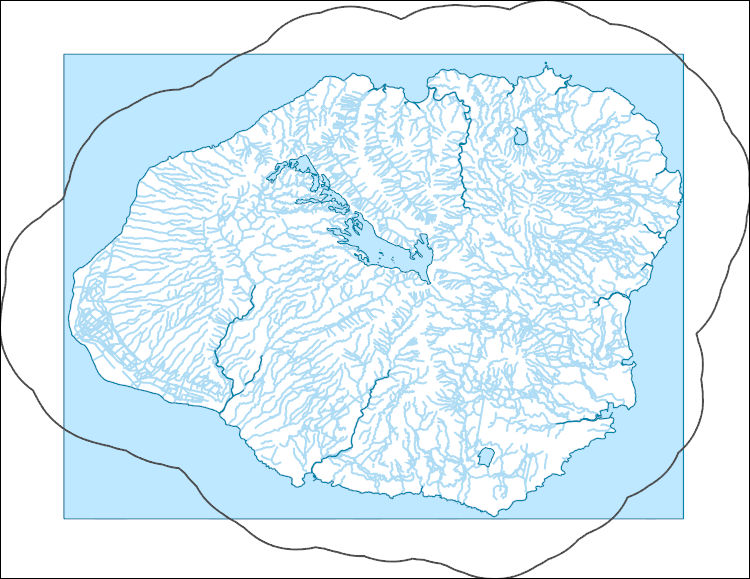
The National Hydrography Dataset (NHD) is a feature-based database that interconnects and uniquely identifies the stream segments or reaches that make up the nation's surface water drainage system. NHD data was originally developed at 1:100,000-scale and exists at that scale for the whole country. This high-resolution NHD, generally developed at 1:24,000/1:12,000 scale, adds detail to the original 1:100,000-scale NHD. (Data for Alaska, Puerto Rico and the Virgin Islands was developed at high-resolution, not 1:100,000 scale.) Local resolution NHD is being developed where partners and data exist. The NHD contains reach codes for networked features, flow direction, names, and centerline representations for areal water...

The National Hydrography Dataset (NHD) is a feature-based database that interconnects and uniquely identifies the stream segments or reaches that make up the nation's surface water drainage system. NHD data was originally developed at 1:100,000-scale and exists at that scale for the whole country. This high-resolution NHD, generally developed at 1:24,000/1:12,000 scale, adds detail to the original 1:100,000-scale NHD. (Data for Alaska, Puerto Rico and the Virgin Islands was developed at high-resolution, not 1:100,000 scale.) Local resolution NHD is being developed where partners and data exist. The NHD contains reach codes for networked features, flow direction, names, and centerline representations for areal water...
|

|
