Filters: Tags: Kemmerer (X)
16 results (90ms)|
Filters
Date Range
Extensions Types Contacts
Categories Tag Types Tag Schemes |
This data set contains imagery from the National Agriculture Imagery Program (NAIP). The NAIP program is administered by USDA FSA and has been established to support two main FSA strategic goals centered on agricultural production. These are, increase stewardship of America's natural resources while enhancing the environment, and to ensure commodities are procured and distributed effectively and efficiently to increase food security. The NAIP program supports these goals by acquiring and providing ortho imagery that has been collected during the agricultural growing season in the U.S. The NAIP ortho imagery is tailored to meet FSA requirements and is a fundamental tool used to support FSA farm and conservation programs....
This data set contains imagery from the National Agriculture Imagery Program (NAIP). The NAIP program is administered by USDA FSA and has been established to support two main FSA strategic goals centered on agricultural production. These are, increase stewardship of America's natural resources while enhancing the environment, and to ensure commodities are procured and distributed effectively and efficiently to increase food security. The NAIP program supports these goals by acquiring and providing ortho imagery that has been collected during the agricultural growing season in the U.S. The NAIP ortho imagery is tailored to meet FSA requirements and is a fundamental tool used to support FSA farm and conservation programs....
Grazing allotments administered by the Kemmerer Field Office.
This data contains fences within the southwest portion of Wyoming at a 1:100,000 scale. A two and one-half year inventory of fences on federal lands was conducted by the Bureau of Land Management (BLM) from 1990 to 1992. The attribute fields describe the type of fences, the 30 x 60- minute quadrangle map which they are found, the ownership of the land, the year the fence was built, and their location according to township, range and section.
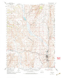
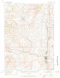
USGS Historical Quadrangle in GeoPDF.
USGS Historical Quadrangle in GeoPDF.
Mule deer in the northern Wyoming Range population use winter ranges in the area between Big Piney and LaBarge. During spring, these deer generally move northwesterly to high-elevation summer ranges in the Salt River and Wyoming Ranges. Interchange with deer in the Sublette herd unit has been documented, with some individuals migrating northwest into Upper Green River drainages. At least one individual migrated 85 mi (137 km) north and summered north of the town of Jackson. Challenges for Wyoming Range mule deer include energy development on winter ranges, vehicle collisions on U.S. Highway 189 between LaBarge and Big Piney, severe winters leading to high episodic mortality, and disease. These data provide the location...
Categories: Data;
Types: Downloadable,
Map Service,
OGC WFS Layer,
OGC WMS Layer,
Shapefile;
Tags: Kemmerer,
United States,
Wyoming,
animal behavior,
migration (organisms),
Mule deer in the southern Wyoming Range population winter north of Evanston in the relatively low mountains between Kemmerer, Wyoming, and Woodruff Narrows Reservoir along the Utah border. Many deer in this population migrate north more than 100 mi (161 km) to summer ranges in the Wyoming Range surrounding Afton, Wyoming. Migrations in this population are not limited to Wyoming, with at least one deer summering in the Caribou Range in Idaho. Challenges for this population include highway and train mortality, especially along U.S. Highway 30. A number of highway underpasses were constructed between 2001 and 2008 along U.S. Highway 30 at Nugget Canyon, which has significantly reduced vehicle-caused mortality. These...
Categories: Data;
Types: Downloadable,
Map Service,
OGC WFS Layer,
OGC WMS Layer,
Shapefile;
Tags: Kemmerer,
United States,
Wyoming,
animal behavior,
migration (organisms),
This data set contains imagery from the National Agriculture Imagery Program (NAIP). The NAIP program is administered by USDA FSA and has been established to support two main FSA strategic goals centered on agricultural production. These are, increase stewardship of America's natural resources while enhancing the environment, and to ensure commodities are procured and distributed effectively and efficiently to increase food security. The NAIP program supports these goals by acquiring and providing ortho imagery that has been collected during the agricultural growing season in the U.S. The NAIP ortho imagery is tailored to meet FSA requirements and is a fundamental tool used to support FSA farm and conservation programs....
These benthic macroinvertebrate data and associated site characteristics were compiled for the purpose of exploring any relationships between large dams in the Colorado River Basin, their flow management and geographical context, and their associated downstream benthic macroinvertebrate communities. The goal of the analyses based upon these data was to understand how dam conditions, specifically hydropower fluctuations for hydropower generation ("hydropeaking") might influence the structure of benthic macroinvertebrate communities, and how this community structure may change with distance downstream from each dam. These benthic macroinvertebrate samples were collected in spring 2015 by scientists from the U.S. Geological...
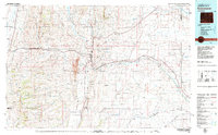
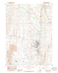
USGS Historical Quadrangle in GeoPDF.
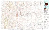
USGS Historical Quadrangle in GeoPDF.
USGS Historical Quadrangle in GeoPDF.
This data set contains imagery from the National Agriculture Imagery Program (NAIP). The NAIP program is administered by USDA FSA and has been established to support two main FSA strategic goals centered on agricultural production. These are, increase stewardship of America's natural resources while enhancing the environment, and to ensure commodities are procured and distributed effectively and efficiently to increase food security. The NAIP program supports these goals by acquiring and providing ortho imagery that has been collected during the agricultural growing season in the U.S. The NAIP ortho imagery is tailored to meet FSA requirements and is a fundamental tool used to support FSA farm and conservation programs....
This database for the National Historic Trails is comprised of digital topographic data and reference line established using point data gathered with Global Positioning System (GPS) technology which represents only an approximation of the centerline of the trails system. This database, which is to be used in conjunction with ArcView/ArcMap software, is provided to assist the user in analyzing the visibility of any proposed location(with proposed 12' structures) within 5 miles of the GPS reference line of the trails in order to evaluate effects to the landscape and setting of National Historic Trails in accordance with the National Historic Preservation Act and its implementing regulations at 36CFR Part 800. This...
Categories: Data;
Types: Downloadable;
Tags: BLM,
Federal Government,
Kemmerer,
Kemmerer Field Office,
Planning,
The Fossil Butte (hereafter referred to as the Monument in this section of the report) elk population winters in the southern Wyoming Range between Fossil Butte National Monument and Cokeville (fig. 45). During spring, they migrate north short (11 mi [18 km]) to medium (74 mi [119 km]) distances. The segment of the elk population that winters near the Monument migrates into the Wyoming Range at the head of the Hams Fork and LaBarge Creek. This population departs their summer ranges during the beginning of archery season in early fall for the Monument, where no hunting is allowed. Elk wintering closer to Cokeville migrate north in the spring along the western edge of the Wyoming Range. Cokeville collared elk departed...
Categories: Data;
Types: Downloadable,
Map Service,
OGC WFS Layer,
OGC WMS Layer,
Shapefile;
Tags: Kemmerer,
United States,
Wyoming,
animal behavior,
migration (organisms),
|

|
