Filters: Tags: LAC DU FLAMBEAU (X)
16 results (135ms)|
Filters
Date Range
Types Contacts
Categories Tag Types Tag Schemes |

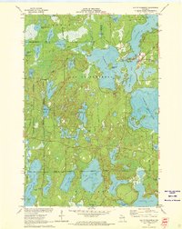
USGS Historical Quadrangle in GeoPDF.
This data set contains imagery from the National Agriculture Imagery Program (NAIP). The NAIP program is administered by USDA FSA and has been established to support two main FSA strategic goals centered on agricultural production. These are, increase stewardship of America's natural resources while enhancing the environment, and to ensure commodities are procured and distributed effectively and efficiently to increase food security. The NAIP program supports these goals by acquiring and providing ortho imagery that has been collected during the agricultural growing season in the U.S. The NAIP ortho imagery is tailored to meet FSA requirements and is a fundamental tool used to support FSA farm and conservation programs....
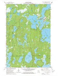

USGS Historical Quadrangle in GeoPDF.
USGS Historical Quadrangle in GeoPDF.

USGS Historical Quadrangle in GeoPDF.

USGS Historical Quadrangle in GeoPDF.
This data release consists of lakebed temperature data collected at the sediment-water interface at the north end of Haskell Lake, Lac du Flambeau Reservation, Wisconsin. Data were collected using a fiber-optic distributed temperature sensor (DTS) during a 5 day period from July 27 to August 1, 2016. Established procedures were followed to estimate lakebed temperatures from the raw DTS data and calibration baths of known temperatures. This data release includes the raw DTS (Stokes and anti-Stokes intensity) data, a shape file of the DTS cable location, photos from the field deployment, and python code for reproducing the full workflow described as part of U.S. Geological Survey Scientific Investigations Report 2020-5005....
Categories: Data Release - In Progress;
Tags: DTS,
Distributed Temperature Sensing,
Groundwater,
Haskell Lake,
Jupyter Notebook,
This data set contains imagery from the National Agriculture Imagery Program (NAIP). The NAIP program is administered by USDA FSA and has been established to support two main FSA strategic goals centered on agricultural production. These are, increase stewardship of America's natural resources while enhancing the environment, and to ensure commodities are procured and distributed effectively and efficiently to increase food security. The NAIP program supports these goals by acquiring and providing ortho imagery that has been collected during the agricultural growing season in the U.S. The NAIP ortho imagery is tailored to meet FSA requirements and is a fundamental tool used to support FSA farm and conservation programs....

USGS Historical Quadrangle in GeoPDF.
USGS Historical Quadrangle in GeoPDF.

This data release contains files for three scenarios of an analytic element (GFLOW) groundwater flow model with particle-tracking that were developed in cooperation with the Lac du Flambeau Band of Lake Superior Chippewa and Indian Health Service to map the probablistic plume extent for a proposed waste-water infiltration lagoon, along with maps to delineate the area contributing recharge to supply wells under 2010 and 2035 pumping conditions. Monte Carlo methods were used to run each scenario thousands of times using a range of parameters developed through prior work (https://doi.org/10.3133/sir20145020). Results illustrate that most of the infiltrated waste water would be expected to flow south, ultimately discharging...

USGS Historical Quadrangle in GeoPDF.
|

|
