Filters: Tags: LAND COVER (X)
989 results (191ms)|
Filters
Date Range
Extensions Types
Contacts
Categories Tag Types
|
Geospatial data that is a derivative land cover product depicting woodland on topographic maps.
Geospatial data that is a derivative land cover product depicting woodland on topographic maps.
Geospatial data that is a derivative land cover product depicting woodland on topographic maps.
The National Park Service (NPS), in conjunction with the Biological Resources Division (BRD) of the U.S. Geological Survey (USGS), has implemented a program to "develop a uniform hierarchical vegetation methodology" at a national level. The program will also create a geographic information system (GIS) database for the parks under its management. The purpose of the data is to document the state of vegetation within the NPS service area during the 1990's, thereby providing a baseline study for further analysis at the Regional or Service-wide level. The vegetation at Devils Tower National Monument was mapped using 1:16,000 scale U.S. Forest Service Color Aerial Photography acquired July 29, 1993. The mapping classification...
The vegetation spatial database coverage (vegetation map) is a product of the Effigy Mounds National Monument Vegetation Mapping Project, USGS-NPS Vegetation Mapping Program (VMP). The U.S. Geological Survey (USGS) Upper Midwest Environmental Sciences Center (UMESC) in La Crosse, Wisconsin, and the Minneapolis Office of NatureServe in Minneapolis, Minnesota, have completed mapping and classification of existing plant communities of Effigy Mounds National Monument (EFMO) and extended surroundings. Photointerpreters, ecologists, and botanists collaborated to describe National Vegetation Classification System (NVCS) plant communities (associations) and determine how best to map them using aerial photographs. --- Two...

This map layer is extracted from a grid map of North America including the Caribbean and most of Mexico. The map layer is an excerpt from a global assessment of forest fragmentation (Riitters et al., 2000). Each pixel value represents an index of forest fragmentation for the surrounding 81 sq. km. The map layer was created by applying spatial algorithms to a 1 sq. km. resolution map of global land cover (Loveland and Belward 1997) known as NAIGBP1_2L, obtained from the USGS Center for EROS Distributed Active Archive Center (DAAC) as part of the Global Land Cover Characteristics database (GLCC)(Loveland et al. 1991, 1999). One of six categories of fragmentation was identified for each forested pixel in North...
The vegetation units on this map were determined through the stereoscopic interpretation of aerial photographs supported by field sampling and ecological analysis. The vegetation boundaries were identified on the photographs by means of the photographic signature and collateral information on slope, hydrology, geography, and vegetation in accordance with the Standardized National Vegetation Classification System (October 1995). The mapped vegetation reflects conditions that existed during the specific year and season that the aerial photographs were taken. There is a margin of error inherent in the use of aerial photographs. Therefore, a detailed ground and historical analysis of a single site may result in a revision...
Geospatial data that is a derivative land cover product depicting woodland on topographic maps.

NLCD 1992, NLCD 2001, and NLCD 2006 are National Land Cover Database classification schemes based primarily on Landsat data along with ancillary data sources, such as topography, census and agricultural statistics, soil characteristics, wetlands, and other land cover maps. NLCD 1992 is a 21-class land cover classification scheme that has been applied consistently across the conterminous U.S. at a spatial resolution of 30 meters. NLCD 2001 is a 16-class land cover classification scheme that also has been applied to the conterminous U.S. at a spatial resolution of 30 meters, and includes Alaska, Hawaii, and Puerto Rico. NLCD 2006 quantifies land cover change for the conterminous U.S. between the years 2001 to 2006....
Geospatial data that is a derivative land cover product depicting woodland on topographic maps.

This dataset was created in order to facilitate transboundary conservation work and research projects, by integrating land cover maps into a single dataset from Cape Caution, BC, to Yakutat Bay, AK. It includes three levels of land classification, site index, elevation, hydric soils (yes/no), karst (yes/no), primary and secondary species, size class, and volume class. It also includes a number of other important attributes from individual datasets, which were not crosswalked between the different areas. This file represents Land Classification Level 3.
Gap Analysis Program (GAP) Landcover, restricted to original WLCI boundary (effective 2007-May 2009)
This data contains land cover (mostly vegetation types) for the entire state of Wyoming at 1:100,000 scale. Attribute fields describe primary and secondary land cover, crown closure, wetlands, disturbance and other important land cover types occuring within the polygon. Only the fields for primary land cover and percentage of each polygon occupied by that land cover are complete in the coverage, but other attribute fields are populated when information was available.
Categories: Data;
Types: Downloadable,
Map Service,
OGC WFS Layer,
OGC WMS Layer,
Shapefile;
Tags: biotic,
land cover,
natural,
plant,
urban,
This geospatial database covers vegetation land cover and land use for Wind Cave National Park and surrounding areas and is authorized as part of the USGS/NPS Vegetation Mapping Program http://www.usgs.gov/core_science_systems/csas/vip/index.html. The program is administered by the Biological Resources Division (BRD) of the United States Geological Survey (USGS). This mapping effort was performed by the US Bureau of Reclamation's (USBR) Remote Sensing and GIS Group, Technical Service Center, Denver, CO. The vegetation mapping program is part of a larger Inventory and Monitoring (I&M) program started by the National Park Service (NPS) http://science.nature.nps.gov/im/. I&M goals are, among others, to map the vegetation...

Abstract: This dataset portrays 28 forest type groups across the contiguous United States. These data were derived from MODIS composite images from the 2002 and 2003 growing seasons in combination with nearly 100 other geospatial data layers, including elevation, slope, aspect, ecoregions, and PRISM climate data. The dataset was developed as a collaborative effort between the USFS Forest Inventory and Analysis and Forest Health Monitoring programs and the USFS Remote Sensing Applications Center. Â Purpose: The purpose of this dataset is to portray broad distribution patterns of forest cover in the United States and provide input to national scale modeling projects. The data should not be displayed at scales smaller...

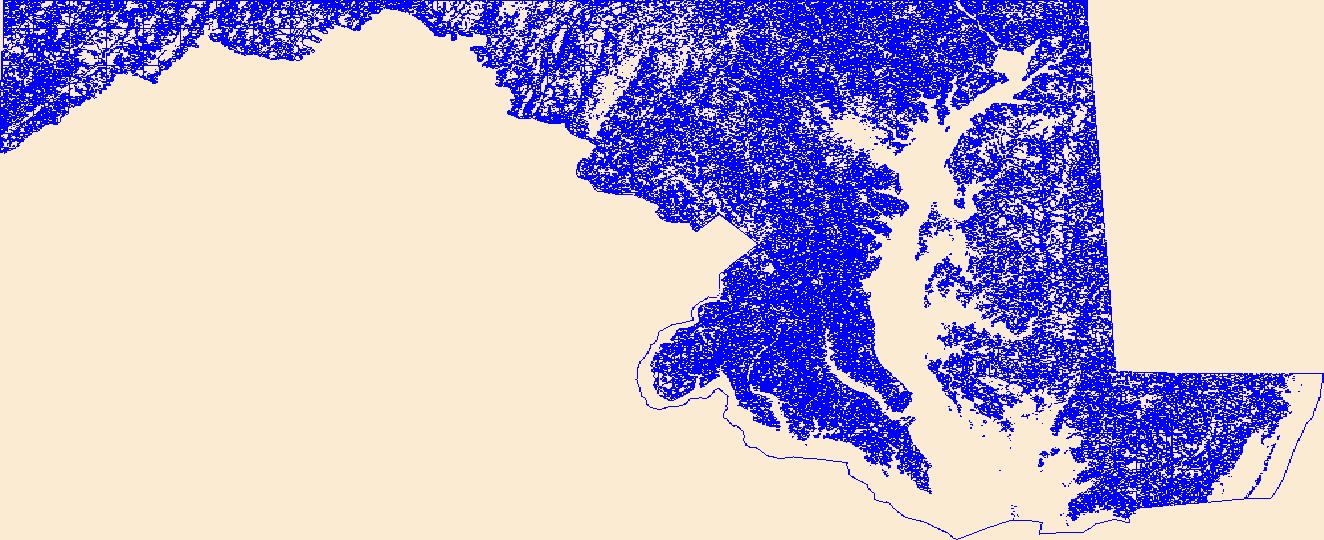
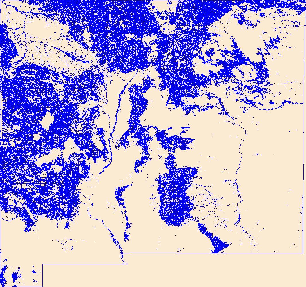
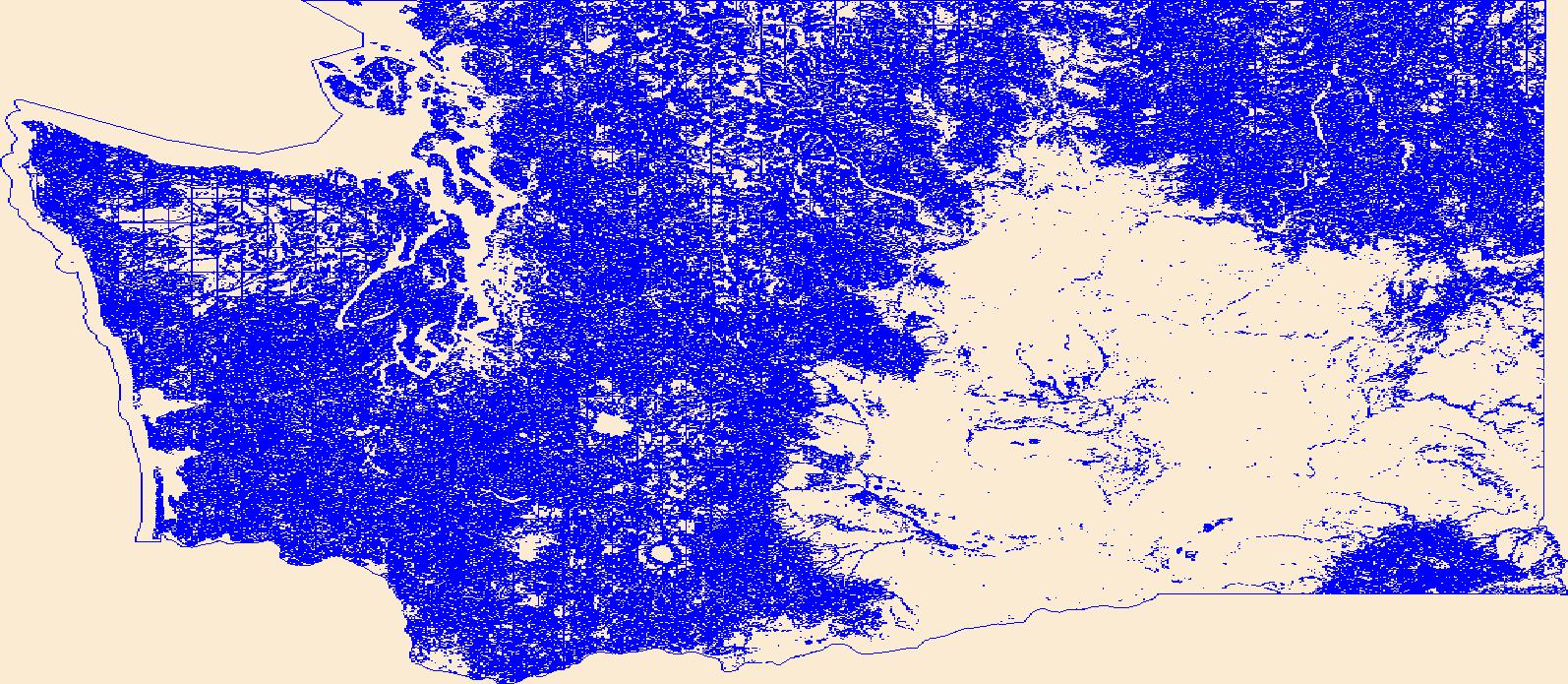
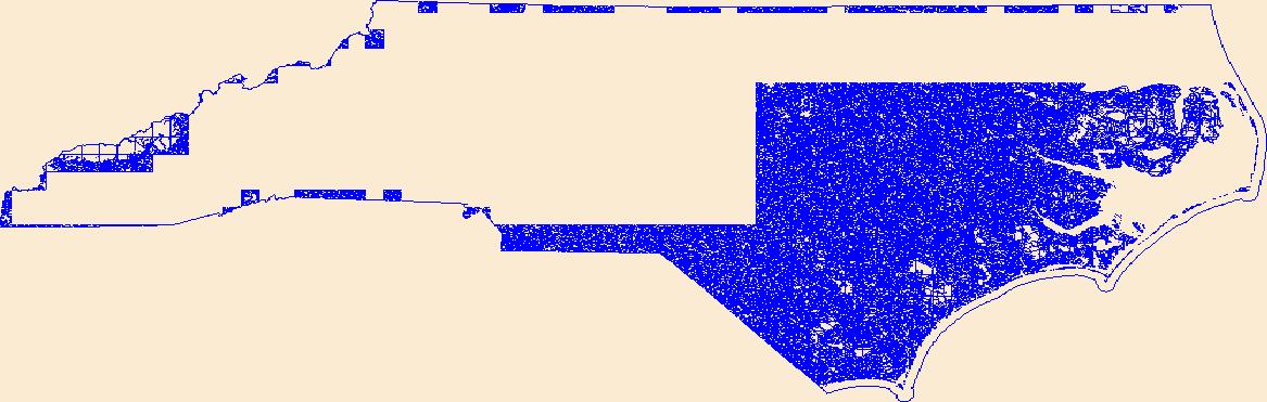
This dataset portrays land cover for NLCD mapping superzone thirteen, which covers all of Maine, Vermont, New Hampshire, Massachusetts, Rhode Island, Connecticut, New York, New Jersey, Delaware, and Maryland, and parts of Pennsylvania, Virginia, West Virginia, and North Carolina. Refer to http://www.mrlc.gov/nlcd_multizone_map.php for a map of the superzones. From NLCD: The National Land Cover Database 2001 was produced through a cooperative project conducted by the Multi-Resolution Land Characteristics (MRLC) Consortium. The MRLC Consortium is a partnership of federal agencies (www.mrlc.gov), consisting of the U.S. Geological Survey (USGS), the National Oceanic and Atmospheric Administration (NOAA), the U.S....
This dataset portrays percent imperviousness surface area for NLCD mapping superzone thirteen, which covers all of Maine, Vermont, New Hampshire, Massachusetts, Rhode Island, Connecticut, New York, New Jersey, Delaware, and Maryland, and parts of Pennsylvania, Virginia, West Virginia, and North Carolina. Refer to http://www.mrlc.gov/nlcd_multizone_map.php for a map of the super-zones. From NLCD: The National Land Cover Database 2001 was produced through a cooperative project conducted by the Multi-Resolution Land Characteristics (MRLC) Consortium. The MRLC Consortium is a partnership of federal agencies (www.mrlc.gov), consisting of the U.S. Geological Survey (USGS), the National Oceanic and Atmospheric Administration...

This dataset contains generalized landcover data for the Prairie Farm Rehabilitation Administration (PFRA) agricultural extent of Alberta and British Columbia. This dataset was subset into two shapefiles. The other half of this dataset covers PFRA agricultural areas of Manitoba and Saskatchewan. The Landcover Generalization process was undertaken to solve rendering problems of the original vectorized landcover data due to its unwieldy/overwhelming size. LANDSAT 7 imagery used in the process was collected during the WGTPP. This landcover imagery has a 30 meter resolution and is stored in over 1,100 vectorized 1:50,000 map sheet tiles. The data requires over seven gigabytes of disc space. If the user wishes to view...

SYNMAP is a new joint I-km global land cover product with improved characteristics for land cover parameterization of the carbon cycle models that reduces land cover uncertainties in carbon budget calculations. The overall advantage of the SYNMAP legend is that all classes are properly defined in terms of plant functional type mixtures, which can be remotely sensed and include the definitions of leaf type and longevity for each class with a tree component. SYNMAP is currently used for parameterization in a European model intercomparison initiative of three global vegetation models: BIOME-BGC, LPJ, and ORCHIDEE. Corroboration of SYNMAP against GLCC, GLC2000 and MODIS land cover products reveals improved agreement...

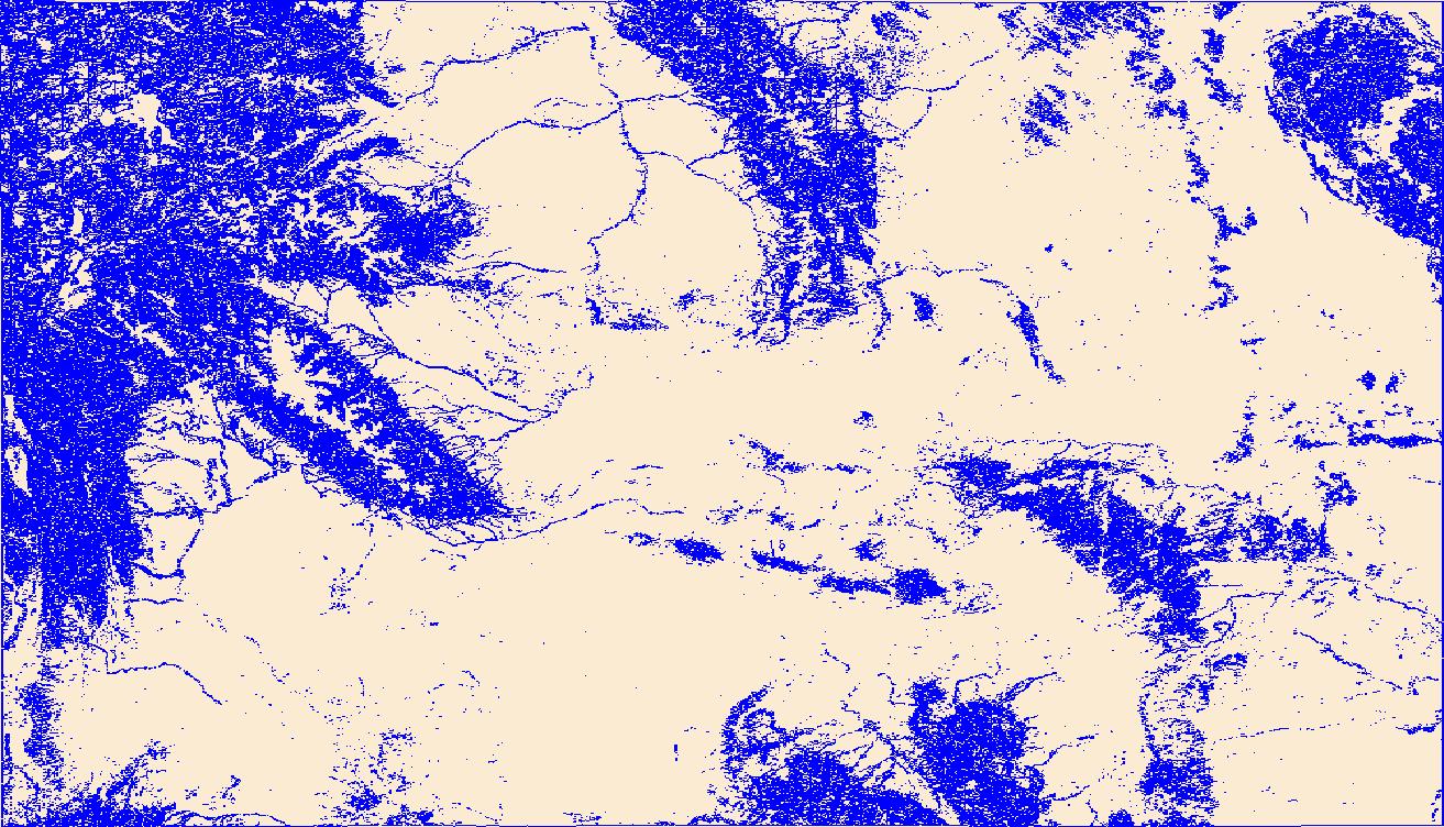
Zone 1 (covering a portion of southwestern Texas) of the contiguous U.S. land cover dataset, NLCD 2006, released 2/16/2011. The full dataset is divided into 25 zones, which can all be found in the NLCD 2006 gallery. The National Land Cover Database products are created through a cooperative project conducted by the Multi-Resolution Land Characteristics (MRLC) Consortium. The MRLC Consortium is a partnership of federal agencies (www.mrlc.gov), consisting of the U.S. Geological Survey (USGS), the National Oceanic and Atmospheric Administration (NOAA), the U.S. Environmental Protection Agency (EPA), the U.S. Department of Agriculture (USDA), the U.S. Forest Service (USFS), the National Park Service (NPS), the U.S....
|

|
