Filters: Tags: LANSING (X)
69 results (35ms)|
Filters
Date Range
Types Contacts
Categories Tag Types Tag Schemes |
This data set contains imagery from the National Agriculture Imagery Program (NAIP). The NAIP program is administered by USDA FSA and has been established to support two main FSA strategic goals centered on agricultural production. These are, increase stewardship of America's natural resources while enhancing the environment, and to ensure commodities are procured and distributed effectively and efficiently to increase food security. The NAIP program supports these goals by acquiring and providing ortho imagery that has been collected during the agricultural growing season in the U.S. The NAIP ortho imagery is tailored to meet FSA requirements and is a fundamental tool used to support FSA farm and conservation programs....

A regional groundwater flow model (https://pubs.usgs.gov/sir/2009/5244/) was updated to reflect 2017 pumping conditions in the Tri-County Region covering most of Clinton, Eaton, and Ingham Counties, Michigan. This model was developed to simulate the regional hydrologic system in Tri-County area and continues to be used for planning and protection of area water supplies. Revised contributing area delineations in response to recent pumping conditions were needed for local wellhead protection area programs. The model was calibrated to water level observations for 2017 from well driller logs, average water levels for 2012-17 from active USGS observation wells, and estimated baseflow for 2012-16 from USGS streamgaging...
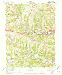
USGS Historical Quadrangle in GeoPDF.
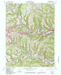
USGS Historical Quadrangle in GeoPDF.
Core Research Center, core S382, from well operated by WEXPRORaw Properties from download, web scrape, MapServer, and Macrostrat API{"Lib Num": "S382", "API Num": "2603322268", "Operator": "WEXPRO", "Well Name": "MATHEWSON 20-1", "Field": "WILDCAT", "State": "NE", "County": "CHEYENNE", "Type": "THICK SLAB", "Photos": "F", "Thin Sec": "F", "Analysis": "F", "Latitude": "41.17607", "Longitude": "-103.1919", "coordinates_geohash": "9xqd5zcgyry3", "Source": "PROVIDED BY DONOR", "Security Flag": null, "crc_collection_name": "core", "sb_parent_id": "4f4e49dae4b07f02db5e0486", "intervals": [{"Formation": "PENNSYLVANIAN", "Age": "PENNSYLVANIAN", "Min Depth": "6838", "Max Depth": "6898"}, {"Formation": "PENNSYLVANIAN", "Age":...
Categories: Physical Item;
Tags: LANSING,
Miocene,
Ogallala Formation,
Ogallala Group or Formation,
PENNSYLVANIAN,
Core Research Center, core E413, from well operated by GEMINI CORPORATIONRaw Properties from download, web scrape, MapServer, and Macrostrat API{"Lib Num": "E413", "API Num": "2608722208", "Operator": "GEMINI CORPORATION", "Well Name": "4-1518 IMA DRAIN", "Field": "BISHOP/PALISADE", "State": "NE", "County": "HITCHCOCK", "Type": "SLABBED", "Photos": "T", "Thin Sec": "F", "Analysis": "T", "Latitude": "40.30904", "Longitude": "-101.19912", "coordinates_geohash": "9z0j34j11tdv", "Source": "FROM STATE RECORDS", "Security Flag": "NO SPECIAL RESTRICTIONS", "crc_collection_name": "core", "sb_parent_id": "4f4e49dae4b07f02db5e0486", "intervals": [{"Formation": "LANSING", "Age": "PENN", "Min Depth": "4350", "Max Depth": "4372"}],...
Categories: Physical Item;
Tags: LANSING,
Miocene,
Ogallala Formation,
Ogallala Group or Formation,
PENN,
This data set contains imagery from the National Agriculture Imagery Program (NAIP). The NAIP program is administered by USDA FSA and has been established to support two main FSA strategic goals centered on agricultural production. These are, increase stewardship of America's natural resources while enhancing the environment, and to ensure commodities are procured and distributed effectively and efficiently to increase food security. The NAIP program supports these goals by acquiring and providing ortho imagery that has been collected during the agricultural growing season in the U.S. The NAIP ortho imagery is tailored to meet FSA requirements and is a fundamental tool used to support FSA farm and conservation programs....
This data set contains imagery from the National Agriculture Imagery Program (NAIP). The NAIP program is administered by USDA FSA and has been established to support two main FSA strategic goals centered on agricultural production. These are, increase stewardship of America's natural resources while enhancing the environment, and to ensure commodities are procured and distributed effectively and efficiently to increase food security. The NAIP program supports these goals by acquiring and providing ortho imagery that has been collected during the agricultural growing season in the U.S. The NAIP ortho imagery is tailored to meet FSA requirements and is a fundamental tool used to support FSA farm and conservation programs....
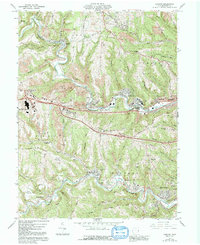
USGS Historical Quadrangle in GeoPDF.
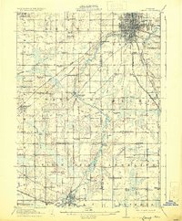
USGS Historical Quadrangle in GeoPDF.
Core Research Center, core C135, from well operated by DEVON CORPORATIONRaw Properties from download, web scrape, MapServer, and Macrostrat API{"Lib Num": "C135", "API Num": "2614521517", "Operator": "DEVON CORPORATION", "Well Name": "1 MORGAN HELLEBERG FARMS", "Field": "WILDCAT", "State": "NE", "County": "RED WILLOW", "Type": "SLABBED", "Photos": "T", "Thin Sec": "F", "Analysis": "F", "Latitude": "40.041256", "Longitude": "-100.388286", "coordinates_geohash": "9z0eg973prhe", "Source": "FROM STATE RECORDS", "Security Flag": "NO SPECIAL RESTRICTIONS", "crc_collection_name": "core", "sb_parent_id": "4f4e49dae4b07f02db5e0486", "intervals": [{"Formation": "LANSING", "Age": "PENN", "Min Depth": "3278", "Max Depth": "3298"}],...
Categories: Physical Item;
Tags: LANSING,
Miocene,
Ogallala Formation,
Ogallala Group or Formation,
PENN,
Core Research Center, core T473, from well operated by RUTLEDGE ROBERTRaw Properties from download, web scrape, MapServer, and Macrostrat API{"Lib Num": "T473", "API Num": "2614505191", "Operator": "RUTLEDGE ROBERT", "Well Name": "6 NEWTON", "Field": "ACKMAN", "State": "NE", "County": "RED WILLOW", "Type": "CHIPS", "Photos": "F", "Thin Sec": "F", "Analysis": "F", "Latitude": "40.120623", "Longitude": "-100.470424", "coordinates_geohash": "9z0s1xxxt6jy", "Source": "FROM STATE RECORDS", "Security Flag": "NO SPECIAL RESTRICTIONS", "crc_collection_name": "core", "sb_parent_id": "4f4e49dae4b07f02db5e0486", "intervals": [{"Formation": "LANSING", "Age": "PENN", "Min Depth": "3403", "Max Depth": "3452"}], "crcwc_url": "https://my.usgs.gov/crcwc/core/report/15538",...
Categories: Physical Item;
Tags: LANSING,
Miocene,
Ogallala Formation,
Ogallala Group or Formation,
PENN,
Core Research Center, core E338, from well operated by MARATHON OIL CORaw Properties from download, web scrape, MapServer, and Macrostrat API{"Lib Num": "E338", "API Num": "2614505686", "Operator": "MARATHON OIL CO", "Well Name": "1 FASSLER W", "Field": "AIRPORT AREA", "State": "NE", "County": "RED WILLOW", "Type": "SLABBED", "Photos": "T", "Thin Sec": "F", "Analysis": "F", "Latitude": "40.248102", "Longitude": "-100.748097", "coordinates_geohash": "9z0kgqvqpnn0", "Source": "FROM STATE RECORDS", "Security Flag": "NO SPECIAL RESTRICTIONS", "crc_collection_name": "core", "sb_parent_id": "4f4e49dae4b07f02db5e0486", "intervals": [{"Formation": "LANSING", "Age": "PENN", "Min Depth": "3644", "Max Depth": "3658"}], "crcwc_url":...
Categories: Physical Item;
Tags: LANSING,
Miocene,
Ogallala Formation,
Ogallala Group or Formation,
PENN,
Core Research Center, core D543, from well operated by EXETER EXPL COMPANYRaw Properties from download, web scrape, MapServer, and Macrostrat API{"Lib Num": "D543", "API Num": "2608721303", "Operator": "EXETER EXPL COMPANY", "Well Name": "12-31 NEINMAN", "Field": "MITCH", "State": "NE", "County": "HITCHCOCK", "Type": "SLABBED", "Photos": "T", "Thin Sec": "F", "Analysis": "F", "Latitude": "40.18255", "Longitude": "-101.20837", "coordinates_geohash": "9z0h8gn2641x", "Source": "FROM STATE RECORDS", "Security Flag": "NO SPECIAL RESTRICTIONS", "crc_collection_name": "core", "sb_parent_id": "4f4e49dae4b07f02db5e0486", "intervals": [{"Formation": "LANSING", "Age": "PENN", "Min Depth": "4137", "Max Depth": "4172"}], "crcwc_url":...
Categories: Physical Item;
Tags: LANSING,
Miocene,
Ogallala Formation,
Ogallala Group or Formation,
PENN,
Core Research Center, core T250, from well operated by STRATA OILRaw Properties from download, web scrape, MapServer, and Macrostrat API{"Lib Num": "T250", "API Num": "2614521469", "Operator": "STRATA OIL", "Well Name": "4 RANDALL", "Field": "FONDO", "State": "NE", "County": "RED WILLOW", "Type": "FULL", "Photos": "T", "Thin Sec": "F", "Analysis": "F", "Latitude": "40.283172", "Longitude": "-100.386255", "coordinates_geohash": "9z0t5tkfqxwb", "Source": "FROM STATE RECORDS", "Security Flag": "NO SPECIAL RESTRICTIONS", "crc_collection_name": "core", "sb_parent_id": "4f4e49dae4b07f02db5e0486", "intervals": [{"Formation": "LANSING", "Age": "PENN", "Min Depth": "3188", "Max Depth": "3198"}], "crcwc_url": "https://my.usgs.gov/crcwc/core/report/16763",...
Categories: Physical Item;
Tags: LANSING,
Miocene,
Ogallala Formation,
Ogallala Group or Formation,
PENN,
This data set contains imagery from the National Agriculture Imagery Program (NAIP). The NAIP program is administered by USDA FSA and has been established to support two main FSA strategic goals centered on agricultural production. These are, increase stewardship of America's natural resources while enhancing the environment, and to ensure commodities are procured and distributed effectively and efficiently to increase food security. The NAIP program supports these goals by acquiring and providing ortho imagery that has been collected during the agricultural growing season in the U.S. The NAIP ortho imagery is tailored to meet FSA requirements and is a fundamental tool used to support FSA farm and conservation programs....
This data set contains imagery from the National Agriculture Imagery Program (NAIP). The NAIP program is administered by USDA FSA and has been established to support two main FSA strategic goals centered on agricultural production. These are, increase stewardship of America's natural resources while enhancing the environment, and to ensure commodities are procured and distributed effectively and efficiently to increase food security. The NAIP program supports these goals by acquiring and providing ortho imagery that has been collected during the agricultural growing season in the U.S. The NAIP ortho imagery is tailored to meet FSA requirements and is a fundamental tool used to support FSA farm and conservation programs....
This data set contains imagery from the National Agriculture Imagery Program (NAIP). The NAIP program is administered by USDA FSA and has been established to support two main FSA strategic goals centered on agricultural production. These are, increase stewardship of America's natural resources while enhancing the environment, and to ensure commodities are procured and distributed effectively and efficiently to increase food security. The NAIP program supports these goals by acquiring and providing ortho imagery that has been collected during the agricultural growing season in the U.S. The NAIP ortho imagery is tailored to meet FSA requirements and is a fundamental tool used to support FSA farm and conservation programs....
Core Research Center, core B195, from well operated by EXETER EXPL COMPANYRaw Properties from download, web scrape, MapServer, and Macrostrat API{"Lib Num": "B195", "API Num": "2608721161", "Operator": "EXETER EXPL COMPANY", "Well Name": "13-33 REAGAN", "Field": "DRY CREEK", "State": "NE", "County": "HITCHCOCK", "Type": "SLABBED", "Photos": "T", "Thin Sec": "F", "Analysis": "F", "Latitude": "40.1782", "Longitude": "-101.17087", "coordinates_geohash": "9z0h9f1wgz7d", "Source": "FROM STATE RECORDS", "Security Flag": "NO SPECIAL RESTRICTIONS", "crc_collection_name": "core", "sb_parent_id": "4f4e49dae4b07f02db5e0486", "intervals": [{"Formation": "LANSING", "Age": "PENN", "Min Depth": "4080", "Max Depth": "4130"}, {"Formation":...
Categories: Physical Item;
Tags: LANSING,
LANSING,
Miocene,
Ogallala Formation,
Ogallala Group or Formation,
Core Research Center, core E379, from well operated by GEMINI CORPORATIONRaw Properties from download, web scrape, MapServer, and Macrostrat API{"Lib Num": "E379", "API Num": "2608721734", "Operator": "GEMINI CORPORATION", "Well Name": "3-704 GODTEL", "Field": "W BOEVAU CANYON", "State": "NE", "County": "HITCHCOCK", "Type": "SLABBED", "Photos": "T", "Thin Sec": "T", "Analysis": "T", "Latitude": "40.25774", "Longitude": "-101.16099", "coordinates_geohash": "9z0j408y64dt", "Source": "FROM STATE RECORDS", "Security Flag": "NO SPECIAL RESTRICTIONS", "crc_collection_name": "core", "sb_parent_id": "4f4e49dae4b07f02db5e0486", "intervals": [{"Formation": "LANSING", "Age": "PENN", "Min Depth": "4266", "Max Depth": "4288"}],...
Categories: Physical Item;
Tags: LANSING,
Miocene,
Ogallala Formation,
Ogallala Group or Formation,
PENN,
|

|
