Filters: Tags: LYONS (X)
129 results (109ms)|
Filters
Date Range
Extensions Types Contacts
Categories Tag Types
|
This data set contains imagery from the National Agriculture Imagery Program (NAIP). The NAIP program is administered by USDA FSA and has been established to support two main FSA strategic goals centered on agricultural production. These are increase stewardship of America's natural resources while enhancing the environment, and to ensure commodities are procured and distributed effectively and efficiently to increase food security. The NAIP program supports these goals by acquiring and providing ortho imagery that has been collected during the agricultural growing season in the U.S. The NAIP ortho imagery is tailored to meet FSA requirements and is a fundamental tool used to support FSA farm and conservation programs....
This data set contains imagery from the National Agriculture Imagery Program (NAIP). The NAIP program is administered by USDA FSA and has been established to support two main FSA strategic goals centered on agricultural production. These are increase stewardship of America's natural resources while enhancing the environment, and to ensure commodities are procured and distributed effectively and efficiently to increase food security. The NAIP program supports these goals by acquiring and providing ortho imagery that has been collected during the agricultural growing season in the U.S. The NAIP ortho imagery is tailored to meet FSA requirements and is a fundamental tool used to support FSA farm and conservation programs....
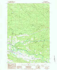
USGS Historical Quadrangle in GeoPDF.
USGS Historical Quadrangle in GeoPDF.
Core Research Center, core D485, from well operated by POMEROY PRODUCTIONRaw Properties from download, web scrape, MapServer, and Macrostrat API{"Lib Num": "D485", "API Num": "0506906137", "Operator": "POMEROY PRODUCTION", "Well Name": "6 COMMUNITY", "Field": "FORT COLLINS", "State": "CO", "County": "LARIMER", "Type": "SLABBED", "Photos": "T", "Thin Sec": "T", "Analysis": "T", "Latitude": "40.66647", "Longitude": "-105.037072", "coordinates_geohash": "9xjr3g476g6q", "Source": "FROM STATE RECORDS", "Security Flag": "NO SPECIAL RESTRICTIONS", "crc_collection_name": "core", "sb_parent_id": "4f4e49dae4b07f02db5e0486", "intervals": [{"Formation": "LYONS", "Age": "PERM", "Min Depth": "6123", "Max Depth": "6180"}], "crcwc_url":...
Core Research Center, core B522, from well operated by NEILSON ENTERPRISESRaw Properties from download, web scrape, MapServer, and Macrostrat API{"Lib Num": "B522", "API Num": "0512310059", "Operator": "NEILSON ENTERPRISES", "Well Name": "1 PARKER", "Field": "UNNAMED", "State": "CO", "County": "WELD", "Type": "SLABBED", "Photos": "F", "Thin Sec": "F", "Analysis": "T", "Latitude": "40.597751", "Longitude": "-104.905158", "coordinates_geohash": "9xjquyd7h9k9", "Source": "FROM STATE RECORDS", "Security Flag": "NO SPECIAL RESTRICTIONS", "crc_collection_name": "core", "sb_parent_id": "4f4e49dae4b07f02db5e0486", "intervals": [{"Formation": "LYONS", "Age": "PERM", "Min Depth": "9045", "Max Depth": "9061"}, {"Formation":...
Categories: Physical Item;
Tags: CRET,
Eolium (Windblown Clay, Silt (Loess), Sand And Granules),
LYONS,
PERM,
SUSSEX,
Core Research Center, core F033, from well operated by SHELL OIL COMPANYRaw Properties from download, web scrape, MapServer, and Macrostrat API{"Lib Num": "F033", "API Num": "0512305582", "Operator": "SHELL OIL COMPANY", "Well Name": "1 COLORADO NATIONAL BANK", "Field": "WILDCAT", "State": "CO", "County": "WELD", "Type": "SLABBED", "Photos": "T", "Thin Sec": "T", "Analysis": "T", "Latitude": "40.682805", "Longitude": "-104.031361", "coordinates_geohash": "9xnp2wndt8db", "Source": "FROM STATE RECORDS", "Security Flag": "NO SPECIAL RESTRICTIONS", "crc_collection_name": "core", "sb_parent_id": "4f4e49dae4b07f02db5e0486", "intervals": [{"Formation": "MORRISON", "Age": "JURA", "Min Depth": "8096", "Max Depth": "8101"},...
Core Research Center, core A840, from well operated by VIKING PETROLEUMRaw Properties from download, web scrape, MapServer, and Macrostrat API{"Lib Num": "A840", "API Num": "0512308615", "Operator": "VIKING PETROLEUM", "Well Name": "1 CACTUS HILL STATE", "Field": "WILDCAT", "State": "CO", "County": "WELD", "Type": "SLABBED", "Photos": "T", "Thin Sec": "T", "Analysis": "T", "Latitude": "40.576062", "Longitude": "-104.905367", "coordinates_geohash": "9xjqufdhxy0v", "Source": "FROM STATE RECORDS", "Security Flag": "NO SPECIAL RESTRICTIONS", "crc_collection_name": "core", "sb_parent_id": "4f4e49dae4b07f02db5e0486", "intervals": [{"Formation": "LYONS", "Age": "PERM", "Min Depth": "8937", "Max Depth": "8998"}], "crcwc_url":...
Core Research Center, core B187, from well operated by TIGER OILRaw Properties from download, web scrape, MapServer, and Macrostrat API{"Lib Num": "B187", "API Num": "0506906072", "Operator": "TIGER OIL", "Well Name": "34-21 WADLEIGH", "Field": "WILDCAT", "State": "CO", "County": "LARIMER", "Type": "SLABBED", "Photos": "T", "Thin Sec": "F", "Analysis": "T", "Latitude": "40.6408", "Longitude": "-105.007461", "coordinates_geohash": "9xjr4qrvuf4p", "Source": "FROM STATE RECORDS", "Security Flag": "NO SPECIAL RESTRICTIONS", "crc_collection_name": "core", "sb_parent_id": "4f4e49dae4b07f02db5e0486", "intervals": [{"Formation": "DAKOTA J", "Age": "CRET", "Min Depth": "6350", "Max Depth": "6407"}, {"Formation": "LYONS",...
Core Research Center, core A774, from well operated by AMOCO PRODUCTIONRaw Properties from download, web scrape, MapServer, and Macrostrat API{"Lib Num": "A774", "API Num": "0512308757", "Operator": "AMOCO PRODUCTION", "Well Name": "312 CHAMPLIN 1A", "Field": "WILDCAT", "State": "CO", "County": "WELD", "Type": "SLABBED", "Photos": "T", "Thin Sec": "T", "Analysis": "T", "Latitude": "40.684062", "Longitude": "-104.64168", "coordinates_geohash": "9xjx6y63b4u4", "Source": "FROM STATE RECORDS", "Security Flag": "NO SPECIAL RESTRICTIONS", "crc_collection_name": "core", "sb_parent_id": "4f4e49dae4b07f02db5e0486", "intervals": [{"Formation": "LYONS", "Age": "PERM", "Min Depth": "9268", "Max Depth": "9314"}], "crcwc_url":...
Categories: Physical Item;
Tags: Calabrian - Middle Pleistocene,
LYONS,
Older gravels and alluviums,
PERM,
gravel
This data set contains imagery from the National Agriculture Imagery Program (NAIP). The NAIP program is administered by USDA FSA and has been established to support two main FSA strategic goals centered on agricultural production. These are, increase stewardship of America's natural resources while enhancing the environment, and to ensure commodities are procured and distributed effectively and efficiently to increase food security. The NAIP program supports these goals by acquiring and providing ortho imagery that has been collected during the agricultural growing season in the U.S. The NAIP ortho imagery is tailored to meet FSA requirements and is a fundamental tool used to support FSA farm and conservation programs....
This data set contains imagery from the National Agriculture Imagery Program (NAIP). The NAIP program is administered by USDA FSA and has been established to support two main FSA strategic goals centered on agricultural production. These are, increase stewardship of America's natural resources while enhancing the environment, and to ensure commodities are procured and distributed effectively and efficiently to increase food security. The NAIP program supports these goals by acquiring and providing ortho imagery that has been collected during the agricultural growing season in the U.S. The NAIP ortho imagery is tailored to meet FSA requirements and is a fundamental tool used to support FSA farm and conservation programs....
This data set contains imagery from the National Agriculture Imagery Program (NAIP). The NAIP program is administered by USDA FSA and has been established to support two main FSA strategic goals centered on agricultural production. These are, increase stewardship of America's natural resources while enhancing the environment, and to ensure commodities are procured and distributed effectively and efficiently to increase food security. The NAIP program supports these goals by acquiring and providing ortho imagery that has been collected during the agricultural growing season in the U.S. The NAIP ortho imagery is tailored to meet FSA requirements and is a fundamental tool used to support FSA farm and conservation programs....
This data set contains imagery from the National Agriculture Imagery Program (NAIP). The NAIP program is administered by USDA FSA and has been established to support two main FSA strategic goals centered on agricultural production. These are increase stewardship of America's natural resources while enhancing the environment, and to ensure commodities are procured and distributed effectively and efficiently to increase food security. The NAIP program supports these goals by acquiring and providing ortho imagery that has been collected during the agricultural growing season in the U.S. The NAIP ortho imagery is tailored to meet FSA requirements and is a fundamental tool used to support FSA farm and conservation programs....
This data set contains imagery from the National Agriculture Imagery Program (NAIP). The NAIP program is administered by USDA FSA and has been established to support two main FSA strategic goals centered on agricultural production. These are increase stewardship of America's natural resources while enhancing the environment, and to ensure commodities are procured and distributed effectively and efficiently to increase food security. The NAIP program supports these goals by acquiring and providing ortho imagery that has been collected during the agricultural growing season in the U.S. The NAIP ortho imagery is tailored to meet FSA requirements and is a fundamental tool used to support FSA farm and conservation programs....
This dataset contains the delineated areas of postglacial and glacial deposits within the study area. This digital dataset is the result of a study to investigate the hydrogeology of the Fairport-Lyons channel and inter-drumlin aquifer system and to map the extent of the glacial aquifers in southern Wayne County, New York; it supports USGS SIR 2021-5086, "Hydrogeology of aquifers within the Fairport-Lyons channel system and adjacent areas in Wayne, Ontario, and Seneca Counties, New York."
Categories: Data;
Types: Downloadable,
Map Service,
OGC WFS Layer,
OGC WMS Layer,
Shapefile;
Tags: Aquifer Mapping,
Fairport,
Groundwater and Streamflow Information,
Hydrogeologic Characterization,
Lyons,
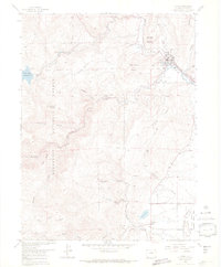
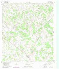
USGS Historical Quadrangle in GeoPDF.
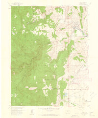
USGS Historical Quadrangle in GeoPDF.
USGS Historical Quadrangle in GeoPDF.
USGS Historical Quadrangle in GeoPDF.
|

|
