Filters: Tags: Lake Almanor (X)
5 results (8ms)|
Filters
Date Range
Contacts
Categories Tag Types Tag Schemes |
This data release provides access to an aeromagnetic survey over a part of northern California, an area that includes the cities of Portola, California, and Reno, Nevada. The survey extends across the northern part of the Sierra Nevada from Honey Lake in the north to Lake Tahoe in the south and over parts of the Sierra Nevada foothills. These data were acquired between March 3 and May 3, 2021, by EDCON-PRJ, Inc., working under contract to the U.S. Geological Survey. The nominal flying height was based on a best fit, pre-planned, three-dimensional draped surface targeted at 305 m above terrain, subject to aircraft climb and descent limitations. Steep terrain in parts of the survey area required significant departures...
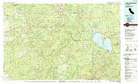
USGS Historical Quadrangle in GeoPDF.
This data release presents point data associated with the geologic and geophysical maps of the Sierra Nevada Digital Earth Science Atlas led by the California Geological Survey and U.S. Geological Survey. Data include principal fact information for new gravity measurements collected by the U.S. Geological Survey from 2012 to 2023 and for existing gravity measurements compiled from 21 sources. Nearly 29,000 gravity measurements were processed to complete Bouguer and isostatic gravity anomalies to provide information on crustal structure, such as depth extent of plutons and arc terranes, and geometry of Cenozoic basins developed along the margins of the Sierra Nevada. Density and magnetic property measurements were...
Categories: Data;
Tags: Eldorado National Forest,
Lake Almanor,
Lake Isabella,
Lake Tahoe,
Mono Lake,

USGS Historical Quadrangle in GeoPDF.
This data release contains data from flightlines collected during an aeromagnetic survey of the Burney region of northeastern California. These data were gridded and magnetization boundaries were calculated using the maximum horizontal gradient method on the gridded data.
|

|
