Filters: Tags: Lake Crescent (X)
17 results (15ms)|
Filters
Date Range
Types Contacts
Categories Tag Types Tag Schemes |
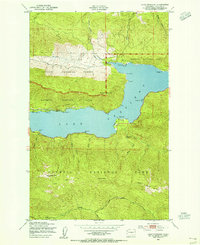
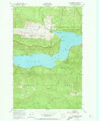
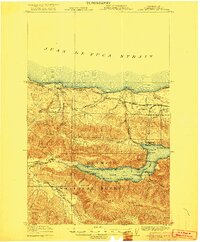
USGS Historical Quadrangle in GeoPDF.

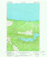
USGS Historical Quadrangle in GeoPDF.
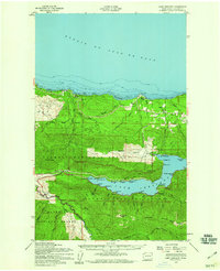
USGS Historical Quadrangle in GeoPDF.

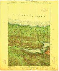
USGS Historical Quadrangle in GeoPDF.
USGS Historical Quadrangle in GeoPDF.
In February 2016 the U.S. Geological Survey, Pacific Coastal and Marine Science Center in cooperation with North Carolina State University and the National Park Service collected multibeam bathymetry and acoustic backscatter data in Lake Crescent located in Olympic National Park, Washington. Data were collected using a Reson 7111 multibeam echosounder pole-mounted to the 36-foot USGS R/V Parke Snavely. These metadata describe the multibeam acoustic-backscatter data file that is included in "LakeCrescent_backscatter_3m_UTM10_NAD83.zip" which is accessible from https://doi.org/10.5066/F7B56GW5.
This data set contains imagery from the National Agriculture Imagery Program (NAIP). The NAIP program is administered by USDA FSA and has been established to support two main FSA strategic goals centered on agricultural production. These are, increase stewardship of America's natural resources while enhancing the environment, and to ensure commodities are procured and distributed effectively and efficiently to increase food security. The NAIP program supports these goals by acquiring and providing ortho imagery that has been collected during the agricultural growing season in the U.S. The NAIP ortho imagery is tailored to meet FSA requirements and is a fundamental tool used to support FSA farm and conservation programs....
This data set contains imagery from the National Agriculture Imagery Program (NAIP). The NAIP program is administered by USDA FSA and has been established to support two main FSA strategic goals centered on agricultural production. These are, increase stewardship of America's natural resources while enhancing the environment, and to ensure commodities are procured and distributed effectively and efficiently to increase food security. The NAIP program supports these goals by acquiring and providing ortho imagery that has been collected during the agricultural growing season in the U.S. The NAIP ortho imagery is tailored to meet FSA requirements and is a fundamental tool used to support FSA farm and conservation programs....

USGS Historical Quadrangle in GeoPDF.
USGS Historical Quadrangle in GeoPDF.
This data set contains imagery from the National Agriculture Imagery Program (NAIP). The NAIP program is administered by USDA FSA and has been established to support two main FSA strategic goals centered on agricultural production. These are, increase stewardship of America's natural resources while enhancing the environment, and to ensure commodities are procured and distributed effectively and efficiently to increase food security. The NAIP program supports these goals by acquiring and providing ortho imagery that has been collected during the agricultural growing season in the U.S. The NAIP ortho imagery is tailored to meet FSA requirements and is a fundamental tool used to support FSA farm and conservation programs....

USGS Historical Quadrangle in GeoPDF.
In February 2016 the U.S. Geological Survey, Pacific Coastal and Marine Science Center in cooperation with North Carolina State University and the National Park Service collected multibeam bathymetry and acoustic backscatter data in Lake Crescent located in Olympic National Park, Washington. These data were collected to support geologic hazard studies within the lake including mapping submarine landslides and faulting. Data were collected using a Reson 7111 multibeam echosounder pole-mounted to the 36-foot USGS R/V Parke Snavely. This USGS data release provides the processed bathymetry data in ASCIIRaster format, the acoustic backscatter data in TIFF format, as well as PDF maps of shaded relief bathymetry and acoustic...
Categories: Data;
Types: Citation;
Tags: Bathymetry,
Bathymetry,
Bathymetry and Elevation,
CMGP,
Geology,
This data set contains imagery from the National Agriculture Imagery Program (NAIP). The NAIP program is administered by USDA FSA and has been established to support two main FSA strategic goals centered on agricultural production. These are, increase stewardship of America's natural resources while enhancing the environment, and to ensure commodities are procured and distributed effectively and efficiently to increase food security. The NAIP program supports these goals by acquiring and providing ortho imagery that has been collected during the agricultural growing season in the U.S. The NAIP ortho imagery is tailored to meet FSA requirements and is a fundamental tool used to support FSA farm and conservation programs....
USGS Historical Quadrangle in GeoPDF.
USGS Historical Quadrangle in GeoPDF.
In February 2016 the U.S. Geological Survey, Pacific Coastal and Marine Science Center in cooperation with North Carolina State University and the National Park Service collected multibeam bathymetry and acoustic-backscatter data in Lake Crescent located in Olympic National Park, Washington. Data were collected using a Reson 7111 multibeam echosounder pole-mounted to the 36-foot USGS R/V Parke Snavely. These metadata describe the multibeam bathymetry raster data file that is included in "LakeCrescent_bathy_3m_UTM10_NAD83_NAVD88.zip" which is accessible from https://doi.org/10.5066/F7B56GW5.
|

|
