Filters: Tags: Land (X) > partyWithName: U.S. Geological Survey (X)
18 results (155ms)|
Filters
Date Range
Types Contacts
Categories Tag Types Tag Schemes |
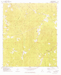
USGS Historical Quadrangle in GeoPDF.

These data were released prior to the October 1, 2016 effective date for the USGS’s policy dictating the review, approval, and release of scientific data as referenced in USGS Survey Manual Chapter 502.8 Fundamental Science Practices: Review and Approval of Scientific Data for Release. This data set depicts land use and land cover from the 1970s and 1980s and has been previously published by the U.S. Geological Survey (USGS) in other file formats. This version has been reformatted to other file formats and includes minor edits applied by the U.S. Environmental Protection Agency (USEPA) and USGS scientists. This data set was developed to meet the needs of the USGS National Water-Quality Assessment (NAWQA) Program.

These data were released prior to the October 1, 2016 effective date for the USGS’s policy dictating the review, approval, and release of scientific data as referenced in USGS Survey Manual Chapter 502.8 Fundamental Science Practices: Review and Approval of Scientific Data for Release. This data set depicts land use and land cover from the 1970s and 1980s and has been previously published by the U.S. Geological Survey (USGS) in other file formats. This version has been reformatted to other file formats and includes minor edits applied by the U.S. Environmental Protection Agency (USEPA) and USGS scientists. This data set was developed to meet the needs of the USGS National Water-Quality Assessment (NAWQA) Program.
This file (wymt_ffa_2018C.psf) contains specifications to run PeakFQ version 7.3 for peak-flow frequency analyses for selected streamgages in Carbon County, Montana, based on data through water year 2018.
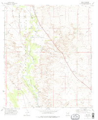
USGS Historical Quadrangle in GeoPDF.
This file (wymt_ffa_2018C_WATSTORE.txt) contains peak flow data for peak-flow frequency analyses for selected streamgages in Carbon County, Montana, based on data through water year 2018. The file is in a text format called WATSTORE (National Water Data Storage and Retrieval System) available from NWISWeb (http://nwis.waterdata.usgs.gov/usa/nwis/peak).
In 2021, the U.S. Geological Survey (USGS), in cooperation with the National Geological and Geophysical Data Preservation Program, cataloged and scanned notes and calculations for indirect measurements taken during flood events in Montana. This product provides a publicly available catalog of the field notes, photos, survey information, and calculations for indirect measurements at selected sites. Indirect measurements are surveyed by the USGS after floods by identifying high water marks along rivers indicating the maximum stream stage. These high water marks are used to estimate the peak discharge through standardized methods. Estimates of peak streamflow from the indirect estimates were were added to the National...
Categories: Data;
Types: Map Service,
OGC WFS Layer,
OGC WMS Layer,
OGC WMS Service;
Tags: Land,
Montana,
North America,
United States,
biota,
The Management Options Database synthesizes and documents a comprehensive set of management practices implemented by the water managers on behalf of a collective (e.g., municipal water systems, irrigation districts) or as individuals (e.g., farmers) to adapt to drought conditions in the Rio Grande/Río Bravo basin. This database provides input to implement the policies in the agent-based module of the ENVISION RGB integrated model (i.e., the range of possible decisions the agents can make in the model) and explore new scenarios of water management. It was developed drawing on the ethnographic data collected by the ethnographic team (Friedman, Paladino). Regular meetings were facilitated by the modeling team (Koch,...
Categories: Data;
Tags: Conservation,
Land,
Management Practices,
Rio Bravo Basin,
Rio Grande Basin,
Soil gas methane and combustible gas concentrations collected from oil and gas well pad locations in Utah. Soil gas samples were measured on site and/or collected for later analysis as described in supporting documentation. Multiple sample locations around well head and depths within the soil profile are available for select sites. Supporting documents provide information of sample collection protocol and data quality assurance.
Categories: Data;
Types: Map Service,
OGC WFS Layer,
OGC WMS Layer,
OGC WMS Service;
Tags: Big Flat,
Big Indian North,
Big Indian South,
Big Valley,
Bluebell,
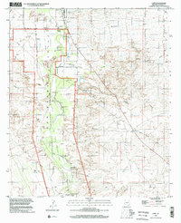
USGS Historical Quadrangle in GeoPDF.
The USGS Wyoming-Montana Water Science Center (WY–MT WSC) completed a report (Sando and McCarthy, 2018) documenting methods for peak-flow frequency analysis following implementation of the Bulletin 17C guidelines. The methods are used to provide estimates of peak-flow quantiles for 66.7-, 50-, 42.9-, 20-, 10-, 4-, 2-, 1-, 0.5-, and 0.2-percent annual exceedance probabilities (AEPs) for selected USGS streamgages. This data release presents peak-flow frequency analyses for selected streamgages in the Upper Yellowstone River Basin, based on data through water year 2022, using methods described by Sando and McCarthy (2018).
Categories: Data;
Types: Map Service,
OGC WFS Layer,
OGC WMS Layer,
OGC WMS Service;
Tags: Carbon County, MT,
Clarks Fork Yellowstone,
Land,
Montana,
North America,
This is a release of data presented in the report "Binational Study of the Transboundary San Pedro Aquifer", Callegary and others, 2016: Callegary, J.B., Minjárez Sosa, I., Tapia Villaseñor, E.M., dos Santos, P., Monreal Saavedra, R., Grijalva Noriega, F.J., Huth, A.K., Gray, F., Scott, C.A., Megdal, S.B., Oroz Ramos, L.A., Rangel Medina, M., Leenhouts, J.M., 2016, Binational Study of the Transboundary San Pedro Aquifer: International Boundary and Water Commission. The United States and Mexico share waters in a number of hydrological basins and aquifers that cross the International Boundary. Both the United States and Mexico recognize that, in a region of scarce water and expanding populations, better...
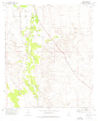
USGS Historical Quadrangle in GeoPDF.
This file (wymt_ffa_2022Yellowstone_WATSTORE.txt) contains peak-flow input data for PeakFQ for peak-flow frequency analyses for selected streamgages based on data through water year 2022. The file format is called WATSTORE (National Water Data Storage and Retrieval System) available from NWISWeb (http://nwis.waterdata.usgs.gov/usa/nwis/peak).
Types: Map Service,
OGC WFS Layer,
OGC WMS Layer,
OGC WMS Service;
Tags: Carbon County, MT,
Clarks Fork Yellowstone,
Land,
Map Service,
Montana,

These data were released prior to the October 1, 2016 effective date for the USGS’s policy dictating the review, approval, and release of scientific data as referenced in USGS Survey Manual Chapter 502.8 Fundamental Science Practices: Review and Approval of Scientific Data for Release. This polygon data set provides ancillary information to supplement a release of enhanced U.S. Geological Survey (USGS) historical land-use and land-cover data. The data set presents some of the original file-header documentation, as well as some details describing how the data files were used in the data release, in a geographic context.

These data were released prior to the October 1, 2016 effective date for the USGS’s policy dictating the review, approval, and release of scientific data as referenced in USGS Survey Manual Chapter 502.8 Fundamental Science Practices: Review and Approval of Scientific Data for Release. This polygon data set documents the spatial extent of polygon files included in a release of enhanced U.S. Geological Survey historical land-use and land-cover data.
The USGS Wyoming-Montana Water Science Center (WY–MT WSC) completed a report (Sando and McCarthy, 2018) documenting methods for peak-flow frequency analysis following implementation of the Bulletin 17C guidelines. The methods are used to provide estimates of peak-flow quantiles for 50-, 42.9-, 20-, 10-, 4-, 2-, 1-, 0.5-, and 0.2-percent annual exceedance probabilities (AEPs) for selected streamgages operated by the WY–MT WSC. This data release presents peak-flow frequency analyses for selected streamgages in Carbon County, Montana, that were based on methods described by Sando and McCarthy (2018).
This file (wymt_ffa_2022Yellowstone.psf) contains specifications to run PeakFQ version 7.4.1 for peak-flow frequency analyses for selected streamgages based on data through water year 2022.
Types: Map Service,
OGC WFS Layer,
OGC WMS Layer,
OGC WMS Service;
Tags: Carbon County, MT,
Clarks Fork Yellowstone,
Land,
Map Service,
Montana,
|

|
