Filters: Tags: Land Use (X)
470 results (486ms)|
Filters
Date Range
Extensions Types Contacts
Categories Tag Types
|
The US Geological Survey Chesapeake Bay Watershed Land Cover Data Series, 2011 edition, (CBLCD-e11) consists of Level I Land Cover data for the years 1984, 1992, 2001, 2006 and 2011. It consists of a series of five 8-bit unsigned integer raster data files of 30 meter spatial resolution in Albers Conic Equal Area projection, NAD83 datum. The 1984 – 2006 data layers were created by aggregating most Level II Anderson classes of the USGS CBLCD Land Cover Data Series released in 2010 (Irani and Claggett, 2010).
Federally owned and managed public lands occupy approximately 30 percent of the land area of the United States, and anywhere from 50 percent to more than 80 percent of the land area of many of the western states. Determining the appropriate use of these lands involves balancing objectives related to economic, recreational, and conservation interests. This paper examines established and emerging conflicts within and across these objectives through both a narrative discussion of specific topics and a series of case studies. The authors find that new challenges, including pressures to devote portions of public lands to renewable energy project development and the multifaceted threats presented by climate change, will...
Biomassfu els currently (1994) supplya round1 4% of the world’se nergy,b ut most of this is in the form of traditional fuelwood, residuesa ndd ung, which is often inefficienta nd can be environmentallyd etrimental.B iomassc an supplyh eat and electricity, liquid and gaseousfu els. A numbero f developedc ountriesd erive a significanta mounto f their primary energy from biomassU: SA 4%, Finland 18%, Sweden1 6%a ndA ustria 13%.P resentlyb iomasse nergy suppliesa t least2 EJ year-’ in WesternE uropew hich is about4 % of primarye nergy (54 ET). Estimates howa likely potentiali n Europei n 2050o f 9.0-13.5 El dependingo n land areas(1 0%o f useablela nd, 33 Mha), yields (lo-15 oven-dry tonnes( ODt) ha-‘), and recoverabler...
Categories: Publication;
Types: Citation;
Tags: Biomass energy,
Carbon sequestration,
Environment,
Fossil fuel substitution,
Land use,

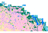
This dataset portrays land cover for north-central Alaska, part of NLCD superzone 15. To reduce file size, Alaska was divided into ten zones, which can be found in the NLCD 2001 gallery . For more infomation on NLCD superzones, including a map, refer to http://www.mrlc.gov/nlcd_multizone_map.php . From NLCD: The National Land Cover Database 2001 was produced through a cooperative project conducted by the Multi-Resolution Land Characteristics (MRLC) Consortium. The MRLC Consortium is a partnership of federal agencies (www.mrlc.gov), consisting of the U.S. Geological Survey (USGS), the National Oceanic and Atmospheric Administration (NOAA), the U.S. Environmental Protection Agency (EPA), the U.S. Department of Agriculture...
This data file contains a list of journal articles found in a recent search for research relevant to studying landscape perceptions. We collected all peer reviewed academic articles containing the keywords “landscape” and “perception” on the web of science resulting in 3497 records. To eliminate studies not directly addressing landscape perception we filtered out medical journal articles (n=1211). We also chose to limit our assessment to journals directly concerned with the landscape perception topic, omitting those with fewer than 5 articles pertaining to these keywords (n=1044). The abstract and title of the remaining articles (n=1242) were further scanned to discard irrelevant studies and evaluate specific methods...
Categories: Data;
Tags: Geography,
Land Use Change,
USGS Science Data Catalog (SDC),
World,
land cover,
This dataset contains generalized landcover data for the Prairie Farm Rehabilitation Administration (PFRA) determined agricultural extent of Manitoba and Saskatchewan. This dataset was subset into two shapefiles. The other half of this dataset covers PFRA agricultural areas of Alberta and British Columbia. The Landcover Generalization process was undertaken to solve rendering problems of the original vectorized landcover data due to its unwieldy/overwhelming size. LANDSAT 7 imagery used in the process was collected during the WGTPP. This landcover imagery has a 30 meter resolution and is stored in over 1,100 vectorized 1:50,000 map sheet tiles. The data requires over seven gigabytes of disc space. If the user wishes...
This dataset contains a projection of land use and land cover for the conterminous United States for the period 2001 - 2061. This projection used the USGS's LUCAS (Land Use and Carbon Scenario Simulator) model to project a business as usual scenario of land cover and land use change. By running the LUCAS model on the USGS's YETI high performance computer and parallelizing the computation, we ran 100 Monte Carlo simulations based on empirically observed rates of change at a relatively fine scale (270m). We sampled from multiple observed rates of change at the county level to introduce heterogeneity into the Monte Carlo simulations. Using this approach allowed the model to project different outcomes that were summarized...

This dataset portrays land cover for Puerto Rico, which is NLCD mapping superzone seventeen. Refer to http://www.mrlc.gov/nlcd_multizone_map.php for a map of the superzones. From NLCD: The National Land Cover Database 2001 was produced through a cooperative project conducted by the Multi-Resolution Land Characteristics (MRLC) Consortium. The MRLC Consortium is a partnership of federal agencies (www.mrlc.gov), consisting of the U.S. Geological Survey (USGS), the National Oceanic and Atmospheric Administration (NOAA), the U.S. Environmental Protection Agency (EPA), the U.S. Department of Agriculture (USDA), the U.S. Forest Service (USFS), the National Park Service (NPS), the U.S. Fish and Wildlife Service (FWS),...
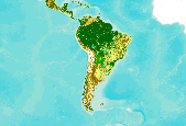
This dataset is an extract from the GlobCover 2009 land cover map, covering Central and South America. The GlobCover 2009 land cover map is derived by an automatic and regionally-tuned classification of a time series of global MERIS (MEdium Resolution Imaging Spectrometer) FR mosaics for the year 2009. The global land cover map counts 22 land cover classes defined with the United Nations (UN) Land Cover Classification System (LCCS). For more information on the GlobCover project, see http://ionia1.esrin.esa.int/ Note on display: class 210: Water Bodies is set to "transparent" to improve display in the Data Basin map. Within the extract's extent, no data were removed from the original dataset.

Description and data downloaded from DRECP Website: http://www.drecp.org/meetings/2012-07-25-26_workshop/background/Department_of_Defense_Materials/This information and data is provided in support of the Desert Renewable Energy Conservation Plan. Attachment 1 provides a Department of Defense (DoD) comprehensive matrix detailing potential military operational constraints by Development Focus Area. Attachment 2 provides associated conflict maps by renewable energy technology. Regarding the color coding:·        The red areas represent locations where there is a high likelihood of unacceptable risk to national security, and then technology identified might impact military operations, testing and training.Â...
This metadata record documents 11 comma delimited tables representing the amount of reported best management practice (BMP) implementation for the years from 1985 to 2014 at three geographic scales: county or land-river modeling segment, River Input Monitoring (RIM) station drainage areas, and the entire Chesapeake Bay Watershed (CBWS). Data originated from the Chesapeake Bay Watershed jurisdictions including Maryland, Pennsylvania, Virginia, Delaware, New York, West Virginia, and the District of Columbia. Data were reported to the Chesapeake Bay Program for an annual review of progress toward meeting nitrogen, phosphorus, and sediment reduction goals.
These are the boundaries of current Land Use Plans. Represents the spatial extent and boundaries for existing BLM Land Use Planning Area (LUPA) polygons. Land Use Planning Areas are geographic areas within which the BLM will make decisions during a land use planning effort. Land Use Planning Area Boundaries shift from an "in-progress" status and become Existing Land Use Planning Areas when the Land Use Plan has been approvided and a Record of Decision Date has been established. At this point, these LUPAs are officially "existing".
The geographic information system (GIS) format spatial data set of vegetation for Apostle Islands National Lakeshore (APIS) was created for the National Park Service (NPS) Vegetation Inventory Program (VIP). The APIS covers an area of approximately 28,972 ha (71,591 acres). The map classification scheme used to create the vegetation data set is designed to represent local vegetation types at the finest level possible using the National Vegetation Classification (NVC) Standard (Vr 2). Physiognomic information was also recorded, including height (woody vegetation), canopy density, and coverage patterns. The vegetation data set was developed by interpreting aerial photographs collected in 2004 and extensive field surveys....
This tabular data set represents the percent of land cover classes from the 2019 edition of the National Land Cover databases for the years 2001, 2004, 2006, 2008, 2011, 2013, 2016 and 2019 compiled for two spatial components of the NHDPlus version 2.1 data suite (NHDPlusv2) for the conterminous United States; 1) individual reach catchments and 2) reach catchments accumulated upstream through the river network. These databases can be linked to the NHDPlus version 2 data suite by the unique identifier COMID. The source data is the "National Land Cover Database (NLCD) 2019 Products (ver. 2.0, June 2021)" databases for the years 2001, 2004, 2006, 2008, 2011, 2013, 2016, and 2019 produced by the United States Geological...

These data were released prior to the October 1, 2016 effective date for the USGS’s policy dictating the review, approval, and release of scientific data as referenced in USGS Survey Manual Chapter 502.8 Fundamental Science Practices: Review and Approval of Scientific Data for Release. Estimates of area and aerial extent of land-use categories are an essential component for computing the water budget of the High Plains aquifer. These raster land-use land class data represent yearly simulated future land use for the High Plains from 2009 to 2050 These data were developed using the FOREcasting SCEnarios (FORE-SCE) of future land cover model (Sohl and others, 2007; Sohl and Sayler 2008) for two (A2 and B2) of the...

These data were released prior to the October 1, 2016 effective date for the USGS’s policy dictating the review, approval, and release of scientific data as referenced in USGS Survey Manual Chapter 502.8 Fundamental Science Practices: Review and Approval of Scientific Data for Release. Estimates of land use categories are an essential component for computing the water budget of the High Plains aquifer. These raster land-use data represent yearly estimated land use for the High Plains from 1949 to 2008. These data were developed using the FOREcasting SCEnarios of future land cover (FORE-SCE) model (Sohl and others, 2007) and then processed using a Geographic Information System (GIS). The GIS software used to process...
The Hawaii Forest Bird Survey (HFBS) systematically characterized plant and bird communities across transects spanning all major Hawaiian Islands except O‘ahu. This extensive dataset has now been organized into a database and associated geographic information system (GIS) layers. This baseline provides an opportunity to assess how forest ecosystems and their constituent bird and plant populations have changed over time. As part of the HaBiTATS (Hawaiian Biodiversity Trends Across Time and Space) project, a select area on Hawai‘i Island was surveyed in 2015 with the objective of demonstrating the potential of using the HFBS methodology to reassess the status of bird and plant communities across multiple geographic...
The Hawaii Forest Bird Survey (HFBS) systematically characterized plant and bird communities across transects spanning all major Hawaiian Islands except O‘ahu. This extensive dataset has now been organized into a database and associated geographic information system (GIS) layers. This baseline provides an opportunity to assess how forest ecosystems and their constituent bird and plant populations have changed over time. As part of the HaBiTATS (Hawaiian Biodiversity Trends Across Time and Space) project, a select area on Hawai‘i Island was surveyed in 2015 with the objective of demonstrating the potential of using the HFBS methodology to reassess the status of bird and plant communities across multiple geographic...
The Central Platte River Image Library is an extensive dataset of historic 1860's surveys by the Government Land Office and aerial photographs from 1938-2012. All datasets are either public domain property of the U.S. Government or published by the Rainwater Basin Joint Venture (RWBJV) with permission from the respective owner (specifically the Platte River Recovery Implementation Program or Central Platte Natural Resources District). The Central Platte River region of Nebraska extends from approximately Jeffery Reservoir (Western Extent) to Columbus (Eastern Extent). The library was completed May 2014 - Sept 2016 by the Rainwater Basin Joint Venture.
The Central Platte River Image Library is an extensive dataset of historic 1860's surveys by the Government Land Office and aerial photographs from 1938-2012. All datasets are either public domain property of the U.S. Government or published by the Rainwater Basin Joint Venture (RWBJV) with permission from the respective owner (specifically the Platte River Recovery Implementation Program or Central Platte Natural Resources District). The Central Platte River region of Nebraska extends from approximately Jeffery Reservoir (Western Extent) to Columbus (Eastern Extent). The library was completed May 2014 - Sept 2016 by the Rainwater Basin Joint Venture.
Categories: Data;
Types: Citation,
Downloadable,
Map Service,
OGC WFS Layer,
OGC WMS Layer,
Shapefile;
Tags: Land Use,
Nebraska,
imageryBaseMapsEarthCover
|

|
