Filters
Date Range
Contacts
Tag Types
Tag Schemes
|

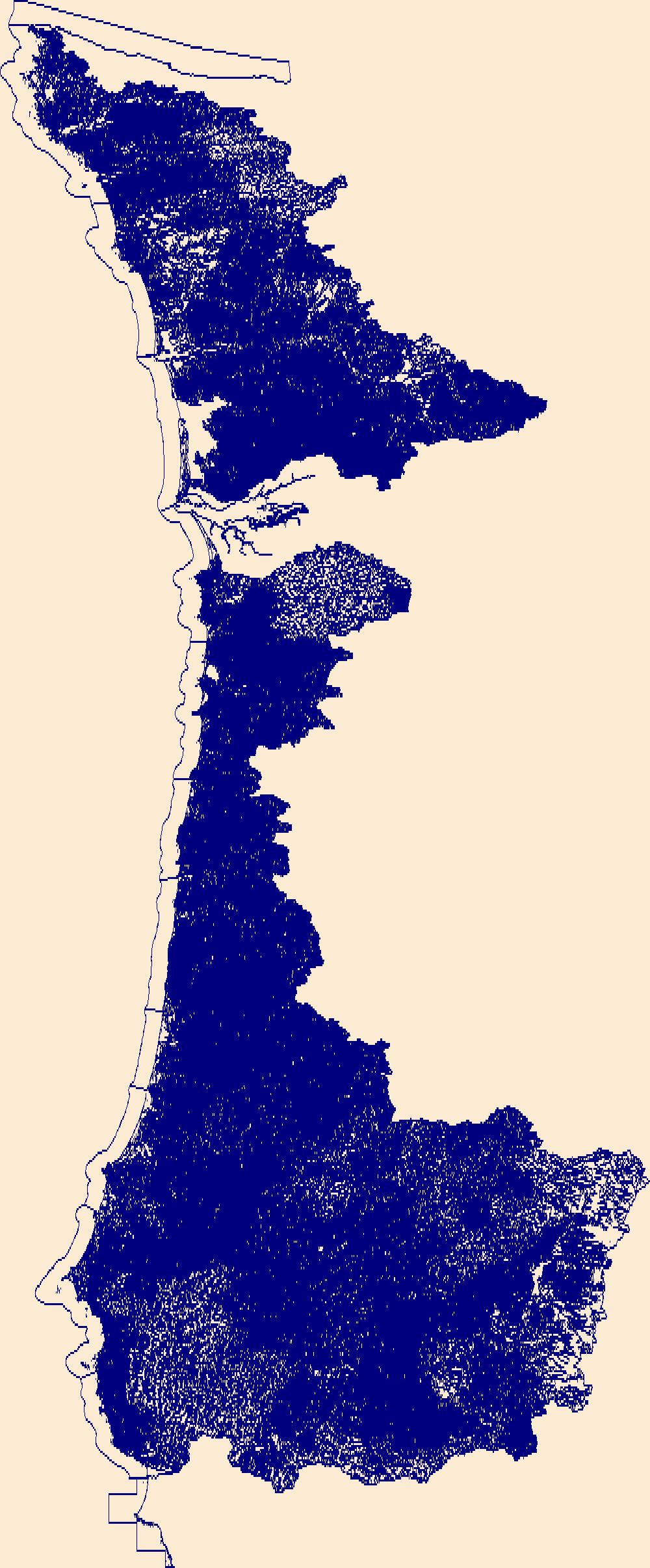
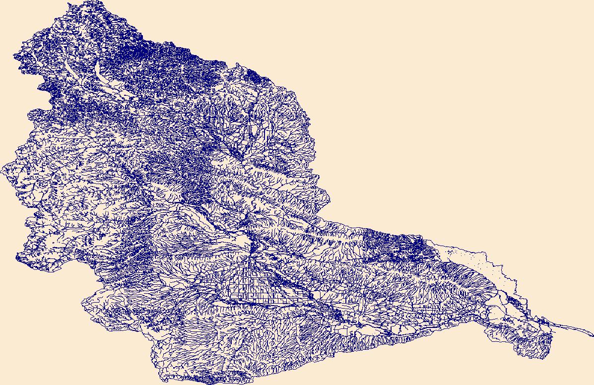
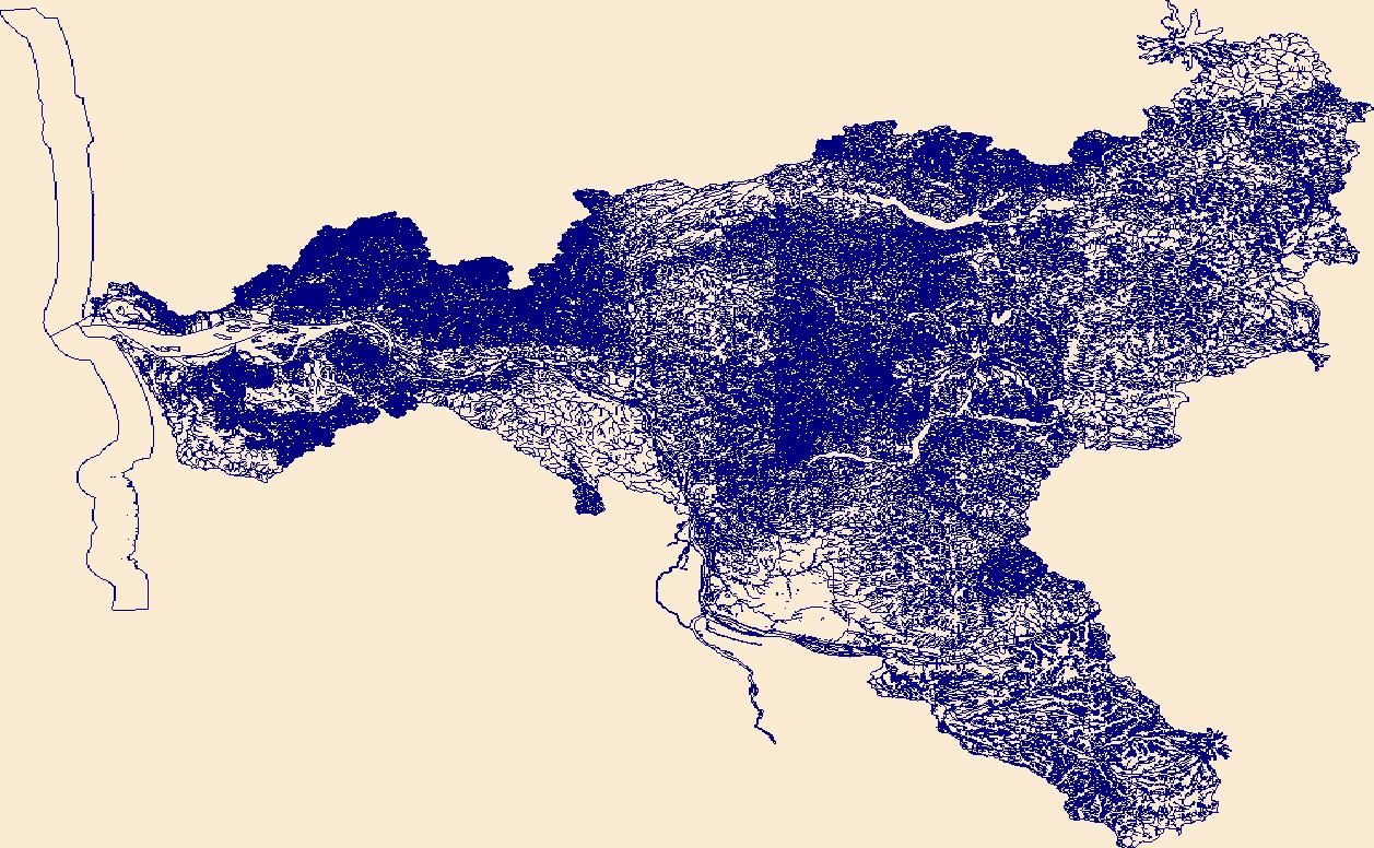
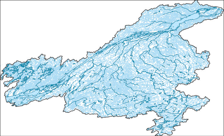
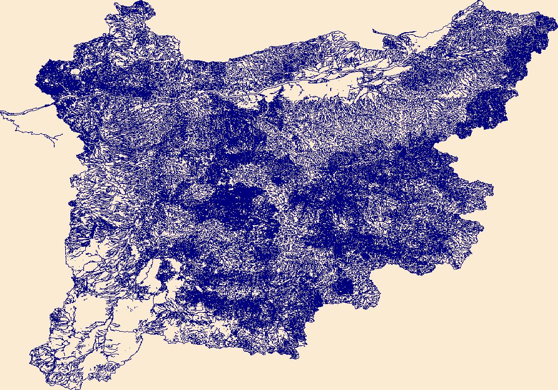
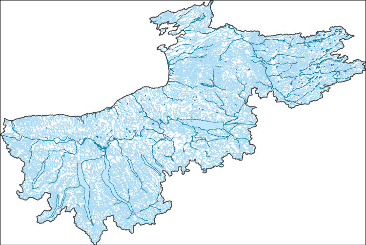
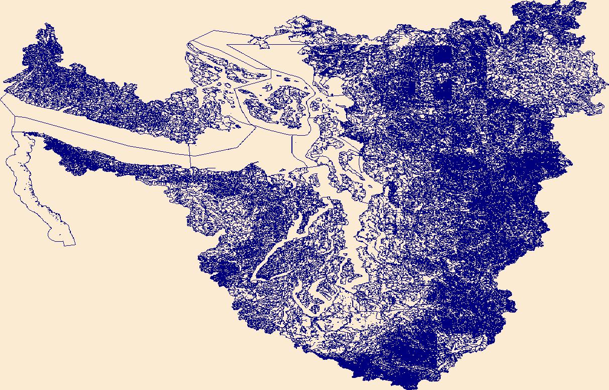
The High Resolution National Hydrography Dataset Plus (NHDPlus HR) is an integrated set of geospatial data layers, including the best available National Hydrography Dataset (NHD), the 10-meter 3D Elevation Program Digital Elevation Model (3DEP DEM), and the National Watershed Boundary Dataset (WBD). The NHDPlus HR combines the NHD, 3DEP DEMs, and WBD to create a stream network with linear referencing, feature naming, "value added attributes" (VAAs), elevation-derived catchments, and other features for hydrologic data analysis. The stream network with linear referencing is a system of data relationships applied to hydrographic systems so that one stream reach "flows" into another and "events" can be tied to and traced...
Tags: Adams County,
Adams County,
Asotin County,
Baker County,
Beaverhead County, All tags...
Benewah County,
Blaine County,
Boise County,
Camas County,
Clearwater County,
Columbia County,
Custer County,
Downloadable Data,
Elmore County,
FileGDB,
FileGDB 10.1,
Franklin County,
Garfield County,
Grant County,
HU-4 Subregion,
HU-4 Subregion,
HU4_1706,
Hydrography,
ID,
Idaho,
Idaho County,
Latah County,
Lemhi County,
Lewis County,
Lincoln County,
MT,
Mineral County,
Missoula County,
Montana,
NHDPlus HR Rasters,
NHDPlus High Resolution (NHDPlus HR),
National Hydrography Dataset (NHD),
National Hydrography Dataset Plus High Resolution (NHDPlus HR),
National Hydrography Dataset Plus High Resolution (NHDPlus HR) Current,
Nez Perce County,
OR,
Oregon,
Ravalli County,
Shoshone County,
Spokane County,
US,
Umatilla County,
Union County,
United States,
Valley County,
WA,
Walla Walla County,
Wallowa County,
Washington,
Whitman County,
base maps,
cartography,
catchments,
channels,
digital elevation models,
drainage basins,
earth sciences,
elevation,
environment,
geographic information systems,
geoscientific,
geospatial analysis,
hydrographic datasets,
hydrographic features,
hydrology,
imagery,
inland waters,
lakes,
land surface characteristics,
reservoirs,
river reaches,
rivers,
streamflow,
streamflow data,
streams,
topography,
water bodies,
water quality,
water resources,
watersheds, Fewer tags

The High Resolution National Hydrography Dataset Plus (NHDPlus HR) is an integrated set of geospatial data layers, including the best available National Hydrography Dataset (NHD), the 10-meter 3D Elevation Program Digital Elevation Model (3DEP DEM), and the National Watershed Boundary Dataset (WBD). The NHDPlus HR combines the NHD, 3DEP DEMs, and WBD to create a stream network with linear referencing, feature naming, "value added attributes" (VAAs), elevation-derived catchments, and other features for hydrologic data analysis. The stream network with linear referencing is a system of data relationships applied to hydrographic systems so that one stream reach "flows" into another and "events" can be tied to and traced...
Tags: Allegany County,
Allegheny County,
Barbour County,
Braxton County,
Doddridge County, All tags...
Downloadable Data,
Fayette County,
FileGDB,
FileGDB 10.1,
Garrett County,
Grant County,
Greene County,
HU-4 Subregion,
HU-4 Subregion,
HU4_0502,
Harrison County,
Hydrography,
Lewis County,
MD,
Marion County,
Maryland,
Monongalia County,
NHDPlus HR Rasters,
NHDPlus High Resolution (NHDPlus HR),
National Hydrography Dataset (NHD),
National Hydrography Dataset Plus High Resolution (NHDPlus HR),
National Hydrography Dataset Plus High Resolution (NHDPlus HR) Current,
PA,
Pendleton County,
Pennsylvania,
Pocahontas County,
Preston County,
Randolph County,
Somerset County,
Taylor County,
Tucker County,
US,
United States,
Upshur County,
WV,
Washington County,
Webster County,
West Virginia,
Westmoreland County,
Wetzel County,
base maps,
cartography,
catchments,
channels,
digital elevation models,
drainage basins,
earth sciences,
elevation,
environment,
geographic information systems,
geoscientific,
geospatial analysis,
hydrographic datasets,
hydrographic features,
hydrology,
imagery,
inland waters,
lakes,
land surface characteristics,
reservoirs,
river reaches,
rivers,
streamflow,
streamflow data,
streams,
topography,
water bodies,
water quality,
water resources,
watersheds, Fewer tags
The High Resolution National Hydrography Dataset Plus (NHDPlus HR) is an integrated set of geospatial data layers, including the best available National Hydrography Dataset (NHD), the 10-meter 3D Elevation Program Digital Elevation Model (3DEP DEM), and the National Watershed Boundary Dataset (WBD). The NHDPlus HR combines the NHD, 3DEP DEMs, and WBD to create a stream network with linear referencing, feature naming, "value added attributes" (VAAs), elevation-derived catchments, and other features for hydrologic data analysis. The stream network with linear referencing is a system of data relationships applied to hydrographic systems so that one stream reach "flows" into another and "events" can be tied to and traced...
Tags: Benton County,
CA,
California,
Clallam County,
Clatsop County, All tags...
Columbia County,
Coos County,
Cowlitz County,
Curry County,
Del Norte County,
Douglas County,
Downloadable Data,
FileGDB,
FileGDB 10.1,
Grays Harbor County,
HU-4 Subregion,
HU-4 Subregion,
HU4_1710,
Hydrography,
Jackson County,
Jefferson County,
Josephine County,
Klamath County,
Lane County,
Lewis County,
Lincoln County,
Mason County,
NHDPlus HR Rasters,
NHDPlus High Resolution (NHDPlus HR),
National Hydrography Dataset (NHD),
National Hydrography Dataset Plus High Resolution (NHDPlus HR),
National Hydrography Dataset Plus High Resolution (NHDPlus HR) Current,
OR,
Oregon,
Pacific County,
Polk County,
Siskiyou County,
Thurston County,
Tillamook County,
US,
United States,
WA,
Wahkiakum County,
Washington,
Washington County,
Yamhill County,
base maps,
cartography,
catchments,
channels,
digital elevation models,
drainage basins,
earth sciences,
elevation,
environment,
geographic information systems,
geoscientific,
geospatial analysis,
hydrographic datasets,
hydrographic features,
hydrology,
imagery,
inland waters,
lakes,
land surface characteristics,
reservoirs,
river reaches,
rivers,
streamflow,
streamflow data,
streams,
topography,
water bodies,
water quality,
water resources,
watersheds, Fewer tags
The High Resolution National Hydrography Dataset Plus (NHDPlus HR) is an integrated set of geospatial data layers, including the best available National Hydrography Dataset (NHD), the 10-meter 3D Elevation Program Digital Elevation Model (3DEP DEM), and the National Watershed Boundary Dataset (WBD). The NHDPlus HR combines the NHD, 3DEP DEMs, and WBD to create a stream network with linear referencing, feature naming, "value added attributes" (VAAs), elevation-derived catchments, and other features for hydrologic data analysis. The stream network with linear referencing is a system of data relationships applied to hydrographic systems so that one stream reach "flows" into another and "events" can be tied to and traced...
Tags: Benton County,
Chelan County,
Downloadable Data,
FileGDB,
FileGDB 10.1, All tags...
HU-4 Subregion,
HU-4 Subregion,
HU4_1703,
Hydrography,
King County,
Kittitas County,
Klickitat County,
Lewis County,
NHDPlus HR Rasters,
NHDPlus High Resolution (NHDPlus HR),
National Hydrography Dataset (NHD),
National Hydrography Dataset Plus High Resolution (NHDPlus HR),
National Hydrography Dataset Plus High Resolution (NHDPlus HR) Current,
Pierce County,
US,
United States,
WA,
Washington,
Yakima County,
base maps,
cartography,
catchments,
channels,
digital elevation models,
drainage basins,
earth sciences,
elevation,
environment,
geographic information systems,
geoscientific,
geospatial analysis,
hydrographic datasets,
hydrographic features,
hydrology,
imagery,
inland waters,
lakes,
land surface characteristics,
reservoirs,
river reaches,
rivers,
streamflow,
streamflow data,
streams,
topography,
water bodies,
water quality,
water resources,
watersheds, Fewer tags
The High Resolution National Hydrography Dataset Plus (NHDPlus HR) is an integrated set of geospatial data layers, including the best available National Hydrography Dataset (NHD), the 10-meter 3D Elevation Program Digital Elevation Model (3DEP DEM), and the National Watershed Boundary Dataset (WBD). The NHDPlus HR combines the NHD, 3DEP DEMs, and WBD to create a stream network with linear referencing, feature naming, "value added attributes" (VAAs), elevation-derived catchments, and other features for hydrologic data analysis. The stream network with linear referencing is a system of data relationships applied to hydrographic systems so that one stream reach "flows" into another and "events" can be tied to and traced...
Tags: Clackamas County,
Clark County,
Clatsop County,
Columbia County,
Cowlitz County, All tags...
Downloadable Data,
FileGDB,
FileGDB 10.1,
HU-4 Subregion,
HU-4 Subregion,
HU4_1708,
Hood River County,
Hydrography,
Lewis County,
Multnomah County,
NHDPlus HR Rasters,
NHDPlus High Resolution (NHDPlus HR),
National Hydrography Dataset (NHD),
National Hydrography Dataset Plus High Resolution (NHDPlus HR),
National Hydrography Dataset Plus High Resolution (NHDPlus HR) Current,
OR,
Oregon,
Pacific County,
Pierce County,
Skamania County,
US,
United States,
WA,
Wahkiakum County,
Wasco County,
Washington,
Yakima County,
base maps,
cartography,
catchments,
channels,
digital elevation models,
drainage basins,
earth sciences,
elevation,
environment,
geographic information systems,
geoscientific,
geospatial analysis,
hydrographic datasets,
hydrographic features,
hydrology,
imagery,
inland waters,
lakes,
land surface characteristics,
reservoirs,
river reaches,
rivers,
streamflow,
streamflow data,
streams,
topography,
water bodies,
water quality,
water resources,
watersheds, Fewer tags

The High Resolution National Hydrography Dataset Plus (NHDPlus HR) is an integrated set of geospatial data layers, including the best available National Hydrography Dataset (NHD), the 10-meter 3D Elevation Program Digital Elevation Model (3DEP DEM), and the National Watershed Boundary Dataset (WBD). The NHDPlus HR combines the NHD, 3DEP DEMs, and WBD to create a stream network with linear referencing, feature naming, "value added attributes" (VAAs), elevation-derived catchments, and other features for hydrologic data analysis. The stream network with linear referencing is a system of data relationships applied to hydrographic systems so that one stream reach "flows" into another and "events" can be tied to and traced...
Tags: Allegheny County,
Ashtabula County,
Athens County,
Beaver County,
Belmont County, All tags...
Braxton County,
Brooke County,
Butler County,
Calhoun County,
Carroll County,
Clay County,
Columbiana County,
Crawford County,
Doddridge County,
Downloadable Data,
Fairfield County,
FileGDB,
FileGDB 10.1,
Gallia County,
Geauga County,
Gilmer County,
Greene County,
Guernsey County,
HU-4 Subregion,
HU-4 Subregion,
HU4_0503,
Hancock County,
Harrison County,
Harrison County,
Hocking County,
Hydrography,
Jackson County,
Jefferson County,
Lawrence County,
Lewis County,
Mahoning County,
Marion County,
Marshall County,
Mason County,
Meigs County,
Mercer County,
Monongalia County,
Monroe County,
Morgan County,
NHDPlus HR Rasters,
NHDPlus High Resolution (NHDPlus HR),
National Hydrography Dataset (NHD),
National Hydrography Dataset Plus High Resolution (NHDPlus HR),
National Hydrography Dataset Plus High Resolution (NHDPlus HR) Current,
Noble County,
OH,
Ohio,
Ohio County,
PA,
Pennsylvania,
Perry County,
Pleasants County,
Portage County,
Ritchie County,
Roane County,
Stark County,
Trumbull County,
Tyler County,
US,
United States,
Upshur County,
Venango County,
WV,
Washington County,
Washington County,
Webster County,
West Virginia,
Wetzel County,
Wirt County,
Wood County,
base maps,
cartography,
catchments,
channels,
digital elevation models,
drainage basins,
earth sciences,
elevation,
environment,
geographic information systems,
geoscientific,
geospatial analysis,
hydrographic datasets,
hydrographic features,
hydrology,
imagery,
inland waters,
lakes,
land surface characteristics,
reservoirs,
river reaches,
rivers,
streamflow,
streamflow data,
streams,
topography,
water bodies,
water quality,
water resources,
watersheds, Fewer tags
The High Resolution National Hydrography Dataset Plus (NHDPlus HR) is an integrated set of geospatial data layers, including the best available National Hydrography Dataset (NHD), the 10-meter 3D Elevation Program Digital Elevation Model (3DEP DEM), and the National Watershed Boundary Dataset (WBD). The NHDPlus HR combines the NHD, 3DEP DEMs, and WBD to create a stream network with linear referencing, feature naming, "value added attributes" (VAAs), elevation-derived catchments, and other features for hydrologic data analysis. The stream network with linear referencing is a system of data relationships applied to hydrographic systems so that one stream reach "flows" into another and "events" can be tied to and traced...
Tags: Downloadable Data,
Essex County,
FileGDB,
FileGDB 10.1,
Franklin County, All tags...
HU-4 Subregion,
HU-4 Subregion,
HU4_0429,
Hamilton County,
Herkimer County,
Hydrography,
Jefferson County,
Lewis County,
NHDPlus HR Rasters,
NHDPlus High Resolution (NHDPlus HR),
NY,
National Hydrography Dataset (NHD),
National Hydrography Dataset Plus High Resolution (NHDPlus HR),
National Hydrography Dataset Plus High Resolution (NHDPlus HR) Current,
New York,
St. Lawrence County,
US,
United States,
base maps,
cartography,
catchments,
channels,
digital elevation models,
drainage basins,
earth sciences,
elevation,
environment,
geographic information systems,
geoscientific,
geospatial analysis,
hydrographic datasets,
hydrographic features,
hydrology,
imagery,
inland waters,
lakes,
land surface characteristics,
reservoirs,
river reaches,
rivers,
streamflow,
streamflow data,
streams,
topography,
water bodies,
water quality,
water resources,
watersheds, Fewer tags
The High Resolution National Hydrography Dataset Plus (NHDPlus HR) is an integrated set of geospatial data layers, including the best available National Hydrography Dataset (NHD), the 10-meter 3D Elevation Program Digital Elevation Model (3DEP DEM), and the National Watershed Boundary Dataset (WBD). The NHDPlus HR combines the NHD, 3DEP DEMs, and WBD to create a stream network with linear referencing, feature naming, "value added attributes" (VAAs), elevation-derived catchments, and other features for hydrologic data analysis. The stream network with linear referencing is a system of data relationships applied to hydrographic systems so that one stream reach "flows" into another and "events" can be tied to and traced...
Tags: Baker County,
Benton County,
Clackamas County,
Columbia County,
Crook County, All tags...
Deschutes County,
Douglas County,
Downloadable Data,
FileGDB,
FileGDB 10.1,
Gilliam County,
Grant County,
HU-4 Subregion,
HU-4 Subregion,
HU4_1707,
Harney County,
Hood River County,
Hydrography,
Jefferson County,
Klamath County,
Klickitat County,
Lake County,
Lane County,
Lewis County,
Linn County,
Marion County,
Morrow County,
Multnomah County,
NHDPlus HR Rasters,
NHDPlus High Resolution (NHDPlus HR),
National Hydrography Dataset (NHD),
National Hydrography Dataset Plus High Resolution (NHDPlus HR),
National Hydrography Dataset Plus High Resolution (NHDPlus HR) Current,
OR,
Oregon,
Sherman County,
Skamania County,
US,
Umatilla County,
Union County,
United States,
WA,
Walla Walla County,
Wallowa County,
Wasco County,
Washington,
Wheeler County,
Yakima County,
base maps,
cartography,
catchments,
channels,
digital elevation models,
drainage basins,
earth sciences,
elevation,
environment,
geographic information systems,
geoscientific,
geospatial analysis,
hydrographic datasets,
hydrographic features,
hydrology,
imagery,
inland waters,
lakes,
land surface characteristics,
reservoirs,
river reaches,
rivers,
streamflow,
streamflow data,
streams,
topography,
water bodies,
water quality,
water resources,
watersheds, Fewer tags

The High Resolution National Hydrography Dataset Plus (NHDPlus HR) is an integrated set of geospatial data layers, including the best available National Hydrography Dataset (NHD), the 10-meter 3D Elevation Program Digital Elevation Model (3DEP DEM), and the National Watershed Boundary Dataset (WBD). The NHDPlus HR combines the NHD, 3DEP DEMs, and WBD to create a stream network with linear referencing, feature naming, "value added attributes" (VAAs), elevation-derived catchments, and other features for hydrologic data analysis. The stream network with linear referencing is a system of data relationships applied to hydrographic systems so that one stream reach "flows" into another and "events" can be tied to and traced...
Tags: Adams County,
Athens County,
Boone County,
Boyd County,
Bracken County, All tags...
Brown County,
Butler County,
Cabell County,
Campbell County,
Carroll County,
Carter County,
Clark County,
Clermont County,
Clinton County,
Dearborn County,
Decatur County,
Downloadable Data,
Elliott County,
Fayette County,
FileGDB,
FileGDB 10.1,
Fleming County,
Franklin County,
Gallatin County,
Gallia County,
Grant County,
Greene County,
Greenup County,
HU-4 Subregion,
HU-4 Subregion,
HU4_0509,
Hamilton County,
Highland County,
Hocking County,
Hydrography,
IN,
Indiana,
Jackson County,
KY,
Kenton County,
Kentucky,
Lawrence County,
Lawrence County,
Lewis County,
Lincoln County,
Logan County,
Madison County,
Mason County,
Mason County,
Meigs County,
Mingo County,
Montgomery County,
Morgan County,
NHDPlus HR Rasters,
NHDPlus High Resolution (NHDPlus HR),
National Hydrography Dataset (NHD),
National Hydrography Dataset Plus High Resolution (NHDPlus HR),
National Hydrography Dataset Plus High Resolution (NHDPlus HR) Current,
OH,
Ohio,
Ohio County,
Pendleton County,
Pike County,
Putnam County,
Ripley County,
Ross County,
Rowan County,
Scioto County,
Switzerland County,
US,
United States,
Vinton County,
WV,
Warren County,
Wayne County,
West Virginia,
base maps,
cartography,
catchments,
channels,
digital elevation models,
drainage basins,
earth sciences,
elevation,
environment,
geographic information systems,
geoscientific,
geospatial analysis,
hydrographic datasets,
hydrographic features,
hydrology,
imagery,
inland waters,
lakes,
land surface characteristics,
reservoirs,
river reaches,
rivers,
streamflow,
streamflow data,
streams,
topography,
water bodies,
water quality,
water resources,
watersheds, Fewer tags
The High Resolution National Hydrography Dataset Plus (NHDPlus HR) is an integrated set of geospatial data layers, including the best available National Hydrography Dataset (NHD), the 10-meter 3D Elevation Program Digital Elevation Model (3DEP DEM), and the National Watershed Boundary Dataset (WBD). The NHDPlus HR combines the NHD, 3DEP DEMs, and WBD to create a stream network with linear referencing, feature naming, "value added attributes" (VAAs), elevation-derived catchments, and other features for hydrologic data analysis. The stream network with linear referencing is a system of data relationships applied to hydrographic systems so that one stream reach "flows" into another and "events" can be tied to and traced...
Tags: Cayuga County,
Chemung County,
Cortland County,
Downloadable Data,
FileGDB, All tags...
FileGDB 10.1,
HU-4 Subregion,
HU-4 Subregion,
HU4_0414,
Hamilton County,
Herkimer County,
Hydrography,
Jefferson County,
Lewis County,
Livingston County,
Madison County,
Monroe County,
NHDPlus HR Rasters,
NHDPlus High Resolution (NHDPlus HR),
NY,
National Hydrography Dataset (NHD),
National Hydrography Dataset Plus High Resolution (NHDPlus HR),
National Hydrography Dataset Plus High Resolution (NHDPlus HR) Current,
New York,
Oneida County,
Onondaga County,
Ontario County,
Oswego County,
Schuyler County,
Seneca County,
Steuben County,
Tioga County,
Tompkins County,
US,
United States,
Wayne County,
Yates County,
base maps,
cartography,
catchments,
channels,
digital elevation models,
drainage basins,
earth sciences,
elevation,
environment,
geographic information systems,
geoscientific,
geospatial analysis,
hydrographic datasets,
hydrographic features,
hydrology,
imagery,
inland waters,
lakes,
land surface characteristics,
reservoirs,
river reaches,
rivers,
streamflow,
streamflow data,
streams,
topography,
water bodies,
water quality,
water resources,
watersheds, Fewer tags

The High Resolution National Hydrography Dataset Plus (NHDPlus HR) is an integrated set of geospatial data layers, including the best available National Hydrography Dataset (NHD), the 10-meter 3D Elevation Program Digital Elevation Model (3DEP DEM), and the National Watershed Boundary Dataset (WBD). The NHDPlus HR combines the NHD, 3DEP DEMs, and WBD to create a stream network with linear referencing, feature naming, "value added attributes" (VAAs), elevation-derived catchments, and other features for hydrologic data analysis. The stream network with linear referencing is a system of data relationships applied to hydrographic systems so that one stream reach "flows" into another and "events" can be tied to and traced...
Tags: Anderson County,
Bath County,
Bell County,
Boone County,
Bourbon County, All tags...
Boyle County,
Bracken County,
Breathitt County,
Campbell County,
Carroll County,
Carter County,
Casey County,
Clark County,
Clay County,
Downloadable Data,
Elliott County,
Estill County,
Fayette County,
FileGDB,
FileGDB 10.1,
Fleming County,
Floyd County,
Franklin County,
Gallatin County,
Garrard County,
Grant County,
HU-4 Subregion,
HU-4 Subregion,
HU4_0510,
Harlan County,
Harrison County,
Henry County,
Hydrography,
Jackson County,
Jessamine County,
Johnson County,
KY,
Kenton County,
Kentucky,
Knott County,
Knox County,
Laurel County,
Lee County,
Leslie County,
Letcher County,
Lewis County,
Lincoln County,
Madison County,
Magoffin County,
Mason County,
Menifee County,
Mercer County,
Montgomery County,
Morgan County,
NHDPlus HR Rasters,
NHDPlus High Resolution (NHDPlus HR),
National Hydrography Dataset (NHD),
National Hydrography Dataset Plus High Resolution (NHDPlus HR),
National Hydrography Dataset Plus High Resolution (NHDPlus HR) Current,
Nicholas County,
Owen County,
Owsley County,
Pendleton County,
Perry County,
Pike County,
Powell County,
Robertson County,
Rockcastle County,
Rowan County,
Scott County,
Shelby County,
Trimble County,
US,
United States,
VA,
Virginia,
Wise County,
Wolfe County,
Woodford County,
base maps,
cartography,
catchments,
channels,
digital elevation models,
drainage basins,
earth sciences,
elevation,
environment,
geographic information systems,
geoscientific,
geospatial analysis,
hydrographic datasets,
hydrographic features,
hydrology,
imagery,
inland waters,
lakes,
land surface characteristics,
reservoirs,
river reaches,
rivers,
streamflow,
streamflow data,
streams,
topography,
water bodies,
water quality,
water resources,
watersheds, Fewer tags
The High Resolution National Hydrography Dataset Plus (NHDPlus HR) is an integrated set of geospatial data layers, including the best available National Hydrography Dataset (NHD), the 10-meter 3D Elevation Program Digital Elevation Model (3DEP DEM), and the National Watershed Boundary Dataset (WBD). The NHDPlus HR combines the NHD, 3DEP DEMs, and WBD to create a stream network with linear referencing, feature naming, "value added attributes" (VAAs), elevation-derived catchments, and other features for hydrologic data analysis. The stream network with linear referencing is a system of data relationships applied to hydrographic systems so that one stream reach "flows" into another and "events" can be tied to and traced...
Tags: Chelan County,
Clallam County,
Downloadable Data,
FileGDB,
FileGDB 10.1, All tags...
Grays Harbor County,
HU-4 Subregion,
HU-4 Subregion,
HU4_1711,
Hydrography,
Island County,
Jefferson County,
King County,
Kitsap County,
Kittitas County,
Lewis County,
Mason County,
NHDPlus HR Rasters,
NHDPlus High Resolution (NHDPlus HR),
National Hydrography Dataset (NHD),
National Hydrography Dataset Plus High Resolution (NHDPlus HR),
National Hydrography Dataset Plus High Resolution (NHDPlus HR) Current,
Okanogan County,
Pierce County,
San Juan County,
Skagit County,
Snohomish County,
Thurston County,
US,
United States,
WA,
Washington,
Whatcom County,
Yakima County,
base maps,
cartography,
catchments,
channels,
digital elevation models,
drainage basins,
earth sciences,
elevation,
environment,
geographic information systems,
geoscientific,
geospatial analysis,
hydrographic datasets,
hydrographic features,
hydrology,
imagery,
inland waters,
lakes,
land surface characteristics,
reservoirs,
river reaches,
rivers,
streamflow,
streamflow data,
streams,
topography,
water bodies,
water quality,
water resources,
watersheds, Fewer tags
|
|

