Filters: Tags: Long Island (X)
201 results (15ms)|
Filters
Date Range
Extensions Types Contacts
Categories Tag Types
|
This data provides an estimated raster surface of dissolved oxygen values across a region covered by an August 23, 2016 AUV survey. The raster was generated by using a natural neighbors interplator within a GIS on the empirical data set. This interpolator was chosen due to the non-normal distribution observed among the data, and its ability to produce smoother approximations than alternative interpolation methods. There are three files available for download in the 'Attached Files' section below. There is a zip file which contains the interpolated dissolved oxygen surface, an xml file which contains metadata, and a layer file which can be used to import the layer's symbology.
Investigations of coastal change and coastal resources often require continuous elevation profiles from the seafloor to coastal terrestrial landscapes. Differences in elevation data collection in the terrestrial and marine environments result in separate elevation products that may not share a vertical datum. This data release contains the assimilation of multiple elevation products into a continuous digital elevation model at a resolution of 3-arcseconds (approximately 90 meters) from the terrestrial landscape to the seafloor for the contiguous U.S., focused on the coastal interface. All datasets were converted to a consistent horizontal datum, the North American Datum of 1983, but the native vertical datum for...
Types: Map Service,
OGC WFS Layer,
OGC WMS Layer,
OGC WMS Service;
Tags: Alabama,
CMGP,
California,
Canadian Hydrographic Service,
Chesapeake Bay,
This data set contains imagery from the National Agriculture Imagery Program (NAIP). The NAIP program is administered by USDA FSA and has been established to support two main FSA strategic goals centered on agricultural production. These are, increase stewardship of America's natural resources while enhancing the environment, and to ensure commodities are procured and distributed effectively and efficiently to increase food security. The NAIP program supports these goals by acquiring and providing ortho imagery that has been collected during the agricultural growing season in the U.S. The NAIP ortho imagery is tailored to meet FSA requirements and is a fundamental tool used to support FSA farm and conservation programs....
This data set contains imagery from the National Agriculture Imagery Program (NAIP). The NAIP program is administered by USDA FSA and has been established to support two main FSA strategic goals centered on agricultural production. These are, increase stewardship of America's natural resources while enhancing the environment, and to ensure commodities are procured and distributed effectively and efficiently to increase food security. The NAIP program supports these goals by acquiring and providing ortho imagery that has been collected during the agricultural growing season in the U.S. The NAIP ortho imagery is tailored to meet FSA requirements and is a fundamental tool used to support FSA farm and conservation programs....
This data set contains imagery from the National Agriculture Imagery Program (NAIP). The NAIP program is administered by USDA FSA and has been established to support two main FSA strategic goals centered on agricultural production. These are, increase stewardship of America's natural resources while enhancing the environment, and to ensure commodities are procured and distributed effectively and efficiently to increase food security. The NAIP program supports these goals by acquiring and providing ortho imagery that has been collected during the agricultural growing season in the U.S. The NAIP ortho imagery is tailored to meet FSA requirements and is a fundamental tool used to support FSA farm and conservation programs....
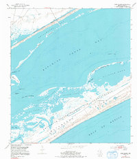
Surveys of the bathymetry and backscatter intensity of the sea floor south of Long Island, New York, were carried out in November 1998 using a Simrad EM1000 multibeam echosounder mounted on the Canadian Coast Guard ship Frederick G. Creed. The purpose of the multibeam echosounder surveys was to explore the bathymetry and backscatter intensity of the sea floor in several areas off the southern coast of Long Island along the 20-meter isobath. Survey areas offshore of Fire Island Inlet, Moriches Inlet, Shinnecock Inlet, and southwest of Montauk Point were about 1 kilometer (km) wide and 10 km long. The area was mapped by the U.S. Geological Survey with support from the Canadian Hydrographic Service and the University...
This data set contains imagery from the National Agriculture Imagery Program (NAIP). The NAIP program is administered by USDA FSA and has been established to support two main FSA strategic goals centered on agricultural production. These are, increase stewardship of America's natural resources while enhancing the environment, and to ensure commodities are procured and distributed effectively and efficiently to increase food security. The NAIP program supports these goals by acquiring and providing ortho imagery that has been collected during the agricultural growing season in the U.S. The NAIP ortho imagery is tailored to meet FSA requirements and is a fundamental tool used to support FSA farm and conservation programs....
Understanding how sea-level rise will affect coastal landforms and the species and habitats they support is critical for crafting approaches that balance the needs of humans and native species. Given this increasing need to forecast sea-level rise effects on barrier islands in the near and long terms, we are developing Bayesian networks to evaluate and to forecast the cascading effects of sea-level rise on shoreline change, barrier island state, and piping plover habitat availability. We use publicly available data products, such as lidar, orthophotography, and geomorphic feature sets derived from those, to extract metrics of barrier island characteristics at consistent sampling distances. The metrics are then incorporated...
Categories: Data;
Types: Downloadable,
GeoTIFF,
Map Service,
Raster;
Tags: Atlantic Ocean,
Barrier Island,
CMGP,
Coastal Habitat,
Coastal and Marine Geology Program,
Background In recent years, more and more people have become concerned about Long Island's supply of freshwater. Currently, there is no comprehensive, island-wide resource that summarizes recent U.S. Geological Survey (USGS) research related to the Island's aquifer system. A webpage will be developed by the USGS that will compile published data from the hydrologic-surveillance program, in place since the mid-1970’s, and various USGS sources, and supplement this information with more recent seasonal and annual hydrologic technical assistance will be provided to the Suffolk County Water Authority (SCWA) to help them produce an easy to understand annual report that will provide a snapshot of the state of Long Island's...
Categories: Data,
Project;
Types: Downloadable,
Map Service,
OGC WFS Layer,
OGC WMS Layer,
Shapefile;
Tags: Cooperative Water Program,
GW or SW,
GW or SW,
GW or SW,
Geospatial Applications,
USGS Historical Quadrangle in GeoPDF.
USGS Historical Quadrangle in GeoPDF.
Understanding how sea-level rise will affect coastal landforms and the species and habitats they support is critical for crafting approaches that balance the needs of humans and native species. Given this increasing need to forecast sea-level rise effects on barrier islands in the near and long terms, we are developing Bayesian networks to evaluate and to forecast the cascading effects of sea-level rise on shoreline change, barrier island state, and piping plover habitat availability. We use publicly available data products, such as lidar, orthophotography, and geomorphic feature sets derived from those, to extract metrics of barrier island characteristics at consistent sampling distances. The metrics are then incorporated...
Categories: Data;
Types: Downloadable,
Map Service,
OGC WFS Layer,
OGC WMS Layer,
Shapefile;
Tags: Atlantic Ocean,
Barrier Island,
CMGP,
Coastal and Marine Geology Program,
Fire Island,
Surveys of the bathymetry and backscatter intensity of the sea floor south of Long Island, New York, were carried out in November 1998 using a Simrad EM1000 multibeam echosounder mounted on the Canadian Coast Guard ship Frederick G. Creed. The purpose of the multibeam echosounder surveys was to explore the bathymetry and backscatter intensity of the sea floor in several areas off the southern coast of Long Island along the 20-meter isobath. Survey areas offshore of Fire Island Inlet, Moriches Inlet, Shinnecock Inlet, and southwest of Montauk Point were about 1 kilometer (km) wide and 10 km long. The area was mapped by the U.S. Geological Survey with support from the Canadian Hydrographic Service and the University...
Surveys of the bathymetry and backscatter intensity of the sea floor south of Long Island, New York, were carried out in November 1998 using a Simrad EM1000 multibeam echosounder mounted on the Canadian Coast Guard ship Frederick G. Creed. The purpose of the multibeam echosounder surveys was to explore the bathymetry and backscatter intensity of the sea floor in several areas off the southern coast of Long Island along the 20-meter isobath. Survey areas offshore of Fire Island Inlet, Moriches Inlet, Shinnecock Inlet, and southwest of Montauk Point were about 1 kilometer (km) wide and 10 km long. The area was mapped by the U.S. Geological Survey with support from the Canadian Hydrographic Service and the University...
This data set contains imagery from the National Agriculture Imagery Program (NAIP). The NAIP program is administered by USDA FSA and has been established to support two main FSA strategic goals centered on agricultural production. These are, increase stewardship of America's natural resources while enhancing the environment, and to ensure commodities are procured and distributed effectively and efficiently to increase food security. The NAIP program supports these goals by acquiring and providing ortho imagery that has been collected during the agricultural growing season in the U.S. The NAIP ortho imagery is tailored to meet FSA requirements and is a fundamental tool used to support FSA farm and conservation programs....
Atlantic coast piping plover (Charadrius melodus) nest sites are typically found on low-lying beach and dune systems, which respond rapidly to coastal processes like sediment overwash, inlet formation, and island migration that are sensitive to climate-related changes in storminess and the rate of sea-level rise. Data were obtained to understand piping plover habitat distribution and use along their Atlantic Coast breeding range. A smartphone application called iPlover was developed to collect standardized data on habitat characteristics at piping plover nest locations. The application capitalized on a network of trained monitors that observe piping plovers throughout their U.S. Atlantic coast breeding range as...
State and local county health departments have detected per- and polyfluoroalkyl substances (PFAS) in groundwater downgradient of airports and military and firefighting training areas in Long Island, New York. However, the occurrence and spatial distribution of PFAS throughout the surficial aquifer is not well established. Shallow groundwater samples were collected in 2018 from two observation well networks; the Sentinel network and Wastewater Treatment Plant groundwater (WTPGW) network. The Sentinel network is an island-wide group of wells screened within the shallow upper glacial (surficial, <100 feet deep) aquifer, which were sampled to assess the occurrence of PFAS in different land-use settings. The WTPGW network...
Categories: Data;
Types: Downloadable,
Map Service,
OGC WFS Layer,
OGC WMS Layer,
Shapefile;
Tags: Contaminants, Emerging,
Geochemistry,
Groundwater-Quality Monitoring,
Hydrology,
Long Island,
This model archive makes available the Soil-Water-Balance (SWB) model (Westenbroek and others, 2010) and input data used to estimate the potential amount of annual groundwater recharge to the Long Island aquifer system from 1900 to 2019 as described in U.S. Geological Survey Scientific Investigations Report 2021-5143. Input data for two SWB simulations are included in the archive. The first simulation uses existing land-use/land-cover datasets to estimate changes in recharge with changing land use from 1900-2019 (referred to as the post-development simulation). The second simulation assumed a forested, undeveloped (pre-development simulation) condition across Long Island for the same period. The same soil coverages...
|

|
