Filters: Tags: Lower Pahranagat Lake (X)
4 results (7ms)|
Filters
Date Range
Types Contacts
Categories Tag Types Tag Schemes |
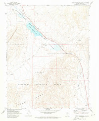
USGS Historical Quadrangle in GeoPDF.
This data release includes a table of concentrations (Sr, U) and radiogenic-isotope compositions (87Sr/86Sr, 234U/238U) for samples of modern lake water as well as a table of isotopic compositions (87Sr/86Sr and 234U/238U) for carbonate-rich samples from a 12.4-m-long composite core of lacustrine sediment from Lower Pahranagat Lake in southeastern Nevada, USA. Stratigraphic and geochronologic context for depths and ages of core material are also included here based on Bayesian age-depth modeling software (Bacon v. 2.2) published in a previous report (Theissen et al., 2019, https://doi.org/10.1017/qua.2019.11).
This data set contains imagery from the National Agriculture Imagery Program (NAIP). The NAIP program is administered by USDA FSA and has been established to support two main FSA strategic goals centered on agricultural production. These are, increase stewardship of America's natural resources while enhancing the environment, and to ensure commodities are procured and distributed effectively and efficiently to increase food security. The NAIP program supports these goals by acquiring and providing ortho imagery that has been collected during the agricultural growing season in the U.S. The NAIP ortho imagery is tailored to meet FSA requirements and is a fundamental tool used to support FSA farm and conservation programs....
This data set contains imagery from the National Agriculture Imagery Program (NAIP). The NAIP program is administered by USDA FSA and has been established to support two main FSA strategic goals centered on agricultural production. These are, increase stewardship of America's natural resources while enhancing the environment, and to ensure commodities are procured and distributed effectively and efficiently to increase food security. The NAIP program supports these goals by acquiring and providing ortho imagery that has been collected during the agricultural growing season in the U.S. The NAIP ortho imagery is tailored to meet FSA requirements and is a fundamental tool used to support FSA farm and conservation programs....
|

|
