Filters: Tags: MAV (X)
12 results (68ms)|
Filters
Date Range
Extensions Types
Contacts
Categories Tag Types
|
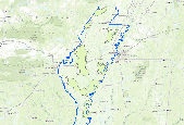
The Gulf Coastal Plains and Ozarks (GCPO) Landscape Conservation Cooperative (LCC) has conducted an ecological assessment of various landscape characteristics, or endpoints, outlined in the LCC Integrated Science Agenda. This data layer addresses the forested wetland amount desired landscape endpoint for the forested wetland ecosystem in the Mississippi Alluvial Valley subgeography of the GCPO LCC. This data was created by reclassification of the 2011 National Land Cover Dataset (NLCD) to pull out only the woody wetlands class (90) from the NLCD dataset.
Categories: Data;
Types: ArcGIS REST Map Service,
ArcGIS Service Definition,
Downloadable,
Map Service;
Tags: AQUATIC ECOSYSTEMS,
AQUATIC ECOSYSTEMS,
BIOSPHERE,
BIOSPHERE,
BIOSPHERE,

The mapped area is located in southeastern Arkansas where it is bounded on the north and east by the mainstem levee systems along the Arkansas and Mississippi Rivers, and on the west by uplands.  The basin continues into Louisiana to the south, but the coverage of this map extends only to the state line, incorporating approximately 1.24 million acres. Separate maps cover the Louisiana portion of the basin as well as the Macon Ridge upland and Ouachita River lowland. There are two separate lowland areas partly separated by the northern end of Macon Ridge that are collectively referred to as the Boeuf-Tensas Basin. The Boeuf Basin is a narrow lowland on the west that consists of sediments deposited in past...

The Tensas Basin portion of the study area is that part of the Mississippi Alluvial Valley within Louisiana that is bounded by the Mississippi River mainstem levee on the east, Macon Ridge and the uplands southwest of Sicily Island on the west, the Red River levee on the south, and the Arkansas State line on the north. The Tensas River and Bayou Macon are the principal streams in the northern and central parts of the study area, and Black River drains the southern part, where it is formed from the confluence of the Tensas with the Ouachita River entering the basin from the west. Various smaller streams arise within the basin and flow to one of those major drainages. The Mississippi River on the eastern boundary...
The Arkansas MAV Conservation Delivery Network serves to link the fundamental planning and design functions of the Lower Mississippi Valley Joint Venture partnership with the delivery programs of conservation partners by establishing a forum for cooperative coordination, leveraging, and targeting of their actions on-the-ground. The Delivery Priority Tool for the AR-MAV CDN is an model overlay that stacks (or combines) Ducks Unlimited's Wetland Restoration Suitability Model for the MAV, the Forest Breeding-bird Reforestation Decision Support Model for the MAV created by the LMV Joint Venture, and Ducks Unlimited's Easement Protection Priority Model for the MAV. The Tool then takes the upper tier(priority values...
Categories: Data;
Types: ArcGIS REST Map Service,
ArcGIS Service Definition,
Downloadable,
Map Service,
OGC WFS Layer,
OGC WMS Layer,
OGC WMS Service;
Tags: Arkansas,
Batture,
CDN,
Conservation,
Conservation Delivery Network,
Arkansas Mississippi Alluvial Valley Conservation Delivery Network boundary and focus areas resulting from the Delivery Prioritization Planning Tool.

The area designated as the Ouachita Basin for the purposes of this mapping effort is that portion of the Mississippi Alluvial Valley within Louisiana that includes the Ouachita River lowlands and Macon Ridge. Although the Ouachita River is the largest stream present, the lowland portion of the study area is usually considered to be part of the Bouef Basin, one of six major lowland areas that comprise the Mississippi Alluvial Valley. Macon Ridge is not normally considered part of any lowland basin but is included in this PNV mapping effort as part of the Ouachita Basin, because most of the internal drainage of Macon Ridge flows to the Ouachita lowlands. Â The landscape of the Ouachita Basin includes unique features,...

The Bayou Meto Basin drains most of the Mississippi Alluvial Valley lowlands immediately north and east of the Arkansas River as well as part of the Grand Prairie. Bayou Meto and Bayou Two Prairie are the only major streams in the basin. The Bayou Meto Basin is the smallest of the four major basins in the Delta Region of Arkansas, comprising approximately 827,000 acres. There are three distinct geomorphic surfaces within the Bayou Meto Basin, although all are products of the Arkansas River and all are composed of features typical of meandering rivers, such as point bar, backswamp, natural levee, and abandoned channel deposits. The lowest and most recent surface is sometimes called the Arkansas Lowlands.Â...
The Gulf Coastal Plains and Ozarks (GCPO) Landscape Conservation Cooperative (LCC) has conducted an ecological assessment of various landscape characteristics, or endpoints, outlined in the LCC Integrated Science Agenda. This data layer addresses the forested wetland amount desired landscape endpoint for the forested wetland ecosystem in the Mississippi Alluvial Valley subgeography of the GCPO LCC. This data was created by reclassification of the 2011 National Land Cover Dataset (NLCD) to pull out only the woody wetlands class (90) from the NLCD dataset. We then overlaid the HUC12 watershed layer and calculated the total amount of forested wetland acreage within each watershed.
Categories: Data;
Types: ArcGIS REST Map Service,
ArcGIS Service Definition,
Downloadable,
Map Service;
Tags: AQUATIC ECOSYSTEMS,
AQUATIC ECOSYSTEMS,
BIOSPHERE,
BIOSPHERE,
Conservation planning,

The Yazoo Basin is located in northwestern Mississippi where it is bounded on the east by rolling uplands and on the west by the mainstem levee system along the Mississippi River. It is about 200 miles long, extending from Memphis to Vicksburg, and has an area of about 7,600 square miles. Except during major floods, surface water entering the Yazoo Basin arrives as precipitation or as runoff from the hills along the eastern flank of the basin. The only surface outlet is through the Yazoo River, which enters the Mississippi River at the southern end of the basin near Vicksburg. Most surface water discharge in the Yazoo River originates in the uplands along the eastern flank of the basin and is carried to the Yazoo...

REVISED JUNE 2013The St. Francis Basin lies in northeastern Arkansas and southeastern Missouri. This map includes only the Arkansas portion of the basin. The eastern boundary is defined by the mainstem Mississippi River levee, and the western boundary is Crowleyâs Ridge.  More than 2 million acres are included in the mapped area. The principal streams are the St. Francis, Tyronza, and Little Rivers. Within Arkansas, approximately half the St. Francis Basin is made up of recent (Holocene) meander belt deposits of the Mississippi River and smaller streams. These include poorly-drained backswamps, better-drained point bars, and well-drained natural levees. Abandoned channel segments form crescent-shaped...
The Delivery Priority Tool for the AR MAV CDN is an model overlay that stacks (or combines) Ducks Unlimited's Wetland Restoration Suitability Model for the MAV batture, the Forest Breeding-bird Reforestation Decision Support Model for the MAV batture created by the LMV Joint Venture, and Ducks Unlimited's Easement Protection Priority Model for the MAV batture. The Tool then takes the upper tier of these overlapping priorities within and establishes those as the CDN's conservation targets.
Categories: Data;
Types: ArcGIS REST Map Service,
ArcGIS Service Definition,
Downloadable,
Map Service;
Tags: Arkansas,
Arkansas,
Batture,
CDN,
CDN,

The Western Lowlands correspond to that portion of the White River basin that lies within the Mississippi Alluvial Valley. It is bounded on the west and north by the Ozark escarpment, on the west and south by the Grand Prairie, and on the east by Crowleyâs Ridge. Part of this area is located in southeast Missouri; however, this map covers only the Arkansas portion of the Western Lowlands, which includes more than 4.5 million acres. Various streams enter the basin from the western uplands in Arkansas, including the Black, Current, Spring, White, and Little Red Rivers. The Cache River and Bayou De View originate within the lowlands on the eastern side of the basin.  All of these streams drain to the White...
|

|
