Filters: Tags: MAYO (X)
8 results (50ms)|
Filters
Date Range
Extensions Types Contacts
Categories Tag Types Tag Schemes |
This data set contains imagery from the National Agriculture Imagery Program (NAIP). The NAIP program is administered by USDA FSA and has been established to support two main FSA strategic goals centered on agricultural production. These are, increase stewardship of America's natural resources while enhancing the environment, and to ensure commodities are procured and distributed effectively and efficiently to increase food security. The NAIP program supports these goals by acquiring and providing ortho imagery that has been collected during the agricultural growing season in the U.S. The NAIP ortho imagery is tailored to meet FSA requirements and is a fundamental tool used to support FSA farm and conservation programs....
This data set contains imagery from the National Agriculture Imagery Program (NAIP). The NAIP program is administered by USDA FSA and has been established to support two main FSA strategic goals centered on agricultural production. These are, increase stewardship of America's natural resources while enhancing the environment, and to ensure commodities are procured and distributed effectively and efficiently to increase food security. The NAIP program supports these goals by acquiring and providing ortho imagery that has been collected during the agricultural growing season in the U.S. The NAIP ortho imagery is tailored to meet FSA requirements and is a fundamental tool used to support FSA farm and conservation programs....
This data set contains imagery from the National Agriculture Imagery Program (NAIP). The NAIP program is administered by USDA FSA and has been established to support two main FSA strategic goals centered on agricultural production. These are, increase stewardship of America's natural resources while enhancing the environment, and to ensure commodities are procured and distributed effectively and efficiently to increase food security. The NAIP program supports these goals by acquiring and providing ortho imagery that has been collected during the agricultural growing season in the U.S. The NAIP ortho imagery is tailored to meet FSA requirements and is a fundamental tool used to support FSA farm and conservation programs....
This data set contains imagery from the National Agriculture Imagery Program (NAIP). The NAIP program is administered by USDA FSA and has been established to support two main FSA strategic goals centered on agricultural production. These are, increase stewardship of America's natural resources while enhancing the environment, and to ensure commodities are procured and distributed effectively and efficiently to increase food security. The NAIP program supports these goals by acquiring and providing ortho imagery that has been collected during the agricultural growing season in the U.S. The NAIP ortho imagery is tailored to meet FSA requirements and is a fundamental tool used to support FSA farm and conservation programs....
A water balance study was carried out during summer 2003 to determine the rate of seepage from the sewage lagoon at Mayo, central Yukon Territory. The lagoon is largely dry, with over 85% of the total area covered by vegetation or bare soil. Measurements of precipitation, inflow, and pond water level, and estimates of evaporation were made to determine the rate of seepage from the lagoon. Precipitation was measured in a network of rain gauges, inflow at the Mayo lift station, and pond water level with staff gauges. Evaporation was estimated by a modified form of the Priestley-Taylor method, and from an evaporation pan placed in an infiltration pond. Daily estimates of seepage from two infiltration ponds at the lagoon...
The 1:100,000-scale geologic map database of the South Boston 30' × 60' quadrangle, Virginia and North Carolina, provides geologic information for the Piedmont along the I-85 and U.S. Route 58 corridors and in the Roanoke River watershed, which includes the John H. Kerr Reservoir and Lake Gaston. The Raleigh terrane (located on the eastern side of the map) contains Neoproterozoic to early Paleozoic(?) polydeformed, amphibolite-facies gneisses and schists. The Carolina slate belt of the Carolina terrane (located in the central part of the map) contains Neoproterozoic metavolcanic and metasedimentary rocks at greenschist facies. Although locally complicated, the slate-belt structure mapped across the South Boston...
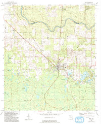
USGS Historical Quadrangle in GeoPDF.
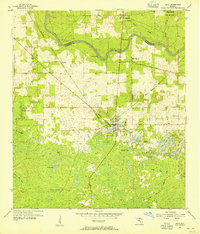
USGS Historical Quadrangle in GeoPDF.
|

|
