Filters: Tags: MEADOW (X)
41 results (83ms)|
Filters
Date Range
Extensions Types Contacts
Categories Tag Types
|
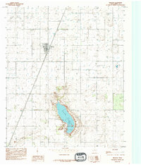
This data set contains imagery from the National Agriculture Imagery Program (NAIP). The NAIP program is administered by USDA FSA and has been established to support two main FSA strategic goals centered on agricultural production. These are, increase stewardship of America's natural resources while enhancing the environment, and to ensure commodities are procured and distributed effectively and efficiently to increase food security. The NAIP program supports these goals by acquiring and providing ortho imagery that has been collected during the agricultural growing season in the U.S. The NAIP ortho imagery is tailored to meet FSA requirements and is a fundamental tool used to support FSA farm and conservation programs....
This data set contains imagery from the National Agriculture Imagery Program (NAIP). The NAIP program is administered by USDA FSA and has been established to support two main FSA strategic goals centered on agricultural production. These are increase stewardship of America's natural resources while enhancing the environment, and to ensure commodities are procured and distributed effectively and efficiently to increase food security. The NAIP program supports these goals by acquiring and providing ortho imagery that has been collected during the agricultural growing season in the U.S. The NAIP ortho imagery is tailored to meet FSA requirements and is a fundamental tool used to support FSA farm and conservation programs....
Locating meadow study sitesMeadow centers as recorded in the ‘Copy of sitecords_areaelev from Caruthers thesis.xls’ file delivered by Debinski in November 2012 were matched to polygons as recorded in files ‘teton97map_area.shp’ and ‘gallatin97map_area.shp’ both also delivered by Debinski in November 2012.In cases where the meadow center did not fall within a meadow polygon, if there was a meadow polygon of the same meadow TYPE nearby (judgment was used here), the meadow center was matched with the meadow polygon of same meadow TYPE. In total, 29 of 30 Gallatin meadow sites and 21 of 25 Teton meadow sites were positively located.Identifying meadow pixels for analysisThe native MODIS 250-meter grid was reprojected...
Categories: Data;
Types: Citation;
Tags: Greater Yellowstone Ecosystem,
MODIS,
NDVI,
North Central CASC,
Plants,
Locating meadow study sitesMeadow centers as recorded in the ‘Copy of sitecords_areaelev from Caruthers thesis.xls’ file delivered by Debinski in November 2012 were matched to polygons as recorded in files ‘teton97map_area.shp’ and ‘gallatin97map_area.shp’ both also delivered by Debinski in November 2012.In cases where the meadow center did not fall within a meadow polygon, if there was a meadow polygon of the same meadow TYPE nearby (judgment was used here), the meadow center was matched with the meadow polygon of same meadow TYPE. In total, 29 of 30 Gallatin meadow sites and 21 of 25 Teton meadow sites were positively located.Identifying meadow pixels for analysisThe native MODIS 250-meter grid was reprojected...
Categories: Data;
Types: Citation;
Tags: Greater Yellowstone Ecosystem,
MODIS,
MODIS NDVI,
North Central CASC,
Plants,
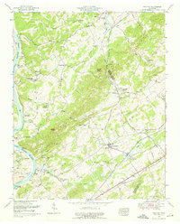
USGS Historical Quadrangle in GeoPDF.
USGS Historical Quadrangle in GeoPDF.
This dataset is the largest global dataset to date of soil respiration, moisture, and temperature measurements, totaling >3800 observations representing 27 temperature manipulation studies, spanning nine biomes and nearly two decades of warming experiments. Data for this study were obtained from a combination of unpublished data and published literature values. We find that although warming increases soil respiration rates, there is limited evidence for a shifting respiration response with experimental warming. We also note a universal decline in the temperature sensitivity of respiration at soil temperatures >25°C. This dataset includes 3817 observations, from control (n=1812), first (i.e., lowest or sole) level...
Categories: Data,
Publication;
Types: Citation;
Tags: Boreal Forest,
Desert,
Ecology,
Meadow,
Northern Shrubland,

The NHESP Natural Communities datalayer consists of polygons that represent the extent of various natural communities of biodiversity conservation interest in Massachusetts. These polygons are based on records of natural communities maintained in the Natural Heritage & Endangered Species Program (NHESP) database. Program scientists classify and delineate natural community polygons by analyzing "on-the-ground" field data and available information about the landscape (particularly topographic maps and aerial photographs). All sites in the NHESP database have been visited by NHESP biologists or by other biologists who have submitted reports on community occurrences that NHESP biologists have reviewed and accepted....
This data set contains imagery from the National Agriculture Imagery Program (NAIP). The NAIP program is administered by USDA FSA and has been established to support two main FSA strategic goals centered on agricultural production. These are increase stewardship of America's natural resources while enhancing the environment, and to ensure commodities are procured and distributed effectively and efficiently to increase food security. The NAIP program supports these goals by acquiring and providing ortho imagery that has been collected during the agricultural growing season in the U.S. The NAIP ortho imagery is tailored to meet FSA requirements and is a fundamental tool used to support FSA farm and conservation programs....
This data set contains imagery from the National Agriculture Imagery Program (NAIP). The NAIP program is administered by USDA FSA and has been established to support two main FSA strategic goals centered on agricultural production. These are increase stewardship of America's natural resources while enhancing the environment, and to ensure commodities are procured and distributed effectively and efficiently to increase food security. The NAIP program supports these goals by acquiring and providing ortho imagery that has been collected during the agricultural growing season in the U.S. The NAIP ortho imagery is tailored to meet FSA requirements and is a fundamental tool used to support FSA farm and conservation programs....
Vegetation and elevation survey data were collected in 4-square-meter quadrats via Real-Time Kinematic GPS from September 9, 2018 to April 17, 2019 on Dauphin Island, AL. Vegetation data included total percent herbaceous cover, percent cover by plant species, and mean height of vegetation within the quadrat. The percent cover by species was used to determine the dominant species for the plot.
This data set contains imagery from the National Agriculture Imagery Program (NAIP). The NAIP program is administered by USDA FSA and has been established to support two main FSA strategic goals centered on agricultural production. These are increase stewardship of America's natural resources while enhancing the environment, and to ensure commodities are procured and distributed effectively and efficiently to increase food security. The NAIP program supports these goals by acquiring and providing ortho imagery that has been collected during the agricultural growing season in the U.S. The NAIP ortho imagery is tailored to meet FSA requirements and is a fundamental tool used to support FSA farm and conservation programs....
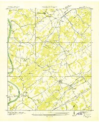
USGS Historical Quadrangle in GeoPDF.
This data set contains imagery from the National Agriculture Imagery Program (NAIP). The NAIP program is administered by USDA FSA and has been established to support two main FSA strategic goals centered on agricultural production. These are increase stewardship of America's natural resources while enhancing the environment, and to ensure commodities are procured and distributed effectively and efficiently to increase food security. The NAIP program supports these goals by acquiring and providing ortho imagery that has been collected during the agricultural growing season in the U.S. The NAIP ortho imagery is tailored to meet FSA requirements and is a fundamental tool used to support FSA farm and conservation programs....
This data set contains imagery from the National Agriculture Imagery Program (NAIP). The NAIP program is administered by USDA FSA and has been established to support two main FSA strategic goals centered on agricultural production. These are increase stewardship of America's natural resources while enhancing the environment, and to ensure commodities are procured and distributed effectively and efficiently to increase food security. The NAIP program supports these goals by acquiring and providing ortho imagery that has been collected during the agricultural growing season in the U.S. The NAIP ortho imagery is tailored to meet FSA requirements and is a fundamental tool used to support FSA farm and conservation programs....
Locating meadow study sitesMeadow centers as recorded in the ‘Copy of sitecords_areaelev from Caruthers thesis.xls’ file delivered by Debinski in November 2012 were matched to polygons as recorded in files ‘teton97map_area.shp’ and ‘gallatin97map_area.shp’ both also delivered by Debinski in November 2012.In cases where the meadow center did not fall within a meadow polygon, if there was a meadow polygon of the same meadow TYPE nearby (judgment was used here), the meadow center was matched with the meadow polygon of same meadow TYPE. In total, 29 of 30 Gallatin meadow sites and 21 of 25 Teton meadow sites were positively located.Identifying meadow pixels for analysisThe native MODIS 250-meter grid was reprojected...
Categories: Data;
Types: Citation;
Tags: Greater Yellowstone Ecosystem,
MODIS,
NDVI,
North Central CASC,
Plants,
This data set contains imagery from the National Agriculture Imagery Program (NAIP). The NAIP program is administered by USDA FSA and has been established to support two main FSA strategic goals centered on agricultural production. These are increase stewardship of America's natural resources while enhancing the environment, and to ensure commodities are procured and distributed effectively and efficiently to increase food security. The NAIP program supports these goals by acquiring and providing ortho imagery that has been collected during the agricultural growing season in the U.S. The NAIP ortho imagery is tailored to meet FSA requirements and is a fundamental tool used to support FSA farm and conservation programs....
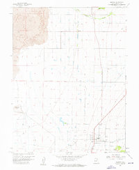
USGS Historical Quadrangle in GeoPDF.
A barrier island habitat prediction model was used to forecast barrier island habitats (for example, beach, dune, intertidal marsh, and woody vegetation) for Dauphin Island, Alabama, based on potential island configurations associated with a variety of restoration measures and varying future conditions of storminess and sea-levels. In this study, we loosely coupled a habitat model framework with decadal hydrodynamic geomorphic model outputs to forecast habitats for 2 potential future conditions related to storminess (that is, "medium" storminess and "high" storminess based on storm climatology data) and 4 sea-level scenarios (that is, a "low" increase in sea level 0.3 m by around 2030 and 2050 and 1.0 m by around...
This data set contains imagery from the National Agriculture Imagery Program (NAIP). The NAIP program is administered by USDA FSA and has been established to support two main FSA strategic goals centered on agricultural production. These are increase stewardship of America's natural resources while enhancing the environment, and to ensure commodities are procured and distributed effectively and efficiently to increase food security. The NAIP program supports these goals by acquiring and providing ortho imagery that has been collected during the agricultural growing season in the U.S. The NAIP ortho imagery is tailored to meet FSA requirements and is a fundamental tool used to support FSA farm and conservation programs....
|

|
