Filters: Tags: MORRISON (X)
415 results (46ms)|
Filters
Date Range
Types Contacts
Categories Tag Types Tag Schemes |
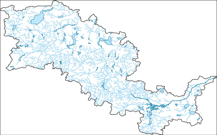
The National Hydrography Dataset (NHD) is a feature-based database that interconnects and uniquely identifies the stream segments or reaches that make up the nation's surface water drainage system. NHD data was originally developed at 1:100,000-scale and exists at that scale for the whole country. This high-resolution NHD, generally developed at 1:24,000/1:12,000 scale, adds detail to the original 1:100,000-scale NHD. (Data for Alaska, Puerto Rico and the Virgin Islands was developed at high-resolution, not 1:100,000 scale.) Local resolution NHD is being developed where partners and data exist. The NHD contains reach codes for networked features, flow direction, names, and centerline representations for areal water...
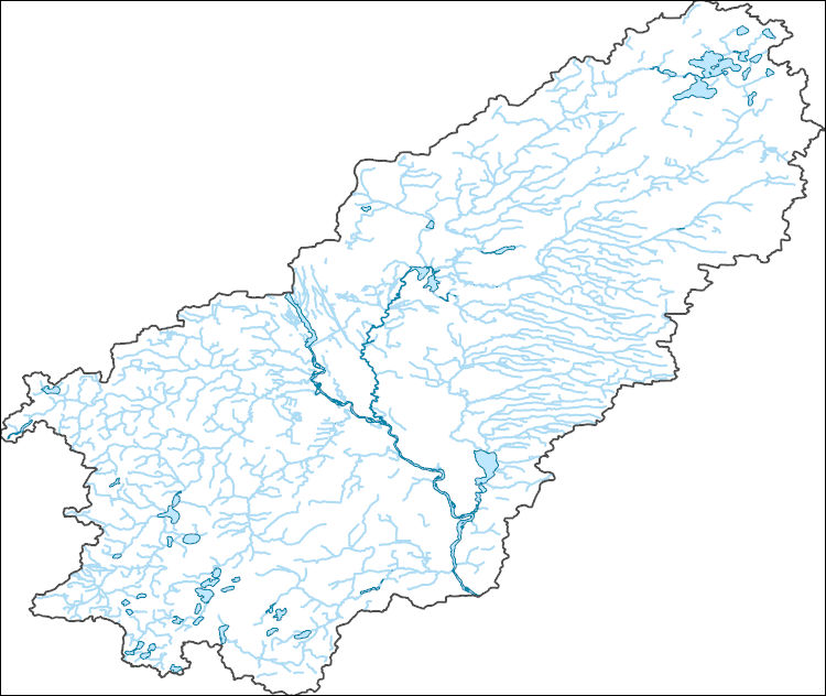
The National Hydrography Dataset (NHD) is a feature-based database that interconnects and uniquely identifies the stream segments or reaches that make up the nation's surface water drainage system. NHD data was originally developed at 1:100,000-scale and exists at that scale for the whole country. This high-resolution NHD, generally developed at 1:24,000/1:12,000 scale, adds detail to the original 1:100,000-scale NHD. (Data for Alaska, Puerto Rico and the Virgin Islands was developed at high-resolution, not 1:100,000 scale.) Local resolution NHD is being developed where partners and data exist. The NHD contains reach codes for networked features, flow direction, names, and centerline representations for areal water...
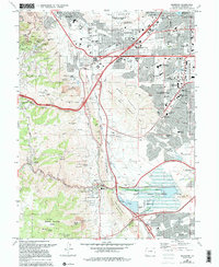
USGS Historical Quadrangle in GeoPDF.
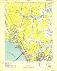
USGS Historical Quadrangle in GeoPDF.
Core Research Center, core B641, from well operated by USGSRaw Properties from download, web scrape, MapServer, and Macrostrat API{"Lib Num": "B641", "API Num": null, "Operator": "USGS", "Well Name": "S-5", "Field": null, "State": "NM", "County": "MCKINLEY", "Type": "SLABBED", "Photos": "F", "Thin Sec": "F", "Analysis": "F", "Latitude": "35.7363745027604", "Longitude": "-108.150272500868", "coordinates_geohash": "9w756cx77zpc", "Source": "CENTER OF QUARTER SECTION", "Security Flag": "NO SPECIAL RESTRICTIONS", "crc_collection_name": "core", "sb_parent_id": "4f4e49dae4b07f02db5e0486", "intervals": [{"Formation": "DAKOTA", "Age": "CRET", "Min Depth": "2250", "Max Depth": "2310"}, {"Formation": "MORRISON", "Age": "JURA",...
Core Research Center, core S302, from well operated by BUREAU OF RECLAMATIONRaw Properties from download, web scrape, MapServer, and Macrostrat API{"Lib Num": "S302", "API Num": null, "Operator": "BUREAU OF RECLAMATION", "Well Name": "DH-40", "Field": "RIDGWAY DAM", "State": "CO", "County": "OURAY", "Type": "FULL", "Photos": "F", "Thin Sec": "F", "Analysis": "F", "Latitude": "38.2373", "Longitude": "-107.7548", "coordinates_geohash": "9wg3ebzk7jme", "Source": "DERIVED FROM MAPPED LOCATION", "Security Flag": "NO SPECIAL RESTRICTIONS", "crc_collection_name": "core", "sb_parent_id": "4f4e49dae4b07f02db5e0486", "intervals": [{"Formation": "MORRISON", "Age": "JURASSIC", "Min Depth": "98", "Max Depth": "367"}], "crcwc_url":...
Core Research Center, core E029, from well operated by CALIFORNIA OILRaw Properties from download, web scrape, MapServer, and Macrostrat API{"Lib Num": "E029", "API Num": "4902505815", "Operator": "CALIFORNIA OIL", "Well Name": "1 C O TWIDALE", "Field": "WALLACE CREEK", "State": "WY", "County": "NATRONA", "Type": "SLABBED", "Photos": "T", "Thin Sec": "T", "Analysis": "T", "Latitude": "42.89472", "Longitude": "-107.26194", "coordinates_geohash": "9xesp0wpzeke", "Source": "FROM STATE RECORDS", "Security Flag": "NO SPECIAL RESTRICTIONS", "crc_collection_name": "core", "sb_parent_id": "4f4e49dae4b07f02db5e0486", "intervals": [{"Formation": "MESAVERDE", "Age": "CRET", "Min Depth": "3008", "Max Depth": "3058"}, {"Formation":...
Core Research Center, core R571, from well operated by MOUNTAIN FUEL SUPPLYRaw Properties from download, web scrape, MapServer, and Macrostrat API{"Lib Num": "R571", "API Num": "4903705407", "Operator": "MOUNTAIN FUEL SUPPLY", "Well Name": "3 CR HETZLER", "Field": "BAXTER BASIN", "State": "WY", "County": "SWEETWATER", "Type": "FULL - DISCONTINUOUS SEGMENTS", "Photos": "T", "Thin Sec": "T", "Analysis": "T", "Latitude": "41.54807", "Longitude": "-109.05786", "coordinates_geohash": "9x6kq7d7p9te", "Source": "FROM STATE RECORDS", "Security Flag": "NO SPECIAL RESTRICTIONS", "crc_collection_name": "core", "sb_parent_id": "4f4e49dae4b07f02db5e0486", "intervals": [{"Formation": "DAKOTA", "Age": "CRET", "Min Depth": "2335",...
Core Research Center, core V015, from well operated by NURE (BENDIX FIELD ENGINEERING)Raw Properties from download, web scrape, MapServer, and Macrostrat API{"Lib Num": "V015", "API Num": null, "Operator": "NURE (BENDIX FIELD ENGINEERING)", "Well Name": "SAN RAFAEL 109", "Field": "SAN RAFAEL SWELL", "State": "UT", "County": "EMERY", "Type": "FULL", "Photos": "F", "Thin Sec": "F", "Analysis": "T", "Latitude": "39.01636", "Longitude": "-111.02384", "coordinates_geohash": "9wcjcwdyv08t", "Source": "CENTER OF QUARTER SECTION", "Security Flag": "NO SPECIAL RESTRICTIONS", "crc_collection_name": "core", "sb_parent_id": "4f4e49dae4b07f02db5e0486", "intervals": [{"Formation": "DRILL CUTTINGS", "Age": "UNKNOWN", "Min Depth":...
Core Research Center, core V010, from well operated by NURE (BENDIX FIELD ENGINEERING)Raw Properties from download, web scrape, MapServer, and Macrostrat API{"Lib Num": "V010", "API Num": null, "Operator": "NURE (BENDIX FIELD ENGINEERING)", "Well Name": "SAN RAFAEL 108", "Field": "SAN RAFAEL SWELL", "State": "UT", "County": "EMERY", "Type": "FULL", "Photos": "F", "Thin Sec": "F", "Analysis": "T", "Latitude": "39.0422", "Longitude": "-111.01363", "coordinates_geohash": "9wcn1g6m6ctf", "Source": "CENTER OF QUARTER SECTION", "Security Flag": "NO SPECIAL RESTRICTIONS", "crc_collection_name": "core", "sb_parent_id": "4f4e49dae4b07f02db5e0486", "intervals": [{"Formation": "DRILL CUTTINGS", "Age": "UNKNOWN", "Min Depth":...
Categories: Physical Item;
Tags: DRILL CUTTINGS,
JURASSIC,
MORRISON,
Tununk Member,
Tununk Member of the Mancos Shale,
Core Research Center, core R586, from well operated by MOUNTAIN FUEL SUPPLYRaw Properties from download, web scrape, MapServer, and Macrostrat API{"Lib Num": "R586", "API Num": "4903705440", "Operator": "MOUNTAIN FUEL SUPPLY", "Well Name": "2 CR HETZLER", "Field": "BAXTER BASIN MID", "State": "WY", "County": "SWEETWATER", "Type": "FULL - DISCONTINUOUS SEGMENTS", "Photos": "T", "Thin Sec": "F", "Analysis": "F", "Latitude": "41.56071", "Longitude": "-109.06147", "coordinates_geohash": "9x6kqjzuetcu", "Source": "FROM STATE RECORDS", "Security Flag": "NO SPECIAL RESTRICTIONS", "crc_collection_name": "core", "sb_parent_id": "4f4e49dae4b07f02db5e0486", "intervals": [{"Formation": "ASPEN", "Age": null, "Min Depth": "2050",...
Core Research Center, core T416, from well operated by PAGOSA VERDERaw Properties from download, web scrape, MapServer, and Macrostrat API{"Lib Num": "T416", "API Num": null, "Operator": "PAGOSA VERDE", "Well Name": "PVTG5-2015", "Field": null, "State": "CO", "County": "ARCHULETA", "Type": "THICK SLAB", "Photos": "F", "Thin Sec": "F", "Analysis": "F", "Latitude": "37.2417", "Longitude": "-107.0092", "coordinates_geohash": "9wegugwk8uj1", "Source": "PROVIDED BY DONOR", "Security Flag": "NO SPECIAL RESTRICTIONS", "crc_collection_name": "core", "sb_parent_id": "4f4e49dae4b07f02db5e0486", "intervals": [{"Formation": "MORRISON", "Age": "JURASSIC", "Min Depth": "202", "Max Depth": "424"}, {"Formation": "ENTRADA", "Age":...
Categories: Physical Item;
Tags: ENTRADA,
Early Cretaceous - Late Cretaceous,
JURASSIC,
JURASSIC,
MORRISON,
Core Research Center, core T414, from well operated by PAGOSA VERDERaw Properties from download, web scrape, MapServer, and Macrostrat API{"Lib Num": "T414", "API Num": null, "Operator": "PAGOSA VERDE", "Well Name": "PVTG1-2014", "Field": null, "State": "CO", "County": "ARCHULETA", "Type": "THICK SLAB", "Photos": "F", "Thin Sec": "F", "Analysis": "F", "Latitude": "37.2519", "Longitude": "-106.9962", "coordinates_geohash": "9wegvjx8pc6x", "Source": "PROVIDED BY DONOR", "Security Flag": "NO SPECIAL RESTRICTIONS", "crc_collection_name": "core", "sb_parent_id": "4f4e49dae4b07f02db5e0486", "intervals": [{"Formation": "MANCOS", "Age": "CRETACEOUS", "Min Depth": "226", "Max Depth": "356"}, {"Formation": "DAKOTA", "Age":...
Categories: Physical Item;
Tags: CRETACEOUS,
CRETACEOUS,
DAKOTA,
ENTRADA,
Early Cretaceous - Late Cretaceous,
Core Research Center, core U195, from well operated by NEWMONT MININGRaw Properties from download, web scrape, MapServer, and Macrostrat API{"Lib Num": "U195", "API Num": null, "Operator": "NEWMONT MINING", "Well Name": "12 OR", "Field": "OREO PROJECT", "State": "CO", "County": "MONTEZUMA", "Type": "FULL", "Photos": "F", "Thin Sec": "F", "Analysis": "F", "Latitude": "37.4499", "Longitude": "-108.0777", "coordinates_geohash": "9wejh9s1rp3g", "Source": "CENTER OF SECTION", "Security Flag": "NO SPECIAL RESTRICTIONS", "crc_collection_name": "core", "sb_parent_id": "4f4e49dae4b07f02db5e0486", "intervals": [{"Formation": "MORRISON", "Age": "JURA", "Min Depth": "779", "Max Depth": "788"}, {"Formation": "INTRUSIVE", "Age":...
Categories: Physical Item;
Tags: INTRUSIVE,
JURA,
Laramide intrusive rocks,
MORRISON,
Maastrichtian - Bartonian
Core Research Center, core R836, from well operated by HUNTER ENERGYRaw Properties from download, web scrape, MapServer, and Macrostrat API{"Lib Num": "R836", "API Num": "2503321161", "Operator": "HUNTER ENERGY", "Well Name": "DUTTON 33-21-11", "Field": "MOSBY DOME", "State": "MT", "County": "GARFIELD", "Type": "THICK SLAB", "Photos": "T", "Thin Sec": "F", "Analysis": "T", "Latitude": "47.045222", "Longitude": "-107.921745", "coordinates_geohash": "c8778hmf3142", "Source": "FROM STATE RECORDS", "Security Flag": "NO SPECIAL RESTRICTIONS", "crc_collection_name": "core", "sb_parent_id": "4f4e49dae4b07f02db5e0486", "intervals": [{"Formation": "MORRISON", "Age": "JURASSIC", "Min Depth": "1415", "Max Depth": "1430"},...
Core Research Center, core A171, from well operated by SINCLAIR OIL & GASRaw Properties from download, web scrape, MapServer, and Macrostrat API{"Lib Num": "A171", "API Num": "2501121122", "Operator": "SINCLAIR OIL & GAS", "Well Name": "1 JOHNS FEDERAL", "Field": "WILDCAT", "State": "MT", "County": "CARTER", "Type": "SLABBED", "Photos": "T", "Thin Sec": "F", "Analysis": "F", "Latitude": "45.661455", "Longitude": "-104.524329", "coordinates_geohash": "c8jev2rtq85k", "Source": "FROM STATE RECORDS", "Security Flag": "NO SPECIAL RESTRICTIONS", "crc_collection_name": "core", "sb_parent_id": "4f4e49dae4b07f02db5e0486", "intervals": [{"Formation": "MORRISON", "Age": "JURA", "Min Depth": "4350", "Max Depth": "4378"}], "crcwc_url":...
Categories: Physical Item;
Tags: JURA,
MORRISON,
Pierre Formation,
Pierre Formation,
Santonian - Campanian,
The Watershed Boundary Dataset (WBD) is a comprehensive aggregated collection of hydrologic unit data consistent with the national criteria for delineation and resolution. It defines the areal extent of surface water drainage to a point except in coastal or lake front areas where there could be multiple outlets as stated by the "Federal Standards and Procedures for the National Watershed Boundary Dataset (WBD)" "Standard" (https://pubs.usgs.gov/tm/11/a3/). Watershed boundaries are determined solely upon science-based hydrologic principles, not favoring any administrative boundaries or special projects, nor particular program or agency. This dataset represents the hydrologic unit boundaries to the 12-digit (6th level)...
This data set contains imagery from the National Agriculture Imagery Program (NAIP). The NAIP program is administered by USDA FSA and has been established to support two main FSA strategic goals centered on agricultural production. These are increase stewardship of America's natural resources while enhancing the environment, and to ensure commodities are procured and distributed effectively and efficiently to increase food security. The NAIP program supports these goals by acquiring and providing ortho imagery that has been collected during the agricultural growing season in the U.S. The NAIP ortho imagery is tailored to meet FSA requirements and is a fundamental tool used to support FSA farm and conservation programs....
This data set contains imagery from the National Agriculture Imagery Program (NAIP). The NAIP program is administered by USDA FSA and has been established to support two main FSA strategic goals centered on agricultural production. These are, increase stewardship of America's natural resources while enhancing the environment, and to ensure commodities are procured and distributed effectively and efficiently to increase food security. The NAIP program supports these goals by acquiring and providing ortho imagery that has been collected during the agricultural growing season in the U.S. The NAIP ortho imagery is tailored to meet FSA requirements and is a fundamental tool used to support FSA farm and conservation programs....
This data set contains imagery from the National Agriculture Imagery Program (NAIP). The NAIP program is administered by USDA FSA and has been established to support two main FSA strategic goals centered on agricultural production. These are, increase stewardship of America's natural resources while enhancing the environment, and to ensure commodities are procured and distributed effectively and efficiently to increase food security. The NAIP program supports these goals by acquiring and providing ortho imagery that has been collected during the agricultural growing season in the U.S. The NAIP ortho imagery is tailored to meet FSA requirements and is a fundamental tool used to support FSA farm and conservation programs....
|

|
