Filters: Tags: MORROW (X)
655 results (210ms)|
Filters
Date Range
Types Contacts
Categories Tag Types Tag Schemes |
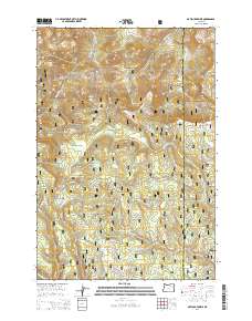
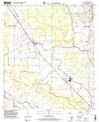
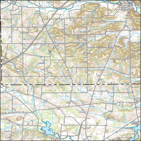
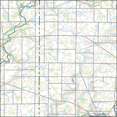
Layered GeoPDF 7.5 Minute Quadrangle Map. Layers of geospatial data include orthoimagery, roads, grids, geographic names, elevation contours, hydrography, and other selected map features.
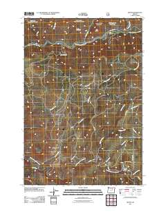
Layered GeoPDF 7.5 Minute Quadrangle Map. Layers of geospatial data include orthoimagery, roads, grids, geographic names, elevation contours, hydrography, and other selected map features.
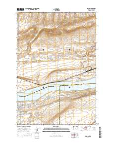
Layered geospatial PDF Map. Layers of geospatial data include orthoimagery, roads, grids, geographic names, elevation contours, hydrography, and other selected map features.
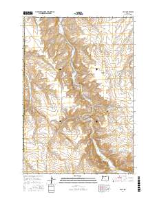
Layered GeoPDF 7.5 Minute Quadrangle Map. Layers of geospatial data include orthoimagery, roads, grids, geographic names, elevation contours, hydrography, and other selected map features.
USGS Historical Quadrangle in GeoPDF.
Core Research Center, core T776, from well operated by ANSCHUTZ CORPORATIONRaw Properties from download, web scrape, MapServer, and Macrostrat API{"Lib Num": "T776", "API Num": "0506306261", "Operator": "ANSCHUTZ CORPORATION", "Well Name": "2-21 BEESON", "Field": "WILDCAT", "State": "CO", "County": "KIT CARSON", "Type": "SLABBED", "Photos": "T", "Thin Sec": "F", "Analysis": "F", "Latitude": "39.170041", "Longitude": "-102.433989", "coordinates_geohash": "9wznv49y50cg", "Source": "FROM STATE RECORDS", "Security Flag": "NO SPECIAL RESTRICTIONS", "crc_collection_name": "core", "sb_parent_id": "4f4e49dae4b07f02db5e0486", "intervals": [{"Formation": "MORROW", "Age": "PENN", "Min Depth": "5417", "Max Depth": "5461"}],...
Core Research Center, core D417, from well operated by TENNECO OILRaw Properties from download, web scrape, MapServer, and Macrostrat API{"Lib Num": "D417", "API Num": "3502520756", "Operator": "TENNECO OIL", "Well Name": "1-4 PROTHRO RANCH", "Field": "SAMPSEL NE", "State": "OK", "County": "CIMARRON", "Type": "SLABBED", "Photos": "F", "Thin Sec": "F", "Analysis": "F", "Latitude": "36.587535", "Longitude": "-102.313677", "coordinates_geohash": "9wx0pu93ydbg", "Source": "FROM STATE RECORDS", "Security Flag": "NO SPECIAL RESTRICTIONS", "crc_collection_name": "core", "sb_parent_id": "4f4e49dae4b07f02db5e0486", "intervals": [{"Formation": "MORROW", "Age": "PENN", "Min Depth": "5041", "Max Depth": "5069"}], "crcwc_url":...
Core Research Center, cutting HH01823, from well operated by LARIO OIL AND GASRaw Properties from download, web scrape, MapServer, and Macrostrat API{"Lib Num": "HH01823", "API Num": "0512111068", "Operator": "LARIO OIL AND GAS", "Well Name": "WAKANDA 3-42", "Field": "WILDCAT", "State": "CO", "County": "WASHINGTON", "Thin Sec": "F", "Analysis": "T", "Latitude": "39.73818", "Longitude": "-102.956", "coordinates_geohash": "9xnf14jexmdj", "Source": "FROM STATE RECORDS", "Min": "3500", "Max": "7300", "Security Flag": "NO SPECIAL RESTRICTIONS", "crc_collection_name": "cutting", "sb_parent_id": "4f4e49d8e4b07f02db5df2d2", "intervals": [{"Formation": "UNKNOWN", "Age": null, "Min Depth": "7214", "Max Depth": "7300"}, {"Formation":...
Core Research Center, core T765, from well operated by ANSCHUTZ CORPORATIONRaw Properties from download, web scrape, MapServer, and Macrostrat API{"Lib Num": "T765", "API Num": "0506306284", "Operator": "ANSCHUTZ CORPORATION", "Well Name": "9-2 VASSIOS", "Field": "WILDCAT", "State": "CO", "County": "KIT CARSON", "Type": "SLABBED", "Photos": "T", "Thin Sec": "F", "Analysis": "F", "Latitude": "39.117489", "Longitude": "-102.960985", "coordinates_geohash": "9wyy9145ghmp", "Source": "FROM STATE RECORDS", "Security Flag": "NO SPECIAL RESTRICTIONS", "crc_collection_name": "core", "sb_parent_id": "4f4e49dae4b07f02db5e0486", "intervals": [{"Formation": "MORROW", "Age": "PENN", "Min Depth": "6372", "Max Depth": "6462"}],...
Core Research Center, core E253, from well operated by HRUBETZ OIL COMPANYRaw Properties from download, web scrape, MapServer, and Macrostrat API{"Lib Num": "E253", "API Num": "1512920657", "Operator": "HRUBETZ OIL COMPANY", "Well Name": "1-24 RUSSELL", "Field": "WILDCAT", "State": "KS", "County": "MORTON", "Type": "SLABBED", "Photos": "T", "Thin Sec": "T", "Analysis": "T", "Latitude": "37.333111", "Longitude": "-101.947228", "coordinates_geohash": "9wxs2hk31km1", "Source": "FROM STATE RECORDS", "Security Flag": "NO SPECIAL RESTRICTIONS", "crc_collection_name": "core", "sb_parent_id": "4f4e49dae4b07f02db5e0486", "intervals": [{"Formation": "MORROW", "Age": "PENN", "Min Depth": "4803", "Max Depth": "4847"}], "crcwc_url":...
Core Research Center, core E890, from well operated by ANSCHUTZ CORPORATI0NRaw Properties from download, web scrape, MapServer, and Macrostrat API{"Lib Num": "E890", "API Num": "0501707496", "Operator": "ANSCHUTZ CORPORATI0N", "Well Name": "1-BIG TIMBER EAST", "Field": "WILDCAT", "State": "CO", "County": "CHEYENNE", "Type": "SLABBED", "Photos": "F", "Thin Sec": "F", "Analysis": "T", "Latitude": "39.041384", "Longitude": "-102.1794", "coordinates_geohash": "9wzq4g70x3mp", "Source": "FROM STATE RECORDS", "Security Flag": "NO SPECIAL RESTRICTIONS", "crc_collection_name": "core", "sb_parent_id": "4f4e49dae4b07f02db5e0486", "intervals": [{"Formation": "MORROW", "Age": "PENN", "Min Depth": "5198", "Max Depth": "5295"}],...
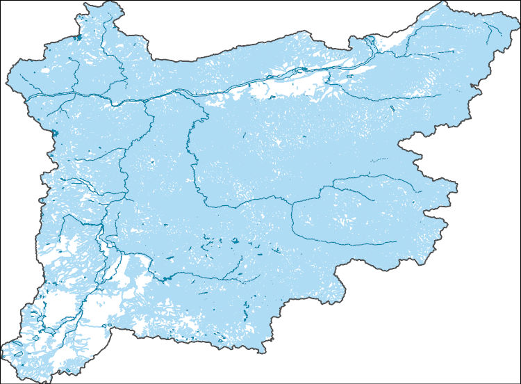
The National Hydrography Dataset (NHD) is a feature-based database that interconnects and uniquely identifies the stream segments or reaches that make up the nation's surface water drainage system. NHD data was originally developed at 1:100,000-scale and exists at that scale for the whole country. This high-resolution NHD, generally developed at 1:24,000/1:12,000 scale, adds detail to the original 1:100,000-scale NHD. (Data for Alaska, Puerto Rico and the Virgin Islands was developed at high-resolution, not 1:100,000 scale.) Local resolution NHD is being developed where partners and data exist. The NHD contains reach codes for networked features, flow direction, names, and centerline representations for areal water...
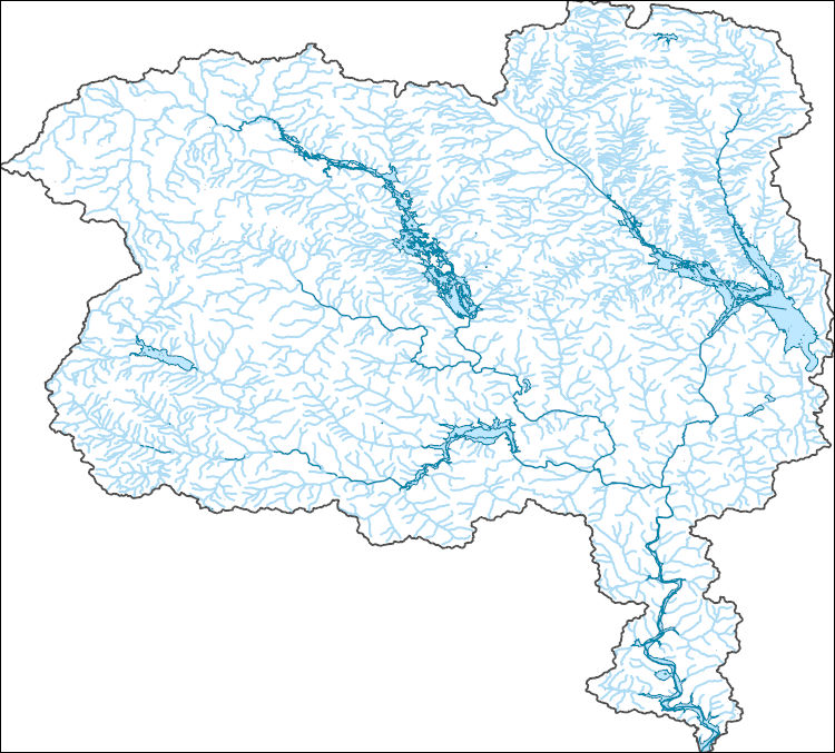
The National Hydrography Dataset (NHD) is a feature-based database that interconnects and uniquely identifies the stream segments or reaches that make up the nation's surface water drainage system. NHD data was originally developed at 1:100,000-scale and exists at that scale for the whole country. This high-resolution NHD, generally developed at 1:24,000/1:12,000 scale, adds detail to the original 1:100,000-scale NHD. (Data for Alaska, Puerto Rico and the Virgin Islands was developed at high-resolution, not 1:100,000 scale.) Local resolution NHD is being developed where partners and data exist. The NHD contains reach codes for networked features, flow direction, names, and centerline representations for areal water...
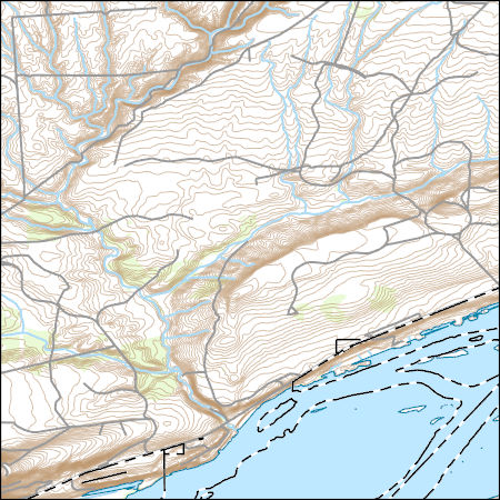
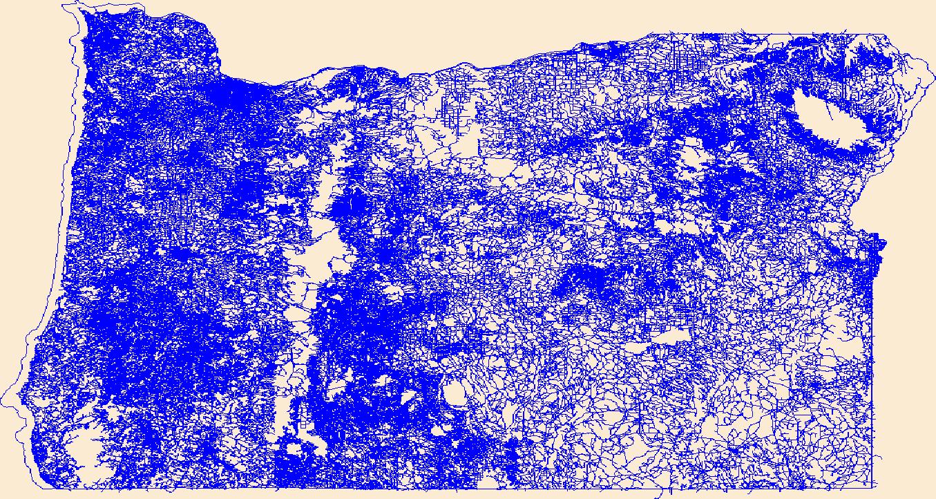
Layers of geospatial data include contours, boundaries, land cover, hydrography, roads, transportation, geographic names, structures, and other selected map features.
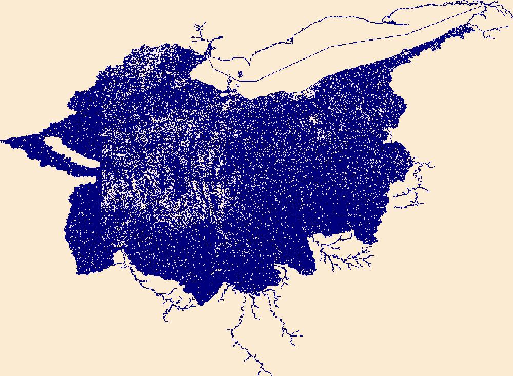
The National Hydrography Dataset (NHD) is a feature-based database that interconnects and uniquely identifies the stream segments or reaches that make up the nation's surface water drainage system. NHD data was originally developed at 1:100,000-scale and exists at that scale for the whole country. This high-resolution NHD, generally developed at 1:24,000/1:12,000 scale, adds detail to the original 1:100,000-scale NHD. (Data for Alaska, Puerto Rico and the Virgin Islands was developed at high-resolution, not 1:100,000 scale.) Local resolution NHD is being developed where partners and data exist. The NHD contains reach codes for networked features, flow direction, names, and centerline representations for areal water...
Layers of geospatial data include roads, airports, trails, and railroads.
Layers of geospatial data include contours, boundaries, land cover, hydrography, roads, transportation, geographic names, structures, and other selected map features.
Layers of geospatial data include contours, boundaries, land cover, hydrography, roads, transportation, geographic names, structures, and other selected map features.
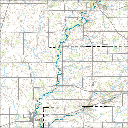
Layers of geospatial data include contours, boundaries, land cover, hydrography, roads, transportation, geographic names, structures, and other selected map features.
Types: Citation;
Tags: 7.5 x 7.5 minute,
7_5_Min,
Combined Vector,
Combined Vector,
Combined Vector,
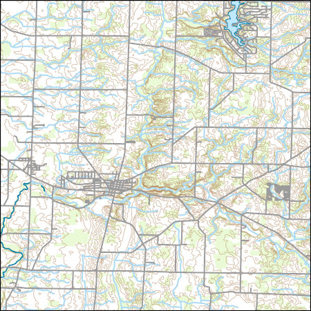
Layers of geospatial data include contours, boundaries, land cover, hydrography, roads, transportation, geographic names, structures, and other selected map features.
Types: Citation;
Tags: 7.5 x 7.5 minute,
7_5_Min,
Combined Vector,
Combined Vector,
Combined Vector,
|

|
