Filters: Tags: Magnesium (X)
59 results (24ms)|
Filters
Date Range
Extensions Types Contacts
Categories Tag Types
|
This data release contains the U.S. salient statistics and world production data extracted from the MAGNESIUM METAL data sheet of the USGS Mineral Commodity Summaries 2023.
This data set represents National Atmospheric Deposition Program (NADP) National Trends Network average of annual precipitation-weighted mean atmospheric deposition for seven select constituents from years 1985-2014 compiled for two spatial components of the NHDPlus version 2 data suite (NHDPlusv2) for the conterminous United States; 1) individual reach catchments and 2) reach catchments accumulated upstream through the river network. The seven constiuents presented here are: Calcium, Nitrate, Sulfate, Inorganic Nitrogen, Magnesium, Ammonium, and Chloride. Units are kilograms per hectare. This dataset can be linked to the NHDPlus version 2 data suite by the unique identifier COMID. The source data was produced by...
This product consists of multiple tabular datasets and associated metadata of water quality information related to rivers, streams, and lakes in the Yukon River watershed between 2014 and 2018. This data release is apart of the National Aeronautics and Space Administration (NASA) funded Arctic-Boreal Vulnerability Experiment (ABoVE) and is an assessment of water quality and greenhouse gas fluxes within the interior of Alaska. Sampling frequency varied across locations, with some sites sampled twice a year or more. Data consist of: organic and inorganic carbon related species, carbon dioxide and methane gas fluxes calculated from manual chamber measurements, nitrogen species, carbon isotopes, oxygen and deuterium...
Categories: Data;
Types: Data,
Map Service,
OGC WFS Layer,
OGC WMS Layer,
OGC WMS Service;
Tags: Alaska,
Boot Lake,
CH4,
CO2,
CO2 Bubble Trap,
In 1991, the U.S. Geological Survey (USGS) began a study of more than 50 major river basins across the Nation as part of the National Water-Quality Assessment (NAWQA) project. One of the major goals of the NAWQA project was to determine how river water quality has changed over time. To support that goal, long-term consistent and comparable monitoring has been conducted by the USGS on streams and rivers throughout the Nation. Outside of the NAWQA project, the USGS and other Federal, State, and local agencies also have collected long-term water-quality data to support their own assessments of changing water quality. In 2017, data from these multiple sources were combined to support one of the most comprehensive assessments...
This raster depicts the percentage of lithological magnesium oxide (MgO) content in surface or near surface geology. We derived these rasters by calculating the average percent MgO content for each map unit in combined surficial-bedrock geologic maps. We used state geologic maps (Preliminary Integrated Geologic Map Databases for the United States, Open File Reports 2004-1355, 2005-1305, 2005-1323, 2005-1324, 2005-1325, 2005-1351, and 2006-1272), which depict surficial geology instead of bedrock when the surficial layers are sufficiently deep. For the state maps that do not incorporate surficial geology (i.e., midwestern states), we overlaid surficial geologic map units with thicknesses greater than 100 feet (from...
Categories: Data,
Map;
Types: ArcGIS REST Map Service,
ArcGIS Service Definition,
Citation,
Downloadable,
GeoTIFF,
Map Service;
Tags: Bedrock,
Conterminous U.S.,
Geochemistry,
Geology,
Magnesium,
The U.S. Geological Survey (USGS) has compiled a geodatabase containing mineral-related geospatial data for 10 countries of interest in Southwest Asia (area of study): Afghanistan, Cambodia, Laos, India, Indonesia, Iran, Nepal, North Korea, Pakistan, and Thailand. The data can be used in analyses of the extractive fuel and nonfuel mineral industries and related economic and physical infrastructure integral for the successful operation of the mineral industries within the area of study as well as the movement of mineral products across domestic and global markets. This geodatabase reflects the USGS ongoing commitment to its mission of understanding the nature and distribution of global mineral commodity supply chains...
The datasets provided here are the output from the Seasonal Kendall Trend (SKT) test and Weighted Regressions on Time, Discharge, and Season (WRTDS) model that characterize changes in water quality in rivers and streams across the Delaware River Basin. SKT results are compiled in "skt_out.csv" for all combinations of site, water-quality parameter, and trend period. WRTDS results are compiled in four datasets. If unspecified, generalized flow normalization (GFN) results are reported. Stationary flow normalization (SFN) results are indicated in the datasets. "wrtds_out_annResults.csv" contains the annual estimates of mean concentration and load and GFN and SFN estimates by site and parameter for the entire calibration...
Categories: Data;
Types: Map Service,
OGC WFS Layer,
OGC WMS Layer,
OGC WMS Service;
Tags: Ammonia,
Calcium,
Chloride,
Delaware,
Delaware River,
The Marcellus Shale Energy and Environment Laboratory (MSEEL) site is a long-term field site and laboratory at the Northeast Natural Energy LLC (NNE) production facility, adjacent to the Monongahela River, located in western Monongalia County, West Virginia, USA. NNE began drilling two horizontal production wells, MIP (Morgantown Industrial Park) -5H and MIP-3H, in the Marcellus Shale in 2014. The wells were completed in December 2015. Large volumes of wastewater are generated with natural gas production. These wastewaters contain organic and inorganic chemical constituents from fracturing fluids used during drilling and stimulation of gas in host rocks/shale, as well as chemical compounds that are derived from...
Compilation of Geospatial Data (GIS) for the Mineral Industries and Related Infrastructure of Africa
This geodatabase reflects the U.S. Geological Survey’s (USGS) ongoing commitment to its mission of understanding the nature and distribution of global mineral commodity supply chains by updating and publishing the georeferenced locations of mineral commodity production and processing facilities, mineral exploration and development sites, and mineral commodity exporting ports in Africa. The geodatabase and geospatial data layers serve to create a new geographic information product in the form of a geospatial portable document format (PDF) map. The geodatabase contains data layers from USGS, foreign governmental, and open-source sources as follows: (1) mineral production and processing facilities, (2) mineral exploration...
This U.S. Geological Survey (USGS) data release provides the descriptions of the only U.S. sites—including mineral regions, mineral occurrences, and mine features—that have reported production and (or) resources of gallium (Ga). The sites in this data release have contained resource and (or) past production of more than 16 metric tons Ga metal, which was the approximate average annual consumption of Ga in the U.S. from 2016 through 2020. This dataset contains the Round Top deposit in Texas and the Apex deposit in Utah. Gallium occurs in many different minerals and rocks where substitution takes place with elements of similar size, such as zinc, or similar charge, such as aluminum. Therefore, Ga is primarily recovered...
Categories: Data;
Types: ArcGIS REST Map Service,
ArcGIS Service Definition,
Downloadable,
Map Service;
Tags: Apex,
BLM,
Bureau of Land Management,
DOI,
Department of the Interior,
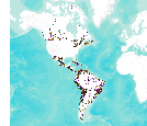
This data set consists of records for over 900 mineral facilities in Latin America and Canada. The mineral facilities include mines, plants, smelters, or refineries of aluminum, cement, coal, copper, diamond, gold, iron and steel, nickel, platinum-group metals, salt, and silver, among others. Records include attributes such as commodity, country, location, company name, facility type and capacity if applicable, and generalized coordinates. The data were compiled from multiple sources, including the 2003 and 2004 USGS Minerals Yearbooks (Latin America and Candada volume), data to be published in the 2005 Minerals Yearbook Latin America and Canada Volume, minerals statistics and information from the USGS minerals...
This data release provides multi-element data for drill core samples from the Mesoproterozoic Nonesuch Formation and Copper Harbor Conglomerate at the Copperwood copper deposit, Michigan, USA. Copper was determined by assay, and sulfur by inductively coupled plasma-optical emission spectrometry (ICP-OES) after aqua regia digestion for most samples. Multi-element whole rock analyses were determined for selected samples. The Copperwood copper deposit is a sediment-hosted stratiform copper deposit in the Presque Isle Syncline of the Upper Peninsula of Michigan. The deposit has a 2018 mineral resource estimate of 42.2 million metric tons (Mt) of measured plus indicated mineral resources in the Lower Copper Bearing Sequence...
Categories: Data;
Tags: Copper Harbor Conglomerate,
Copperwood copper deposit,
Michigan,
NGDB,
National Geochemical Database,
In 1991, the U.S. Geological Survey (USGS) began a study of more than 50 major river basins across the Nation as part of the National Water-Quality Assessment (NAWQA) project. One of the major goals of the NAWQA project was to determine how river water quality has changed over time. To support that goal, long-term consistent and comparable monitoring has been conducted by the USGS on streams and rivers throughout the Nation. Outside of the NAWQA project, the USGS and other Federal, State, and local agencies also have collected long-term water-quality data to support their own assessments of changing water quality. In 2017, data from these multiple sources were combined to support one of the most comprehensive assessments...
Tags: Magnesium

This dataset represents the soils with high kaolinite (low activity clay) content in the North Pacific Landscape Conservation Cooperative.

This dataset respresents the soils with high magnesium content in the North Pacific Landscape Conservation Cooperative.

This dataset consists of records for over 1,500 mineral facilities in Africa and the Middle East. The mineral facilities include mines, plants, mills , or refineries of aluminum, cement, coal, copper, diamond, gold, iron and steel, nickel, platinum-group metals, salt, and silver, among others. Records include attributes such as commodity, country, site, company name, plant capacity if applicable, and generalized coordinates. The data were compiled from multiple sources, including the 2004 USGS Minerals Yearbook (Africa and Middle East volume), minerals statistics and information from the USGS minerals information Web site (http://minerals.usgs.gov/minerals/), and data collected by USGS minerals information country...
Geologists from the Alaska Division of Geological & Geophysical Surveys (DGGS) Mineral Resources Section conducted four weeks of helicopter-supported mapping and fieldwork from June 26 through July 24, 2013. The Styx River project in the Lime Hills C-1 Quadrangle was part of the State-funded Airborne Geophysical/Geological Mineral Inventory (AGGMI) program as part of the State's Strategic Minerals Assessment Project, an initiative designed to evaluate Alaska's potential for rare-earth elements, PGEs, and other similarly supply-challenged resources. The Styx River project area has active and ongoing mineral exploration for deposit types including porphyry copper/molybdenum/gold, reduced intrusion-related gold, and...
This location is part of the Arizona Mineral Industry Location System (AzMILS), an inventory of mineral occurences, prospects and mine locations in Arizona. Maricopa572 is located in T6N R5E Sec 19 SW in the Cave Creek - 7.5 Min quad. This collection consists of various reports, maps, records and related materials acquired by the Arizona Department of Mines and Mineral Resources regarding mining properties in Arizona. Information was obtained by various means, including the property owners, exploration companies, consultants, verbal interviews, field visits, newspapers and publications. Some sections may be redacted for copyright. Please see the access statement.
|

|
